
Warm, Quiet, and Dry… A Spring Weekend that Feels a Lot Like Summer

The Southern Tennessee Weather Blog is proudly presented by Heritage South Community Credit Union.
We Help When Others Won’t!
Visit https://www.heritagesouth.org/ today to see how HSCCU can help YOU!
THE SETUP: WHY NOTHING IS HAPPENING
If you’ve stepped outside today, you already know… this is about as good as it gets for mid-April. Sunshine, comfortable warmth, and absolutely nothing going on weather-wise. That’s not by accident. We are sitting under a strengthening upper-level ridge that is sliding east into the Southeast. When you have ridging overhead, air is sinking instead of rising. Rising air is what creates clouds and storms. Sinking air does the opposite. It shuts that process down.
At the surface, high pressure is anchored to our east. That gives us a steady southerly flow, but the air mass itself is still relatively dry. So we get the warmth without the sticky humidity. It’s a pretty efficient setup for quiet, stable weather.
THE WEEKEND: TURNING UP THE HEAT
As we head into Saturday and Sunday, that ridge becomes even more dominant. Temperatures respond quickly to that. Highs will push into the lower 80s area-wide, with some mid 80s possible in our warmer spots. That puts us getting close to record territory, especially by Sunday.
What’s interesting here is how consistent the pattern is. There’s no front nearby, no organized system approaching, and no real mechanism to cool us down. It’s just steady warming under a stable atmosphere. Even the Plateau, which usually runs a bit cooler, will be right around 80 degrees.
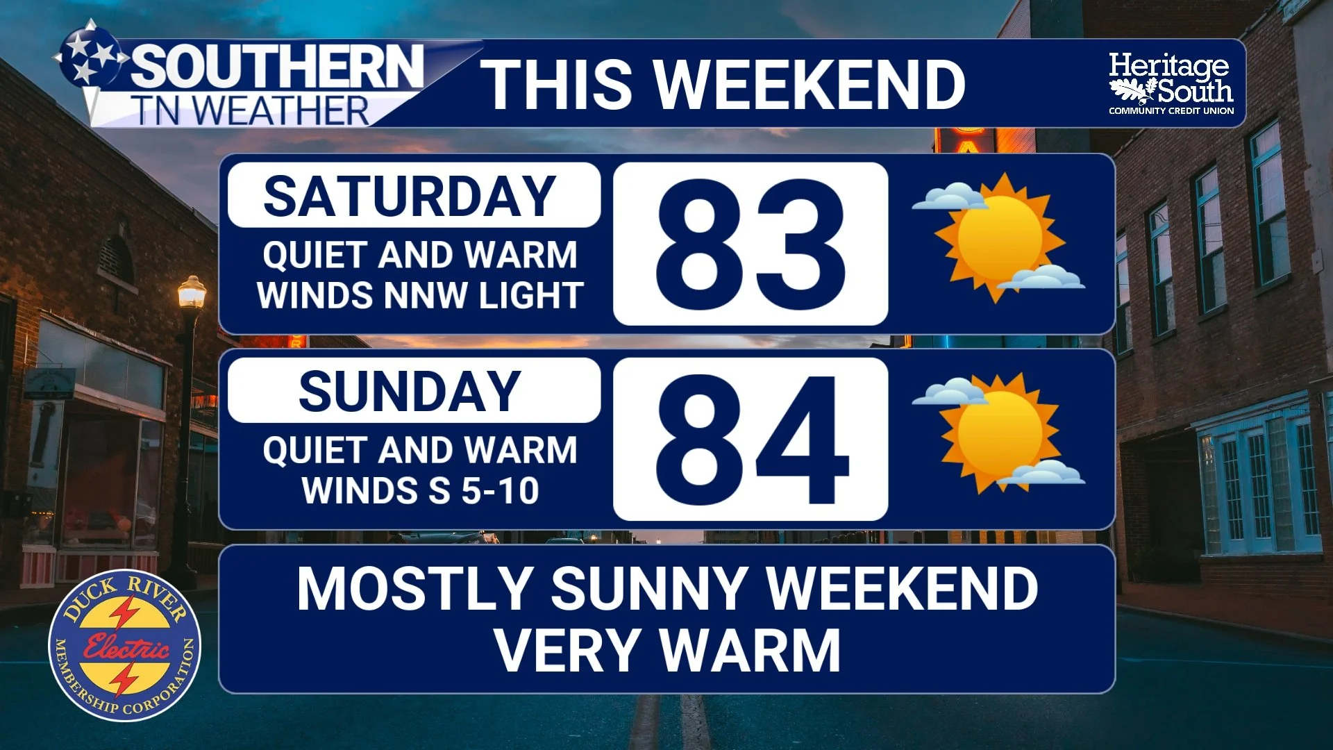
FORECAST - THIS WEEKEND
WHY THE RAIN KEEPS MISSING US
Here’s where things get a little more important long-term. Storm systems are still active across the central U.S., but they keep getting blocked. The pattern right now features troughing out west and ridging over the Southeast. That forces systems to track north and west of us. Remember, RIDGES = High Pressure and generally nice weather… TROUGHS = low pressure and storm systems.
In simple terms… everything that could bring us rain gets pushed away before it ever gets here. Models try to sneak in a few weak disturbances early next week, but the ridge weakens them significantly. Even if a stray shower shows up, rainfall amounts would be very light and very spotty.
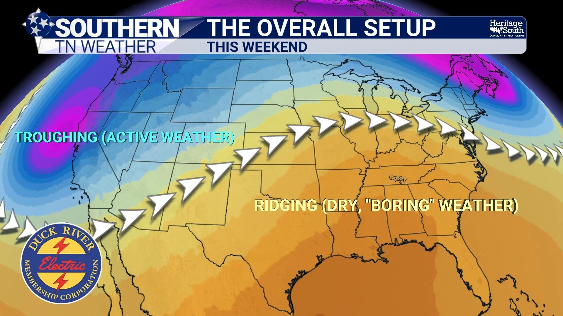
THE OVERALL SETUP - THIS WEEKEND
LOOKING AHEAD: SAME STORY, DIFFERENT DAY
As we move into next week, not much changes. Temperatures stay above normal with highs continuing in the 80s. That ridge holds strong enough to keep any meaningful rain out of the forecast for now. I do have a small chance for rain on Thursday, though.
Eventually, patterns like this do break down. But in the short term, there are no strong signals that happens anytime soon. So we’re left with a stretch of really nice weather… that also continues to dry things out.
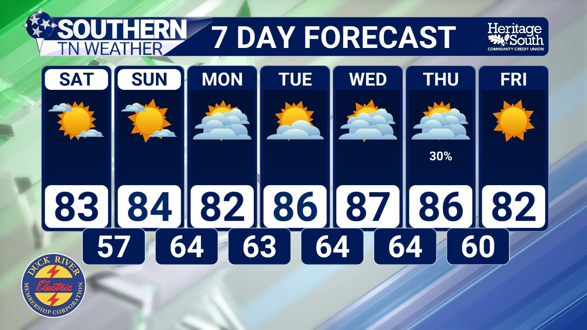
7 DAY FORECAST
The Bottom Line 🧾
• Dry and quiet weather continues
• Warming trend begins and builds into the weekend
• Highs in the 80s with near-record heat possible
• Rain chances remain very low through early next week
📰 Reminder: The Southern Tennessee Weather Blog, presented by Heritage South Community Credit Union, is updated Monday through Friday with fresh, locally tailored forecasts you can trust.