
Drought Concerns Growing… But Rain Returns This Weekend

The Southern Tennessee Weather Blog is proudly presented by Heritage South Community Credit Union.
We Help When Others Won’t!
Visit https://www.heritagesouth.org/ today to see how HSCCU can help YOU!
It has been a familiar story across Southern Middle Tennessee lately. Warm afternoons, breezy winds, and very little in the way of meaningful rainfall. This pattern continues this afternoon and into Friday, but we are starting to see signs of change heading into the weekend. While this is not shaping up to be a high-impact storm system, it will bring our best chance for beneficial rain in quite some time…
Why It’s Been So Warm and Windy
If you have stepped outside today, you have probably noticed the gusty winds and early April heat. That is no accident. High pressure anchored to our southeast continues to act like a conveyor belt, pulling warm and increasingly humid air northward from the Gulf. At the same time, a tightening pressure gradient between that high and a developing system to our west is driving those gusty south winds. Some gusts this afternoon are pushing 30 to 35 MPH.
On top of that, higher heights aloft are promoting sinking air, which limits widespread low-level cloud development and allows temperatures to climb efficiently into the 80s. Even when weak disturbances try to move in, they fall apart quickly as they run into this environment. That is why most of us stay dry today and again through much of Friday.
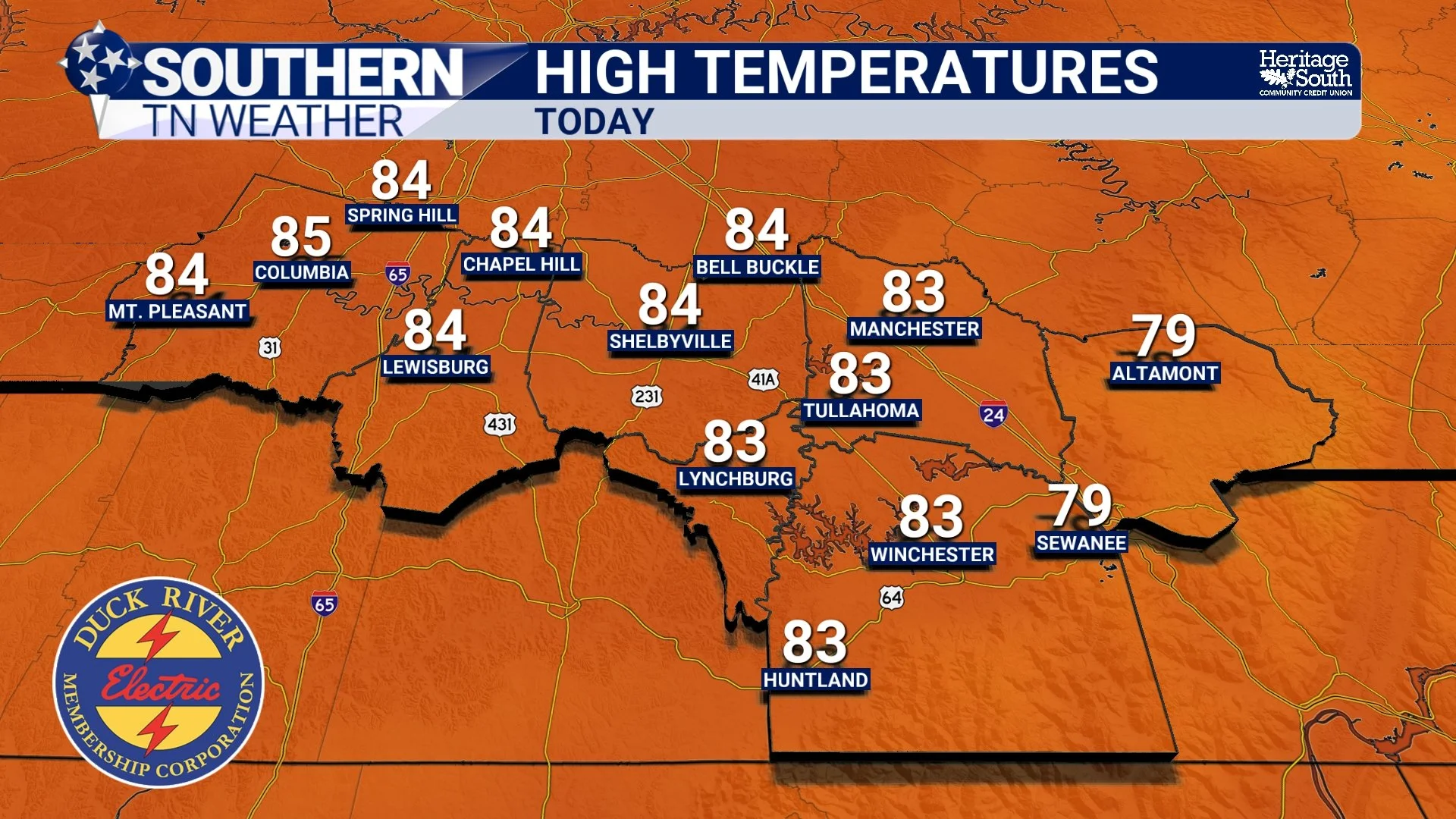
HIGH TEMPS - TODAY
Why Rain Has Been So Limited
Despite the increase in humidity, we have been missing one key ingredient for widespread rainfall…. Strong lift. Most storm systems have been tracking well to our north, leaving us on the southern edge of the storm track. In this position, the atmosphere has moisture and warmth, but not enough forcing to organize storms or produce steady rainfall. That is why any showers we have seen have been brief and scattered.
The latest drought monitor continues to reflect this trend. Conditions are slowly degrading across parts of the Mid-South and Tennessee Valley, including areas of Southern Middle Tennessee. Over the past 90 days, many locations across the region have ranked among their driest stretches on record. That puts into perspective just how much we need a soaking rain. Most of our area is in a level 2 MODERATE drought from the US Drought Monitor. With everything blooming right now, looks can be deceiving!
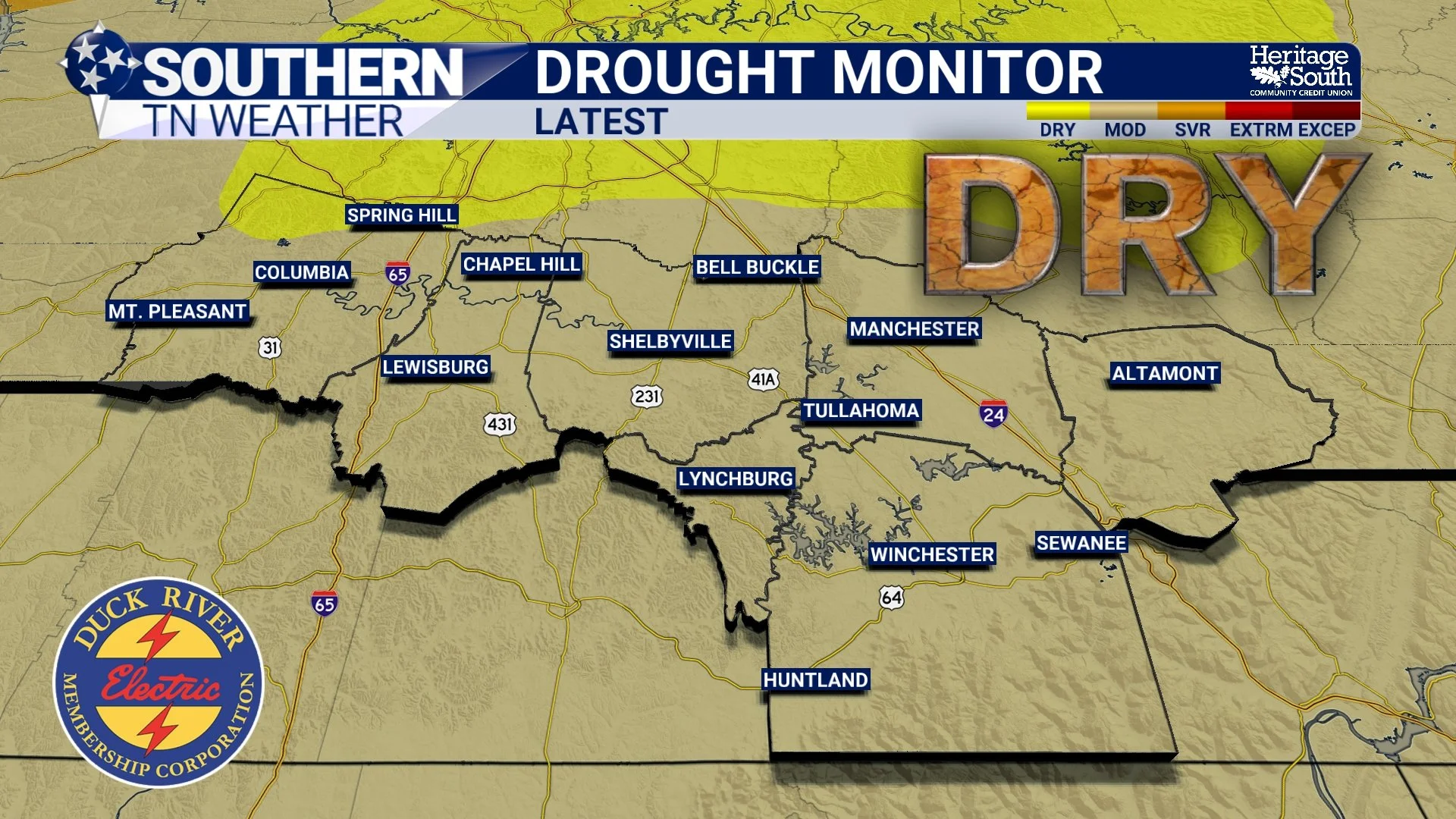
US DROUGHT MONITOR - LATEST
What Changes on Saturday
Saturday is when things finally begin to come together. A stronger system will move out of the Rockies and into the Midwest, dragging a cold front toward Tennessee. Unlike the weaker boundaries we have seen recently, this front will have enough support to actually push through our area.
Clouds will increase through the day Saturday, and showers and thunderstorms will become more widespread during the afternoon and especially into the evening and overnight hours. Exact timing looks to be between 6 PM and midnight, with at least scattered activity possible before then.
Even with that, the overall setup remains fairly unimpressive for severe weather. The strongest dynamics and wind energy stay well to our north. Locally, wind shear is modest and instability is only moderate. This combination supports thunderstorms, but not widespread severe weather.
What this system does offer is moisture. Rainfall totals generally between half an inch and one inch look reasonable. That would go a long way in helping ease the dry conditions we have been dealing with.
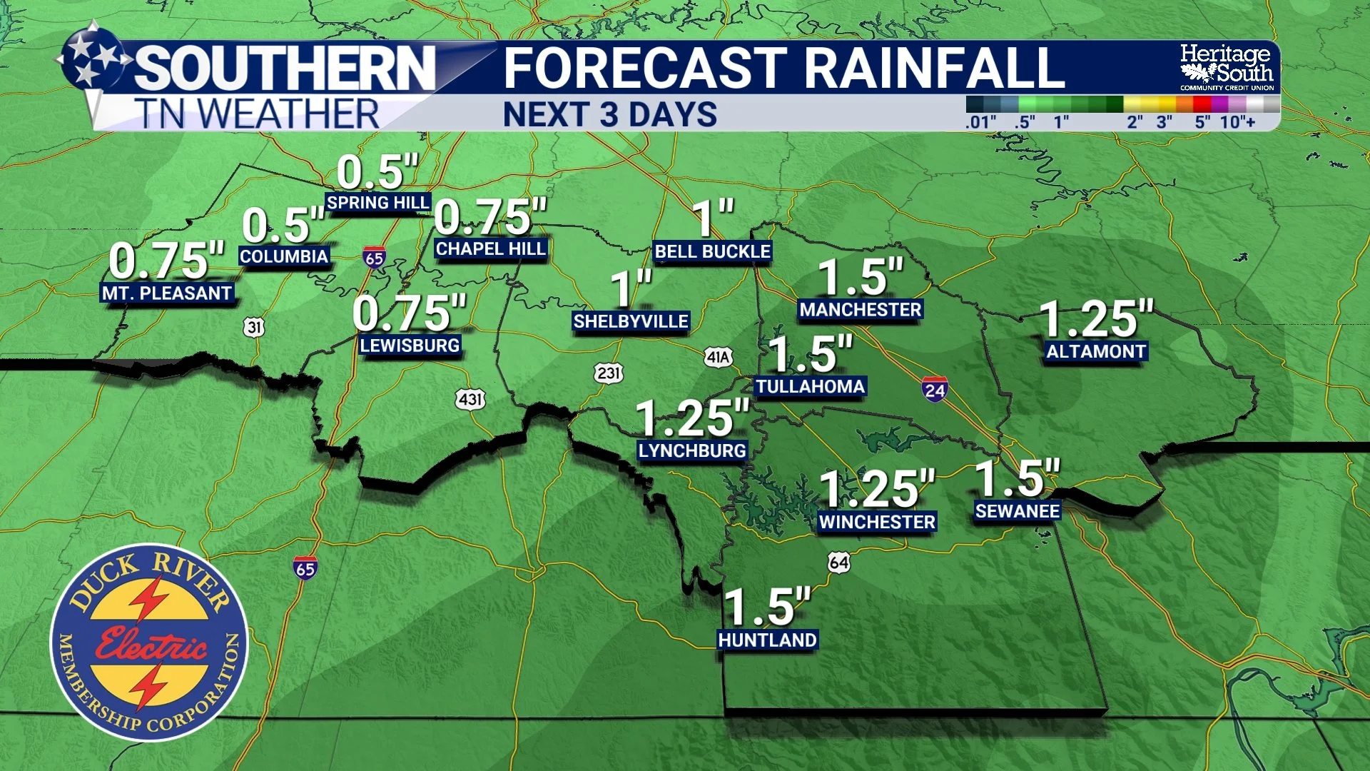
FORECAST RAINFALL - NEXT 3 DAYS
What to Expect After the Front
Once the front moves through late Saturday night into early Sunday, the pattern shifts quickly. Winds turn out of the northwest, drier air moves in, and temperatures drop back into the 60s for highs. After several days in the 80s, that cooler air will be noticeable, but it is much closer to normal for early April.
Sunday looks mostly dry outside of a few lingering showers, mainly toward the Plateau early in the day. Early next week stays quiet with seasonable temperatures and cooler mornings in the 40s. Unfortunately, no widespread rainfall is in the forecast the next 7 days after the system on Saturday.
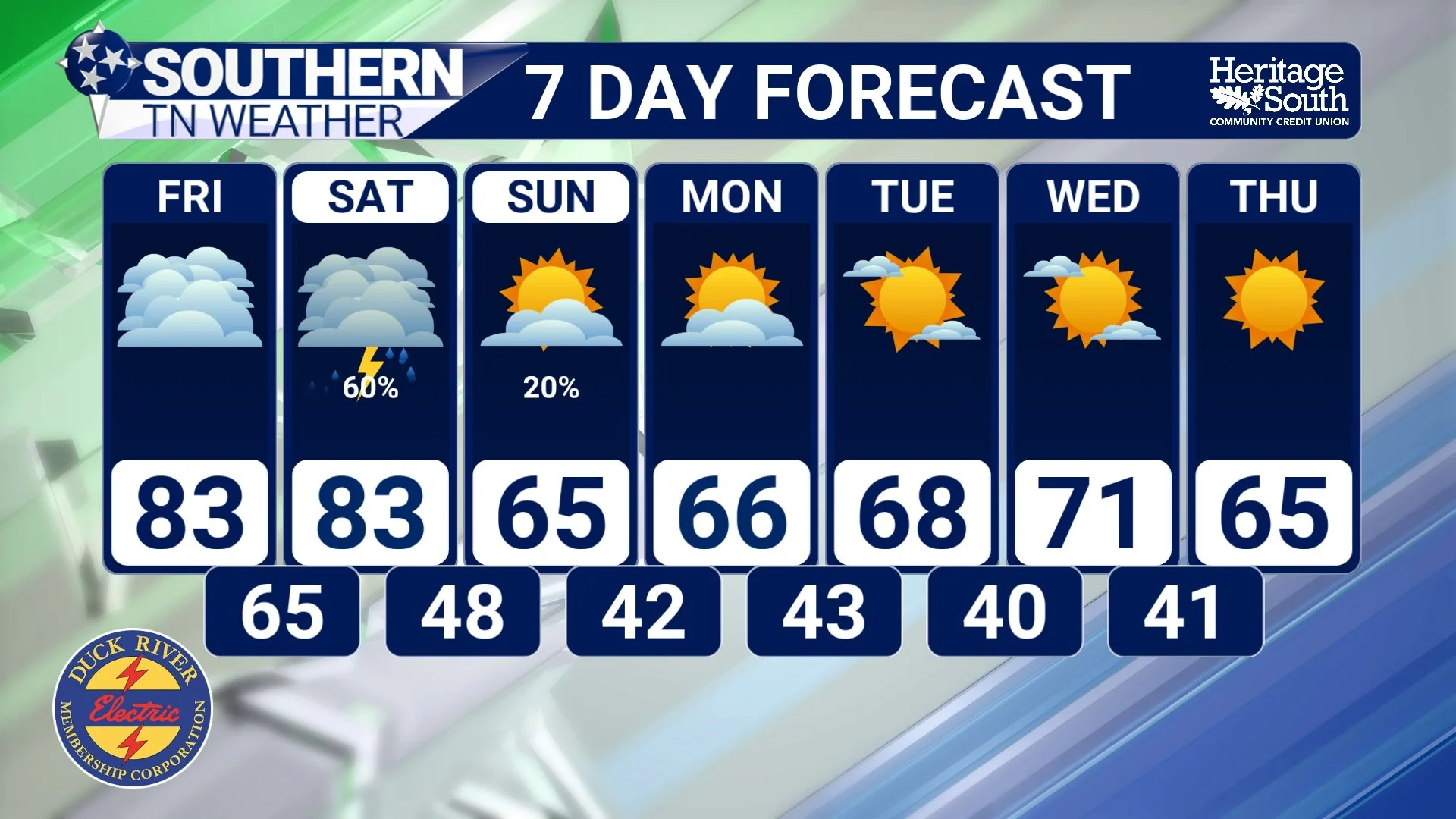
7-DAY FORECAST
The Bottom Line 🧾
• Warm and windy conditions continue through Friday with highs in the 80s
• A stronger cold front brings widespread showers and storms Saturday evening
• Severe weather risk is low, but a few storms could produce gusty winds
• Rainfall totals around 0.75 to 1 inch will help with dry conditions
• Cooler, more seasonable air returns Sunday into early next week
📰 Reminder: The Southern Tennessee Weather Blog, presented by Heritage South Community Credit Union, is updated Monday through Friday with fresh, locally tailored forecasts you can trust.