
Dry Stretch Continues… But Summer-Like Heat Builds Back In

The Southern Tennessee Weather Blog is proudly presented by Heritage South Community Credit Union.
We Help When Others Won’t!
Visit https://www.heritagesouth.org/ today to see how HSCCU can help YOU!
If you’ve stepped outside today, you’ve probably noticed something a little different compared to this time last week. The air feels cleaner, cooler, and much less humid. That’s not by accident. It’s the result of a strong area of high pressure settling in across the region, and it’s going to control our weather for several more days.
Let’s break down what’s happening, why it’s happening, and what it means for Southern Middle Tennessee.
A Quiet Pattern… and Why It’s So Quiet
Right now, we are sitting under the influence of surface high pressure. Think of high pressure as a dome of sinking air. As air sinks, it warms and dries out, which makes it very difficult for clouds and storms to develop. That’s why skies have been mostly clear, humidity has been low, and rain chances are essentially nonexistent.
On top of that, the upper-level pattern is working in our favor for quiet weather. We’re currently in a northwest flow aloft, which is bringing in slightly cooler and drier air from the north. That’s what has allowed temperatures to settle back into the upper 60s and low 70s after the recent warmth. At night, with clear skies and dry air, heat escapes efficiently. That’s why mornings are starting off chilly, with lows dipping into the 40s. It’s classic springtime radiational cooling.
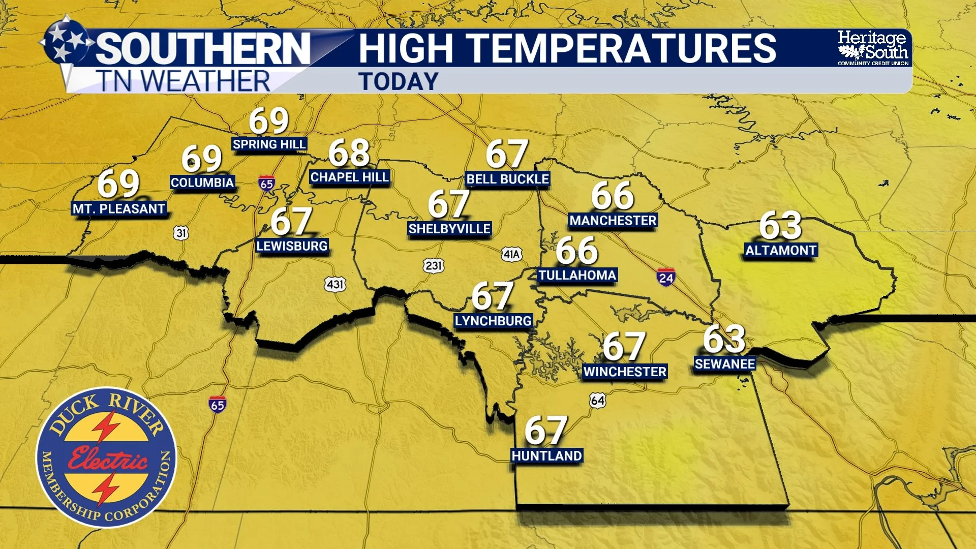
HIGH TEMPS - TODAY
The Pattern Begins changing Midweek
By Wednesday, things start to change… The same high pressure that’s keeping us dry will begin to shift east. When that happens, winds turn around to the south. That is what meteorologists call “return flow.”
This is important because southerly winds pull warmer air northward from the Gulf region. Even without much moisture at first, this process leads to steady warming. At the same time, upper-level ridging begins to build overhead. This is essentially a strengthening of that “dome” of warm air in the atmosphere. As heights rise aloft, temperatures at the surface respond by climbing as well. The result? A gradual but noticeable warming trend beginning Wednesday and continuing through the weekend.
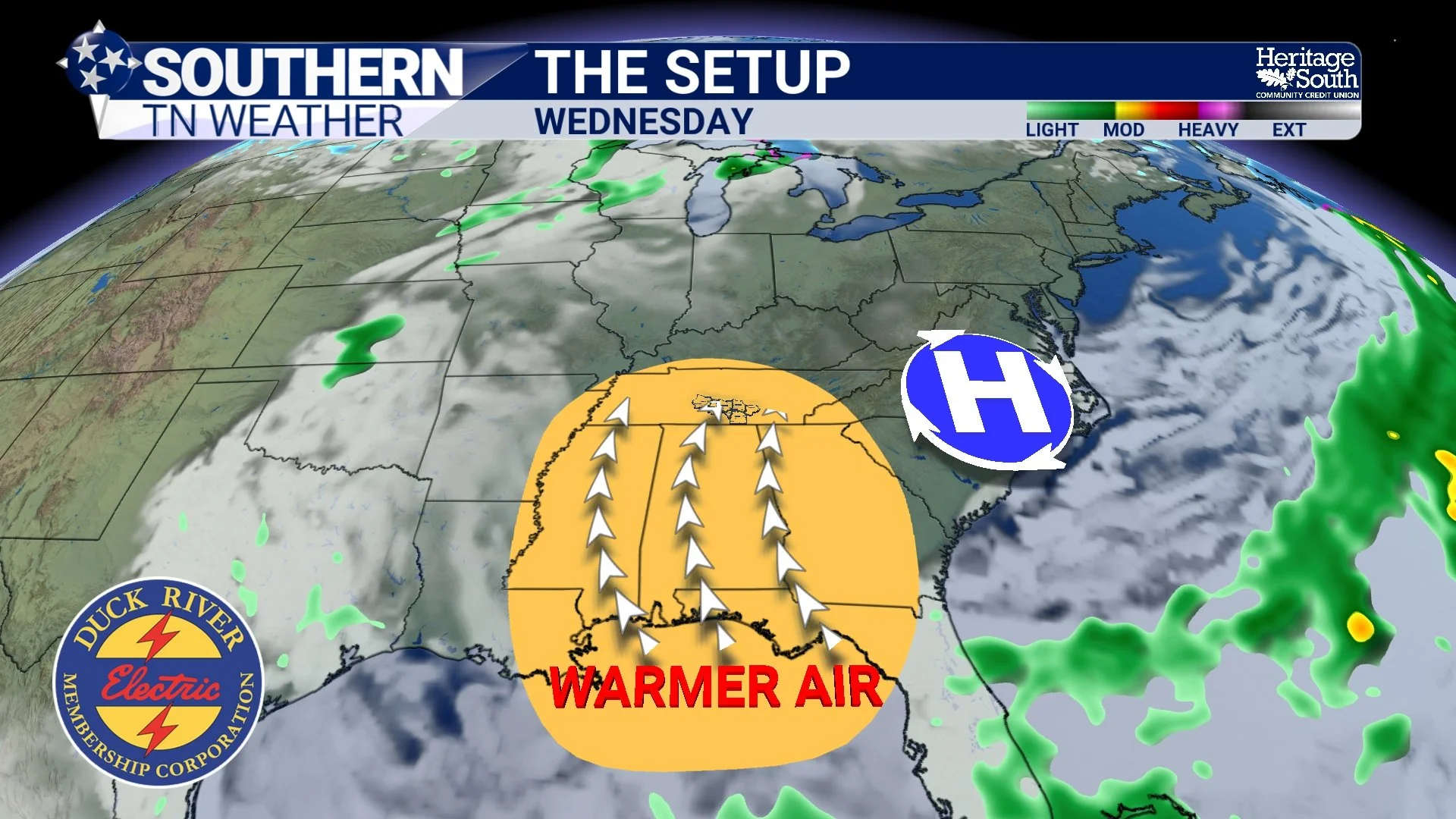
THE SETUP - WEDNESDAY
From Cool Mornings to Near-Record Afternoons
By late week into the weekend, we’re talking about a completely different feel. Afternoon highs will climb into the 80s across Southern Middle Tennessee, and some spots could push the upper 80s. There’s even a low-end chance a few locations flirt with 90 degrees by Sunday or Monday of next week…
For early April, that is well above normal. In fact, some of these temperatures will be approaching record territory. What’s interesting is how stable the pattern looks. Forecast models are tightly clustered, which means confidence is high that this warm stretch will occur. So while we’re enjoying cool mornings now, don’t get used to it. We’re heading right back toward early summer vibes.
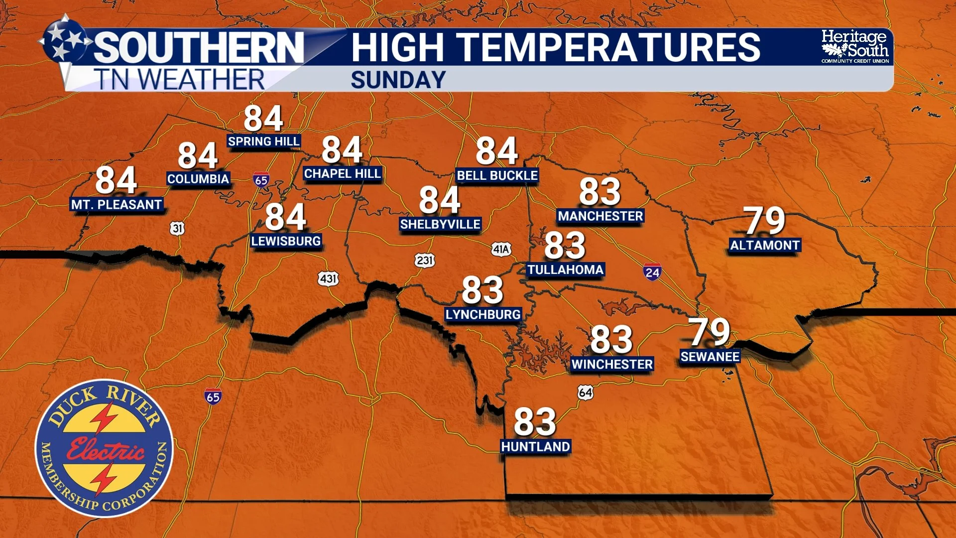
HIGH TEMPERATURES - SUNDAY
The Bigger Concern: Rain (or Lack of It)
Here’s the part that matters long-term. Despite a decent round of rain over the weekend, the pattern ahead is not favorable for additional rainfall. High pressure tends to block storm systems, and that’s exactly what we’re seeing. There are no meaningful rain chances in the forecast through at least the next 7 days, and likely beyond that. From a scientific standpoint, this is tied to the persistence of ridging across the Southeast. Storm systems are being forced to track well to our north, and without strong disturbances or moisture convergence locally, we simply cannot generate rain.
This is where drought concerns start to creep back in… Spring is typically one of our wetter times of year. When we miss multiple rain opportunities during this period, deficits can build quickly. Soil moisture begins to drop, vegetation becomes stressed, and fire danger can increase under the right conditions. So while the quiet weather is great for outdoor plans, it comes with a tradeoff.
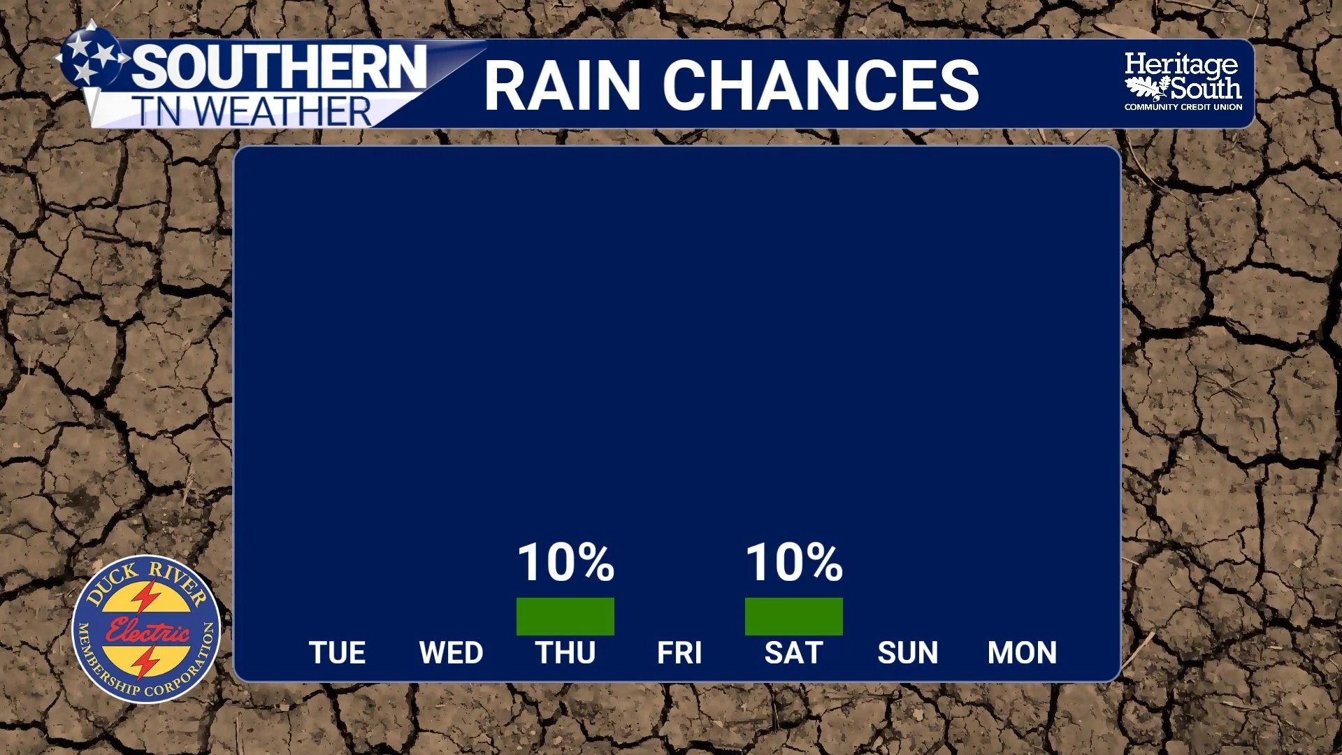
RAIN CHANCES - NEXT 7 DAYS
What to Expect Moving Forward
The overall pattern is simple but important. Quiet now. Warmer soon. Still dry. We’ll keep watching for any signs of pattern breakdown, but right now, there’s no clear signal for a meaningful rainmaker anytime soon.
The Bottom Line 🧾
• Dry and Quiet weather continues through at least Tuesday night
• Cool mornings in the 40s will stick around for a couple more days
• Warming trend begins Wednesday with highs climbing into the 70s
• Summer-like warmth returns this weekend with highs in the 80s
• Near-record temperatures possible Sunday into early next week
• No meaningful rainfall expected for at least the next 7 days
• Drought concerns will continue to gradually increase
📰 Reminder: The Southern Tennessee Weather Blog, presented by Heritage South Community Credit Union, is updated Monday through Friday with fresh, locally tailored forecasts you can trust.