
A Warm, Unsettled Pattern… Tracking Storm Chances Through the Weekend

The Southern Tennessee Weather Blog is proudly presented by Heritage South Community Credit Union.
We Help When Others Won’t!
Visit https://www.heritagesouth.org/ today to see how HSCCU can help YOU!
If it feels more like late May than early April, you’re not wrong. We are sitting in a classic warm sector across Southern Middle Tennessee right now. Temperatures are running well above normal, humidity is increasing, and the atmosphere is just unstable enough to support scattered showers and thunderstorms at times. The key word there is scattered.
This is not a pattern driven by one strong storm system. Instead, it is a series of weaker disturbances moving through a broader flow pattern. That distinction matters because it explains why we will deal with multiple rain chances without a significant severe weather threat.
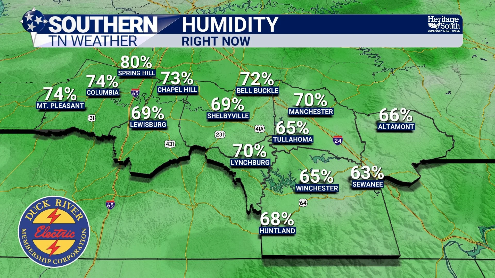
HUMIDITY - RIGHT NOW
Why Storms WILL Develop but Struggle to Strengthen
The atmosphere through the next couple of days is only marginally unstable. There is enough energy for storms to form, but not enough to sustain them for long. One of the biggest clues comes from the instability profile, often called “tall, skinny CAPE.” In simple terms, air can rise, but it does not accelerate upward very efficiently. That leads to storms that build, rain, and collapse fairly quickly.
That is exactly what we are seeing. Brief, pulse-type thunderstorms that pop up during the afternoon, produce a quick downpour, and fade away just as fast. Another limiting factor is weak wind shear. Winds are not changing enough with height to help storms organize. Without that structure, storms stay disorganized and below severe limits.
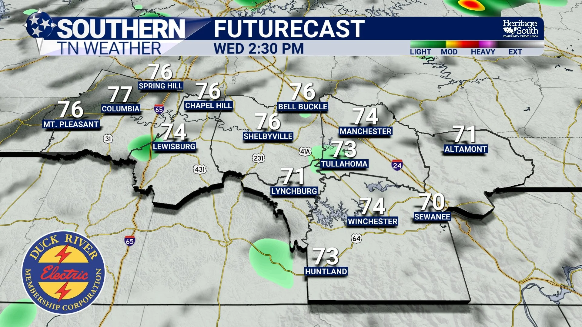
FUTURECAST - THIS AFTERNOON
Why High Pressure Is Still Involved
High pressure is still playing a major role in our weather, even though we are seeing storm chances. It is positioned to our southeast and doing two important things. First, it is pulling in warm and moist air from the Gulf. That is why temperatures are in the 80s and why nights are staying mild in the 60s. Second, it is creating a subtle cap on the atmosphere at times. That cap limits how widespread storms can become. This is especially noticeable on Thursday when storm chances drop a bit despite the continued warmth.
So we end up with a balance. Enough heat and moisture for storms, but enough suppression to keep coverage limited.
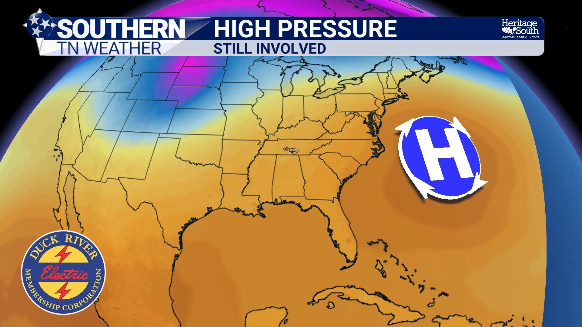
HIGH PRESSURE - STILL INVOLVED
Friday into Saturday Brings a Better Chance for Rain
By Friday, a weak boundary tries to move in from the west. However, it runs into the same high pressure influence and begins to weaken. That means rain chances stay on the lower side and totals remain light. Saturday is when things become more organized…
A stronger cold front approaches the region with better upper-level support. This should allow a more defined line of showers and thunderstorms to develop and move through, especially Saturday evening into the overnight hours. Even with that setup, the overall severe threat remains low. The strongest wind energy and upper-level dynamics stay well to our north. That keeps storms from reaching their full potential locally. That said, a few stronger wind gusts cannot be ruled out as the line moves through.
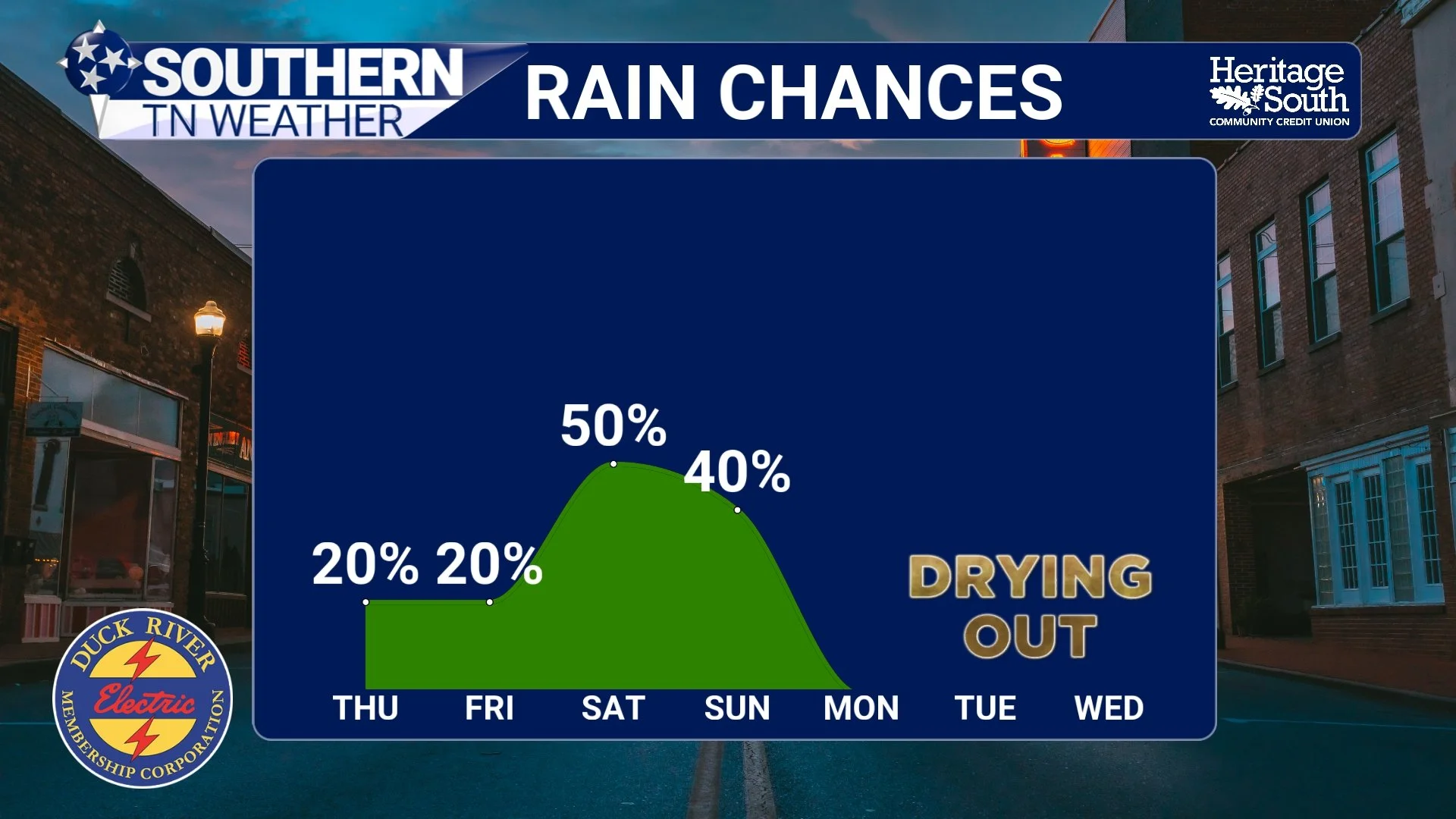
RAIN CHANCES - NEXT 7 DAYS
What Happens After the Front
Once the front moves through early on Easter Sunday, the pattern changes quickly. Winds shift out of the northwest, drier air moves in, and temperatures drop back into the 60s for highs. It will not be cold, but it will feel noticeably different after several days in the 80s. This is a classic spring transition with warm surges followed by quick cooldowns as fronts pass through. Dry weather looks to take us into the middle of the month.
The Bottom Line 🧾
• Warm and humid conditions continue through Saturday with highs in the 80s
• Scattered afternoon and evening storms possible through Friday
• Storms remain weak due to limited instability and wind shear
• Better rain chances arrive Saturday evening into early Sunday
• Severe weather risk is low, but a few gusty storms are possible
• Cooler and drier air returns for Easter Sunday and early next week
📰 Reminder: The Southern Tennessee Weather Blog, presented by Heritage South Community Credit Union, is updated Monday through Friday with fresh, locally tailored forecasts you can trust.