
WEATHER BLOG

Presented By:
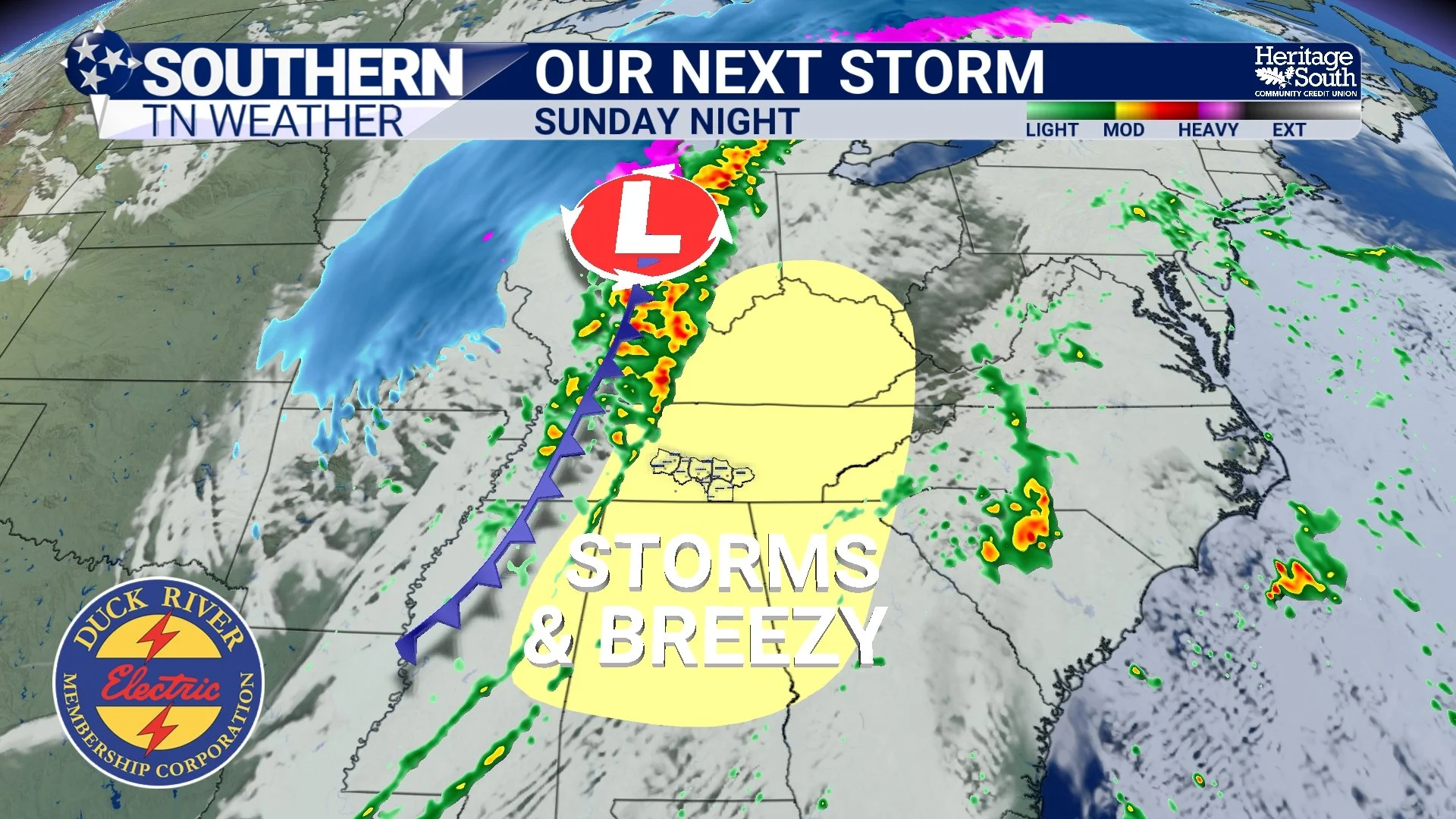
Weather Whiplash Incoming!
If you like dramatic weather changes, the next several days will deliver exactly that across Southern Middle Tennessee. We’re going from cool and breezy today… to spring warmth this weekend… to a stormy cold front Sunday night… and possibly even a few snowflakes early next week. In other words, WEATHER WHIPLASH is on the way.
Strong to Severe Thunderstorms Possible Wednesday
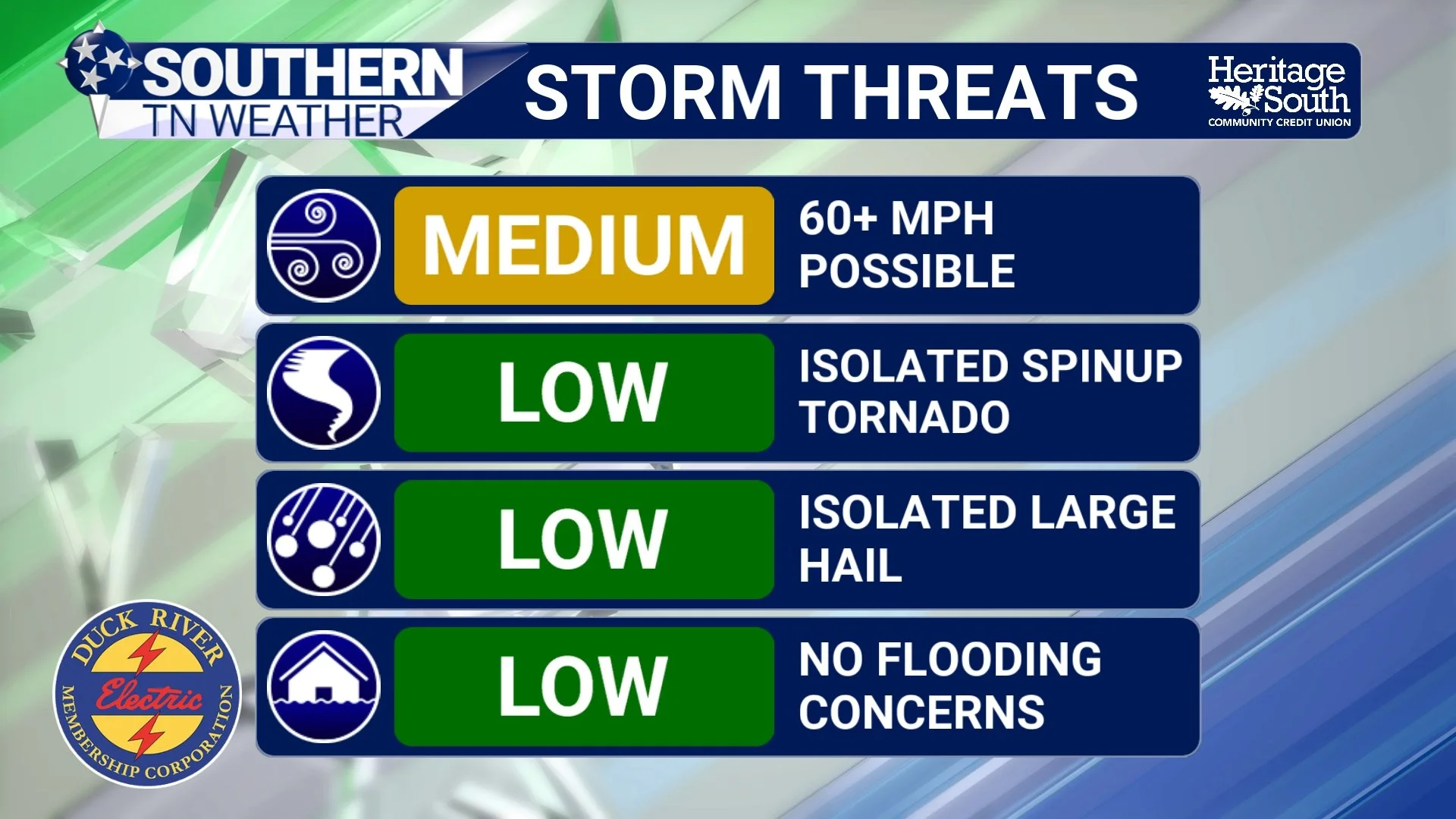
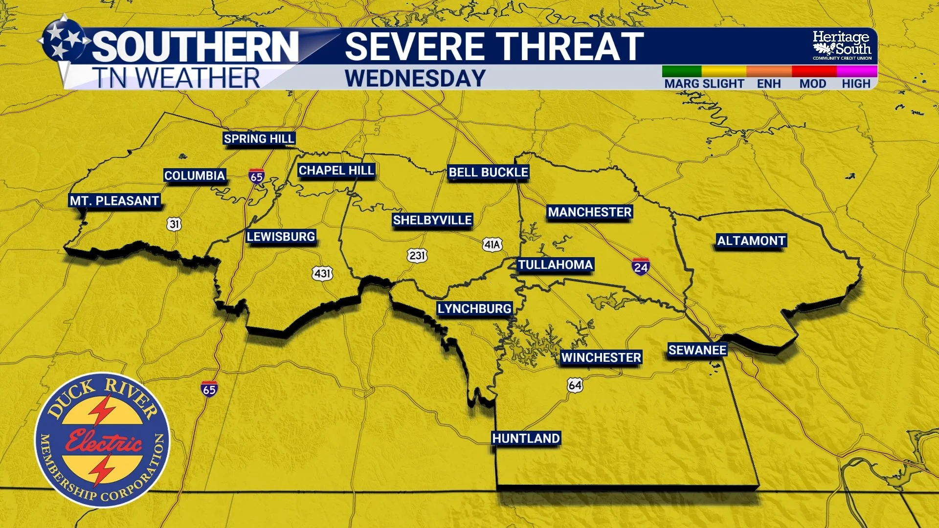
An active stretch of weather continues across Southern Middle Tennessee, with the greatest concern now shifting to Wednesday afternoon and evening, when a line of strong to severe thunderstorms may move across the region. The Storm Prediction Center has placed all of Middle Tennessee under a Slight Risk (Level 2 out of 5) for severe weather on Wednesday. While this is not an unusually high risk for this time of year, it does signal that scattered severe storms are possible, especially during the late afternoon and evening hours.
An Active Pattern to Start The Week… Latest Details Here
An unsettled stretch of weather is underway across Southern Middle Tennessee as several disturbances move through the region over the next few days. While temperatures will remain well above average with highs in the 70s to near 80°, multiple rounds of showers and thunderstorms are expected from late this afternoon through Wednesday night.
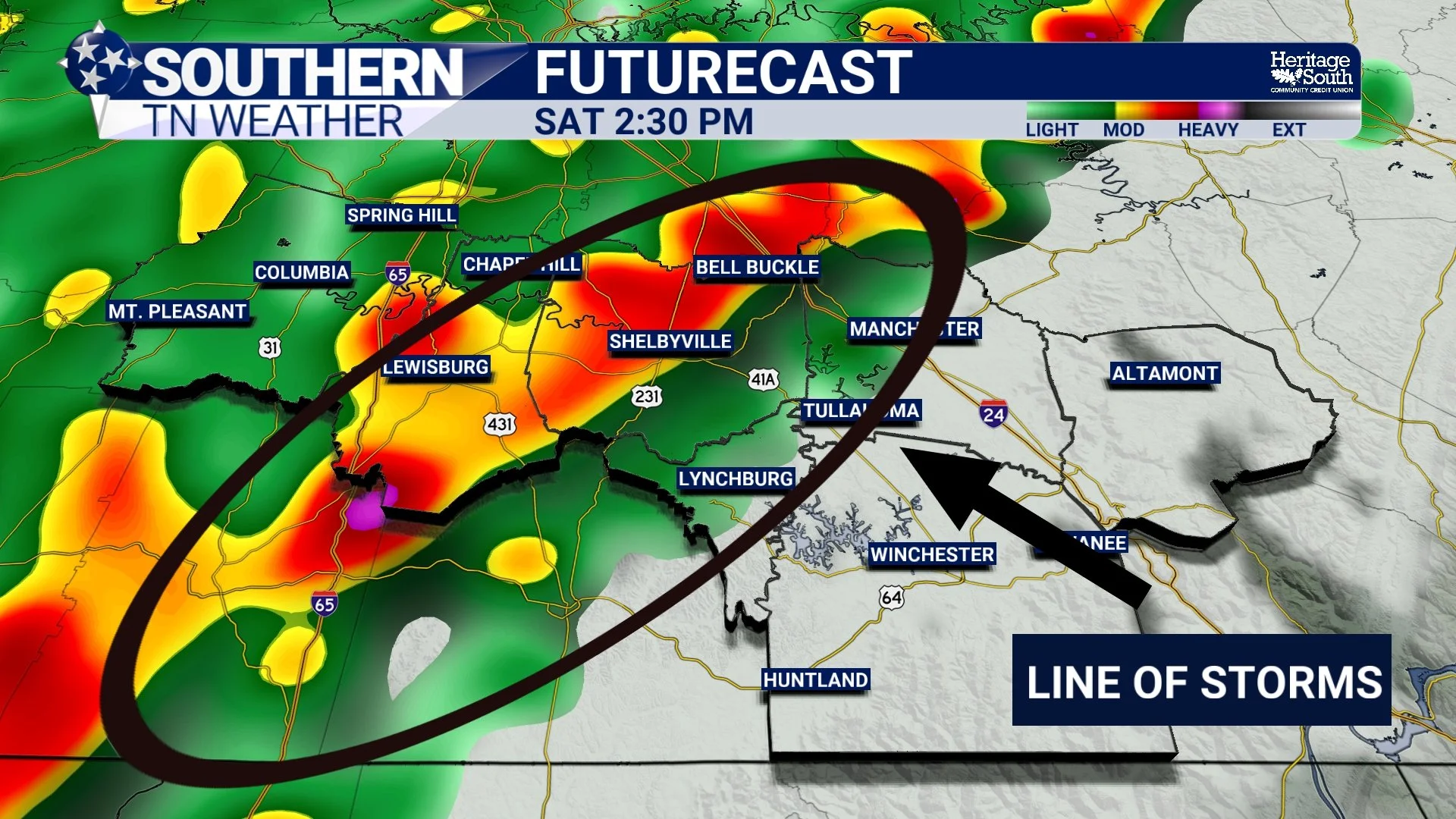
Storms Likely Saturday: Latest Details Here
Today itself remains mostly quiet. A few isolated showers or thunderstorms could pop up late this afternoon or early evening as small disturbances rotate around the ridge overhead, but coverage will remain very limited and severe weather is not expected today. The bigger story arrives tomorrow.
Record Warmth Continues, Weekend Storms on the Horizon
If you stepped outside today and thought it felt more like late April than early March, you’re not alone. Temperatures across Southern Middle Tennessee are pushing well into the upper 70s to near 80 degrees this afternoon, putting record highs in jeopardy for many locations.
Spring Preview Continues Across Southern Middle Tennessee
If it feels more like late April than early March, you’re not imagining it. Temperatures across Southern Middle Tennessee have surged into the mid and upper 70s this afternoon, running 15 to 20 degrees above normal for this time of year.
Springlike Warmth Expands, Weekend Storms Coming
Cloud cover remains in place across Southern Middle Tennessee this afternoon, but temperatures are responding to strong southerly flow. Most areas are climbing into the low to mid 70s … already running 10 to 20 degrees above early March normals.
Warmth Building, Records in Sight
Light rain showers continue across parts of Southern Middle Tennessee this afternoon, especially over our western communities. Much of what’s showing up on radar has struggled to reach the ground due to dry air in the lower levels of the atmosphere.
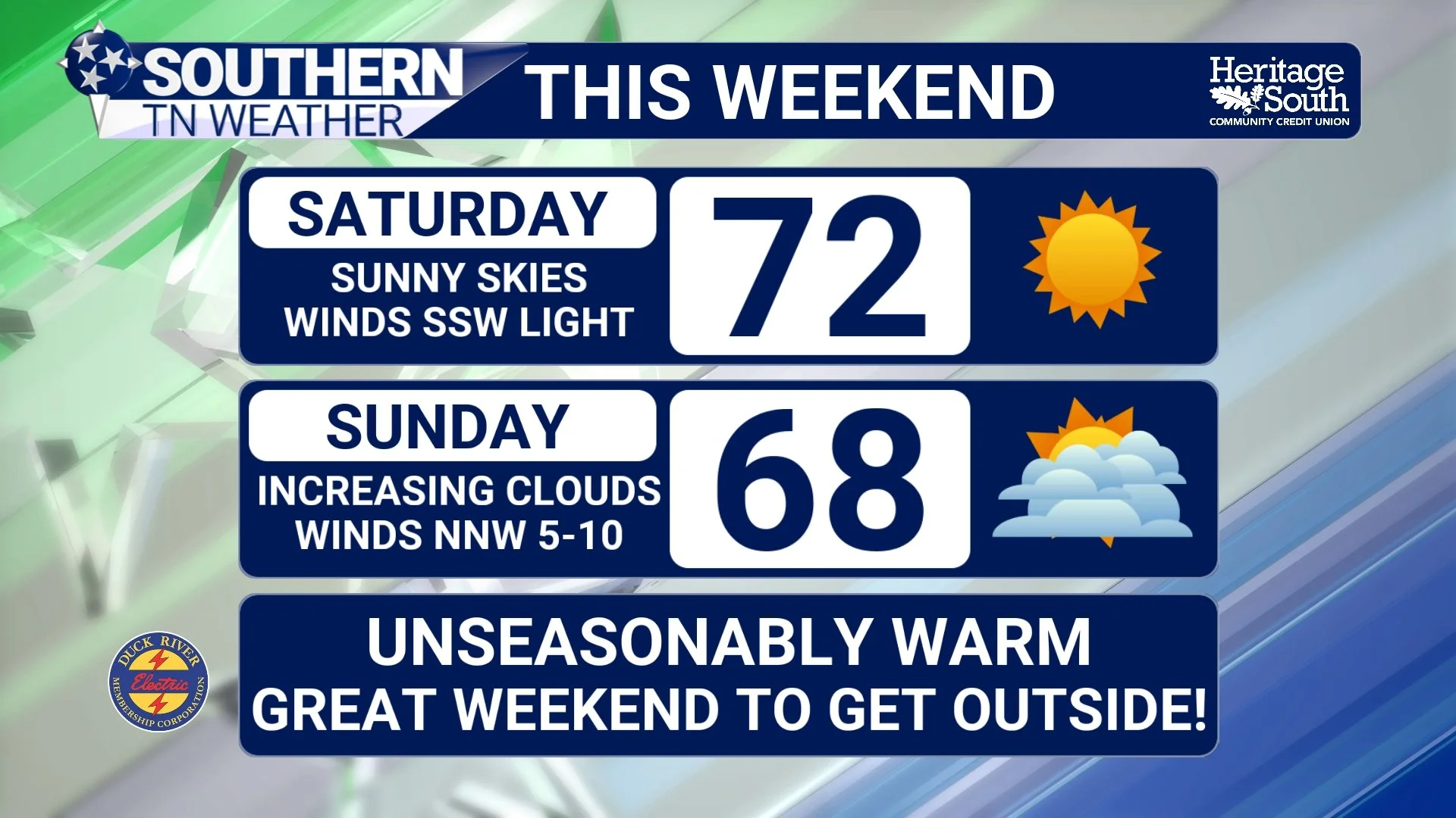
Sunshine, 70° Air, and a Spring-Like Weekend Ahead
High pressure is firmly in control across Southern Middle Tennessee this afternoon, and it shows. After a cool start this morning, temperatures have surged into the mid 60s, with a few communities flirting with 70°. That’s nearly 25 to 30 degrees warmer than where we started the day.
Sunshine Returns, Spring Preview This Weekend
Southern Middle Tennessee is drying out today as the cold front that brought our midweek rain pushes south of the area. Clouds linger this morning, but gradual clearing is expected through the afternoon. You’ll notice a big difference compared to yesterday — no steady rain, no thunder, just improving conditions!
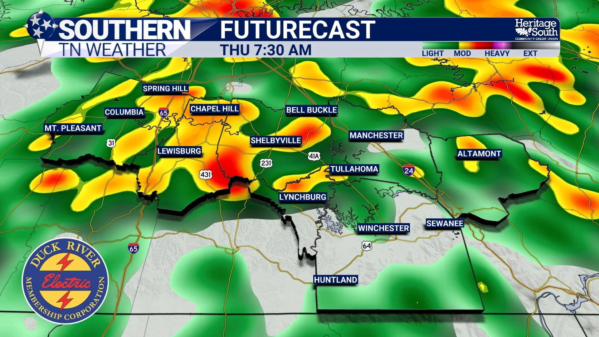
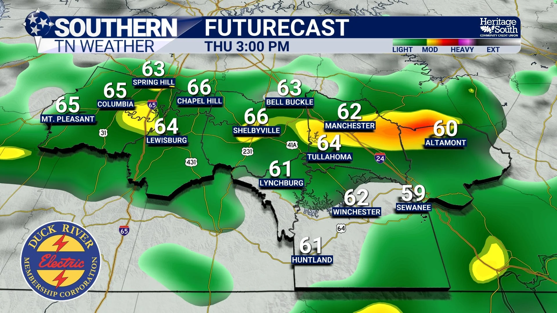
Rain Returns Tonight; Details Here!
Southern Middle Tennessee stays mild this afternoon, but changes are underway. A stalled boundary just to our north combined with an approaching shortwave from the Plains will bring increasing rain chances later today. A shortwave is a small disturbance in the upper levels of the atmosphere.
Winds Pick Up, Rain Moves In Tomorrow
Southern Middle Tennessee is finally breaking out of the freeze we’ve been dealing with over the past few days, and the transition is noticeable today. After several bitterly cold mornings, temperatures are rebounding into the mid 40s to lower 50s this afternoon. The warmer air is arriving on gusty southwest winds, with occasional gusts up to 25 mph. That breeze is a sign that the pattern is shifting in a bigger way…
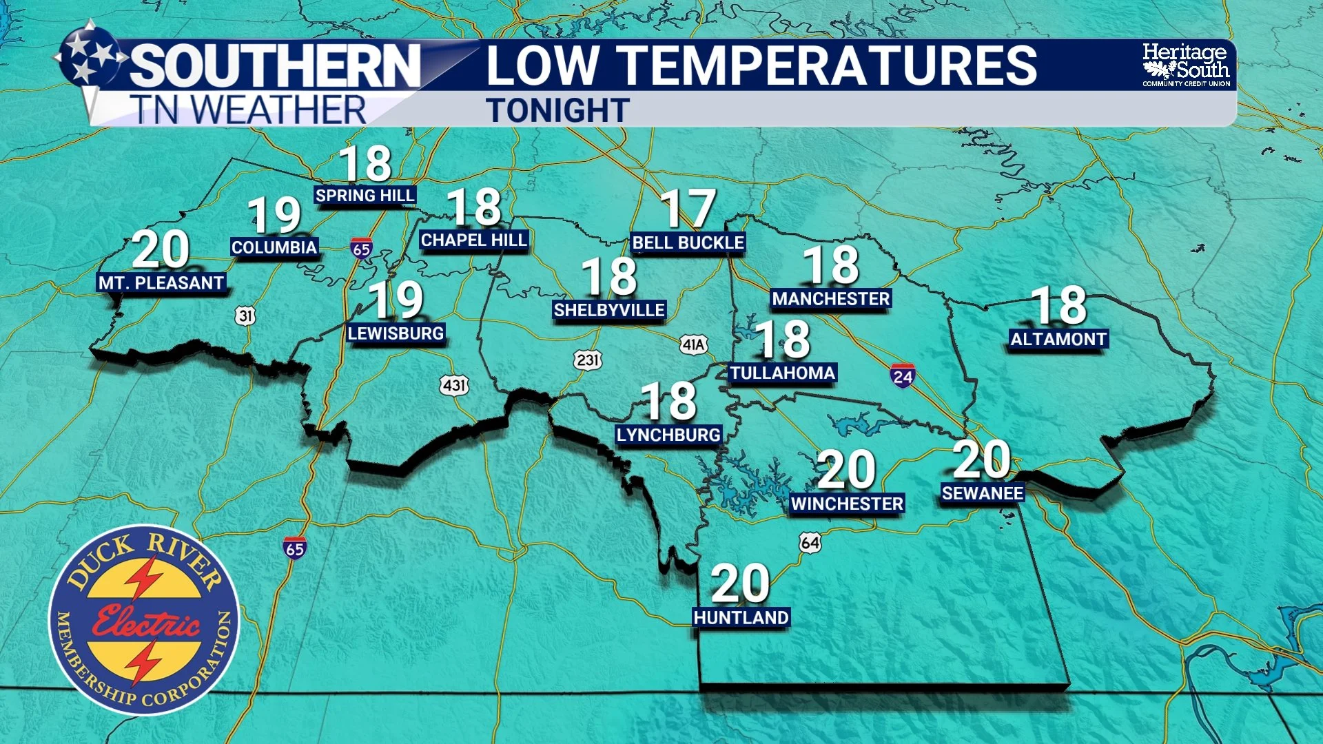
Cold Tonight, Warmer Tomorrow, Rain Returns Midweek
Southern Middle Tennessee is starting the week on a cold and breezy note, but changes are already lining up as we head toward midweek.
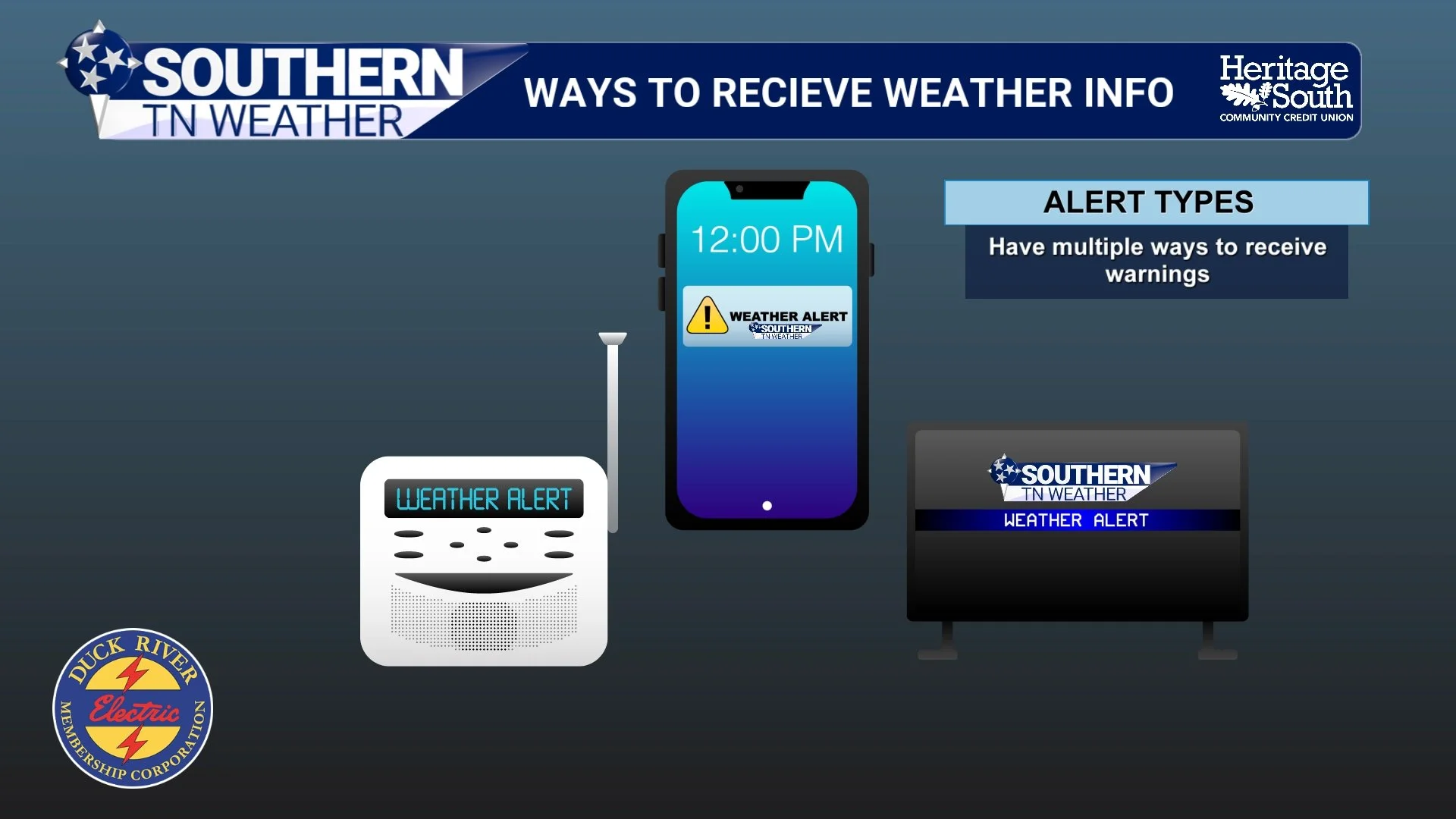
Severe Weather Awareness 2026: Tools to Recieve Weather Information
When severe weather strikes, seconds matter. The difference between being informed and being unaware can save lives. One of the most important steps you can take is making sure you have multiple reliable ways to receive weather information. No single source is enough.
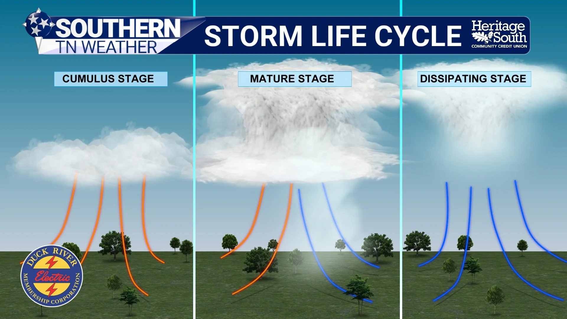
Severe Weather Awareness 2026: Severe Thunderstorms
Regardless of how storms evolve, tonight is a reminder that severe thunderstorm season is here. As part of Severe Weather Awareness Week, today’s focus is on severe thunderstorms and how to stay safe.

Severe Weather Awareness 2026: Tornadoes
Tornadoes can happen any time of year in Middle Tennessee. While spring is peak season, we have seen tornadoes in every month. That is why awareness and preparation matter. A tornado is a violently rotating column of air that extends from a thunderstorm to the ground. They can form quickly and sometimes with little visual warning, especially in heavy rain or at night.
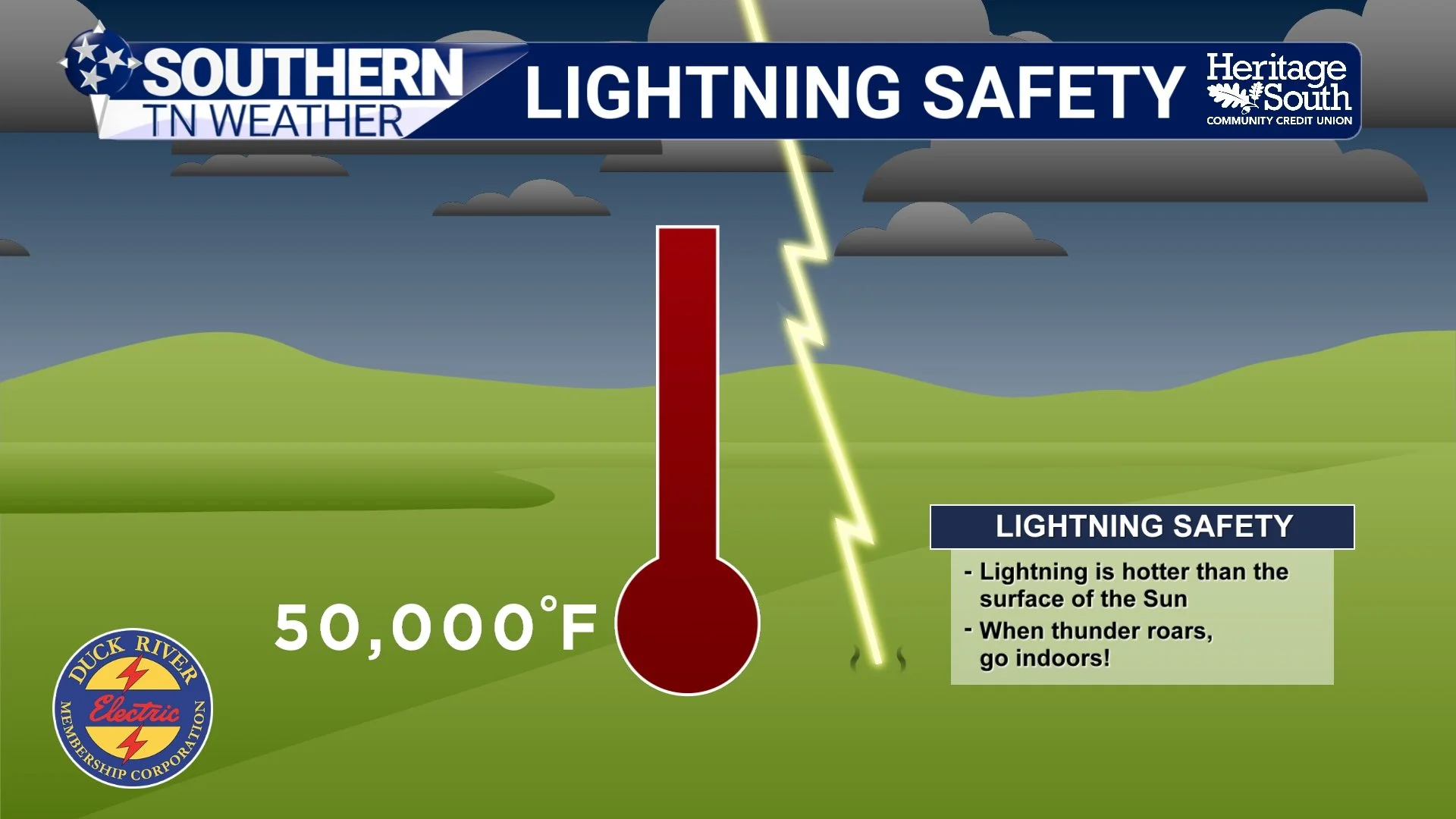
Severe Weather Awareness 2026: Lightning
Lightning is often underestimated, but it is one of the leading weather-related killers in the United States. You don’t need a tornado or damaging winds for lightning to be deadly. Understanding how lightning forms (and how far it can strike) is key to staying safe. Our region sees frequent thunderstorms, especially in spring and summer. Lightning doesn’t need a severe warning to be dangerous. Many lightning injuries happen on “just a stormy day” when people don’t think the threat is serious!
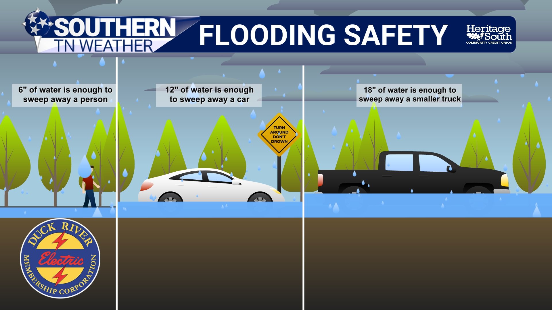
Severe Weather Awareness 2026: Flooding
Flooding is the leading cause of weather-related fatalities in the United States, and it does not take a major storm to create dangerous conditions. Our region is especially vulnerable due to a combination of rolling terrain, creeks and rivers that respond quickly to heavy rain, and areas with poor drainage.
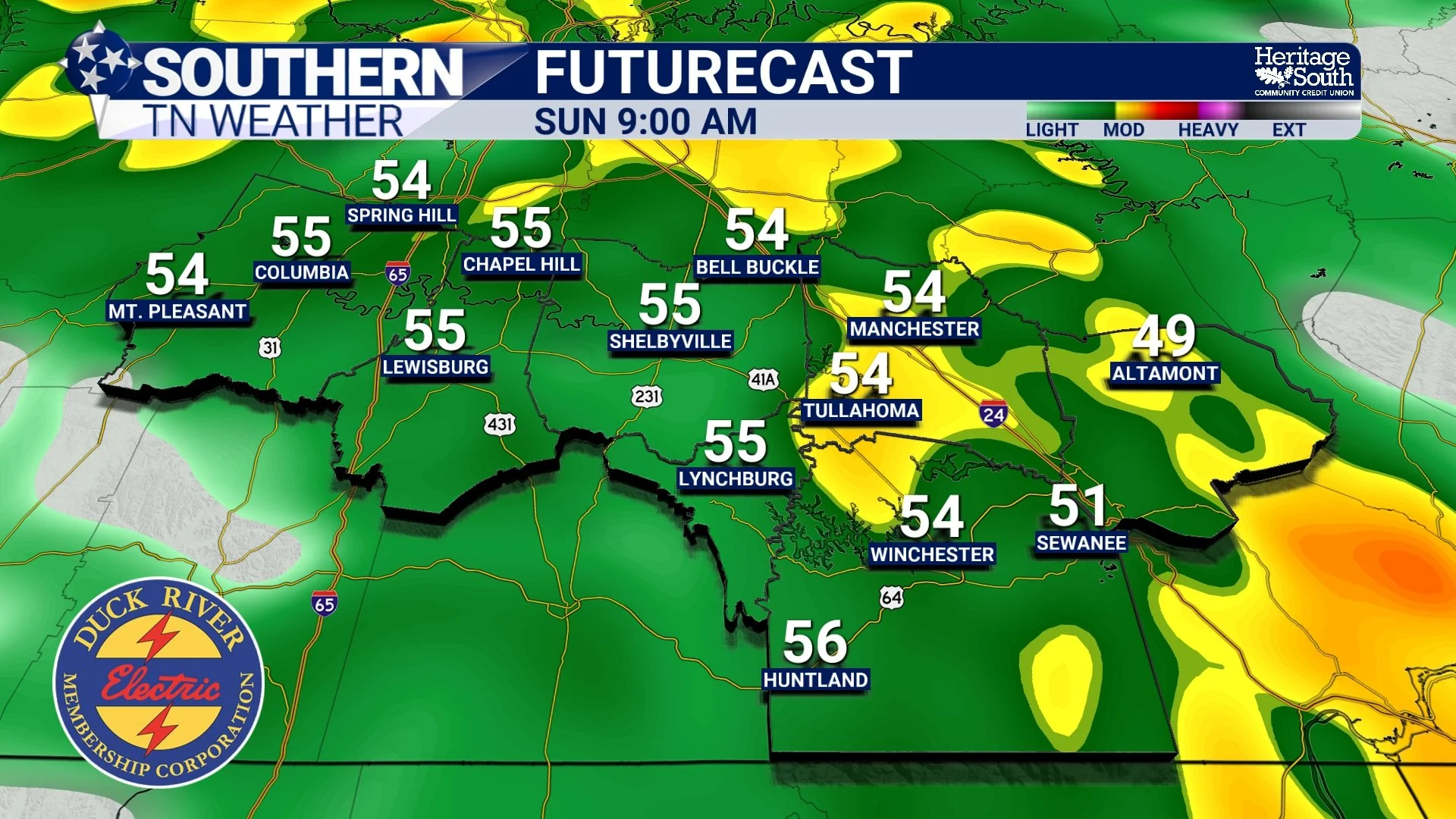
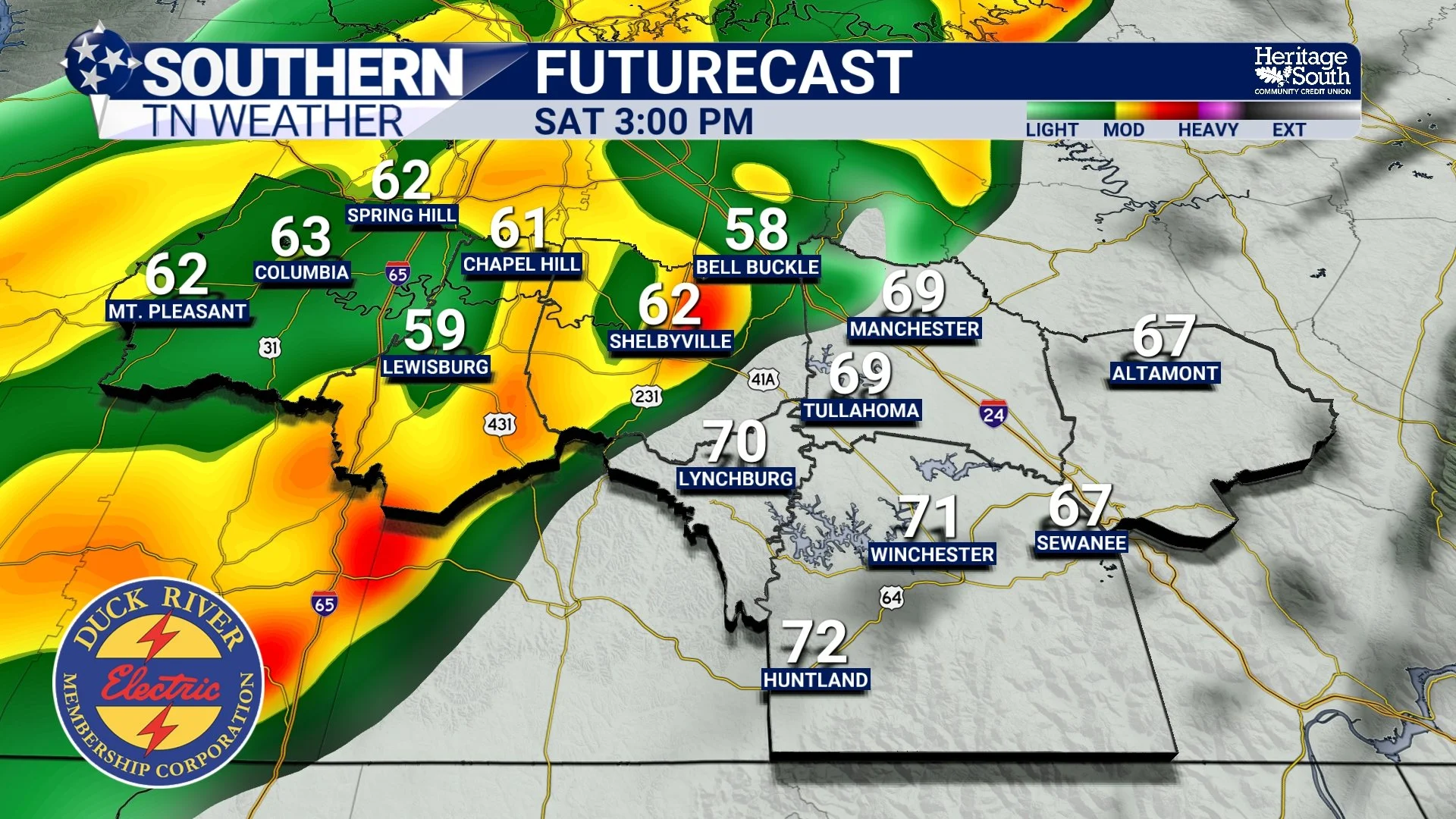
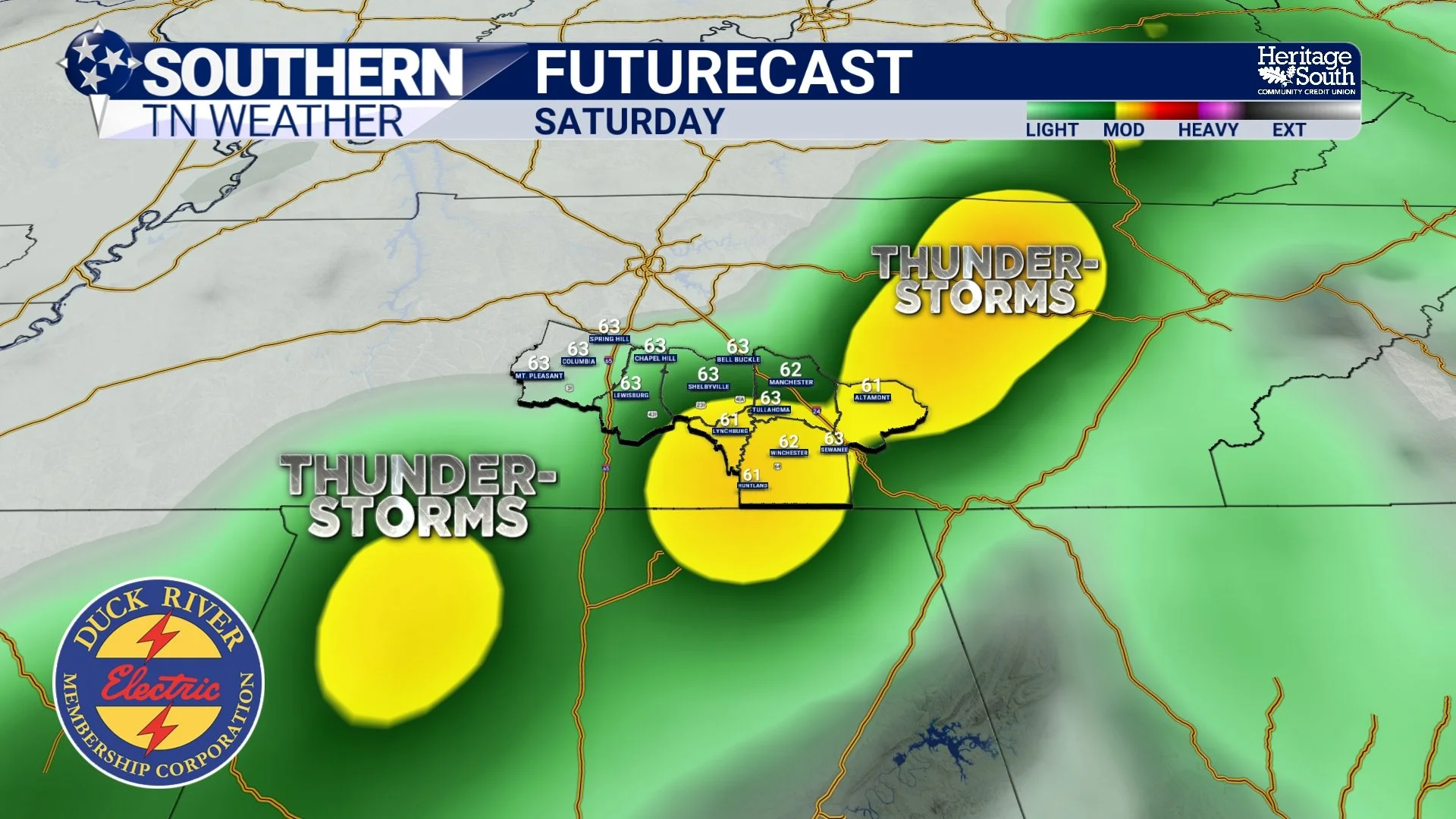
A Wet Weekend Ahead, but No Major Impacts Expected
Southern Middle Tennessee is heading into a noticeably wetter pattern this weekend, but the overall setup favors beneficial rainfall rather than hazardous weather. After a dry finish to the work week and a quiet start to Saturday, a strong storm system will move across the southern United States late Saturday through Sunday, bringing widespread rain to the region. While rainfall will be steady at times, flooding and severe weather concerns remain low.
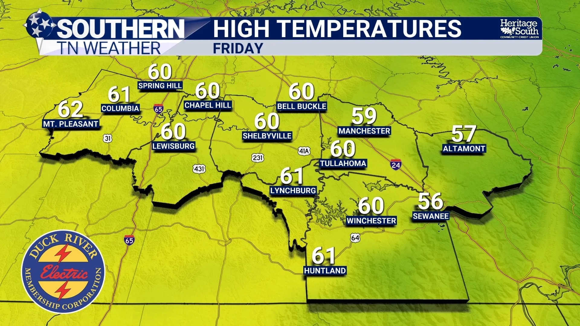
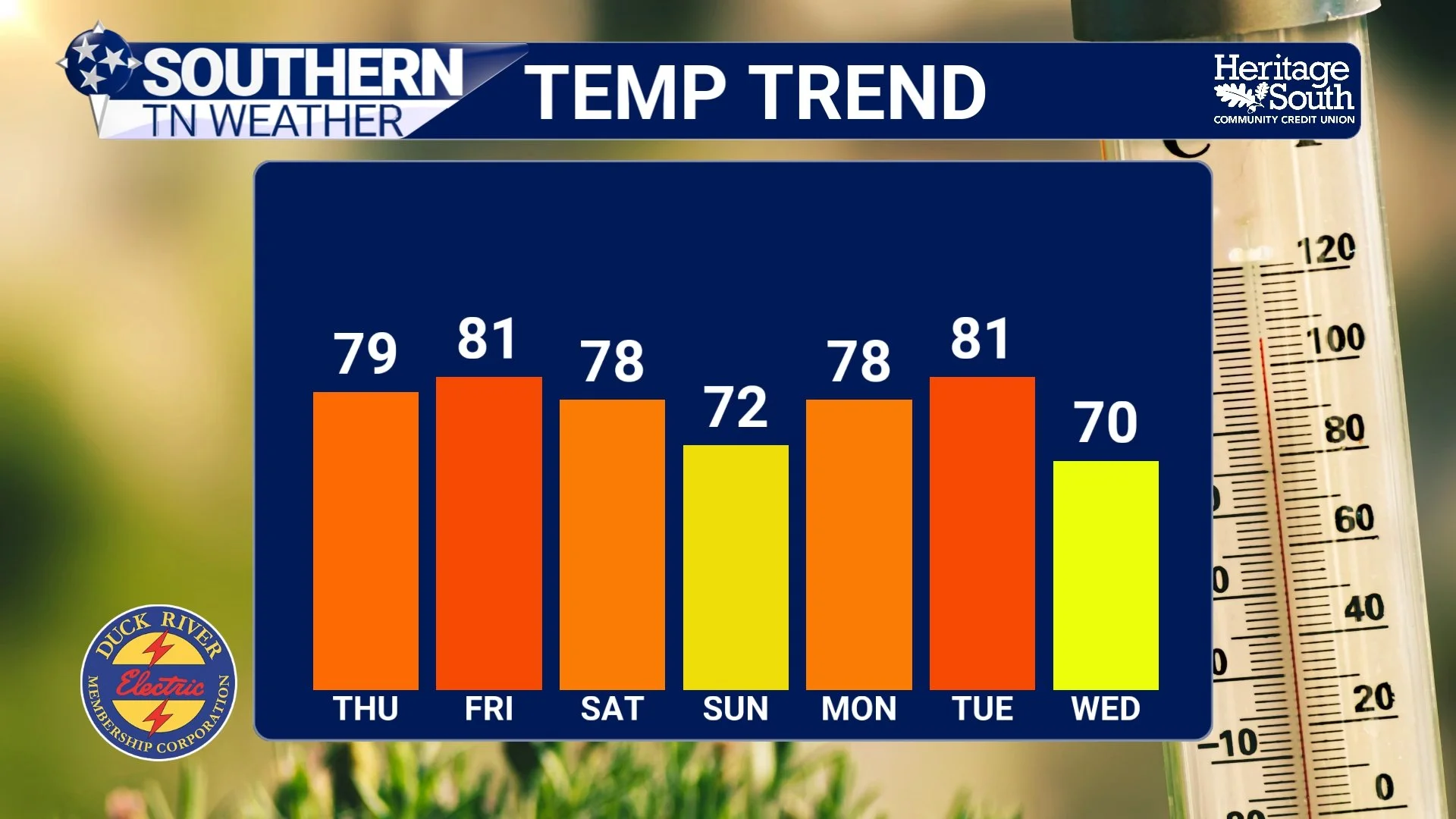
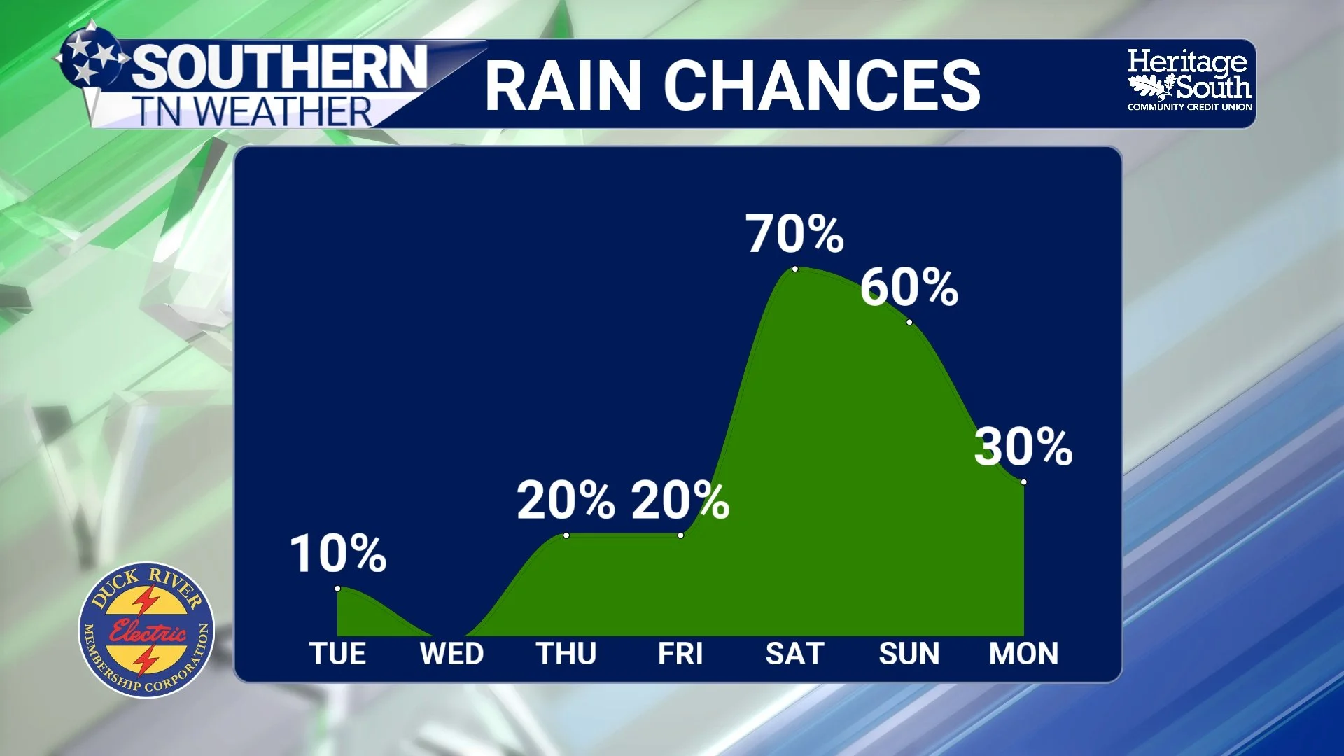
Rain This Weekend, Warmer Weather Next Week
Southern Middle Tennessee is sitting in a brief lull in the active weather pattern today, but that quiet stretch is temporary. High pressure is providing dry and fairly mild conditions through Friday, before a southern-stream system brings a widespread, soaking rain to the region this weekend. After that system moves out, the overall pattern favors above-normal temperatures heading into next week.