
Winds Pick Up, Rain Moves In Tomorrow

The Southern Tennessee Weather Blog is proudly presented by Heritage South Community Credit Union.
We Help When Others Won’t!
Visit https://www.heritagesouth.org/ today to see how HSCCU can help YOU!
Southern Middle Tennessee is finally breaking out of the freeze we’ve been dealing with over the past few days, and the transition is noticeable today. After several bitterly cold mornings, temperatures are rebounding into the mid 40s to lower 50s this afternoon. The warmer air is arriving on gusty southwest winds, with occasional gusts up to 25 mph. That breeze is a sign that the pattern is shifting in a bigger way…
Tonight: Not Nearly as Cold
High pressure that brought us clear skies and teens overnight is sliding off the Southeast coast. As it does, winds remain out of the south and clouds gradually thicken. Instead of lows in the teens or 20s, most of Southern Middle Tennessee will bottom out in the upper 30s to lower 40s tonight. That is a noticeable difference compared to the last few mornings where we had lows in the teens…
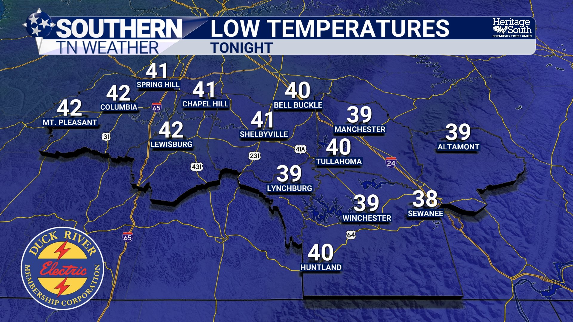
LOW TEMPS - TONIGHT
Wednesday: Clouds Increase, Rain Begins Late
Wednesday stays mild, with highs pushing into the 50s and even near 60 degrees in some of our southern communities. A trailing cold front dropping through the Ohio Valley will approach Tennessee during the day. As it interacts with increasing Gulf moisture, light rain chances will begin developing during the afternoon. Coverage increases Wednesday evening as energy moves along the frontal boundary.
If you have outdoor plans Wednesday, most of the daytime hours look dry. The better chance for widespread rain holds off until after sunset, but be aware that a few sprinkles or light showers will still be possible before sunset.
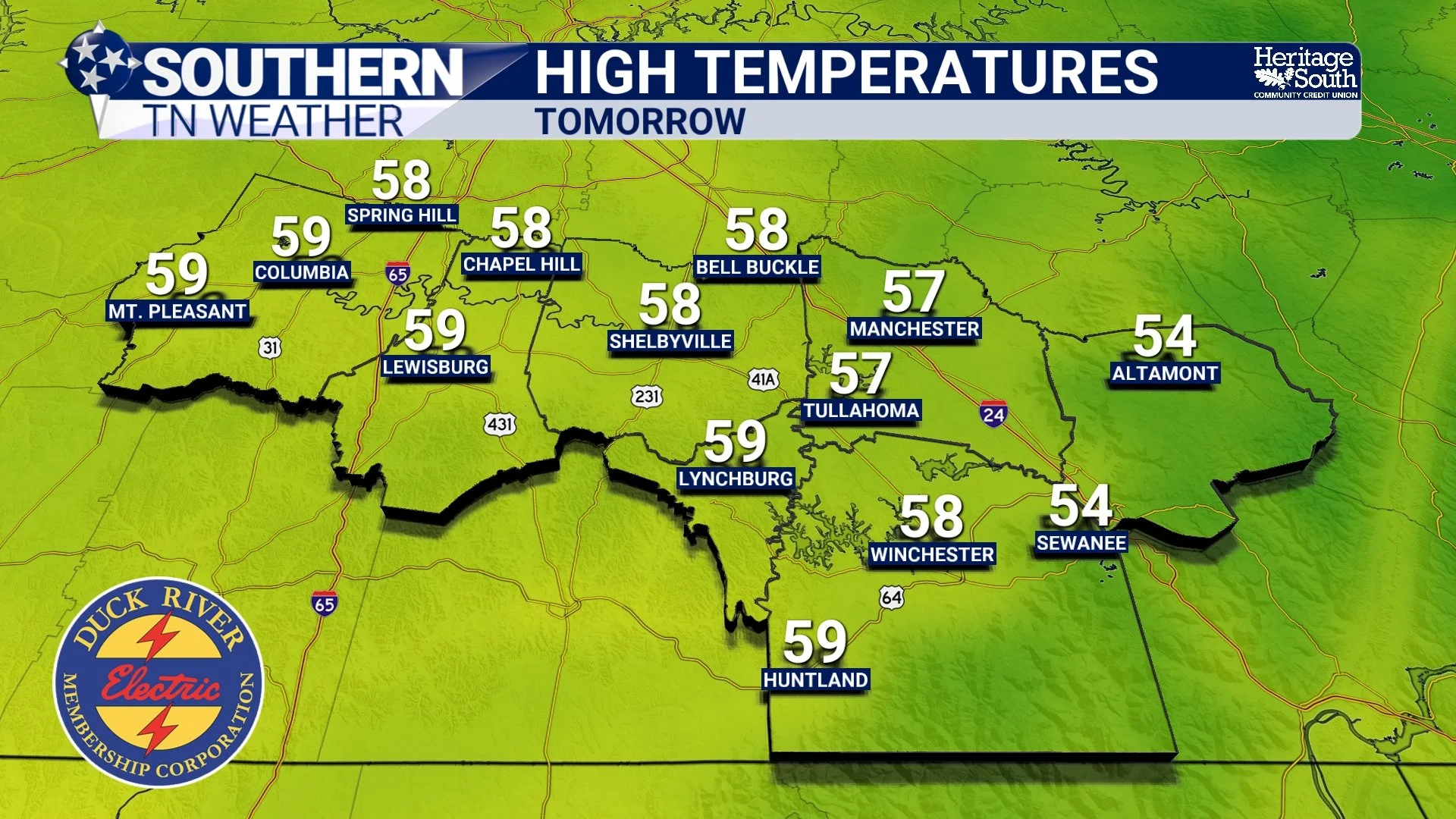
HIGH TEMPS - WEDNESDAY
Wednesday Night into Thursday: Widespread Soaking Rain
Rain becomes likely area-wide Wednesday night and continues through much of Thursday. Latest rainfall projections for our area show us getting between a half inch and 2 inches of rain. This is a healthy soaking rain, but models have trended slightly weaker with this system compared to earlier forecasts. Flooding concerns remain low.
There will be strong wind shear (a.k.a. wind energy) in the atmosphere, but surface instability (a.k.a. storm fuel) appears very limited. That means a few rumbles of thunder are possible, especially late Wednesday night into Thursday, but severe storms are not expected at this time.
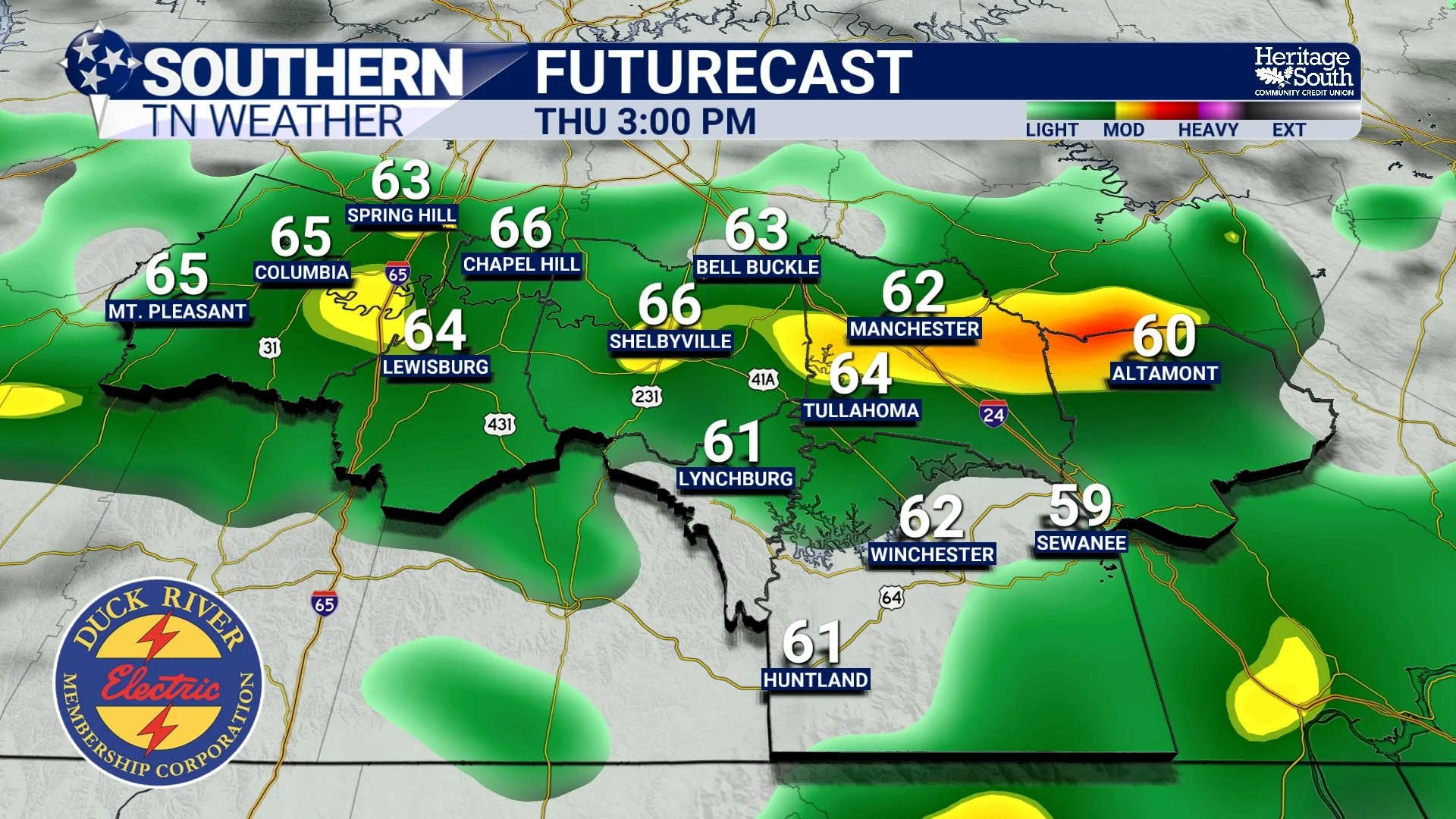
FUTURECAST - THURSDAY AFTERNOON
Late Week and Weekend: Staying Mild
Once the front moves through Thursday night, rain tapers off and we return to a fairly zonal pattern. That setup favors mild temperatures. Highs Friday will reach the low to mid 60s. By Saturday and Sunday, many areas across Southern Middle Tennessee will climb into the upper 60s to lower 70s. Another weak disturbance may bring low rain chances late Sunday into early next week, but nothing major is on the board right now.
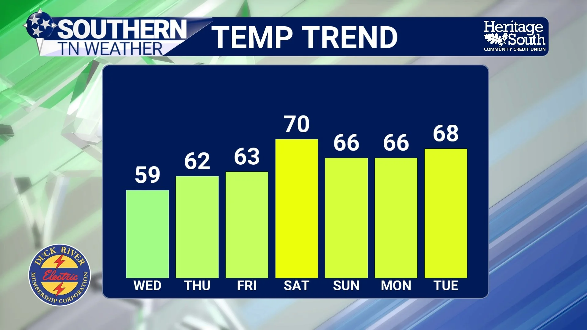
TEMP TREND - NEXT 7 DAYS
The Bottom Line 🧾
Temperatures rebound today with gusty southwest winds.
Much milder tonight with lows near 40.
Rain develops Wednesday afternoon and becomes likely Wednesday night.
Widespread soaking rain Thursday, but severe threat looks low.
Mild 60s and 70s return this weekend.
📰 Reminder: The Southern Tennessee Weather Blog, presented by Heritage South Community Credit Union, is updated Monday through Friday with fresh, locally tailored forecasts you can trust.