
Cold Tonight, Warmer Tomorrow, Rain Returns Midweek

The Southern Tennessee Weather Blog is proudly presented by Heritage South Community Credit Union.
We Help When Others Won’t!
Visit https://www.heritagesouth.org/ today to see how HSCCU can help YOU!
Southern Middle Tennessee is starting the week on a cold and breezy note, but changes are already lining up as we head toward midweek…
Today: Chilly and Breezy
A deep upper-level trough over the eastern United States and high pressure building in from the Plains are keeping us locked into a cold northwest flow. Winds have been gusting between 20 and 25 mph today, making it feel even colder than the thermometer suggests. High temperatures will only reach the low to mid 30s this afternoon. A few flurries were reported earlier, but most of those have wrapped up and clearing skies will continue through the evening.
Tonight: Clear and Very Cold
With high pressure settling overhead, winds will diminish and skies will clear. That combination sets us up for strong radiational cooling. Overnight lows will fall into the teens to lower 20s across Southern Middle Tennessee. Some of our colder rural communities could dip into the upper teens. While winds will be lighter tonight, it will still be a cold start Tuesday morning.
If you use a space heater, remember basic safety rules:
Keep at least 3 feet of space around it
Do not leave it running while asleep
Plug it directly into a wall outlet
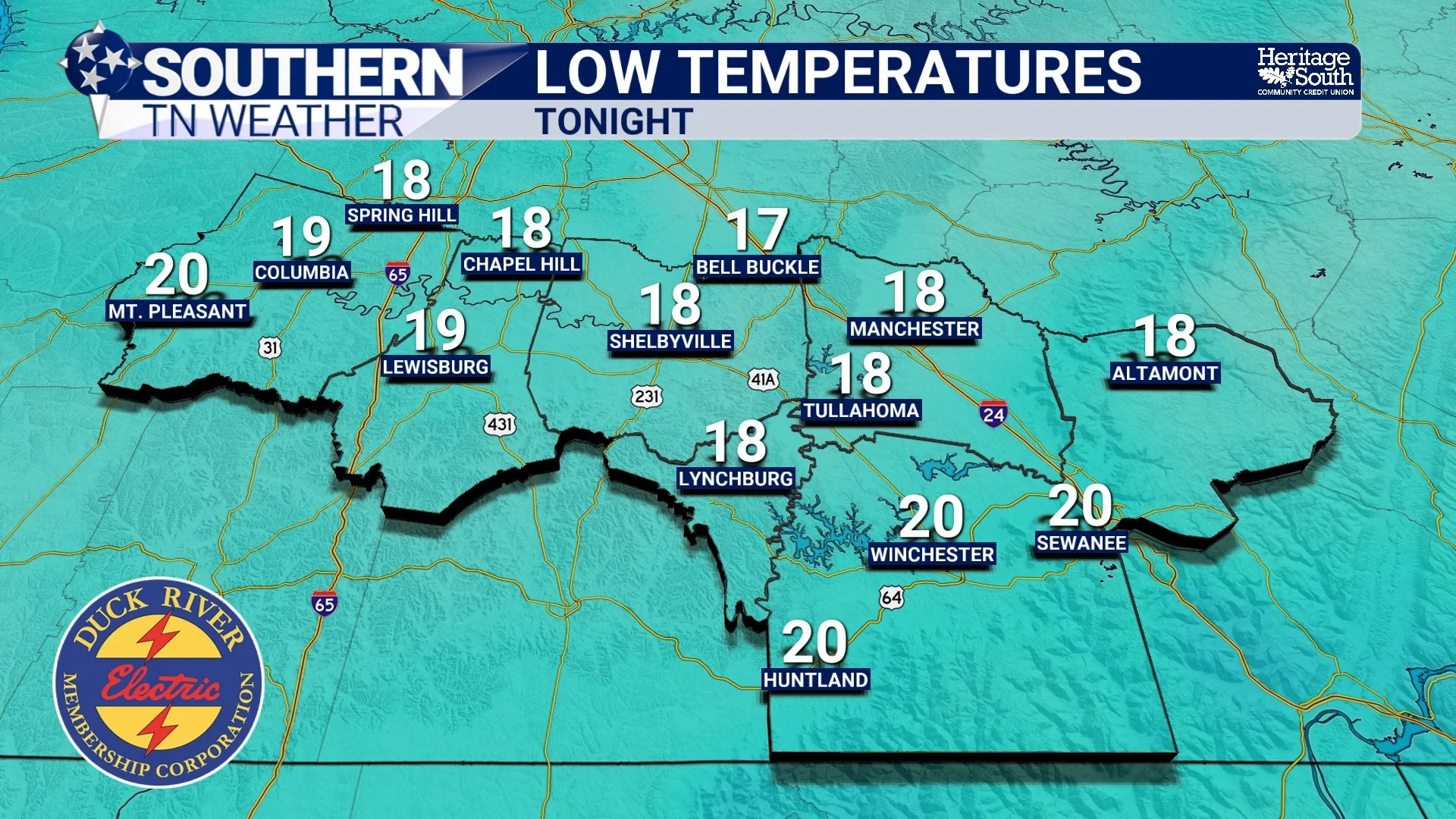
LOW TEMPS - TONIGHT
Tuesday and Wednesday: Gradual Warm-Up
The warming trend begins tomorrow. Southerly winds return Tuesday afternoon with gusts up to 25 mph. Highs will rebound into the mid 40s to lower 50s.
Wednesday looks even milder with highs climbing into the mid 50s to near 60 degrees under mostly cloudy skies. Much of the day will remain dry.
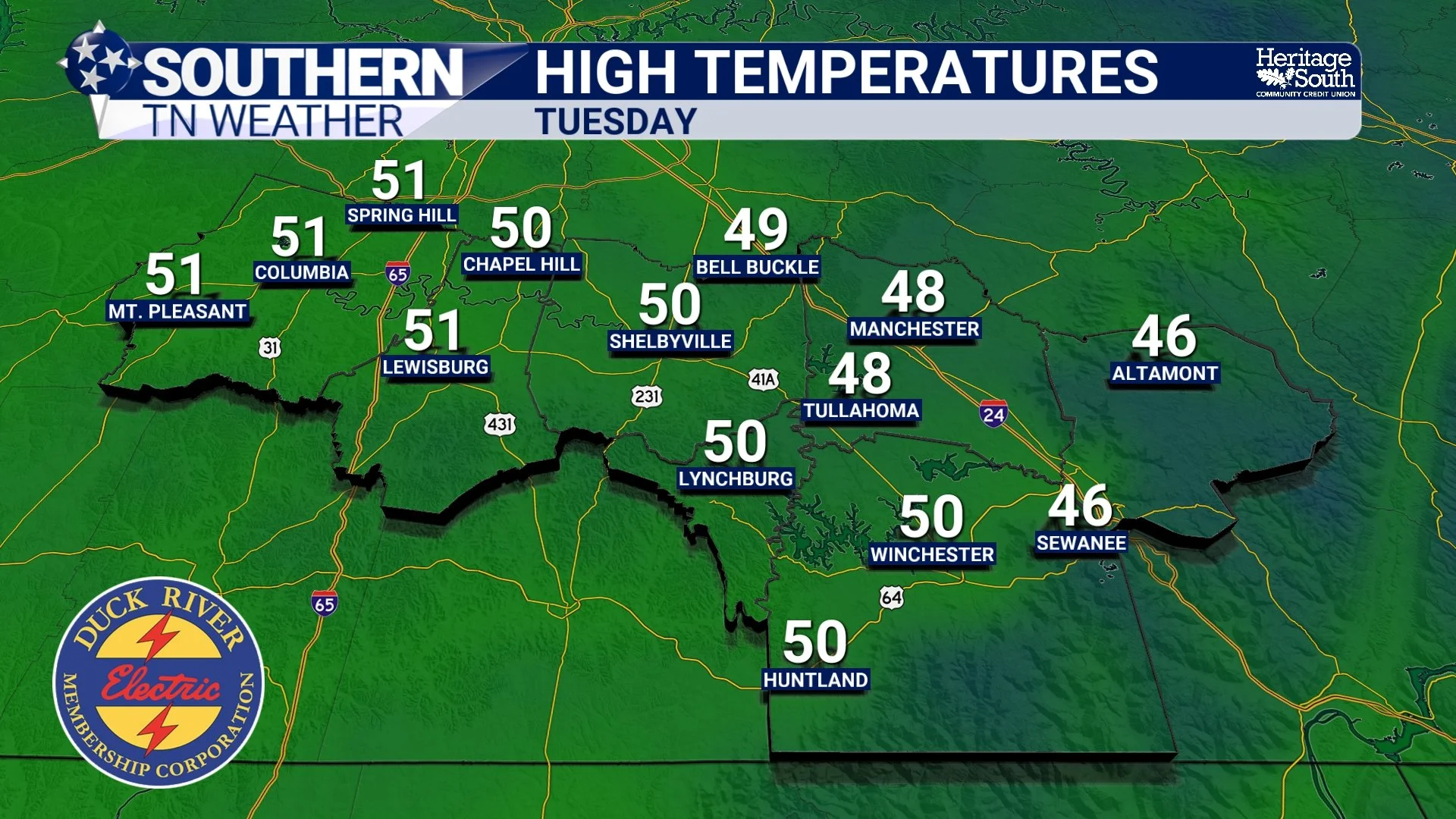
HIGH TEMPS - TOMORROW
Wednesday Night into Thursday: Widespread Rain
Our next storm system develops late Wednesday and moves through Thursday. Showers will begin developing Wednesday evening, becoming more widespread overnight into Thursday morning as a cold front moves through.
Rain totals will generally be between 1 and 2 inches. There will be plenty of wind shear in the atmosphere, but instability (or storm fuel) looks very limited. Because of that, the severe weather risk appears low at this time. A few rumbles of thunder cannot be ruled out, especially across our southern communities, but widespread strong storms are not expected.
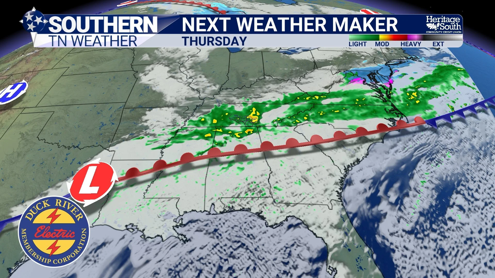
NEXT WEATHER MAKER - THURSDAY
Late Week and Weekend: Mild Again
Behind Thursday’s system, zonal flow sets up and temperatures moderate quickly. Highs will return to the 60s Friday and could approach 70 degrees by Saturday. The weekend looks mild with no major systems currently expected after Thursday.
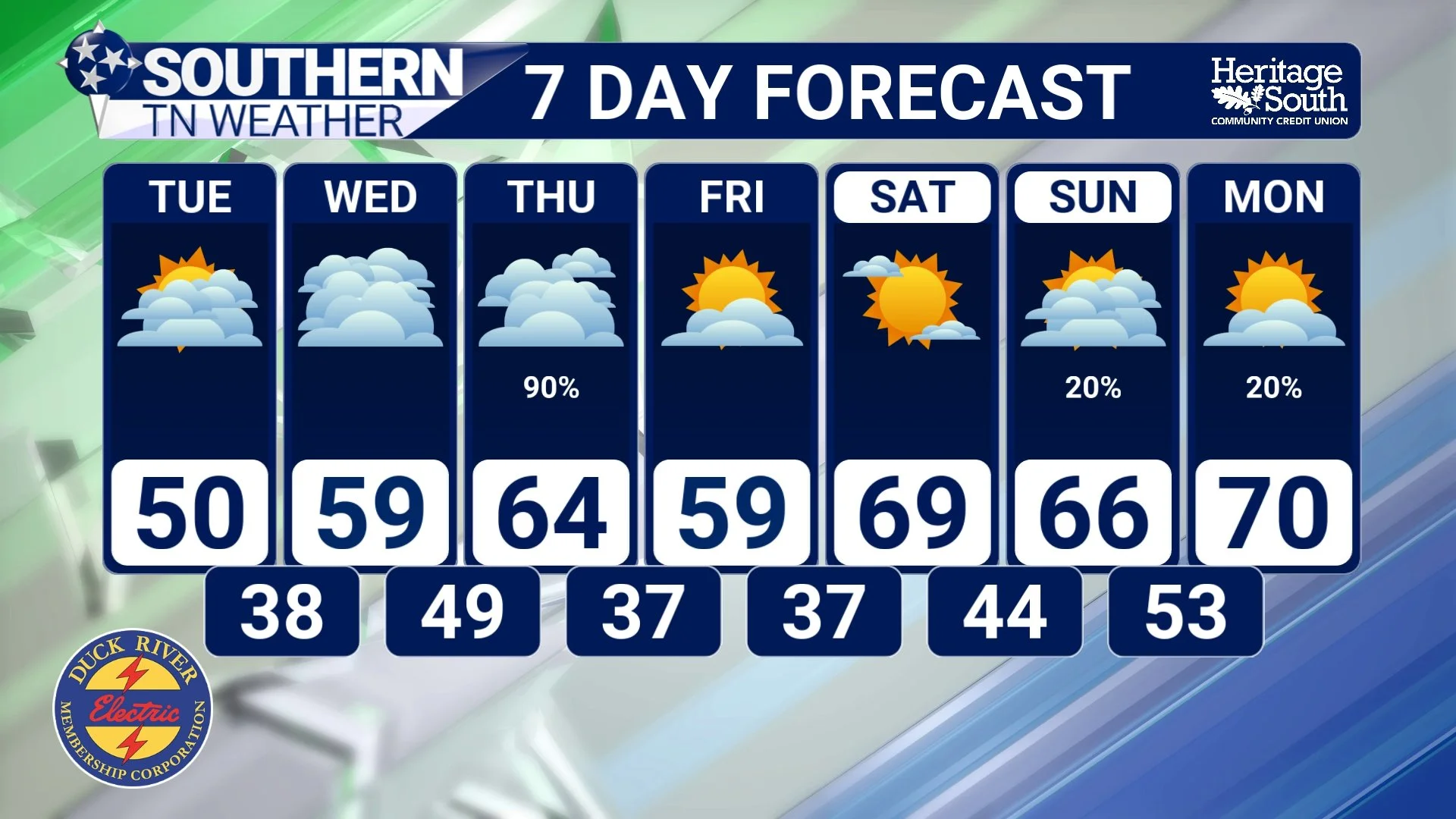
STNWX 7-DAY FORECAST
The Bottom Line 🧾
Cold and clear tonight with lows in the teens.
Warming trend begins Tuesday.
Rain likely Wednesday night into Thursday.
Severe weather risk appears low for now.
Mild air returns for the weekend.
📰 This week is Tennessee Severe Weather Awareness Week. Each day, we will focus on a different hazard that impacts Southern Middle Tennessee, with practical information to help you stay prepared and informed. The Southern Tennessee Weather Blog, presented by Heritage South Community Credit Union, is updated daily with local forecasts and safety information you can trust.