
Severe Weather Awareness 2026: Severe Thunderstorms

The Southern Tennessee Weather Blog is proudly presented by Heritage South Community Credit Union.
We Help When Others Won’t!
Visit https://www.heritagesouth.org/ today to see how HSCCU can help YOU!
Southern Middle Tennessee is experiencing near record warmth today, with highs pushing into the low and mid 70s. Gusty south winds this afternoon could reach 30 to 35 mph at times. While much of the day will stay dry, attention turns to this evening as a cold front approaches from the west.
There is a low chance for severe thunderstorms between 9 PM and 3 AM, especially west of I-65. A MARGINAL risk (level 1/5) is in place from the Storm Prediction Center. Some unexpected clearing earlier today has allowed instability to build, with CAPE (storm fuel) values approaching 1000 J/kg in parts of the region. When combined with strong wind shear, this means a few storms could organize. The main threat would be damaging straight line winds. The overall risk is conditional and depends on how much instability remains after sunset. Regardless of how storms evolve, tonight is a reminder that severe thunderstorm season is here. As part of Severe Weather Awareness Week, today’s focus is on severe thunderstorms and how to stay safe.
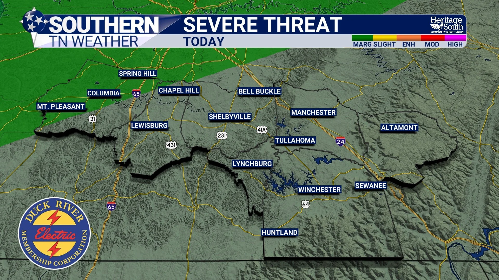
SEVERE WEATHER RISK - TONIGHT
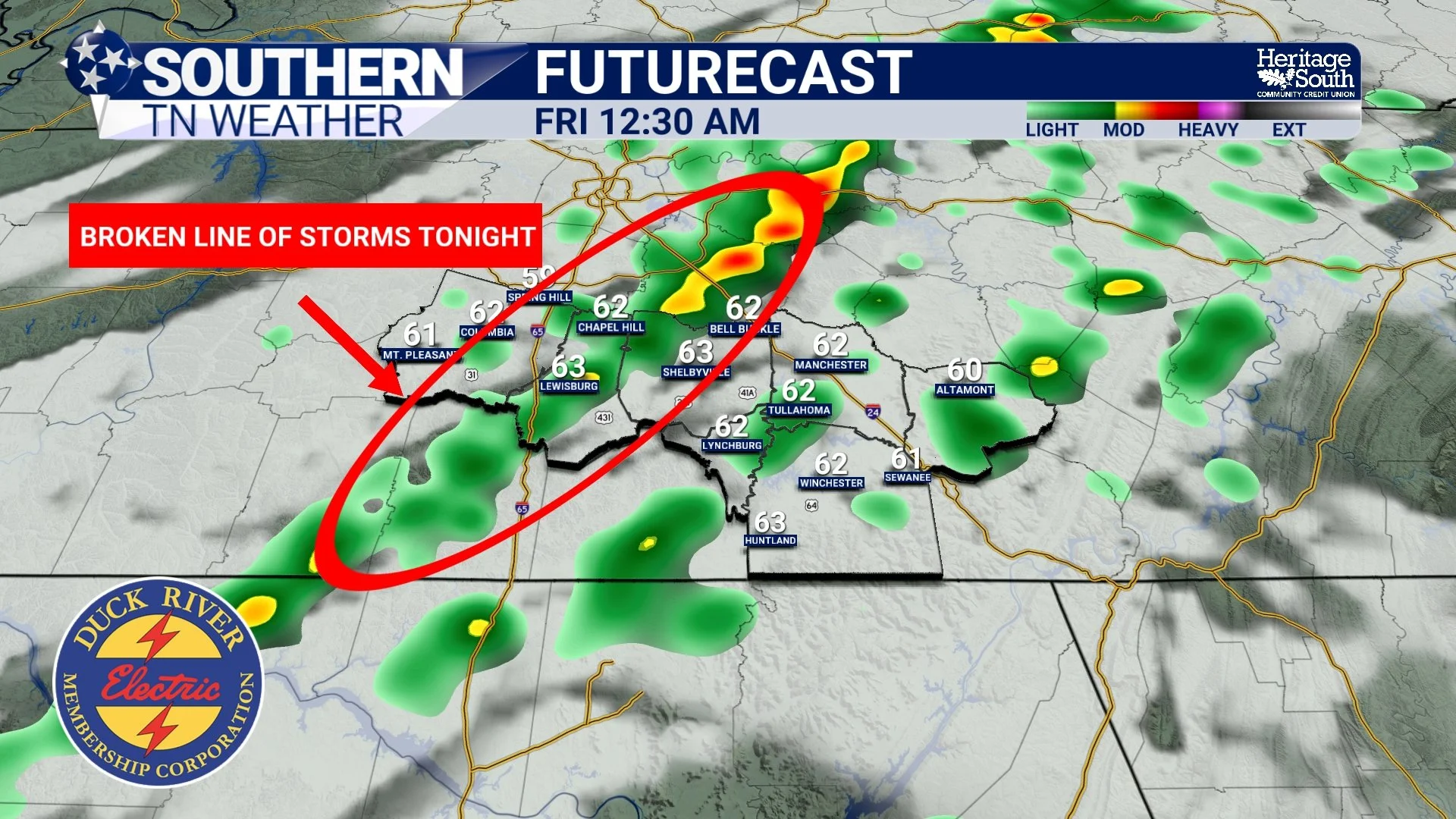
FUTURECAST - TONIGHT
What Makes a Thunderstorm “Severe”?
A thunderstorm becomes severe when it produces:
Wind gusts of 58 mph or stronger
Hail one inch in diameter or larger
A tornado
Severe thunderstorms can develop quickly and sometimes with little warning, especially in the spring across Middle Tennessee.
Understanding the Storm Life Cycle
Thunderstorms go through three main stages:
Cumulus Stage – Warm, moist air rises. Clouds build vertically.
Mature Stage – The storm is strongest. Heavy rain, lightning, strong winds, hail, and tornadoes are possible.
Dissipating Stage – The storm weakens as downdrafts cut off the supply of warm air.
The mature stage is when most severe weather occurs.
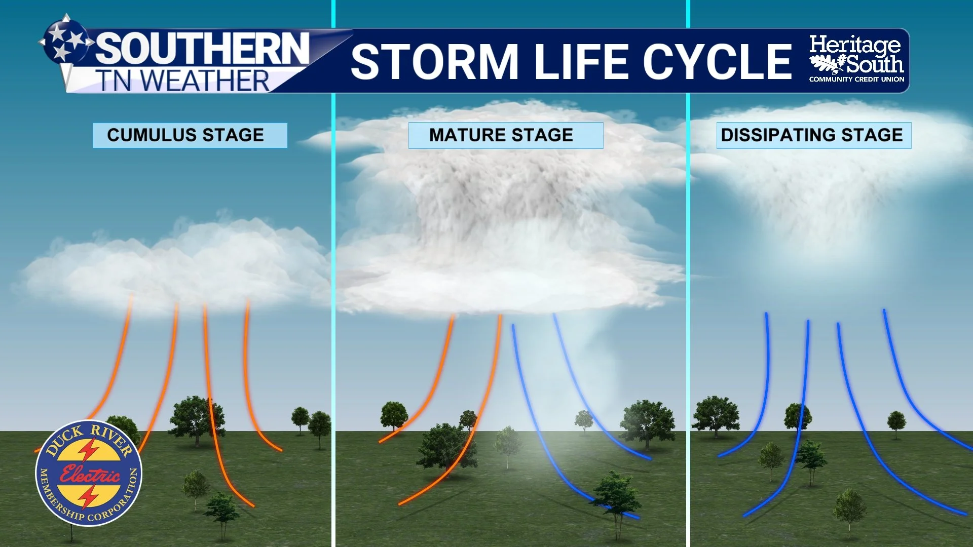
STORM LIFE CYCLE
Watch vs Warning: Know the Difference
A Severe Thunderstorm Watch means conditions are favorable for severe storms. This is the time to review your plan and monitor weather updates.
A Severe Thunderstorm Warning means severe weather is happening or about to happen. You should take shelter immediately.
When warnings are issued, it means lives and property could be at risk.
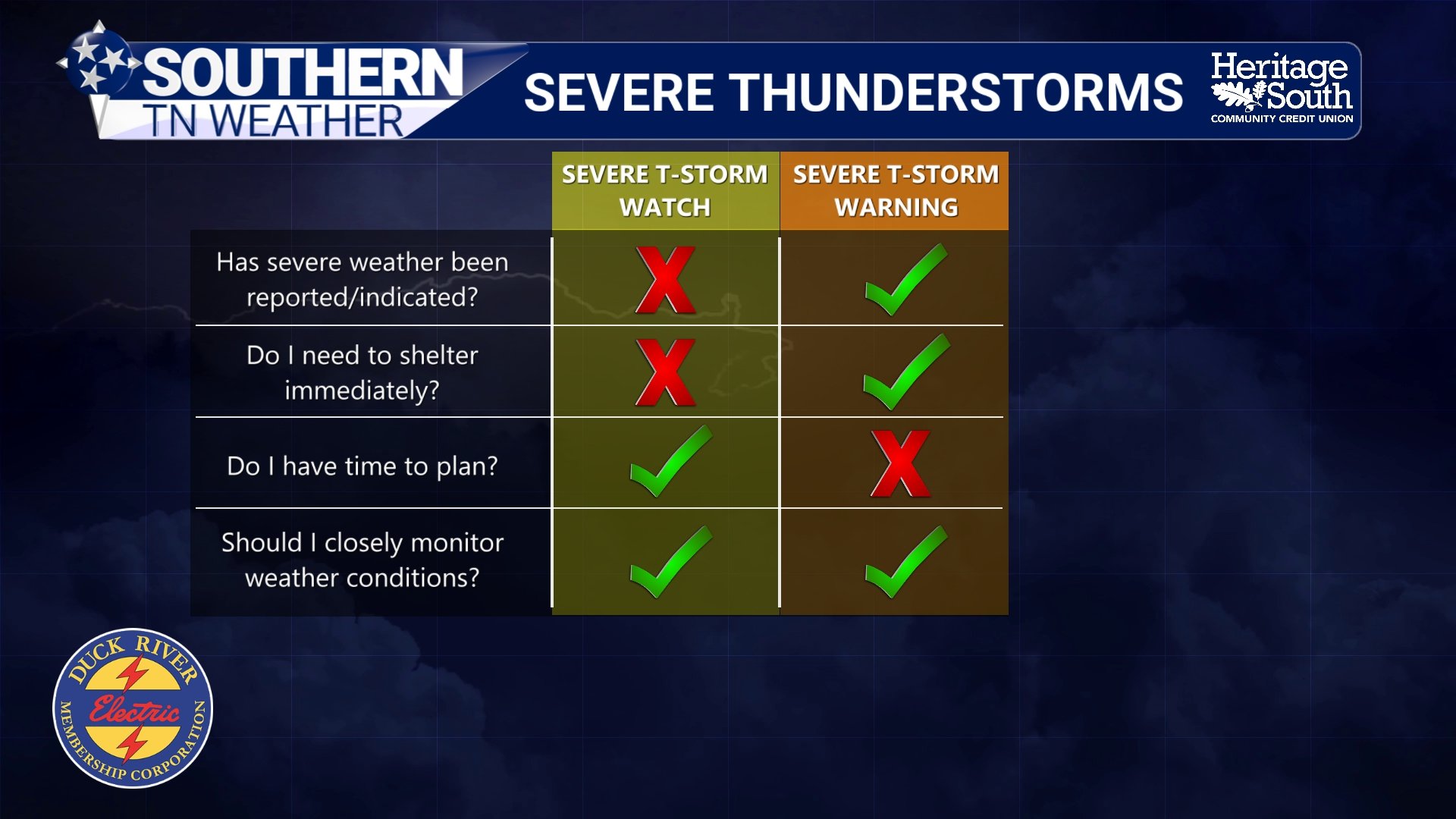
WATCH VS WARNING
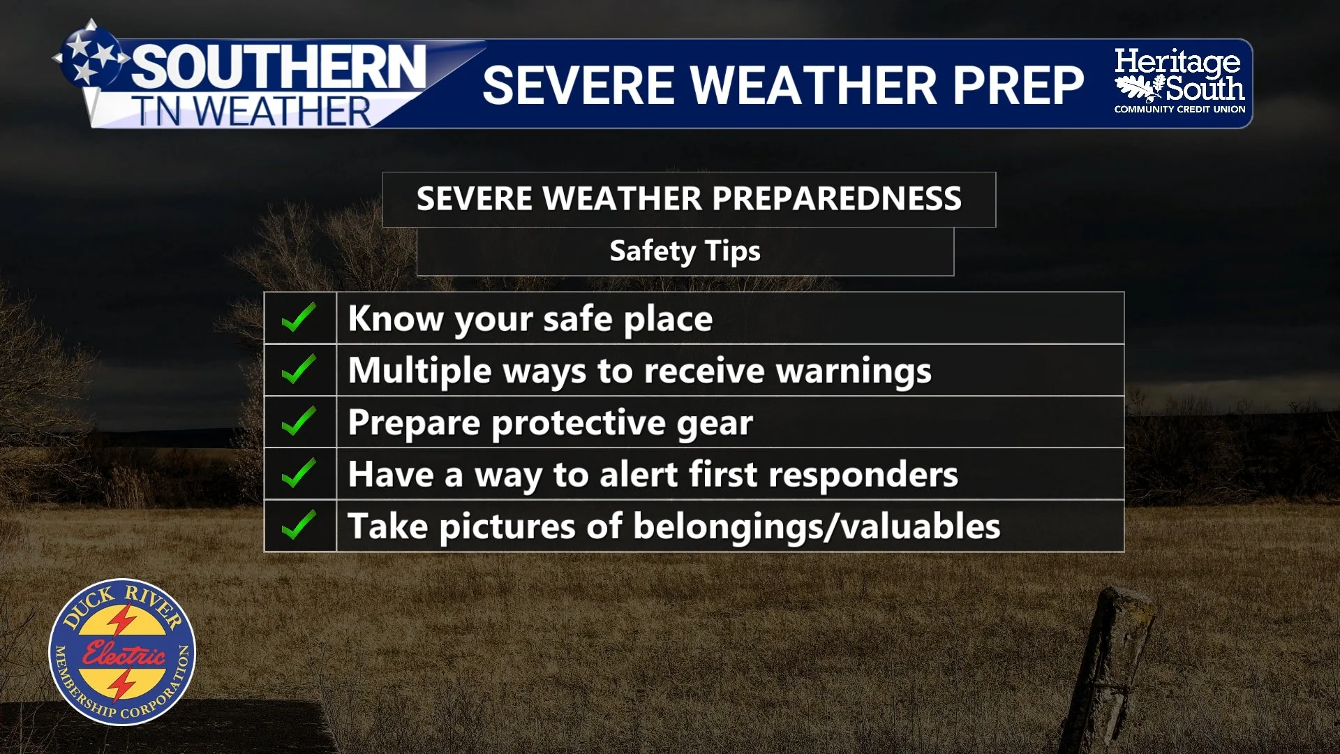
How to Prepare Before Storms Arrive
Preparation should happen before storms develop. Every household should:
Know your safe place inside your home
Have multiple ways to receive warnings, especially at night
Prepare protective gear such as helmets and sturdy shoes
Have a plan to alert first responders if needed
Document valuables for insurance purposes
SEVERE WEATHER PREP
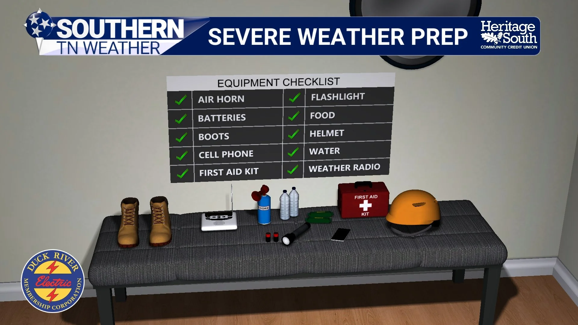
Build a Basic Severe Weather Kit
A simple preparedness kit should include:
Weather radio
Flashlight and extra batteries
Cell phone and backup charger
First aid kit
Bottled water and nonperishable food
Sturdy shoes
Helmet
Air horn
These small steps can make a major difference during an emergency.
SEVERE WEATHER PREP #2
Severe Thunderstorm Safety Reminders
Go indoors when thunder roars
Stay away from windows
Avoid using corded electronics during storms
Do not shelter under trees
Never drive through flooded roadways
Damaging winds and hail from severe thunderstorms can cause as much destruction as lower-end tornadoes.
The Bottom Line 🧾
• A low severe risk exists this evening, mainly west of I-65
• Damaging winds are the primary concern
• Severe thunderstorms are defined by wind, hail, or tornado production
• Watches mean prepare, warnings mean act
• Now is the time to review your severe weather safety plan
📰 This week is Tennessee Severe Weather Awareness Week. Each day, we will focus on a different hazard that impacts Southern Middle Tennessee, with practical information to help you stay prepared and informed. The Southern Tennessee Weather Blog, presented by Heritage South Community Credit Union, is updated daily with local forecasts and safety information you can trust.