
Rain Returns Tonight; Details Here!

The Southern Tennessee Weather Blog is proudly presented by Heritage South Community Credit Union.
We Help When Others Won’t!
Visit https://www.heritagesouth.org/ today to see how HSCCU can help YOU!
Southern Middle Tennessee stays mild this afternoon, but changes are underway. A stalled boundary just to our north combined with an approaching shortwave from the Plains will bring increasing rain chances later today. A shortwave is a small disturbance in the upper levels of the atmosphere. Think of it as a ripple in the jet stream. As it moves overhead, it helps lift air upward, which can enhance cloud development and increase rain chances. Even when surface features look weak, a passing shortwave can be enough to trigger showers and thunderstorms. While we’ve seen plenty of cloud cover, much of the earlier radar activity struggled to reach the ground because of dry air near the surface. That changes as we head deeper into the afternoon.
Warm air advection will gradually moisten the lower levels of the atmosphere after 3 PM. Light showers will begin developing from west to east, becoming more widespread this evening and overnight. If you live west of I-24 (including areas like Bedford, Marshall, Maury, and Moore Co) you have the best chance to hear a few rumbles of thunder after midnight. Severe weather is not expected, but some brief heavier downpours are possible.
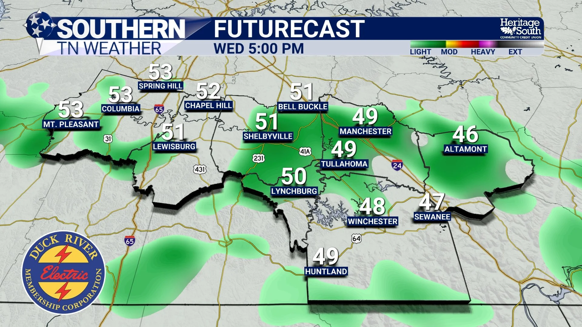
FUTURECAST - 5:00 PM WEDNESDAY
Tonight Through Thursday Morning: Soaking Rain
The steadiest rainfall looks to occur between roughly 8 PM and 9 AM. A strengthening low-level jet and increasing upper-level support will help maximize lift overnight. Even though wind shear will be strong, instability remains weak and elevated, which is why we’re not expecting strong or severe storms. Rainfall totals will vary across Southern Middle Tennessee, but most of us will see a half inch to one inch of rain. This will be a beneficial soaking rain for many areas, especially where soil moisture has fluctuated over the past few weeks. Widespread flooding is not expected, but some brief ponding on roadways could occur during heavier bursts overnight.
Rain will taper from west to east after sunrise Thursday, with most of Southern Middle Tennessee drying out by early to mid-afternoon. Temperatures will remain mild despite the rain, with highs in the mid 50s to lower 60s both today and Thursday.
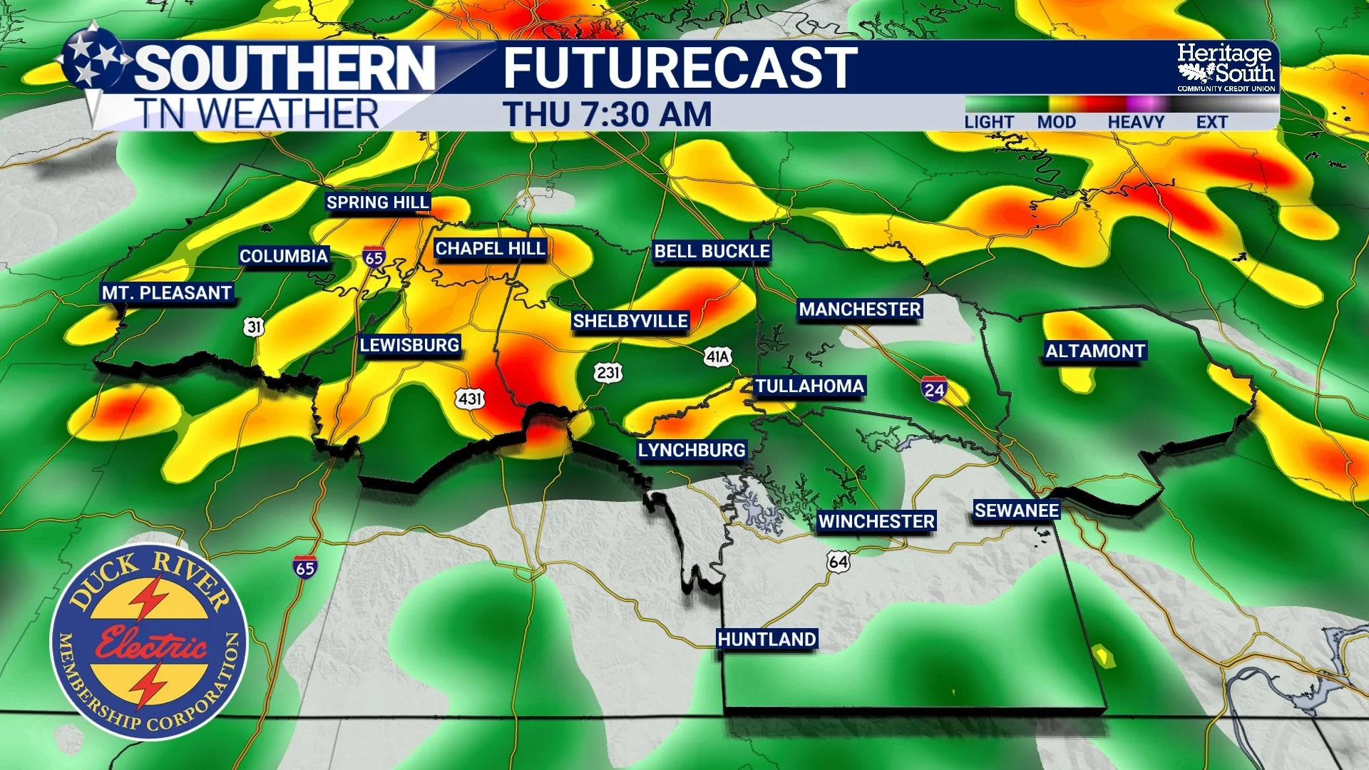
FUTURECAST - 7:30 AM THURSDAY
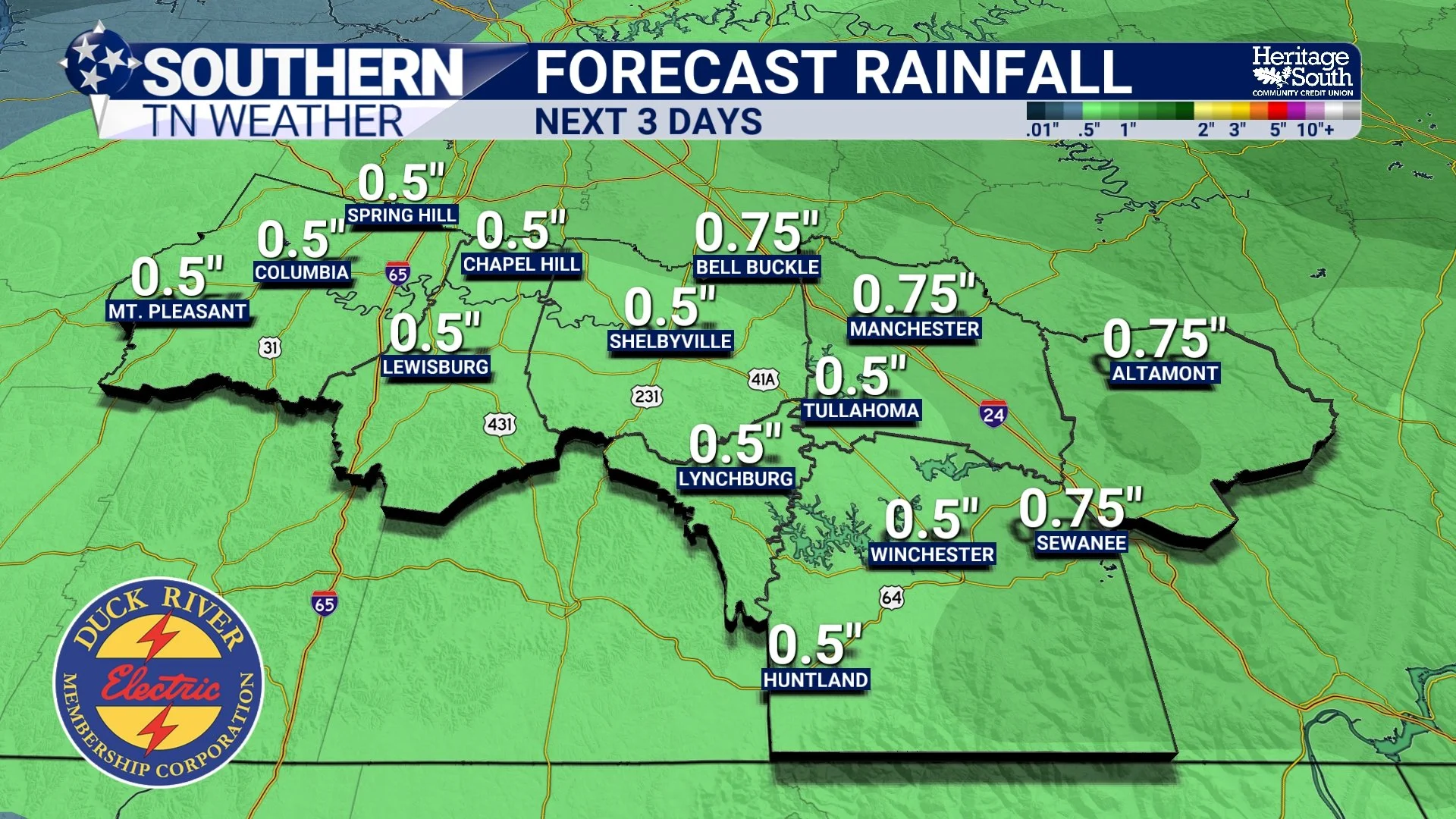
FORECAST RAINFALL - NEXT 3 DAYS
Looking Ahead
Friday and Saturday trend drier as upper-level flow becomes more zonal. Zonal flow means winds in the upper levels of the atmosphere are moving mostly west to east in a fairly straight line. When the jet stream is in this pattern, weather systems tend to move quickly and temperatures are usually milder. It often brings quieter stretches of weather, but weak disturbances can still ride along the flow and produce occasional rain.
The temperature forecast becomes more uncertain late weekend into early next week depending on how far south cooler air pushes. For now, expect generally mild conditions to continue with periodic rain chances returning next week. Bottom line for tonight: Have the umbrella ready, expect a wet overnight commute Thursday morning, and don’t be surprised by a clap of thunder, especially west of I-24.
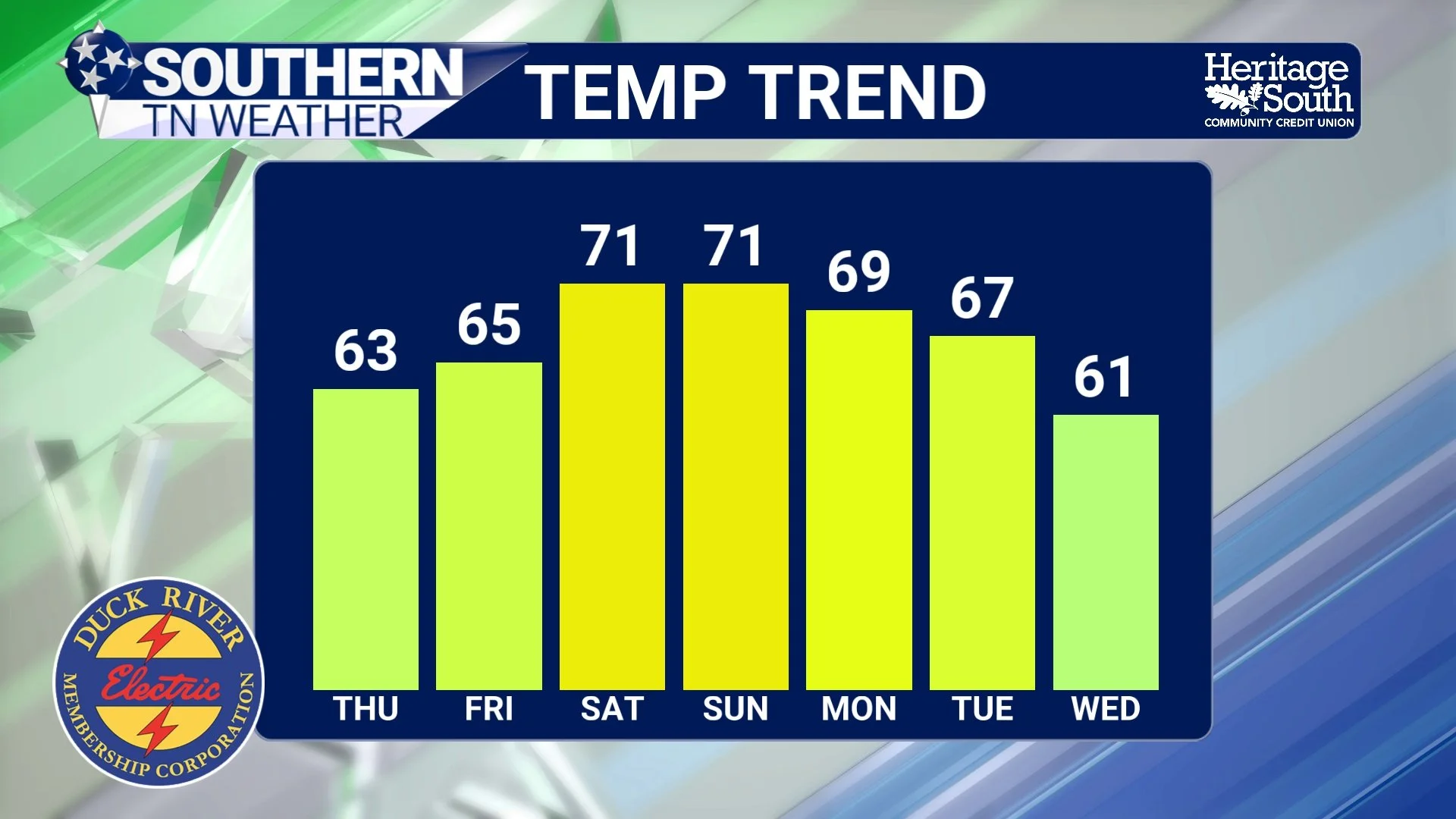
TEMPERATURE TREND - NEXT 7 DAYS
The Bottom Line 🧾
Rain develops after 3 PM and becomes widespread tonight.
Steadiest rainfall occurs between 8 PM and 9 AM.
A few rumbles of thunder are possible, mainly west of I-24.
No severe weather expected.
Rain ends from west to east Thursday morning into early afternoon.
Expect a wet Thursday morning commute across Southern Middle Tennessee.
📰 Reminder: The Southern Tennessee Weather Blog, presented by Heritage South Community Credit Union, is updated Monday through Friday with fresh, locally tailored forecasts you can trust.