
A Wet Weekend Ahead, but No Major Impacts Expected

The Southern Tennessee Weather Blog is proudly presented by Heritage South Community Credit Union.
We Help When Others Won’t!
Visit https://www.heritagesouth.org/ today to see how HSCCU can help YOU!
Southern Middle Tennessee is heading into a noticeably wetter pattern this weekend, but the overall setup favors beneficial rainfall rather than hazardous weather. After a dry finish to the work week and a quiet start to Saturday, a strong storm system will move across the southern United States late Saturday through Sunday, bringing widespread rain to the region. While rainfall will be steady at times, flooding and severe weather concerns remain low.
Dry Through Saturday Morning
High pressure centered over the Tennessee Valley and Mid-Atlantic is firmly in control today and will keep Southern Middle Tennessee dry through tonight and into Saturday morning. Skies will gradually cloud over late tonight as moisture increases aloft, but precipitation should hold off through at least the first half of Saturday.
Temperatures remain mild for mid-February, with highs today and Saturday reaching the upper 50s to lower 60s. Overnight lows tonight fall into the 30s, with some upper 30s to low 40s by Saturday morning.
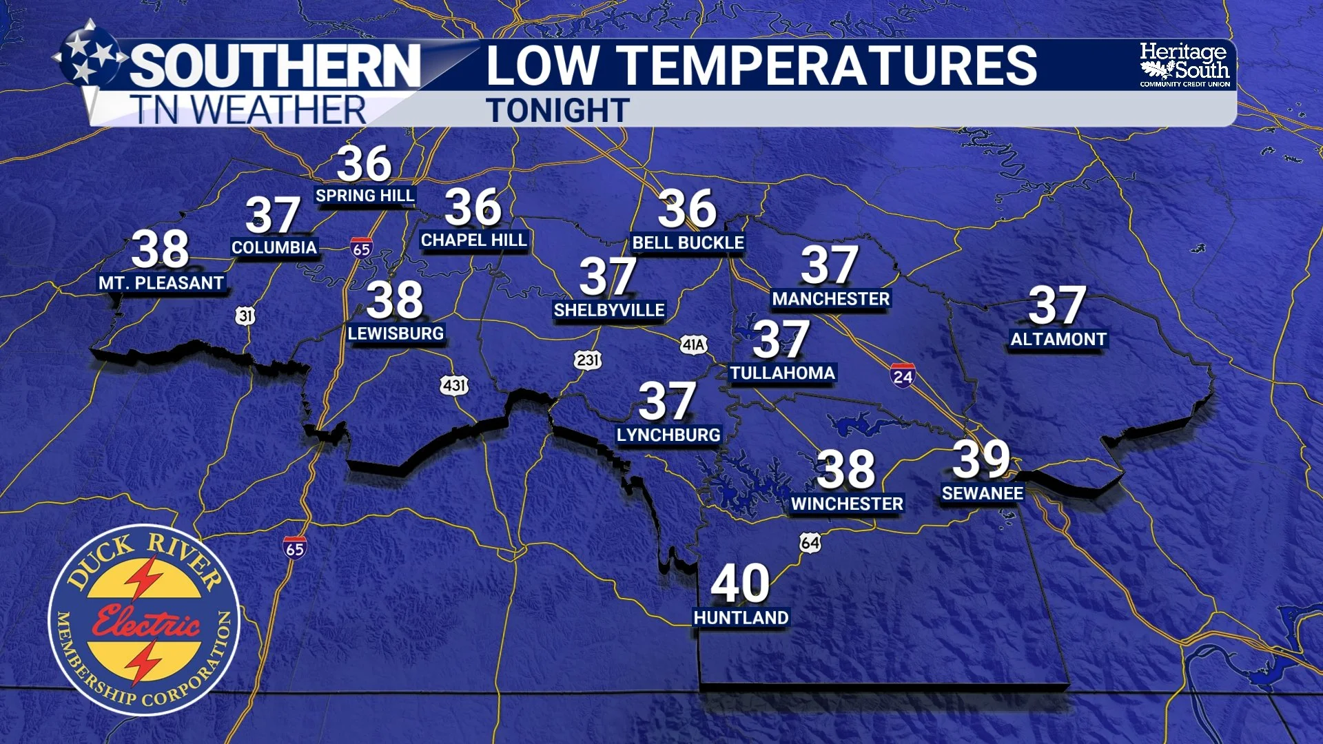
LOW TEMPERATURES - TONIGHT
Late Saturday Through Sunday: Widespread Rain Arrives
Conditions change late Saturday as a strong low pressure system moves east across the southern Plains and into the Deep South. As this system approaches, deep southerly flow pulls Gulf moisture northward into Tennessee. One way meteorologists measure this moisture is through precipitable water (PW), which represents how much rain could fall if all moisture in the atmosphere condensed. PW values around 1.25 inches are unusually high for February and support widespread rainfall.
Rain is most likely to develop Saturday evening mainly between 6 PM and Midnight. It will continue through much of Sunday. Periods of heavier rain are possible, especially late Saturday night into Sunday morning. Current guidance is tightly clustered around 1 to 2 inches of total rainfall across Southern Middle Tennessee, with only a low chance of isolated amounts exceeding 2 inches.
Despite the soaking rain, several factors are working in our favor:
The surface low tracks south of the region
Storm fuel remains displaced to our south
Rainfall rates stay moderate rather than intense
Because of this, flash flooding is not expected. Some ponding on roads and rises on creeks and streams are possible, but river flooding and widespread impacts are unlikely. Thunderstorm chances remain low, and no severe weather is anticipated locally.
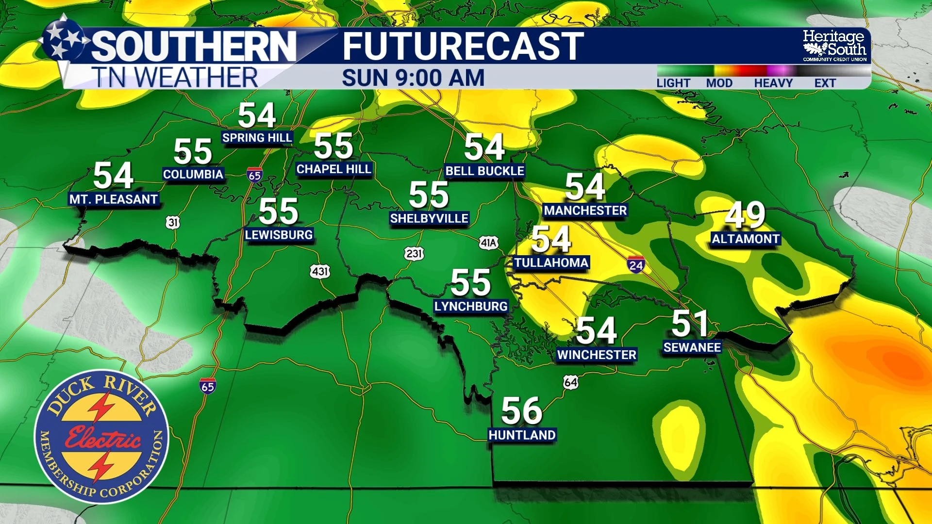
FUTURECAST - SUNDAY MORNING
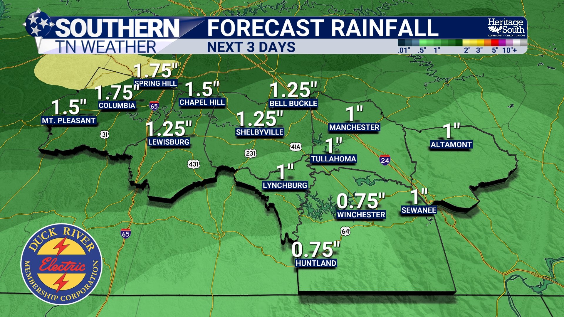
FORECAST RAINFALL - NEXT 3 DAYS
Sunday Night and Beyond: Turning Much Warmer
Rain tapers off Sunday evening as the system exits to the east. Behind it, high pressure quickly builds in and an upper-level ridge expands across the Southeast. This pattern favors a pronounced warm-up heading into next week. By Monday, highs return to the 60s, and from Tuesday through Thursday many locations across Southern Middle Tennessee may reach the lower to mid-70s, which is roughly 20 degrees above normal for this time of year. Some daily record highs may be approached, especially mid-week.
While weak disturbances may flatten the ridge later next week, temperatures are expected to remain well above average with only minimal rain chances.
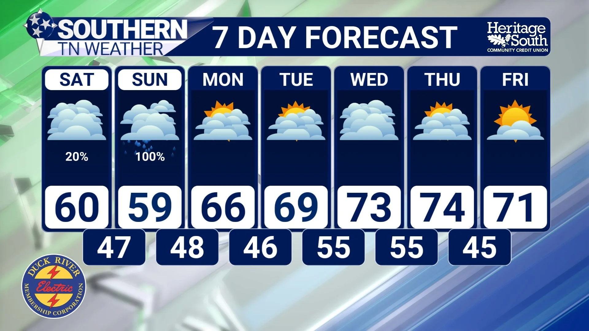
STNWX 7-DAY FORECAST
The Bottom Line 🧾
• Dry weather continues through Saturday morning
• Rain becomes widespread late Saturday through Sunday
• Total rainfall of 1–2 inches expected
• Flooding and severe weather are not expected
• Mild temperatures continue through the weekend
• Very warm, spring-like weather arrives next week
📰 Reminder: The Southern Tennessee Weather Blog, presented by Heritage South Community Credit Union, is updated Monday through Friday with fresh, locally tailored forecasts you can trust.