
Severe Weather Awareness 2026: Tornadoes

The Southern Tennessee Weather Blog is proudly presented by Heritage South Community Credit Union.
We Help When Others Won’t!
Visit https://www.heritagesouth.org/ today to see how HSCCU can help YOU!
Current Weather Overview for Southern Middle Tennessee
Warm, springlike air remains in place across Southern Middle Tennessee today and Thursday. Highs will climb into the mid to upper 70s Thursday, which is near record territory for mid February. Southerly flow continues to pull Gulf moisture northward, with dewpoints rising into the 50s and low 60s. Scattered showers will develop late today into tonight, mainly along and north of I-40. Rainfall totals overnight should range between 0.25 and 0.50 inches.
Thursday afternoon into Thursday night, showers and thunderstorms will return ahead of an approaching cold front. A few storms could produce gusty winds, especially north of I-40 and closer to the Tennessee Kentucky line. While a strong storm cannot be ruled out here locally, the overall severe weather threat remains low at this time. Tornado potential is very low. Behind the front, cooler and more seasonal air returns this weekend. Highs drop back into the 40s and 50s by Sunday, with even colder air early next week.
Tornadoes: What You Need to Know
Tornadoes can happen any time of year in Middle Tennessee. While spring is peak season, we have seen tornadoes in every month. That is why awareness and preparation matter. A tornado is a violently rotating column of air that extends from a thunderstorm to the ground. They can form quickly and sometimes with little visual warning, especially in heavy rain or at night.
How Tornadoes Form
Tornadoes usually develop from strong thunderstorms called supercells. These storms form when wind direction and speed change with height, creating rotation in the atmosphere.
As winds change direction between the surface and upper levels, horizontal rotation develops.
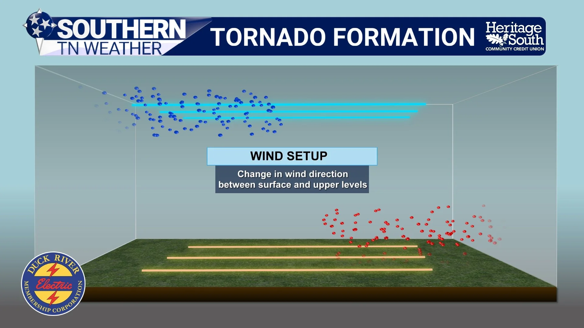
TORNADO FORMATION - WIND SETUP
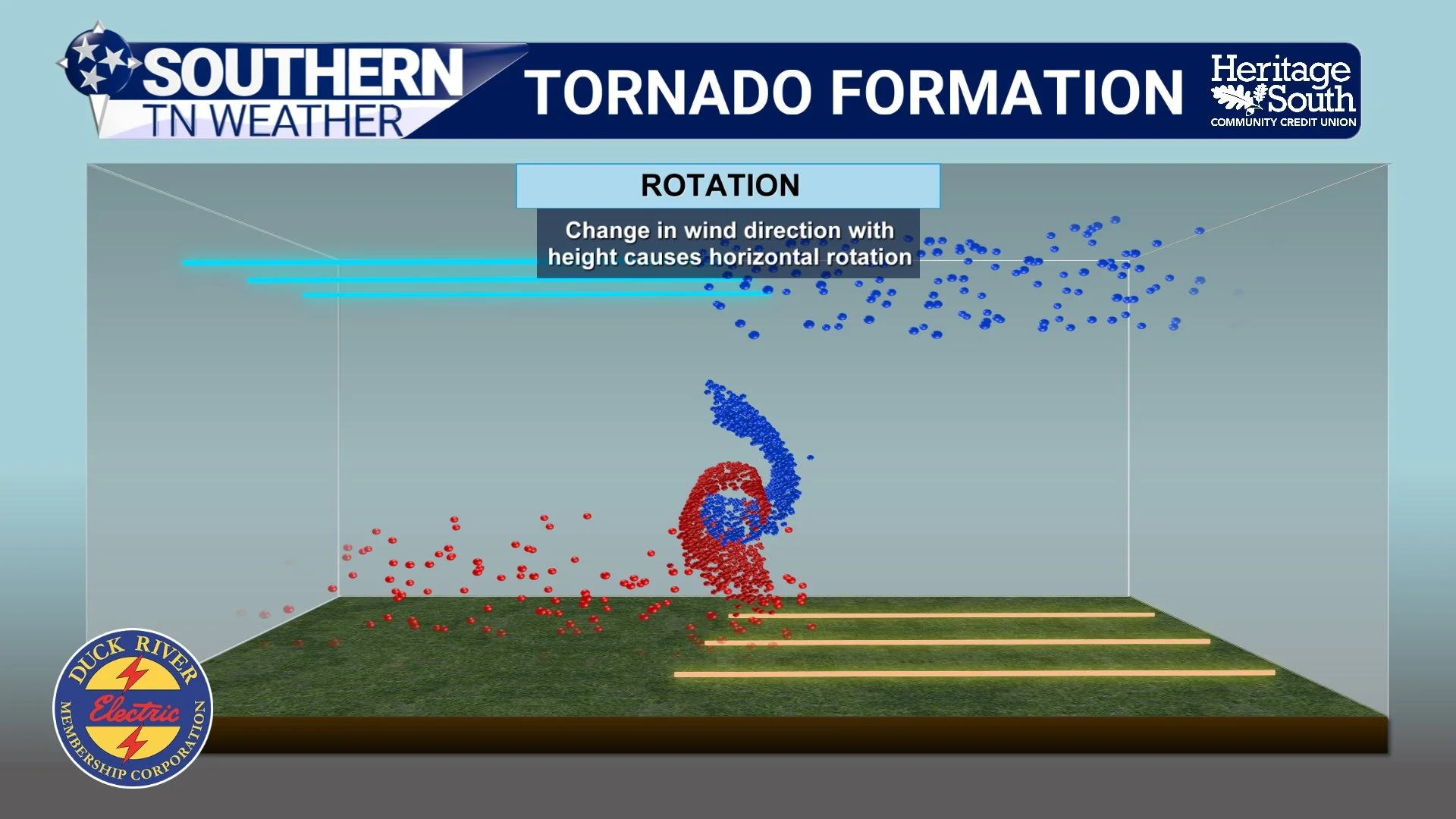
TORNADO FORMATION - ROTATION
Strong upward motion within a thunderstorm tilts that rotation vertically.
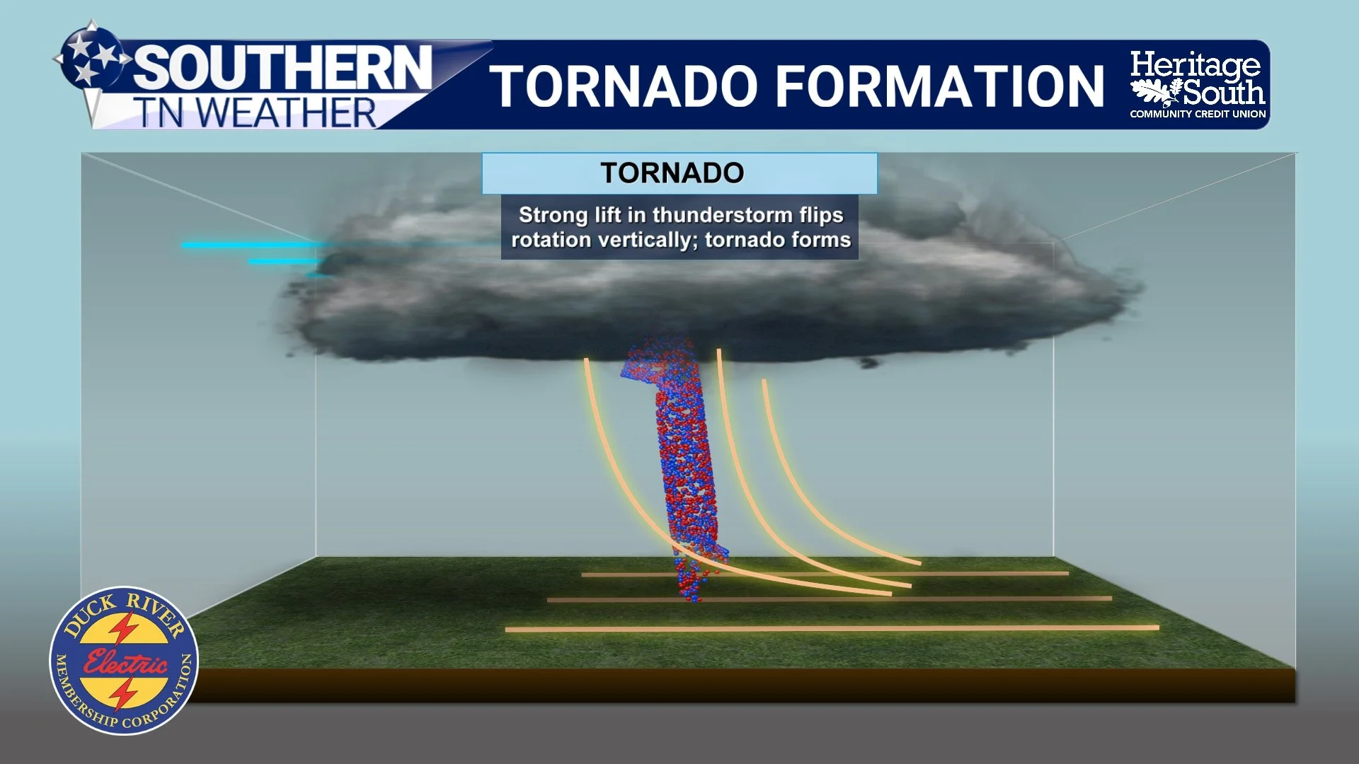
TORNADO FORMATION - VERTICAL ROTATION
When that rotation tightens and stretches downward, a tornado can form.
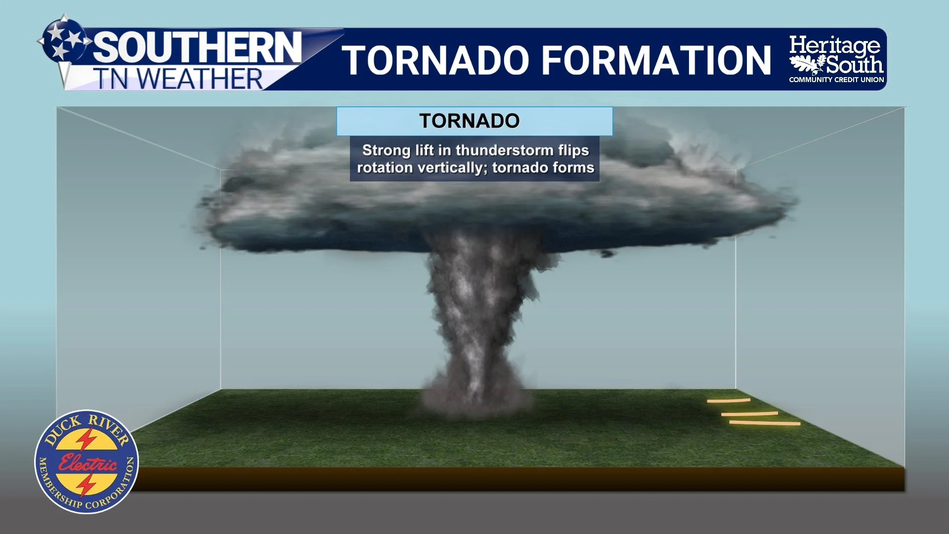
TORNADO FORMATION
Not every thunderstorm produces a tornado. The environment must support instability (storm fuel), wind shear (spin), and sufficient lift. Even this week, although storms are possible Thursday night, instability decreases after sunset, which keeps tornado potential low.
Watch vs Warning
Understanding the difference can save your life.
A Tornado Watch means conditions are favorable. Have a plan.
A Tornado Warning means a tornado is occurring or imminent. Take cover immediately.
Watches typically cover large areas and last several hours. Warnings are smaller and usually last 20 to 60 minutes.
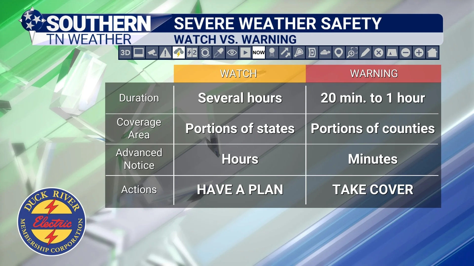
WATCH VS WARNING
Where Is Your Safe Place?
Every home should have a tornado safety plan. If your home has a basement, that is your safest location.
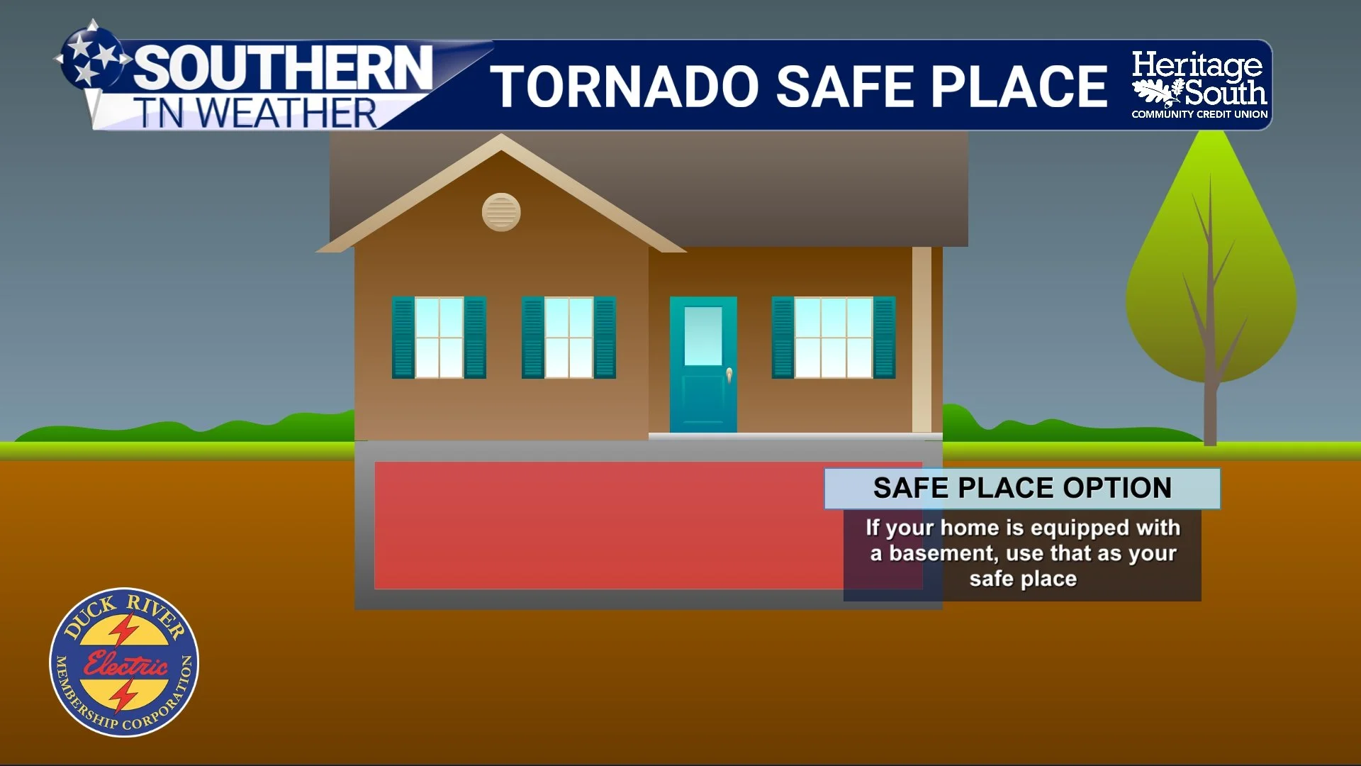
SAFE PLACE - BASEMENT
If you do not have a basement, go to an interior room on the lowest floor. Stay away from windows. Bathrooms and closets often work well.
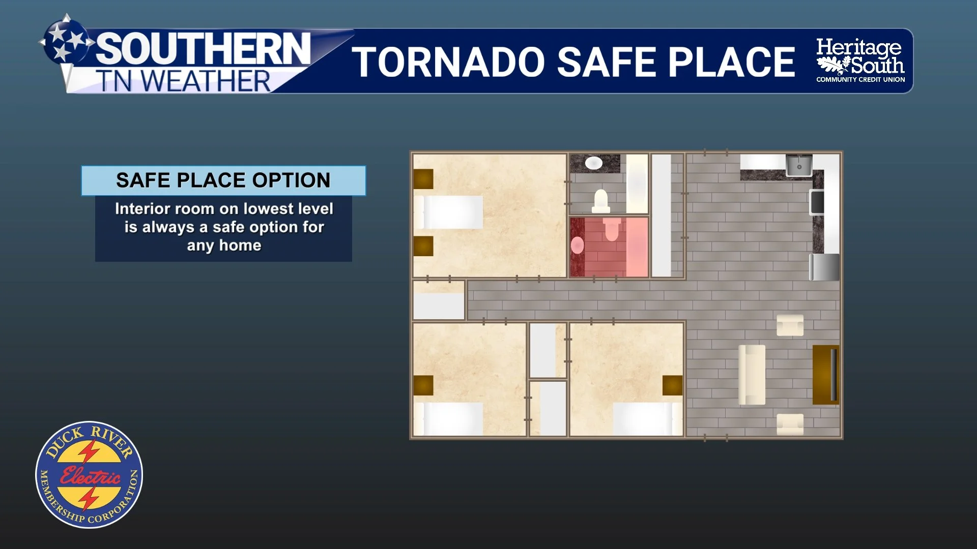
SAFE PLACE - INTERIOR ROOM
An underground storm shelter is an excellent option. Local community shelters or public businesses are also good alternatives if you live in a mobile home.
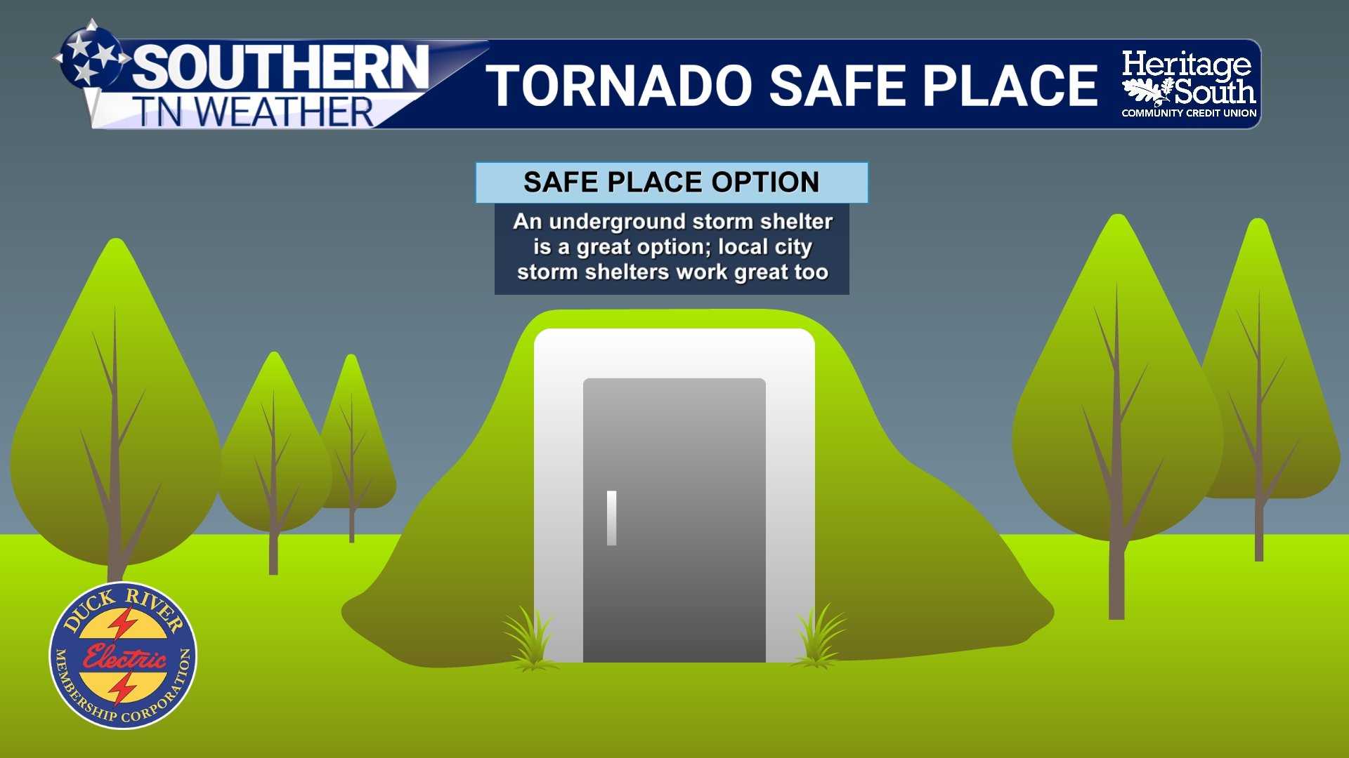
SAFE PLACE - CELLAR
Safety Gear and Preparation
Small details make a big difference.
Wear a helmet to protect your head.
Use sturdy shoes in case you must walk through debris.
Keep a charged cell phone and water nearby.
Have an air horn or whistle to help call for help.
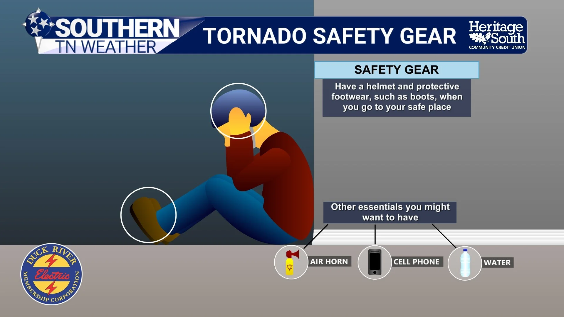
TORNADO SAFETY GEAR
Warning Alerts Matter
Tornadoes can happen quickly, especially at night. You should have multiple ways to receive warnings:
NOAA Weather Radio
Wireless Emergency Alerts on your phone
The STN Weather App
Southern Tennessee Weather Social Media
WeatherCall
Do not rely on outdoor sirens alone. They are meant to be heard outside.
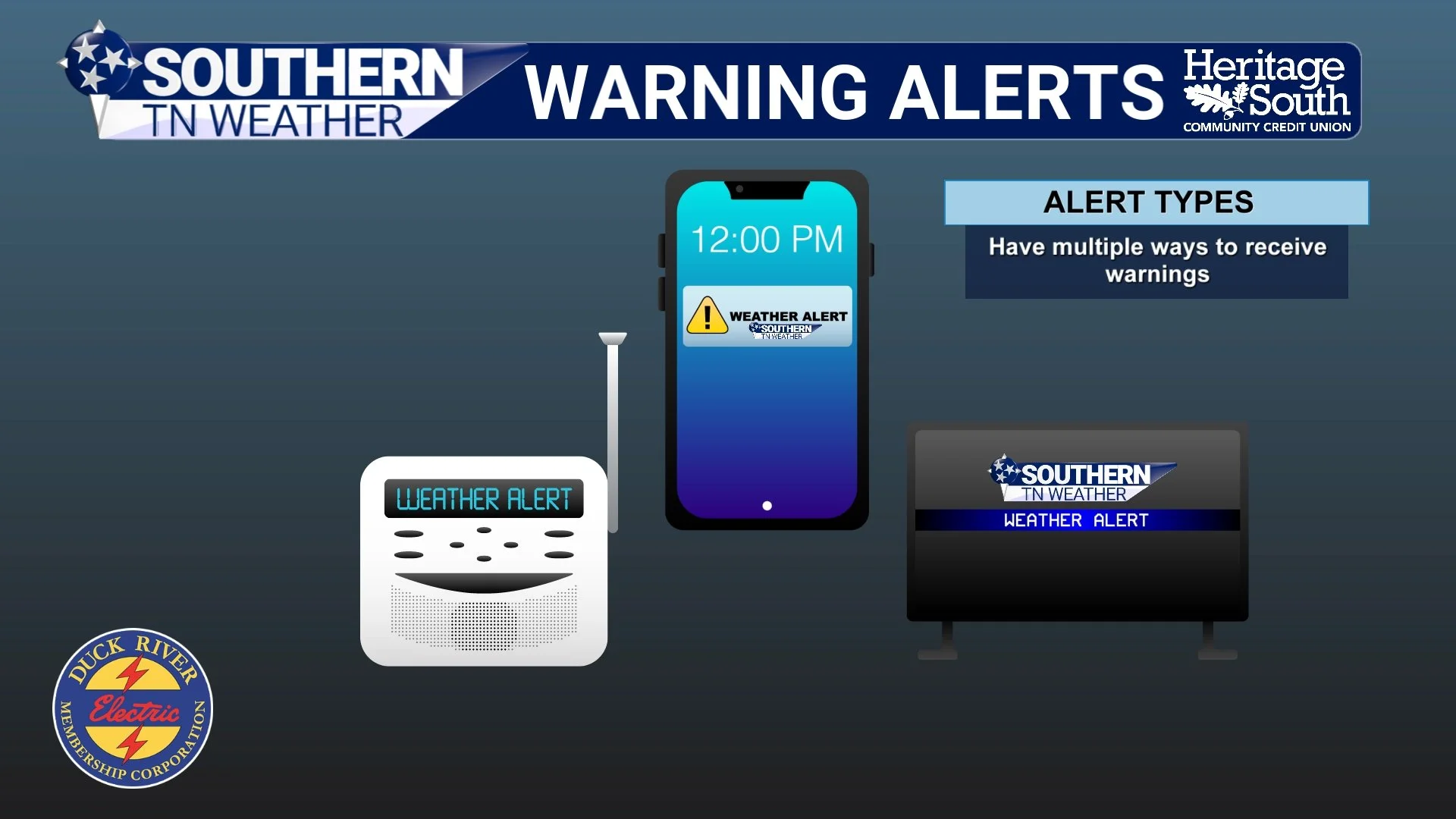
MULTIPLE WAYS TO RECIEVE WARNINGS
The Bottom Line 🧾
• Tornadoes can happen any time of year in Middle Tennessee
• A Watch means be prepared. A Warning means take cover immediately
• Your safest place is a basement or interior room on the lowest floor
• Have multiple ways to receive warnings, especially at night
• Preparation before the storm is what saves lives
📰 This week is Tennessee Severe Weather Awareness Week. Each day, we will focus on a different hazard that impacts Southern Middle Tennessee, with practical information to help you stay prepared and informed. The Southern Tennessee Weather Blog, presented by Heritage South Community Credit Union, is updated daily with local forecasts and safety information you can trust.