
Slim Rain Chances Early This Week; Warm and Dry Christmas

The Southern Tennessee Weather Blog is proudly presented by Heritage South Community Credit Union.
We Help When Others Won’t!
Visit https://www.heritagesouth.org/ today to see how HSCCU can help YOU!
A Mild Start to the Week
It’s a noticeably milder start to the week across Southern Middle Tennessee. Southerly winds have done their job, pushing temperatures back into the mid to upper 50s this morning after yesterday’s sharp cool-down. Dew points are still playing catch-up after crashing into the single digits over the weekend, which is one reason the air feels dry despite the cloud cover hanging around.
Overall, we’re entering a quieter stretch of weather, with above-average temperatures becoming the main story, especially as we head toward Christmas.
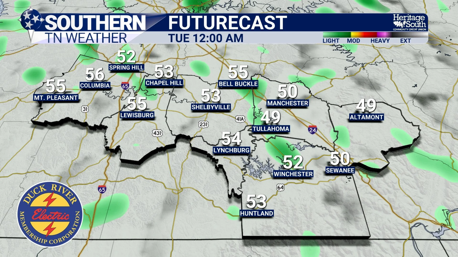
Light Rain Chances Tonight and Tuesday
The first thing to address is the small chance for rain over the next 24 to 36 hours. An upper-level disturbance will ripple across the ridge tonight and again on Tuesday, which may be enough to squeeze out a few light showers, mainly overnight tonight and at times Tuesday.
That said, moisture quality remains poor. Most locations will either stay dry or see only a brief sprinkle or light shower. If rain does occur, amounts will be very light, generally just a few hundredths of an inch at most. No thunderstorms, no severe weather, and no travel impacts are expected. For many communities across Southern Middle Tennessee, this will amount to nothing more than cloudy skies and an occasional sprinkle. Overall, I have rain chances between 20 and 40 percent from tonight through early Christmas Eve. Rainfall totals will generally be less than a tenth of an inch.
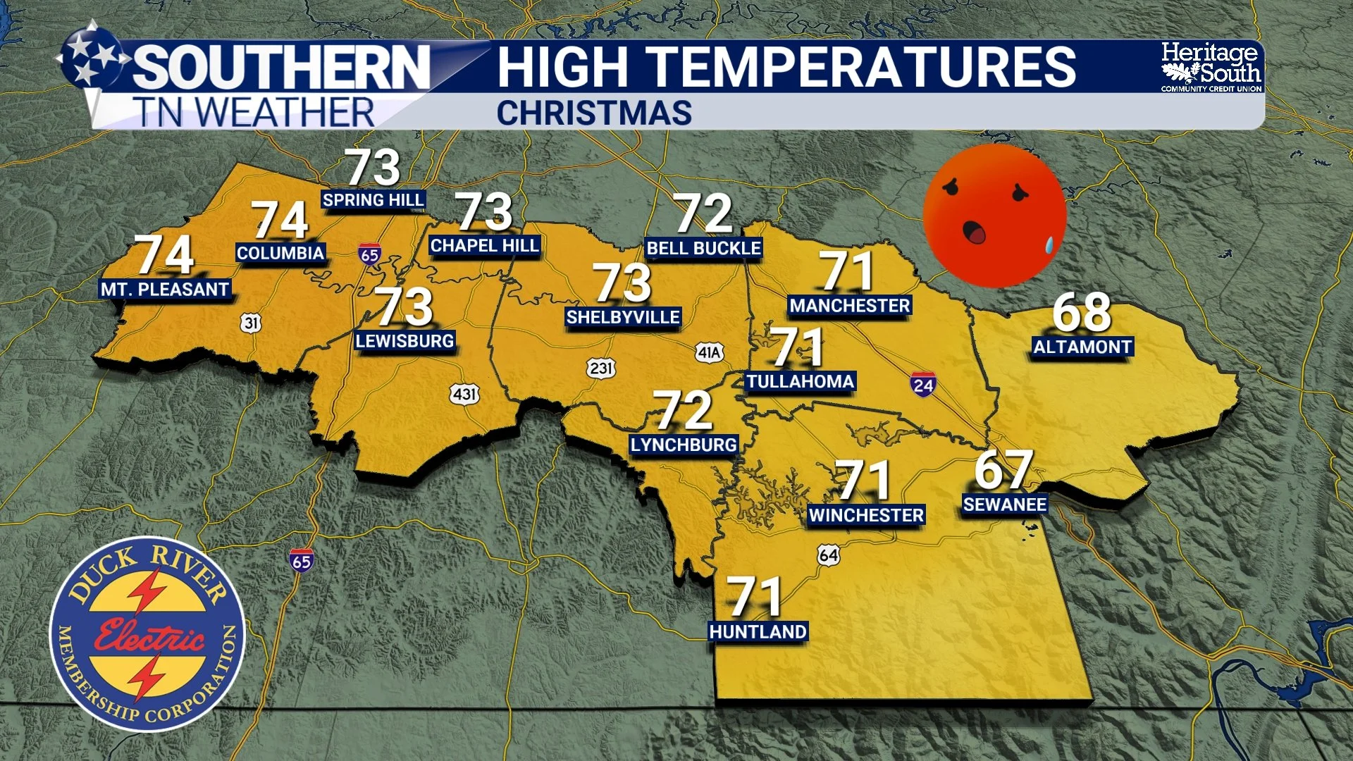
Christmas: Unseasonably Warm
Once we get past the slim rain chances early this week, the pattern turns downright spring-like for late December. High pressure aloft will remain firmly in control, allowing temperatures to continue climbing. By Christmas Eve, highs will approach the upper 60s, and by Christmas Day, many locations will reach the low to mid 70s. That’s roughly 15 to 20 degrees above normal for this time of year.
Conditions look mostly dry for both Christmas Eve and Christmas Day. A few spotty light showers can’t be ruled out well north of us or across higher terrain, but for Southern Middle Tennessee, the forecast favors warm, breezy, and dry weather. Here’s a look at record highs across the area for Christmas. Several locations will be close to these temperatures:
Columbia: 75° (2021)
Lewisburg: 74° (1964)
Shelbyville: 75° (2016)
Tullahoma: 72° (2016)
Coalmont: 69° (2019)
Lynchburg: 75° (2015)
Monteagle: 69° (2019)
Winchester: 74° (2016)
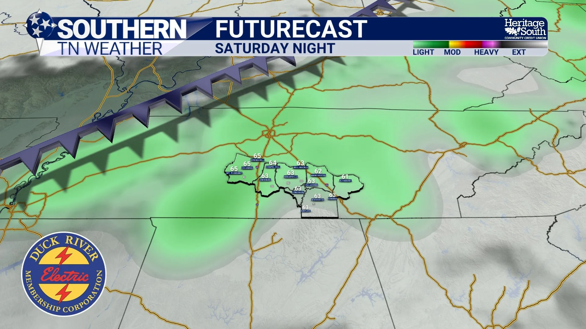
Looking Ahead: Pattern Change Next Weekend
The warm pattern doesn’t last forever. Heading into next weekend, guidance continues to show a stronger cold front pushing through sometime between Saturday night and Sunday.
This system looks more organized than anything we’ll see this week and will likely bring widespread rain along with a noticeable drop in temperatures back toward seasonal levels. Exact timing and rainfall amounts still need refinement, but confidence is growing that a pattern shift is coming. Until then, enjoy the break from cold weather because late December is definitely pressing pause on winter!
The Bottom Line 🧾
• A mild and mostly quiet start to the week across Southern Middle Tennessee
• Only slim chances for light showers tonight and Tuesday, with little to no impact
• Temperatures continue to climb, reaching the upper 60s to low 70s by Christmas
• Christmas Eve and Christmas Day look warm, breezy, and largely dry
• A stronger cold front next weekend may bring rain and a return to more seasonal temperatures
📰 Reminder: The Southern Tennessee Weather Blog (Presented by Heritage South Community Credit Union) is updated Monday through Friday with fresh, locally tailored forecasts you can trust.