
Pretty Quiet Over The Next 7 Days… but Cold Is Coming!

The Southern Tennessee Weather Blog is proudly presented by Heritage South Community Credit Union.
We Help When Others Won’t!
Visit https://www.heritagesouth.org/ today to see how HSCCU can help YOU!
A Breezy, Chilly Wednesday Across Southern Tennessee
Today has been a typical early-December day — patches of sun, some stubborn clouds, and just enough wind to make the 40s / 50s feel noticeably colder than they look. Gusts have been topping out between 20 and 35 mph, which keeps the chill factor elevated even in the middle of the day.
These winds will ease later this evening as a cold front slides through. That front will also set up the potential for a few flurries or light snow showers to our northeast, mainly across the Upper Cumberland. That region sits in a perfect spot for upslope snow whenever northwest winds kick in — but here at home, this system will have very limited influence.
For Southern Middle Tennessee, COLD AND DRY is the theme.
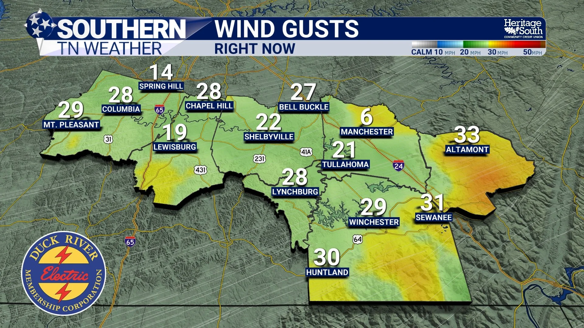
Current Wind Gusts
A Quick Note About Those Snow Chances Northeast of Us
Although the Plateau isn’t directly in our core coverage area, it’s close enough that many people travel through it — so it’s worth a brief mention. Behind tonight’s front, northwest winds will create an environment supportive of some light, elevation-driven snow showers northeast of our counties. A dusting up to a half inch is possible in places like Monterey, Jamestown, and Crossville.
But across Southern Tennessee, no impacts are expected. The moisture is too shallow, temperatures are borderline, and the forcing simply isn’t here locally. You may see a stray flurry in Grundy County, but that’s about it.
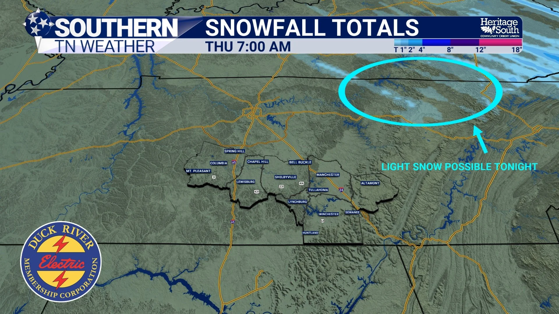
Light snow possible tonight in the UC
The Bigger Story: A Brutal Cold Blast This Weekend
This weekend is the real headline. A strong upper-level trough will dig south over the eastern U.S., sending a surge of Arctic air into the region. And unlike some of the model runs we saw earlier that backed off the extreme cold… the newest data has brought the frigid temperatures back (at least a tad).
Here’s the general idea:
Temperatures warm a bit Thursday and Friday
A dry cold front arrives Friday night
Temperatures crash Saturday night
Widespread teens Sunday morning
Even colder Monday morning, with widespread teens expected again
Confidence is now fairly high. Several guidance suites show a 90% probability of teens across the area, and the blend of models supports this strongly. I feel like I need to mention that there’s NO precipitation involved — just raw, bitter cold.
What This Cold Means for You
If you haven’t already:
Prepare outdoor pets and animals
Winterize pipes and exposed plumbing
Make sure space heaters and fireplaces are safe and functional
Check in on elderly neighbors, friends, or anyone with heating challenges
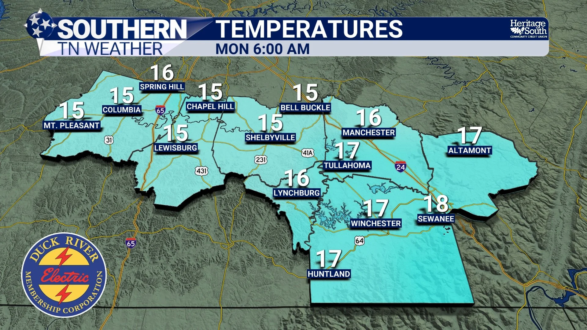
Futurecast Temperatures Monday AM
Looking Ahead
The pattern stays dry through early next week. Our next chance of rain doesn’t show up until around mid-week, and even that looks low-impact at the moment. The sunshine will be nice — but the temperatures will remind you it is December.
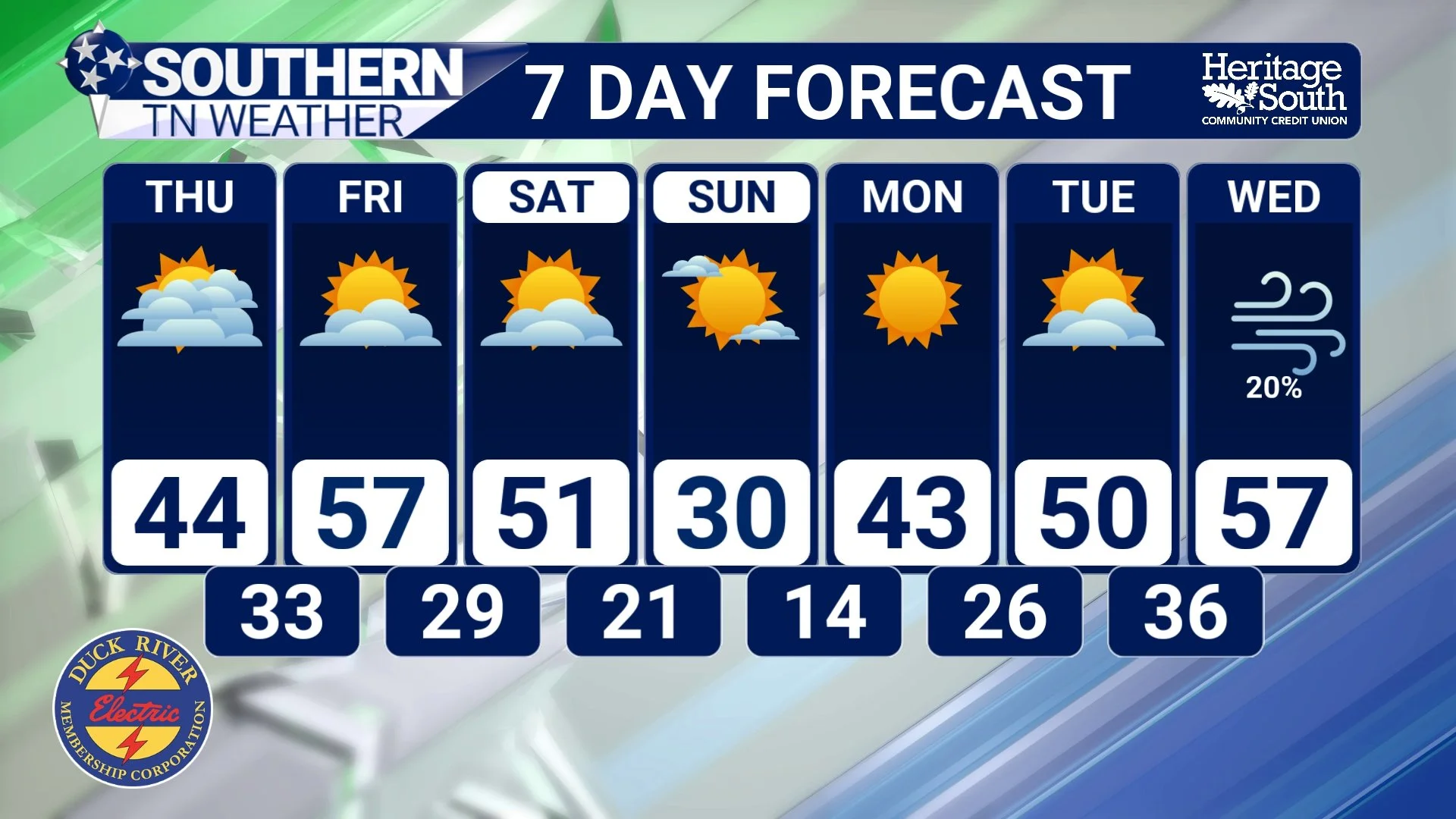
7-Day Forecast
The Bottom Line
A few light snow showers are possible northeast of us tonight on the Plateau
No meaningful impacts expected across Southern Middle Tennessee
Winds diminish tonight after the cold front passes
A cold blast arrives this weekend
Teens are likely Sunday and Monday mornings, with some spots even colder
Dry pattern continues until mid-next week
📰 Reminder: The Southern Tennessee Weather Blog (Presented by Heritage South Community Credit Union) is updated Monday through Friday with fresh, locally tailored forecasts you can trust.