
Dangerous Cold Sunday and Monday, But A Pattern Shift Is on the Horizon!

The Southern Tennessee Weather Blog is proudly presented by Heritage South Community Credit Union.
We Help When Others Won’t!
Visit https://www.heritagesouth.org/ today to see how HSCCU can help YOU!
Thursday has turned out calm and comfortable across Southern Middle Tennessee. We’ve enjoyed some sunshine today, although clouds are gradually increasing ahead of a weak clipper system sliding by to our north in Kentucky. Winds are lighter than yesterday, and Friday will warm up nicely with highs approaching 60 degrees. It’s a welcome break in what has been a chilly stretch — but it won’t last long. A big-time cold snap is coming.
A Major Blast of Arctic Air Is On the Way
A powerful trough of low pressure will dig into the eastern U.S. Saturday night, sending true Arctic air straight into Tennessee. Two cold fronts will sweep through. The second one being the real deal. Behind it, temperatures drop sharply, winds increase, and we head straight into the coldest air we’ve felt so far this season. On Sunday, highs will struggle to reach the 20s across the region. Even with sunshine, wind chills will stay in the teens all afternoon. This air mass will be bitter, dense, and very dry — classic Arctic air that doesn’t bring much moisture with it.
A few flurries or snow showers could sneak into areas northeast of us into Kentucky, but no meaningful precipitation is expected locally.
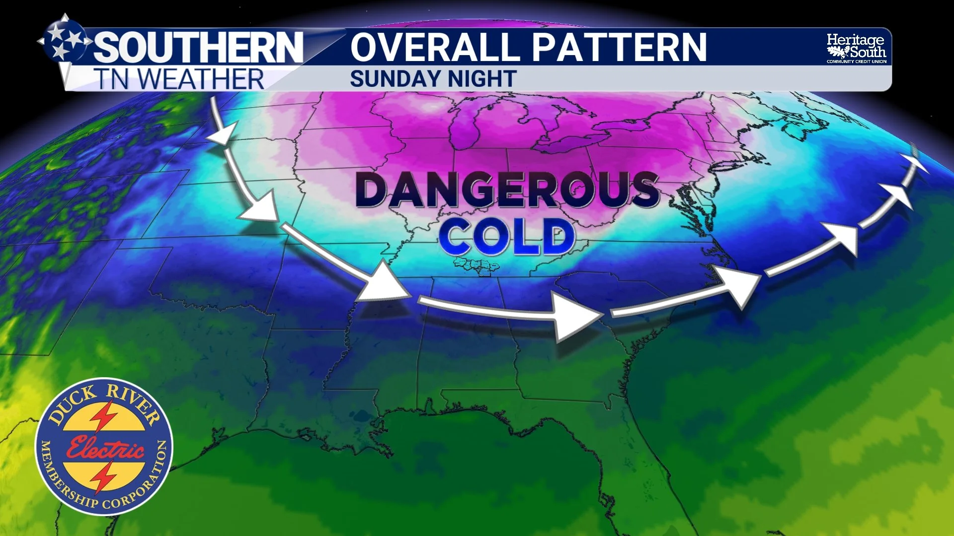
Overall Pattern - Sunday Night
The Coldest Morning Arrives Monday
Sunday night into Monday morning is when the bottom truly drops out. With clear skies and calm winds, temperatures will tank near the single digits across Southern Middle Tennessee.
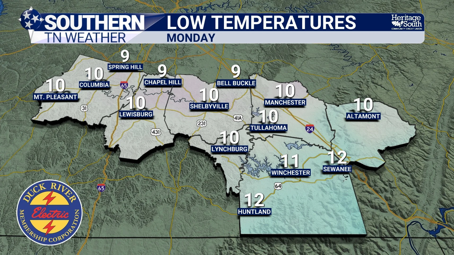
Forecast Lows - Monday Morning
Many communities will be in the 7–12° range, and colder valleys may dip even lower. The National Weather Service now shows exceptionally high confidence in this single-digit cold. If you haven’t already, it’s time to think about protecting pipes, checking heating systems, and planning for pets and livestock. Keep in mind that wind chills will likely be lower than this. A few communities will likely see very dangerous wind chills BELOW ZERO by Monday Morning.
Even Sunday afternoon won’t offer much relief, with highs staying in the 20s (regardless of sunshine).
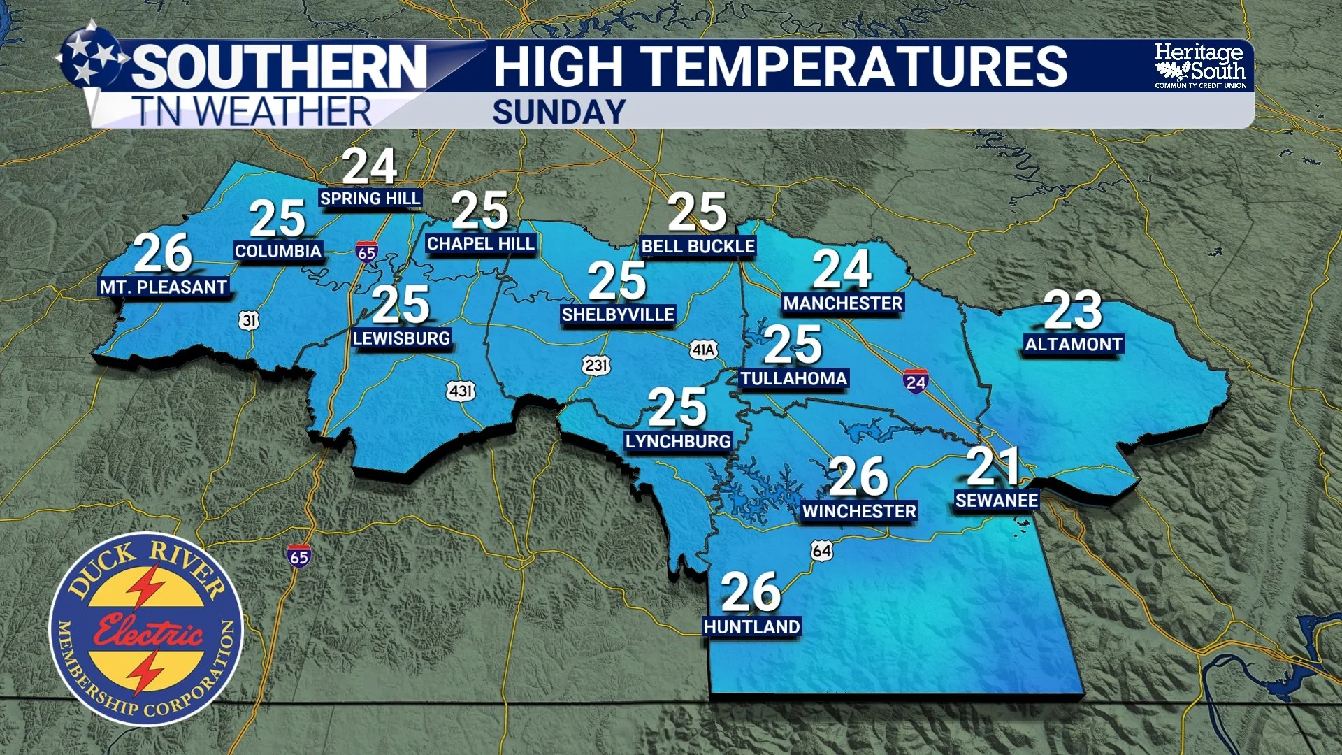
Forecast Highs - Sunday
A Quick Flip Back Toward Milder Weather
Thankfully, this blast of Arctic air will be sharp but short-lived. By Tuesday and Wednesday, temperatures recover into the 50s with much more comfortable mornings.
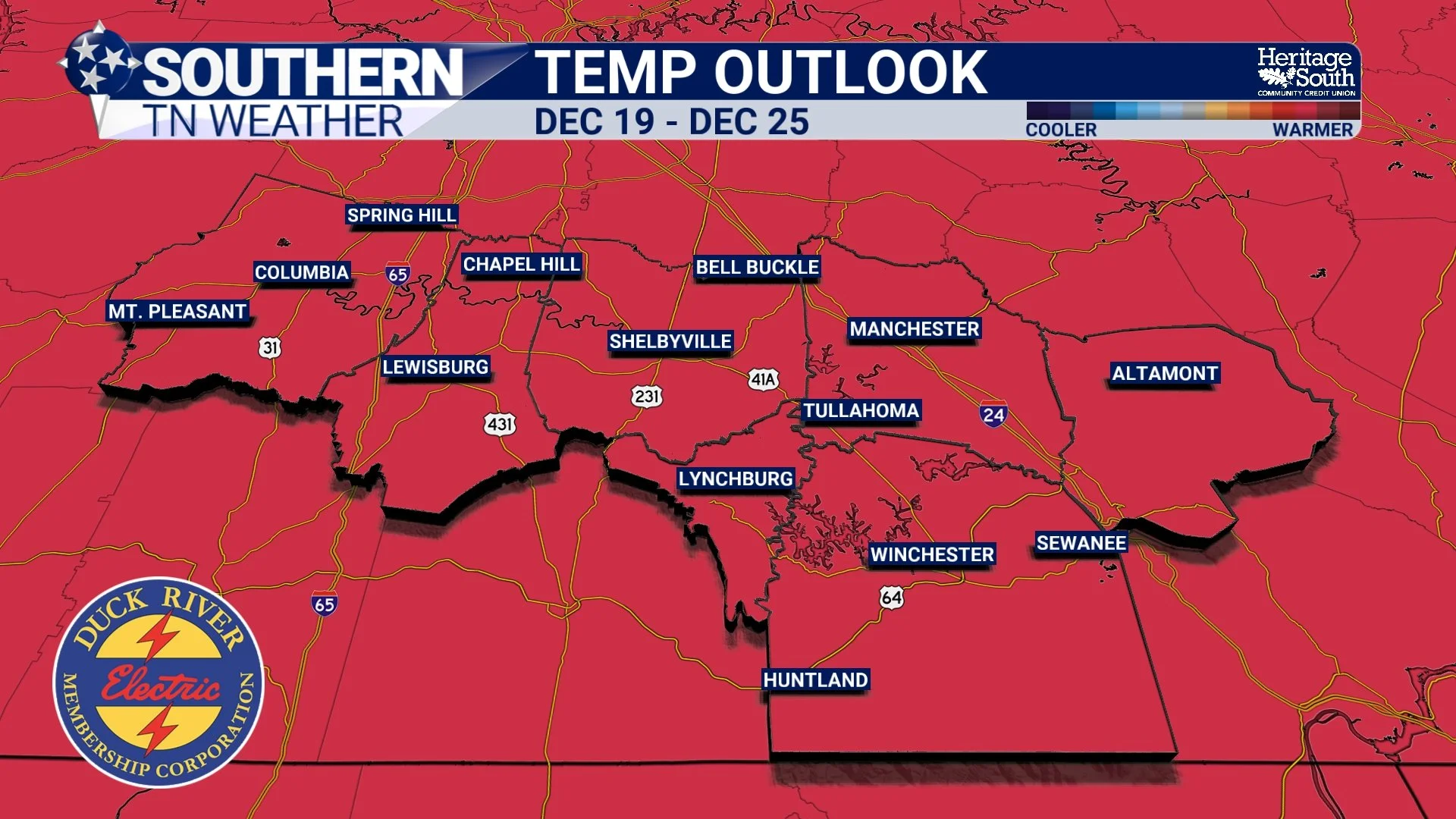
Even more interesting: early indications continue to point toward a warmer-than-average stretch as we head toward Christmas. The overall pattern shifts next week, keeping the jet stream farther north and allowing milder air to take hold across the Southeast. It’s far too early to give specifics for Christmas Day, but the broader setup favors above-average temperatures. below you’ll see the latest Climate Prediction Center outlook for the week leading up to Christmas.
The Bottom Line
• A bitter Arctic blast arrives Saturday night
• Sunday: highs in the 20s, wind chills in the teens
• Monday morning: widespread single-digit lows
• Little to no snow locally — the air is too dry
• Temperatures rebound next week with a warmer pattern leading up to Christmas
📰 Reminder: The Southern Tennessee Weather Blog (Presented by Heritage South Community Credit Union) is updated Monday through Friday with fresh, locally tailored forecasts you can trust.