A Cool Thanksgiving in Store…
Beneficial Rainfall This Morning
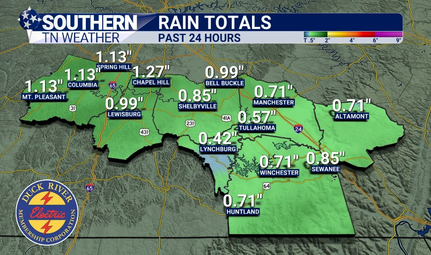
Our much-anticipated storm system moved through early this morning and brought a healthy round of rainfall to Southern Middle Tennessee. Most locations picked up ½ to 1 inch, which matched the forecast nicely. As of the time of this blog post, light to moderate rain is still falling across parts of Franklin and Grundy Counties, so a few spots in our southeast may finish slightly above an inch before everything fully tapers off.
Today’s blog focuses on the quieting weather pattern ahead, what to expect for Thanksgiving, and the return of our next widespread rainmaker.
Cold Front Moves Through Tonight — Clearing Skies Wednesday
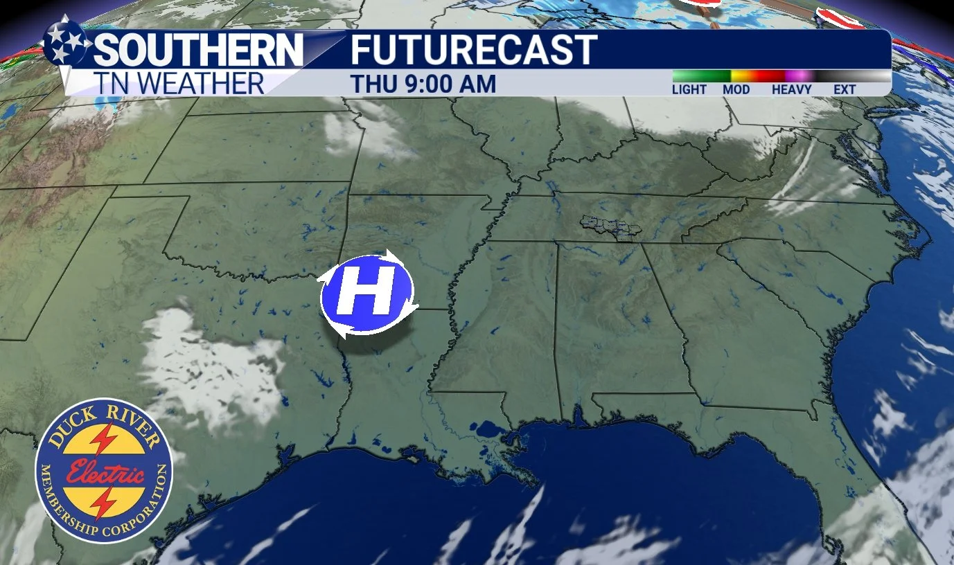
The same cold front responsible for this morning’s rainfall will push through the region later this evening. Behind it, temperatures will drop quickly, and winds will shift out of the northwest. Cloud cover will linger overnight, but conditions will improve sharply on Wednesday as high pressure builds in (see below). By Wednesday afternoon, skies will clear from west to east, setting us up for several days of dry, sunny weather.
Winds will remain a little breezy on Wednesday behind the departing front. Gusts may reach 20–25 mph, but nothing overly noteworthy. The big change will be the cooler air that settles in for the rest of the week.
Below-Average Temperatures Return
A notably cooler air mass arrives tonight and will stay locked in through Friday. While highs on Wednesday will hover near normal (55–60 degrees), both Thursday and Friday will run 10–15 degrees below average, with afternoon temperatures only in the mid-40s. In fact, a few locations may struggle to reach 40 degrees on Friday.
Overnight lows will drop into the 20–30° range, and a widespread hard freeze is expected Wednesday and Thursday nights. If you still have sensitive outdoor plants hanging on, this will likely finish them off for the season.
High pressure builds in tomorrow and into Thursday
Thanksgiving Forecast
Many of you are wondering about Thanksgiving, so let’s get right to it:
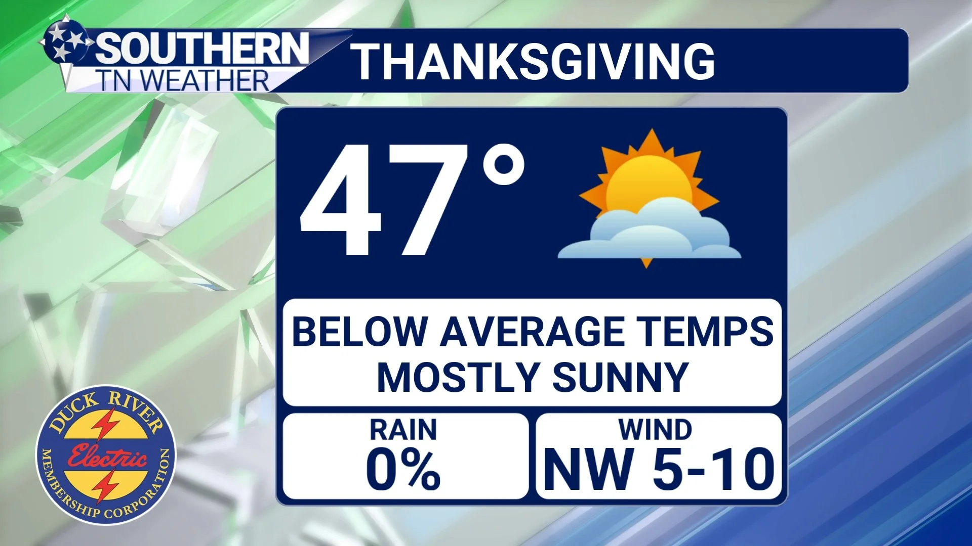
Thanksgiving Day looks beautiful, dry, and seasonably chilly. Expect highs between 45 and 50 degrees under mostly sunny skies. Winds will be lightly brisk out of the northwest, adding a bit of chill in the air — but honestly, it will feel like Thanksgiving should. After a November full of temperature swings, this fall-feeling holiday will be a welcomed change.
Thanksgiving Forecast
Looking Ahead: This Weekend & Early Next Week
As we move into Saturday, clouds will gradually increase ahead of our next storm system. Sunday is shaping up to be our next widespread rain event, though exact timing and details still need to be fine-tuned. Early indications suggest another ½ inch to 1 inch of rainfall, but I’ll narrow down those numbers as the week goes on.
Next week’s pattern continues to trend active, thanks to a developing storm system over the West that eventually moves into the Ohio Valley. More rain chances are likely early next week.
The Bottom Line 🧾
• A cold front moves through tonight, ending the rain and ushering in cooler, drier air
• Sunshine returns Wednesday, with breezy northwest winds and highs in the upper 40s to near 50
• Widespread freezing temperatures expected Wednesday and Thursday nights, with a hard freeze likely
• Thanksgiving will be beautiful but chilly, with highs in the mid to upper 40s under mostly sunny skies
• Saturday starts dry; widespread rain returns Sunday with another ½–1 inch possible
• More rain chances may develop early next week as another system approaches
📰 Reminder: The Southern Tennessee Weather Blog is updated Monday through Friday with fresh, locally tailored forecasts you can trust.
There will NOT be blog updates Wednesday or Thursday due to Thanksgiving and the lack of eventful weather. Enjoy the break, spend time with family, and soak in the beautiful fall weather!


