
Gradual Warm-Up Ahead With Rain Returning Late Week

The Southern Tennessee Weather Blog is proudly presented by Heritage South Community Credit Union.
We Help When Others Won’t!
Visit https://www.heritagesouth.org/ today to see how HSCCU can help YOU!
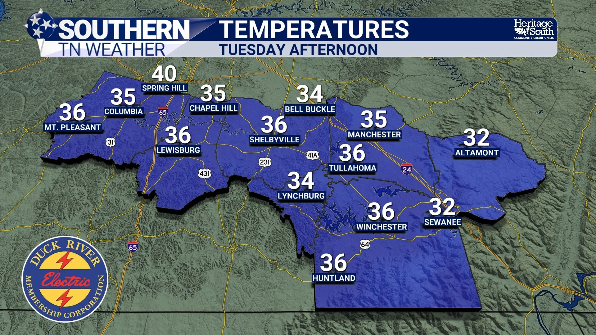
Southern Middle Tennessee is getting a true reminder of winter this afternoon as cold air remains firmly in place behind Sunday’s cold front. While sunshine has returned, temperatures are struggling to climb out of the 30s, and a steady northwest breeze is keeping the chill locked in.
This isn’t a stormy pattern, but it is a transitional one… Cold now, quieter through midweek, then gradually warming as we head toward the New Year with rain chances returning late in the week.
Cold and Quiet This Afternoon
Cold air continues to funnel into the region behind Sunday’s front, keeping temperatures well below normal for late December. Most of Southern Middle Tennessee remains in the lower to mid 30s this afternoon despite full sunshine. Northwest winds of 10–15 mph, with occasional higher gusts, are making it feel even colder at times. While this isn’t extreme cold, it’s a noticeable shift from the mild stretch we experienced last week.
very chilly tonight
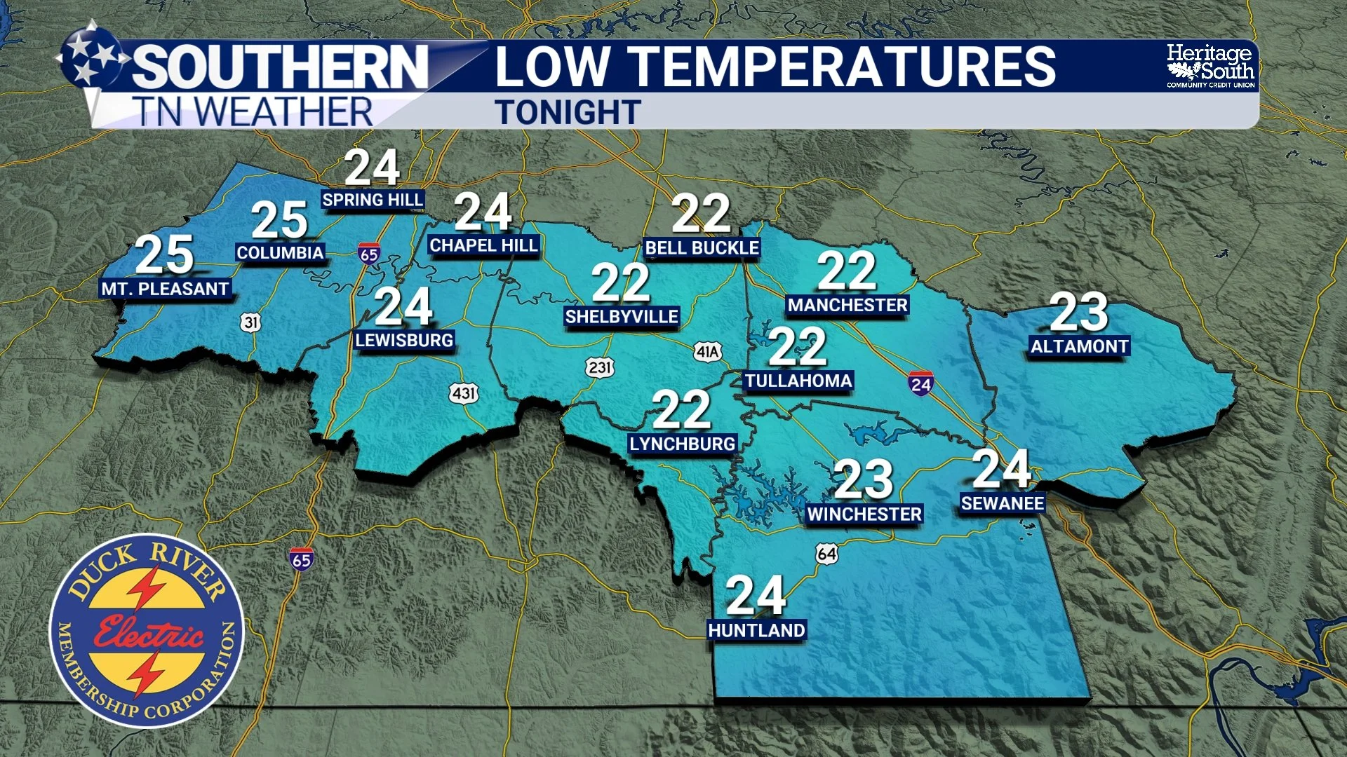
Tonight will once again be quite cold. As winds ease and skies remain mostly clear, temperatures will fall into the low to mid 20s across much of the area, with a few colder spots dipping into the upper teens. Even with lighter winds, wind chills could briefly dip into the teens early Wednesday morning. This is a good time to protect pets, check outdoor plumbing, and prepare for a frosty start to the day.
Midweek Warming Begins Wednesday
By Wednesday, the pattern begins to shift. High pressure settles in, allowing winds to relax and temperatures to slowly rebound. Afternoon highs will climb into the mid to upper 40s with a mix of sun and passing clouds. The warming trend continues into Thursday as southerly flow returns. Highs will rise into the 50s, setting the stage for a noticeably milder end to the week.
Rain Returns Late Week (But No Severe Threat)
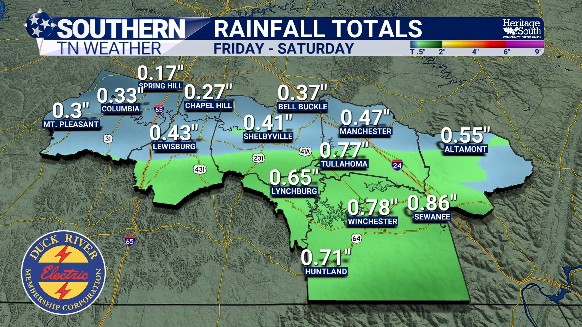
Our next weather system arrives late Friday into Friday night as a disturbance moves in from the west. This system will bring increasing clouds and a period of rain. Rainfall totals currently look to range from about 0.25 to 0.50 inches, with slightly higher amounts possible closer to the Alabama state line. While a few rumbles of thunder can’t be ruled out south of I-40, severe weather is not expected. The overall setup favors light to moderate rain rather than anything impactful.
New Year’s Outlook: Mild and Quiet
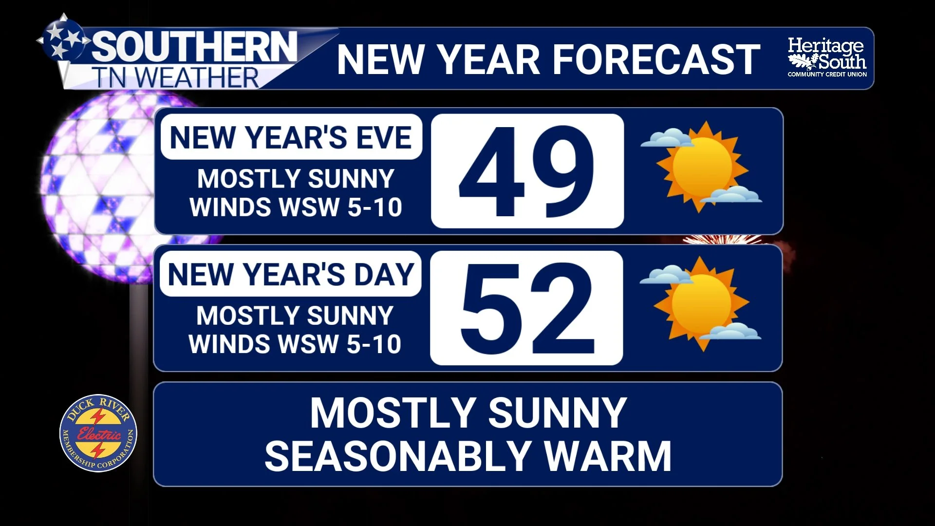
Behind Friday’s system, temperatures rebound once again. New Year’s Eve and New Year’s Day are shaping up to be dry and mild, with highs in the 50s and possibly near 60 degrees in some locations. It looks like a calm and comfortable way to close out 2025 and welcome in 2026 with no major weather concerns on the horizon!
The Bottom Line 🧾
• Cold today and tonight, with lows dropping into the 20s
• Gradual warm-up begins Wednesday
• Rain returns late Friday, but no severe weather expected
• Mild and quiet conditions expected for New Year’s Eve and New Year’s Day
📰 Reminder: The Southern Tennessee Weather Blog (Presented by Heritage South Community Credit Union) is updated Monday through Friday with fresh, locally tailored forecasts you can trust.