
Storms Possible Thursday, But Severe Threat Remains Low

The Southern Tennessee Weather Blog is proudly presented by Heritage South Community Credit Union.
We Help When Others Won’t!
Visit https://www.heritagesouth.org/ today to see how HSCCU can help YOU!
As we head toward the middle of the week, temperatures across Southern Middle Tennessee will continue to trend warmer. Highs will climb into the 50s and lower 60s Wednesday and Thursday, which is well above average for mid-December. That warmth, however, comes with our next widespread rain-maker and a low-end storm threat on Thursday.
A Potent System, But Missing a Key Ingredient
A strong upper-level storm system will move out of the Plains and toward the Mississippi and Tennessee Valleys on Thursday. From a dynamics standpoint, this system is impressive. Winds several thousand feet above the ground will be screaming, with strong jet stream energy and a powerful cold front pushing east. Normally, that kind of setup would raise more concern. But here is the limiting factor: instability.
Storms need fuel to become severe, and in this case, that fuel looks limited across Southern Middle Tennessee. While dewpoints will rise into the low to mid 50s, model guidance continues to show very low surface-based instability, generally under 200 J/kg. Many storms may remain elevated, which greatly reduces the severe weather potential. That is why the Storm Prediction Center has placed us in a low-end Marginal Risk (level 1/5) for severe thunderstorms. A Marginal Risk means isolated severe weather is possible, but widespread or significant impacts are not expected.
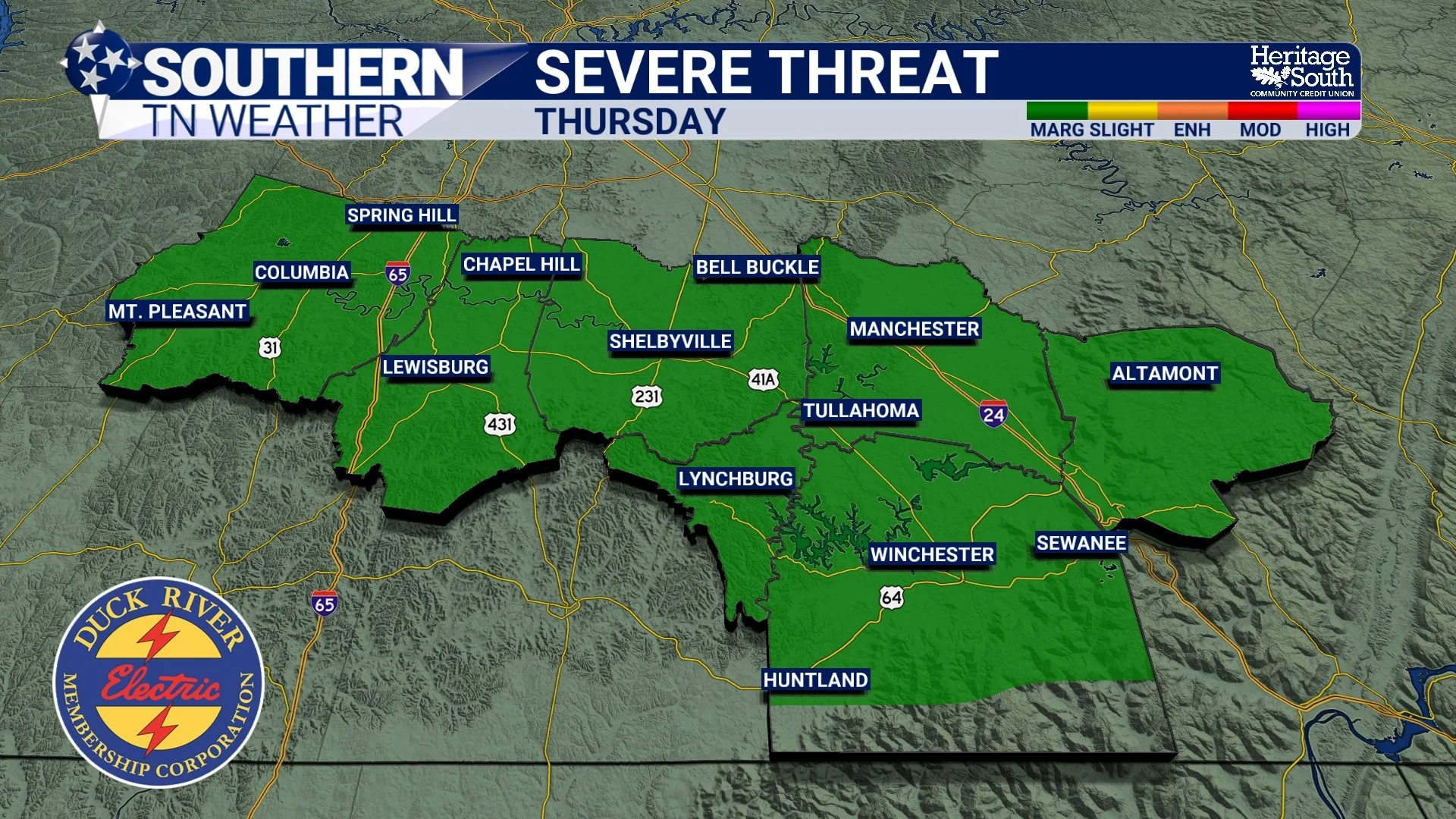
SPC Severe Weather Outlook - Thursday
WHAT WILL Happen Thursday?
Showers and a few thunderstorms will likely overspread the area Thursday afternoon and continue into Thursday evening as the cold front moves through. If any storms become strong, the main concern would be brief gusty winds. Tornado risk appears very low, and hail is not a primary concern. For most folks, the biggest impact will simply be steady rainfall. Current projections suggest 0.50 to 1.0 inch of rain, which will be beneficial but not problematic.
Below, I have the latest run of our in-house weather model. It is on the drier end of the spectrum with Thursday’s system. Personally, I think coverage of showers and storms will be more widespread than what is shown, but this highlights the model disagreement meteorologists deal with on a daily basis, and it is one of the reasons forecasting can be challenging. Thankfully, this is not a high-stakes setup, but still worth keeping an eye on.
For Southern Middle Tennessee, this is shaping up to be a high-coverage rain event with a low-end storm threat, not a severe weather outbreak. That does not mean a warning or two could not be issued on Thursday, so make sure your severe weather plan is ready. That includes having a reliable way to receive warnings, like the Southern Tennessee Weather App.
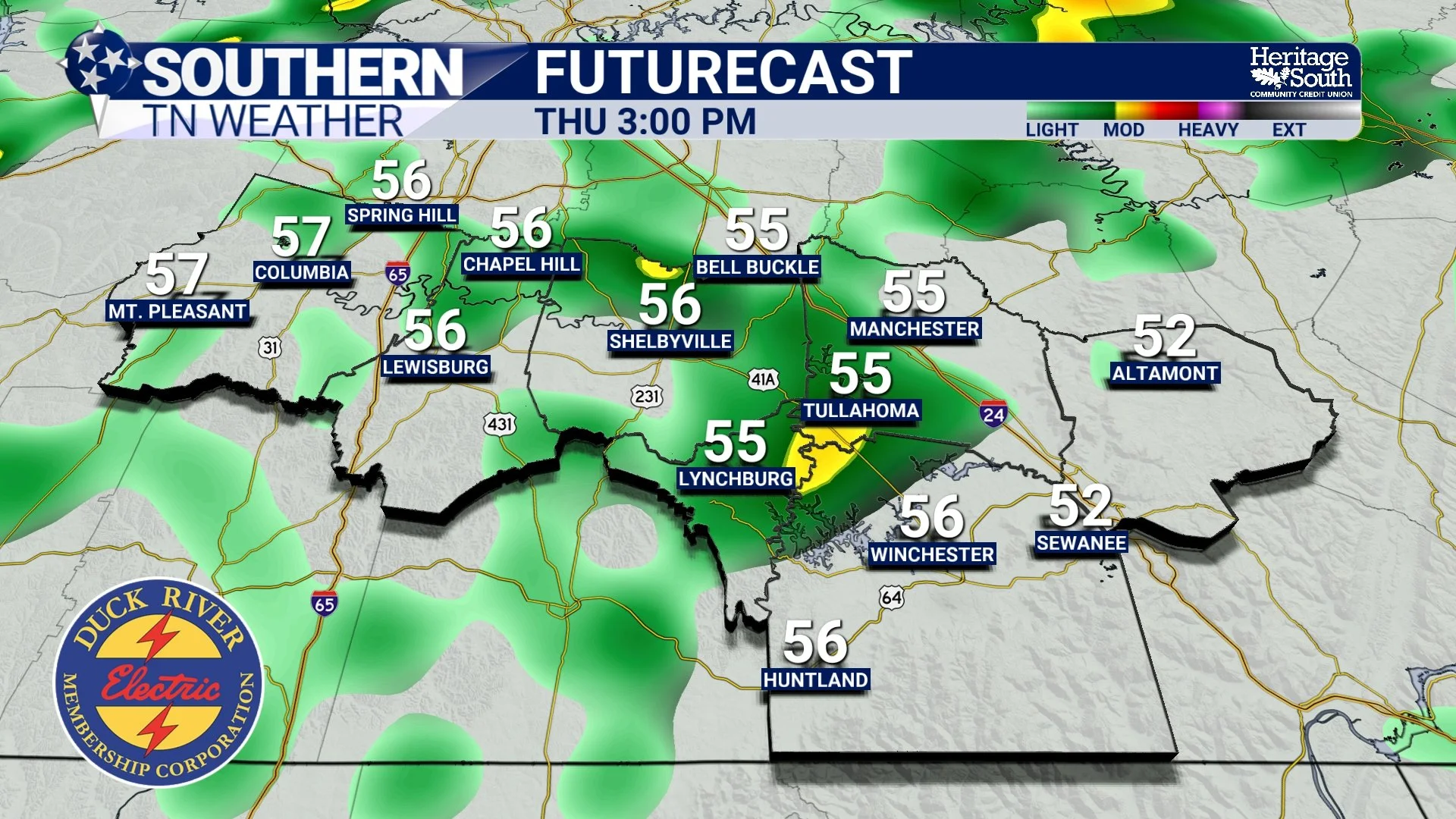
Futurecast - Thursday afternoon and evening
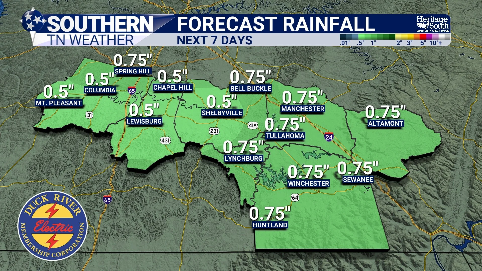
NWS Forecast Rain Totals - Next 7 Days
Timing and Looking Ahead
While we could see an isolated shower on Wednesday, rain chances really ramp up Thursday afternoon and peak Thursday evening as the cold front moves through. Conditions improve overnight Thursday into early Friday as drier air works in behind the front. More specific timing on Thursday’s storm threat should come into focus by tomorrow’s blog as higher-resolution model guidance rolls in.
Temperatures will briefly cool down Friday, but the bigger picture still favors above-normal temperatures heading toward Christmas, with no prolonged cold locked in.
The Bottom Line 🧾
• Widespread rain and a few storms are expected Thursday
• Severe weather chances remain very low
• Isolated gusty winds are the primary concern
• Rainfall totals of 0.50 to 1.0 inch are likely
• A brief cool-down follows Friday, then warmer air returns
This is a great example of a strong-looking system that lacks the fuel needed to become dangerous. The bark is much worse than the bite, if you will… We will keep monitoring trends, but right now there is no reason for alarm across Southern Middle Tennessee. More updates coming as we get closer to Thursday.
📰 Reminder: The Southern Tennessee Weather Blog (Presented by Heritage South Community Credit Union) is updated Monday through Friday with fresh, locally tailored forecasts you can trust.