
Watching Freezing Fog and Late-Week Precip Chances

The Southern Tennessee Weather Blog is proudly presented by Heritage South Community Credit Union.
We Help When Others Won’t!
Visit https://www.heritagesouth.org/ today to see how HSCCU can help YOU!
A Cold, Cloudy, and Foggy Tuesday…
So far, it has been a quiet but very cold Tuesday across Southern Middle Tennessee. Our rain system cleared early this morning, leaving behind widespread totals of one half inch to one inch. Spring Hill was the big winner, picking up just under an inch along the Maury–Williamson County line. These totals aligned nicely with the forecast. Since the rain and its associated cold front moved out, temperatures have struggled all day. Most of us are stuck in the low to mid 30s under thick cloud cover, meaning we’re not getting any help from the sun. Wind chill values remain in the mid 20s, making it feel even colder.
We’re also seeing some patches of fog (and even areas of freezing fog) across the Plateau in Grundy and Franklin Counties. Low cloud ceilings have the Plateau quite literally “in the clouds.” And we may be dealing with more widespread freezing fog tonight… so let’s talk about it.
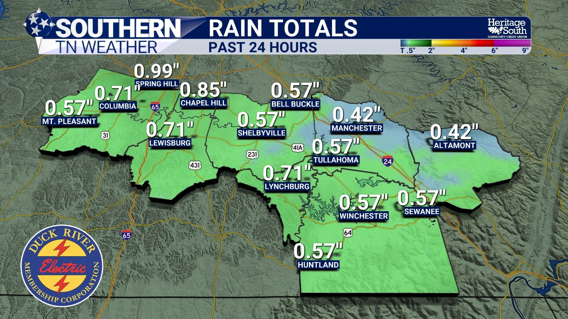
Rain totals over the past 24 hours
Tuesday Night Into Wednesday: Watching for Freezing Fog
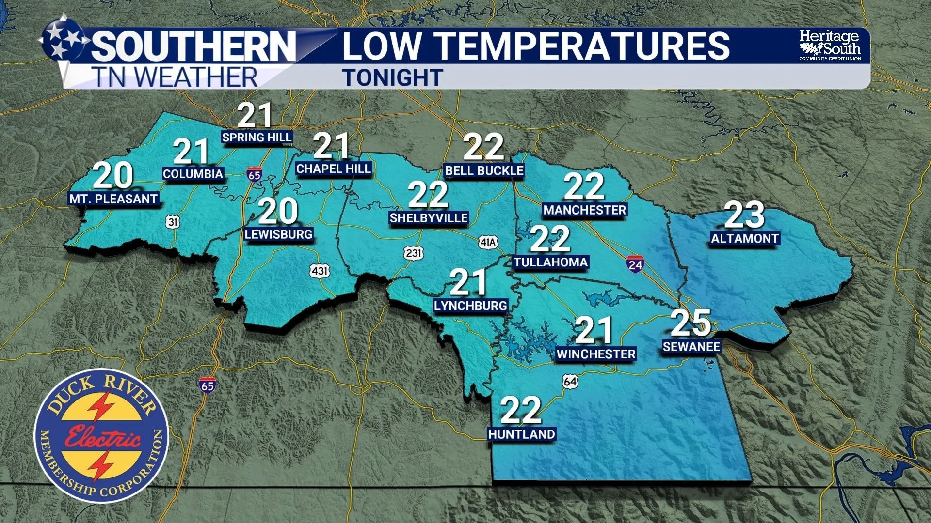
Cold air already over the region will really settle in tonight. Widespread lows in the low to mid 20s are expected, and that means it’s another “protect the four Ps” night: People, Pipes, Plants, and Pets. Before we dive into tonight’s fog potential, let’s talk briefly about what freezing fog actually is.
What Is Freezing Fog?
Freezing fog forms when tiny fog droplets freeze on contact with surfaces that are at or below 32°F. If fog is dense enough — generally when visibility is around one half mile or less — the supercooled droplets can coat bridges, overpasses, and cars with a thin glaze of ice. In other words, it’s icing without precipitation falling from above.
To get freezing fog, we need:
High near-surface moisture (check — our ground is still very saturated from last night’s rain)
Little to no wind (check — calm conditions expected)
Clear or partly clear skies to promote cooling (this is the big question mark…)
Some weather model data shows clouds breaking up overnight, which would allow dense fog to develop. Other data keeps low clouds locked in, which would limit any widespread freezing fog. So the takeaway is that there is potential for freezing fog by daybreak, especially on the Plateau, but it all depends on cloud cover. We’ll monitor trends closely.
Wednesday itself looks much nicer, with decreasing clouds and highs near 50 degrees. It’ll be the warmest day of the week.
Freezing Line Setup Tonight
Thursday Into Friday: Two Small Chances for Wintry Mischief
Our next weather system arrives Thursday night and into Friday morning. There are two separate opportunities for light precipitation — neither of which look very impactful at this time.
Chance #1: Early Thursday Morning
Some models suggest a brief window for a light wintry mix Thursday morning as a weak area moisture moves through. Temperature profiles will be marginal, and the atmosphere may simply be too dry for much to fall. So impacts look very unlikely, but it’s worth keeping an eye on… Tomorrow’s blog will have go over this chance in detail.
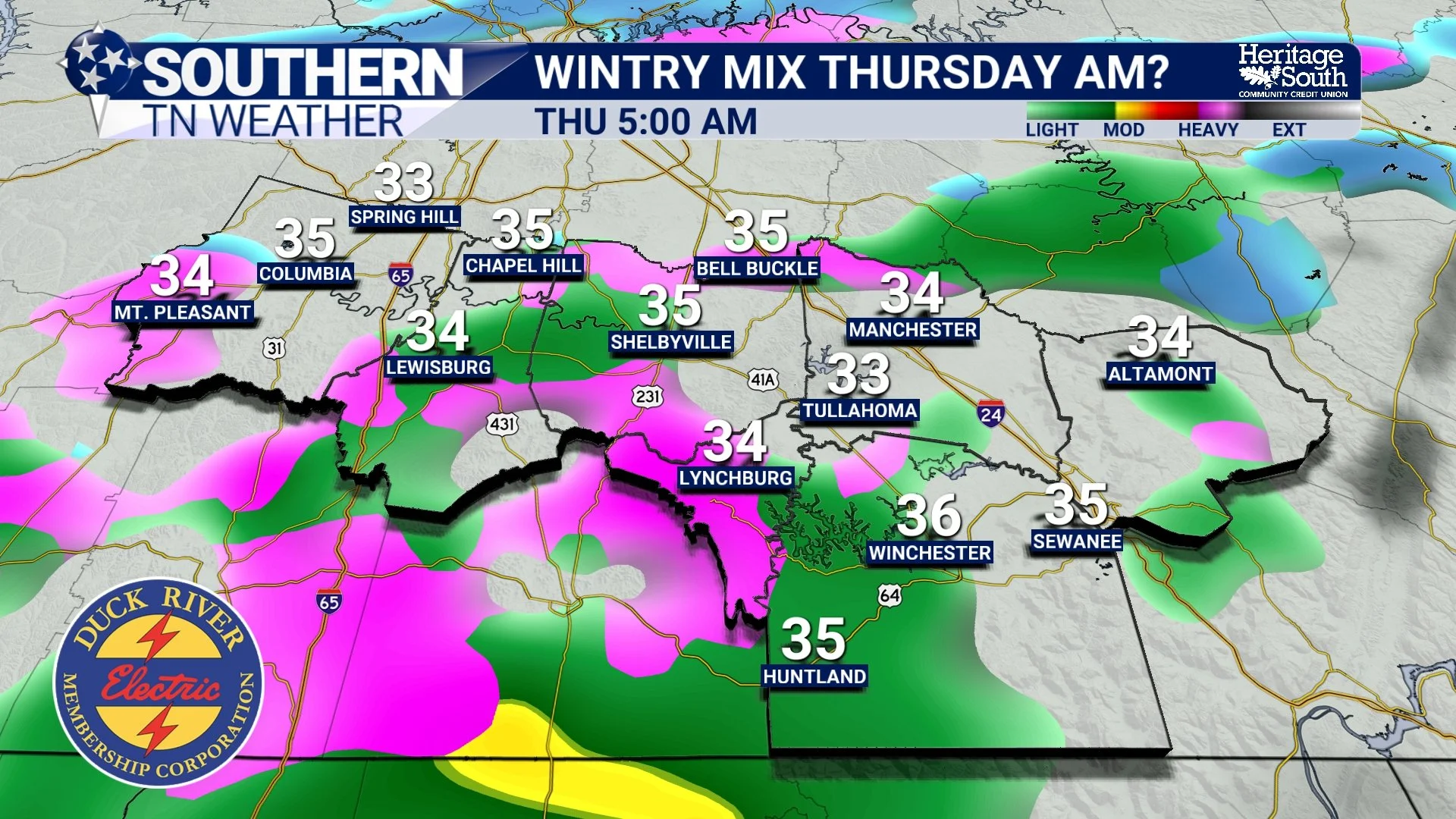
Thursday morning possible wintry mix?
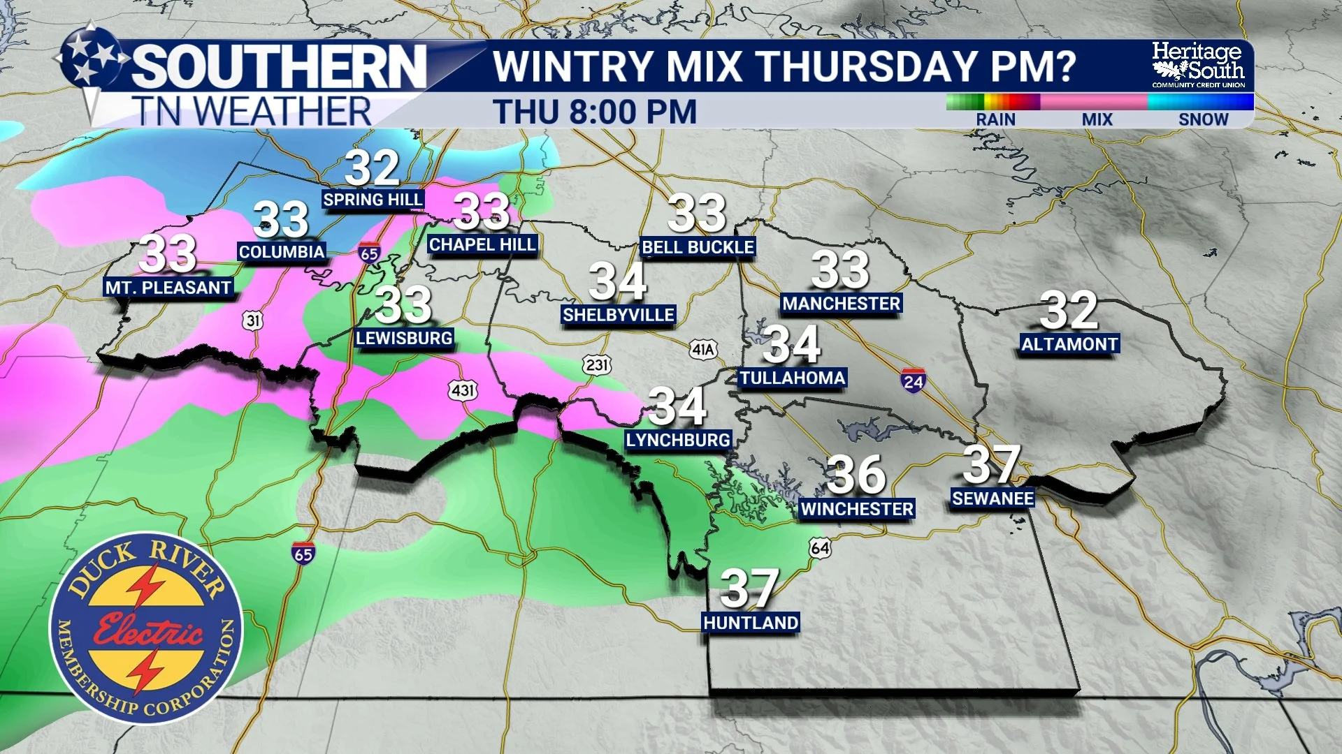
Chance #2: Thursday Evening Into Friday Morning
This is the better chance for precipitation, though still a very light event. A weak disturbance will move across the region Thursday night. If temperatures hang near freezing at the onset, we could see a short period of freezing rain or sleet before temperatures warm enough for a cold rain.
Key points based on current data and NWS guidance:
Forecast soundings show a fairly deep warm layer aloft, making freezing rain harder to occur.
Surface temperatures should stay just warm enough for mostly rain.
A few models do show a glazing of ice in our area, but confidence is low.
Rain totals look light — around one quarter inch or less.
The latest STN Weather Model still hints at a possible brief wintry mix Thursday evening (see below), but a full transition to cold rain is expected by late Thursday night. As always, small temperature changes can make a big difference with winter weather, so we’ll stay on top of the trends.
Looking Ahead
The long-range pattern keeps us chilly with several additional low-end light-rain chances into the weekend and early next week. Sunday and Monday could feature a few more showers, and maybe even some Plateau flakes behind Monday’s system, but confidence is low this far out. Temperatures look to remain below average through at least early next week, with colder nights and a general trend toward a more wintry feel.
The Bottom Line 🧾
• Very cold tonight with lows in the low to mid 20s
• Potential for freezing fog Wednesday morning — mainly on the Plateau
• Wednesday will be the nicest day of the week with highs near 50
• Low-end wintry mix possible Thursday morning and again Thursday night
• Impacts look unlikely, but small temperature changes could alter the forecast
• Light rain totals Thursday–Friday will stay under one quarter inch
• More cold, below-average temperatures ahead through early next week
📰 Reminder: The Southern Tennessee Weather Blog (Presented by Heritage South Community Credit Union) is updated Monday through Friday with fresh, locally tailored forecasts you can trust.