
Cold and Breezy Now, Milder Days Ahead for the New Year

The Southern Tennessee Weather Blog is proudly presented by Heritage South Community Credit Union.
We Help When Others Won’t!
Visit https://www.heritagesouth.org/ today to see how HSCCU can help YOU!
Southern Middle Tennessee is getting a sharp reminder that winter still has some bite left, at least for the next couple of days. A strong cold front pushed through overnight, bringing gusty winds and a noticeable drop in temperatures. While conditions are calmer this afternoon, the cold is here to stay through midweek before a gradual warmup takes over as we head toward the New Year.
Cold and Breezy Conditions Today
Behind last night’s cold front, blustery northwest winds continue to funnel colder air into the region. Wind gusts have reached 25 to 30 mph at times, making it feel noticeably colder than what the thermometer shows. Even with some sunshine breaking through, temperatures are struggling to climb out of the 30s across much of Southern Middle Tennessee.
This setup is the result of a strong low-pressure system over eastern Canada, which has created a tight pressure gradient across the region. Winds will gradually ease later this evening, but the cold air itself is firmly locked in for now.
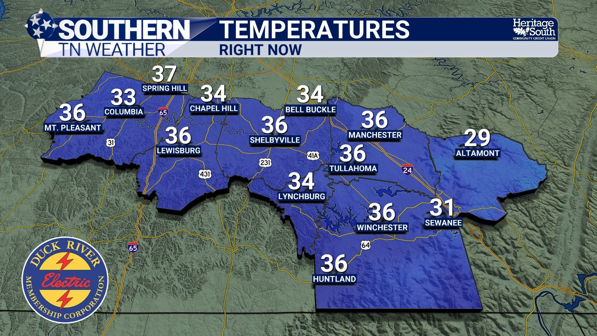
Current Temperatures as of Monday Afternoon
Coldest Air Arrives Tonight into Tuesday
Tonight will likely be the coldest period of the week. As skies clear and winds remain just strong enough to prevent full calm, temperatures will drop into the upper teens and lower 20s for many communities. Wind chills may dip into the teens and even near the single digits at times, especially during the early morning hours Tuesday. Tuesday will stay cold despite abundant sunshine. High temperatures will struggle to reach the low to mid 30s, keeping conditions feeling firmly winter-like.
With this colder air settling in, it’s a good time to take basic cold-weather precautions. Make sure pets have a warm place to stay, protect exposed pipes, and limit extended outdoor exposure during the coldest part of the morning.
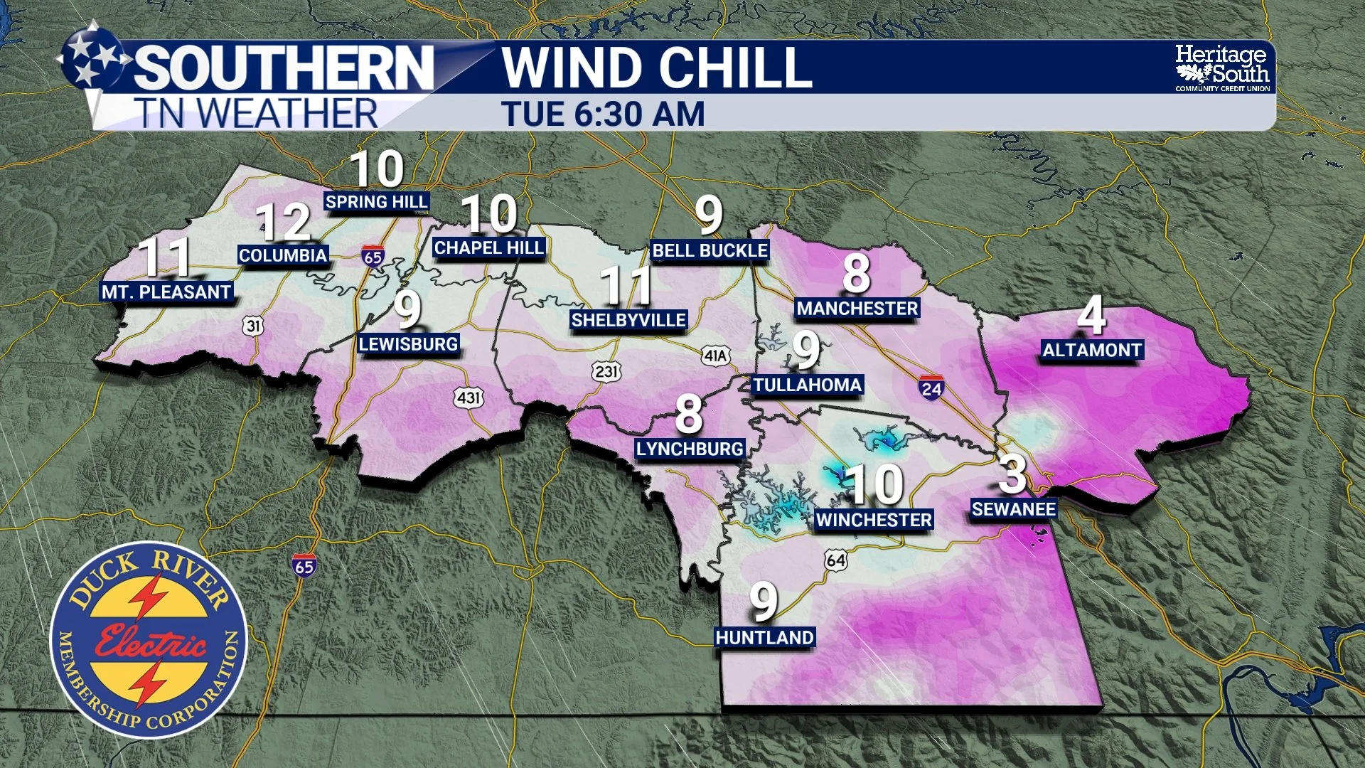
Wind Chill Values - Early Tuesday
Gradual Warming Midweek
By Tuesday night into Wednesday, high pressure begins to take control. Winds will relax, skies will remain mostly clear, and temperatures will slowly begin to rebound.
Highs on Wednesday should reach the upper 40s to near 50 degrees. While still on the cool side, it will feel noticeably better after the early-week chill. Overnight lows will also moderate, settling mostly into the 20s and low 30s.
Rain Chances Return Late Week
Toward the end of the week, another weather system approaches from the west. This will bring increasing cloud cover and a chance for rain late Friday into early Saturday.
Rainfall amounts look modest, generally ranging from a quarter to a half inch. Severe weather is not expected, and overall impacts should remain minimal. Temperatures ahead of this system will rebound nicely, with highs pushing back into the 50s and possibly near 60 degrees.
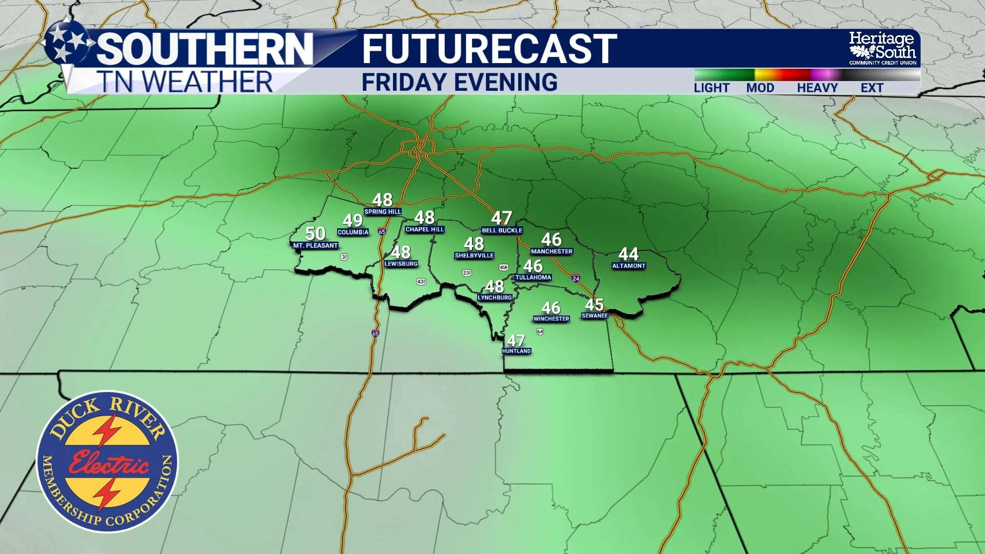
Futurecast - Friday evening
New Year’s Outlook: Mild and Quiet
Looking ahead to New Year’s Eve and New Year’s Day, the pattern looks calm and mild. High pressure rebuilds, keeping conditions dry with temperatures running above average for late December. That means a quiet and comfortable end to the year, with favorable weather for any outdoor plans as we head into 2026.
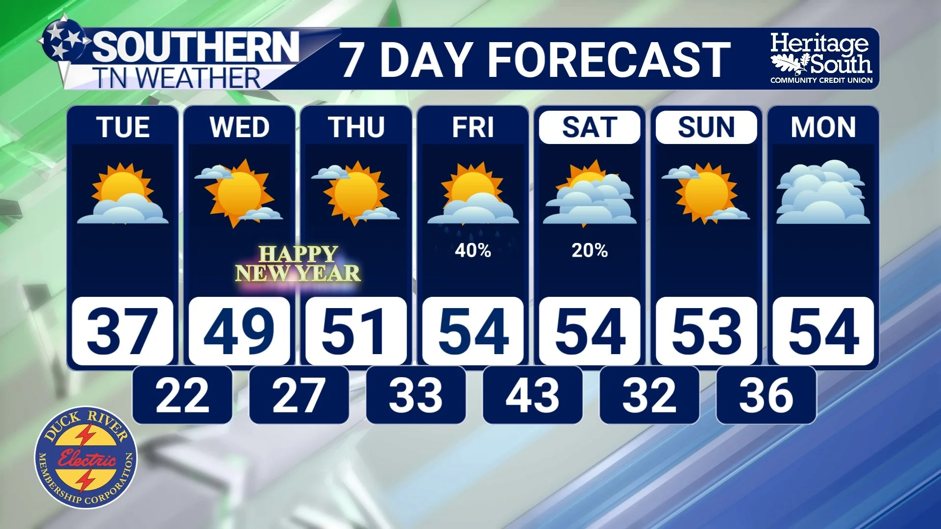
7-Day Forecast
The Bottom Line 🧾
• Cold and breezy conditions continue through Tuesday
• The coldest temperatures arrive late tonight into early Tuesday
• Gradual warming begins midweek
• Light rain returns late Friday into early Saturday
• New Year’s Eve and New Year’s Day look mild and dry
📰 Reminder: The Southern Tennessee Weather Blog (Presented by Heritage South Community Credit Union) is updated Monday through Friday with fresh, locally tailored forecasts you can trust.