Active Weather to Start the New Week…
The Rest of Black Friday & the First Half of Saturday
It’s been a very chilly end to the week across Southern Middle Tennessee. Highs on Thanksgiving only reached the mid to upper 40s, and today we’re struggling to climb out of the mid 40s — a solid 10–15 degrees below average for late November. Tonight brings yet another widespread hard freeze, with lows dipping well into the 20s. We’ll finally start a small warming trend on Saturday. Highs return to the 50s as southerly winds bring in Gulf moisture and increasing cloud cover through the day.
Two weather systems will impact us over the next few days:
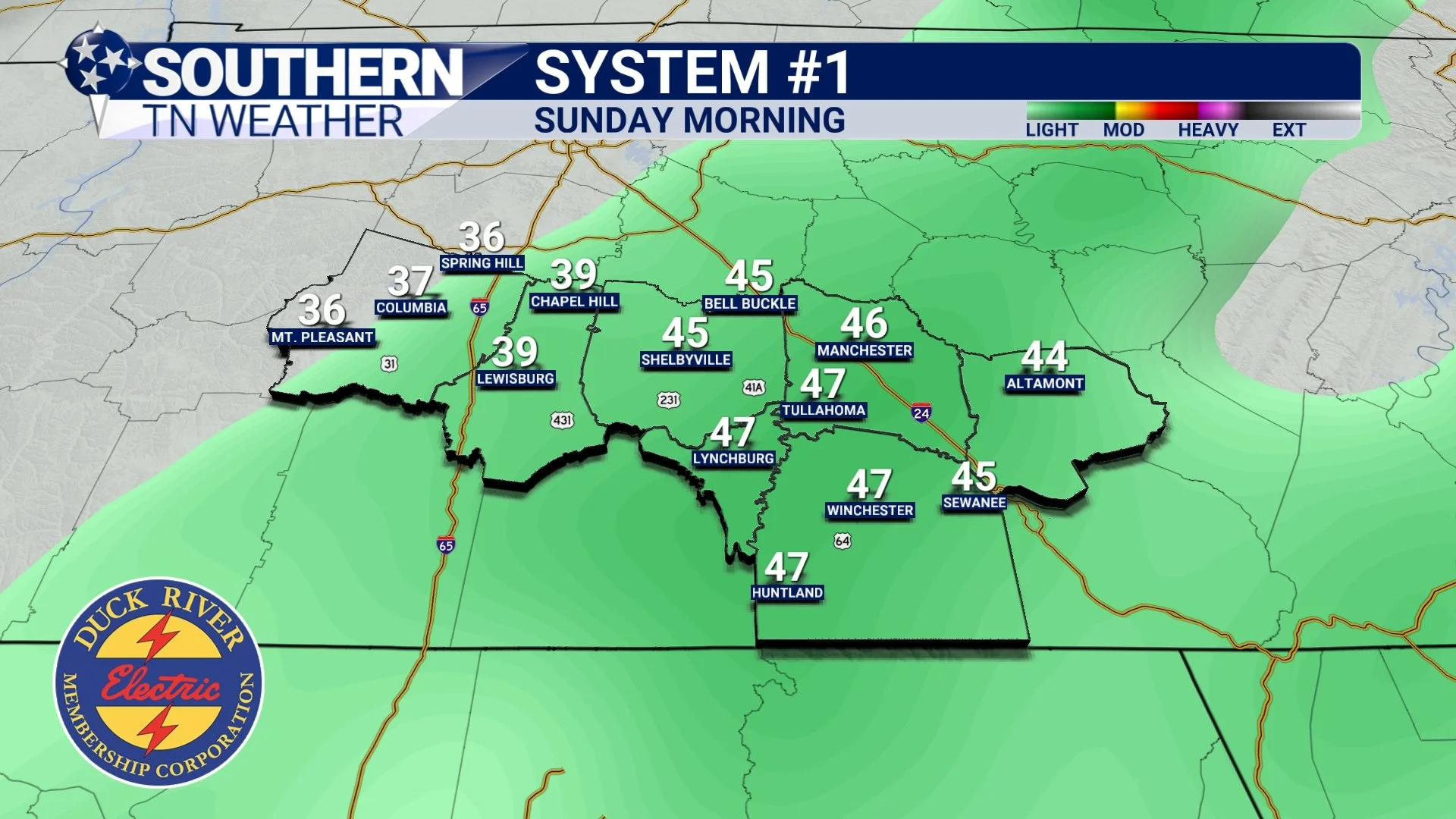
System #1 Saturday night into Sunday morning, and
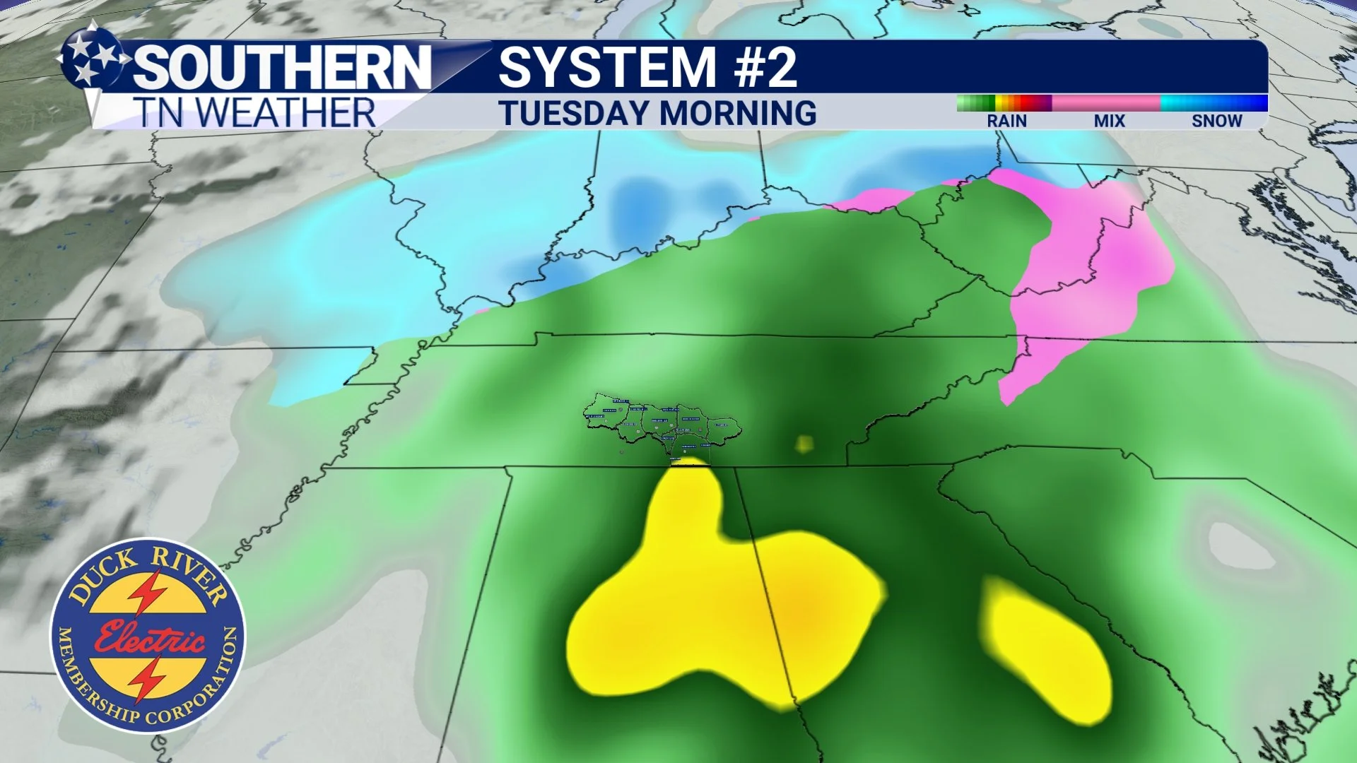
System #2 Monday night into Tuesday, which has some early-season winter-weather buzz around it. Let’s break them down.
System #1 - Saturday Evening into Sunday Morning
This first system won’t be a big headline-maker, but it will bring our next batch of light precipitation. A low-pressure system and cold front will approach Saturday evening (mainly 6–10 PM), increasing moisture and sparking scattered showers. There is a small chance that a few sleet pellets mix in at the onset Saturday evening as cold air lingers near the surface. No travel issues or impacts are expected.
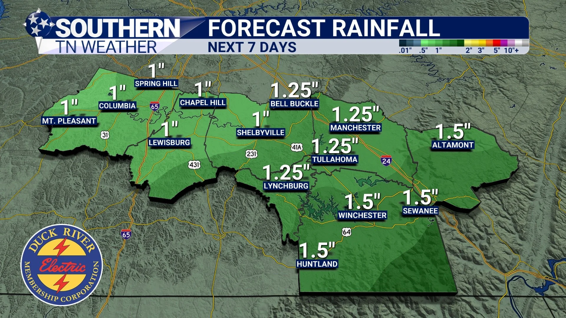
Scattered to widespread light rain will continue overnight and taper off by mid to late Sunday morning, followed by partly cloudy skies Sunday afternoon. Rainfall amounts should remain light — generally a quarter-inch, up to a half-inch at most. This is thanks to the limited moisture with this system. This aligns well with the NWS, which notes widespread rain Saturday night into Sunday morning but “rather light rainfall amounts.”
System #2 - Monday into Tuesday
Our second system early next week is the one grabbing the most attention — and for good reason. A new low-pressure system is expected to develop near the Gulf and move northeast toward the Tennessee Valley. Anytime we see a Gulf Low form in the cooler months, it’s worth paying attention because many of our biggest winter storms begin this way. But as always, where the low tracks after forming is the deciding factor between cold rain and a winter storm. Below, I’ll go over the two most common low tracks for us in the winter months. Please keep in mind that there are other factors NOT listed here, but it’s a good overall explanation. Let’s break this down clearly:
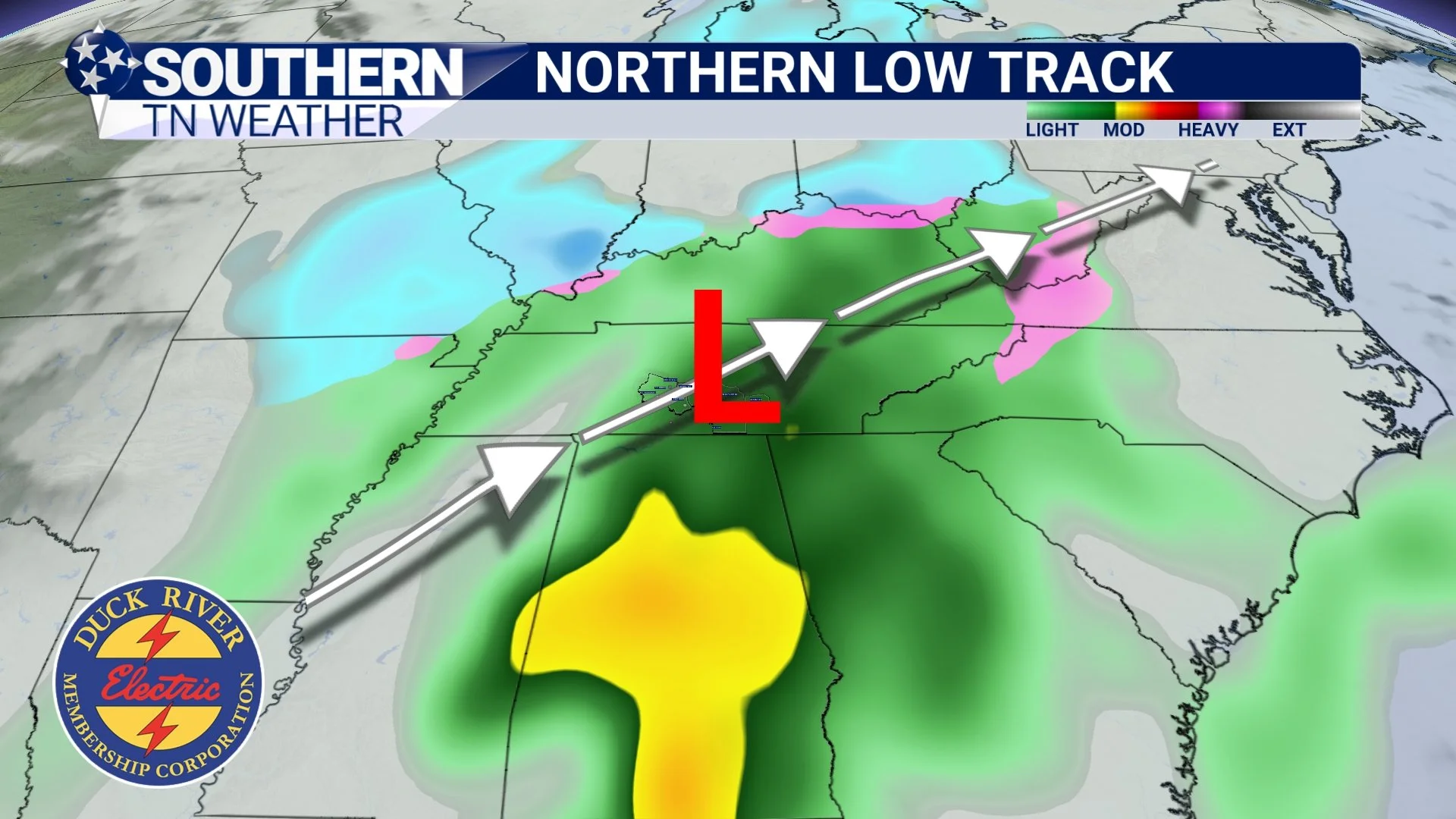
Track 1: The Northern Track (Most Likely Right Now)
This track pulls the low pressure closer to Southern Middle Tennessee. When this happens, warm air wraps around the system, pushing into Middle Tennessee and keeping temperatures too warm for wintry precipitation. Even with cold air nearby, warm air aloft wins out.
Result:
• A cold, soaking rain Monday night through Tuesday
• Highs stuck in the 40s
• No wintry impacts locally
• Snow stays well north or northwest of our area
This is the track currently favored by most long-range model guidance and the National Weather Service.
Northern Low Track
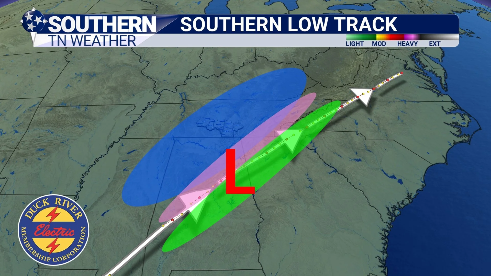
Track 2: The Southern Track (The “Snow-Favored” Track)
This is the track winter-weather fans root for. In this scenario, the low pressure passes farther south, ideally following something close to the Columbus, MS → Birmingham, AL → Atlanta, GA pathway. This keeps the low far enough away that cold, dense Canadian air can overrun the moisture, allowing snow or a wintry mix to develop across Middle Tennessee.
Result (if this track occurred):
• A legitimate chance at accumulating snow
• Colder temperatures dominating
• Moisture and cold air overlapping at the right time
However, this is not the favored solution right now. Models consistently keep the low farther north.
Southern Low Track
So What Does This Mean for Us Here at Home?
For Southern Middle Tennessee, the most likely outcome is:
• A cold rain Monday night into Tuesday (up to ~1”)
• Temperatures in the 40s Monday and Tuesday
• A few leftover flurries? as the system pulls away Tuesday morning
• No impacts from any wintry precipitation
• Snowfall probabilities for 1” or more remain very low (<20%)
The National Weather Service highlights that northwest Middle Tennessee has a slightly better chance for a conversational dusting Tuesday morning — but even there, impacts are considered unlikely.
Most likely outcome at this time…
Of course, if there are any forecast changes within the next few days, I’ll be sure to keep everyone updated. I’ll also have a blog post out on Monday before the system arrives, so we can dissect it well one last time before it moves through.
Rainfall totals - Next 7 Days
The Bottom Line 🧾
• Light rain moves in Saturday evening and ends Sunday morning (up to ½”)
• A stronger system arrives Monday night into Tuesday with a cold soaking rain (up to 1”)
• A few backside flurries Tuesday morning are possible, but impacts are unlikely
• Temperatures remain below normal through late next week
• Someone nearby may see a winter event (especially NW Middle TN) but Southern Middle Tennessee is favored for cold rain
📰 Reminder: The Southern Tennessee Weather Blog is updated Monday through Friday with fresh, locally tailored forecasts you can trust.
There will NOT be blog updates Wednesday or Thursday due to Thanksgiving and the lack of eventful weather. Enjoy the break, spend time with family, and soak in the beautiful fall weather!

