
Enjoy Today… Dangerous Cold Arrives This Weekend

The Southern Tennessee Weather Blog is proudly presented by Heritage South Community Credit Union.
We Help When Others Won’t!
Visit https://www.heritagesouth.org/ today to see how HSCCU can help YOU!
A Calm and Mild Friday (Don’t Waste It)
We’ve caught a brief break in the action this Friday across Southern Middle Tennessee. Aside from a few passing high clouds, sunshine is doing its job and temperatures are responding nicely. Many locations will finish the afternoon with temperatures near normal for this time of year, with highs feeling downright comfortable compared to what we’ve been dealing with lately.
Enjoy it while you can — because this warmth has an expiration date.
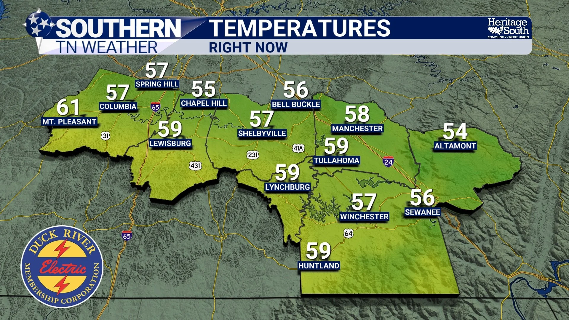
Current Temperatures - Friday Afternoon
Two Cold Fronts, One Big Outcome
I feel like a broken record at this point, but it’s important to nail in the biggest weather story coming up… This weekend’s cold won’t arrive all at once. Instead, two cold fronts will work together to usher in the coldest air of the season so far. The first front moves through later today and early this evening. It’s a weaker boundary, but it will cool us down slightly for Saturday, knocking highs back several degrees compared to today.
The second front arrives late Saturday night — and that’s the one that matters. This stronger Arctic front will open the door for a deep surge of Canadian air to spill into the region.
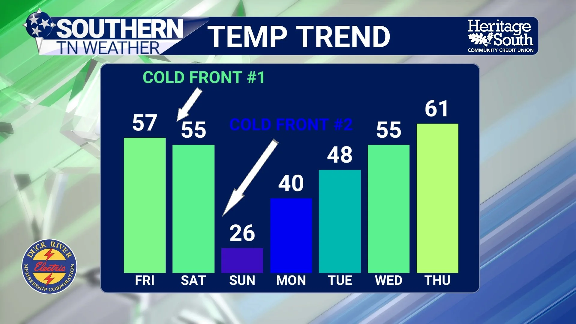
Cold Front Timing / Temp trend
Sunday Morning: Bitter Cold and Dangerous Wind Chills
By early Sunday morning, the cold will be firmly in place. Overnight temperatures will drop into the teens across much of the area, and gusty winds will develop behind the front, blowing 20 to 25 mph through the night.
That combination will drive wind chill values into the single digits Sunday morning, with a few spots getting very close to zero. This is the kind of cold that can become dangerous quickly if you’re not dressed for it or spending extended time outdoors.
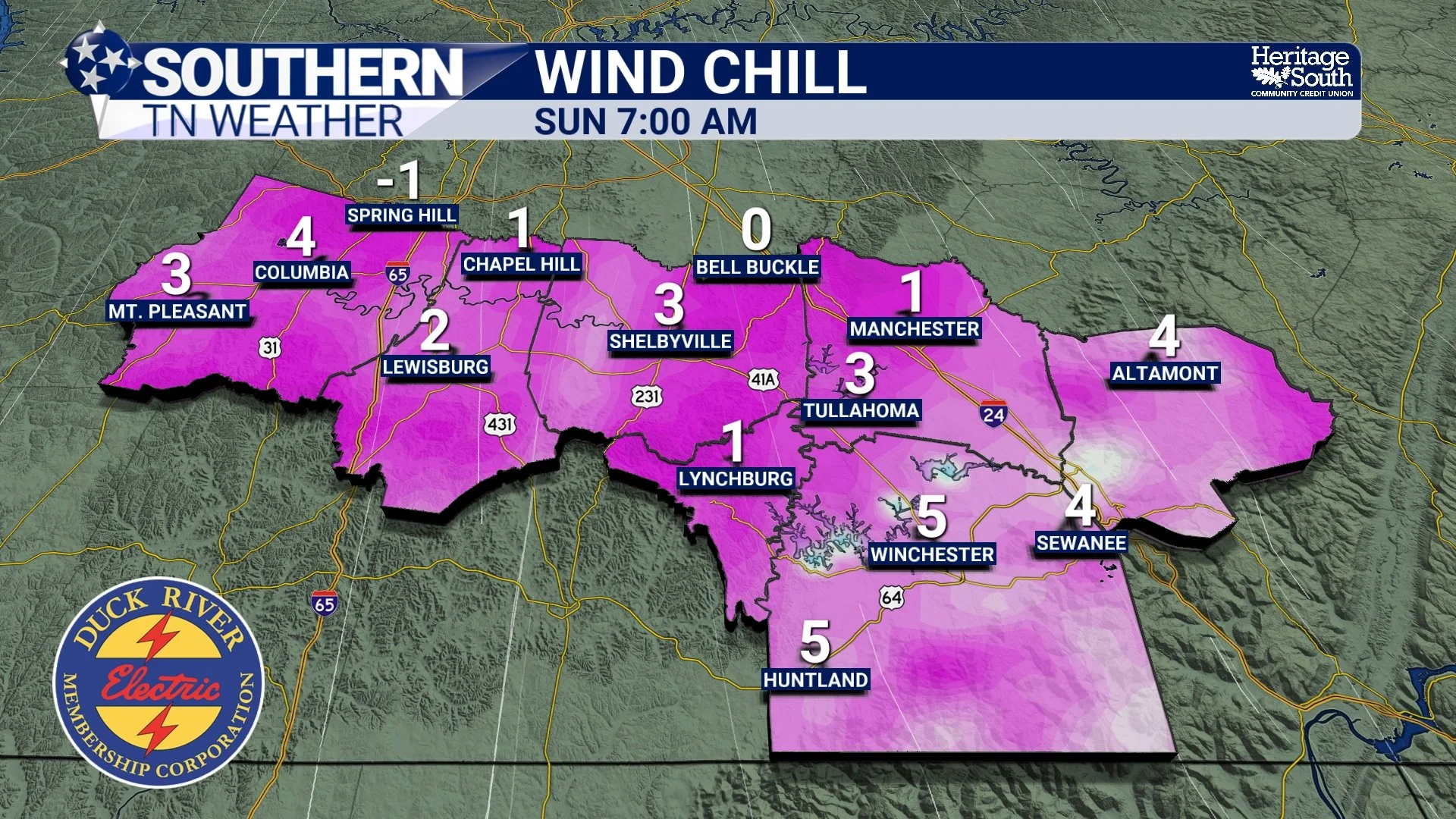
Wind Chills - Sunday Morning
Sunday Night into Monday Morning: The Coldest Stretch
As winds ease Sunday night, the atmosphere will be set up for efficient cooling. Clear skies and high pressure will allow temperatures to fall rapidly.
By Monday morning, widespread teens to single-digit low temperatures are expected… This will likely be the coldest morning we’ve experienced so far this winter season. Keep in mind that wind chill values will likely be even lower than the actual temperature by 5 or 10 degrees.
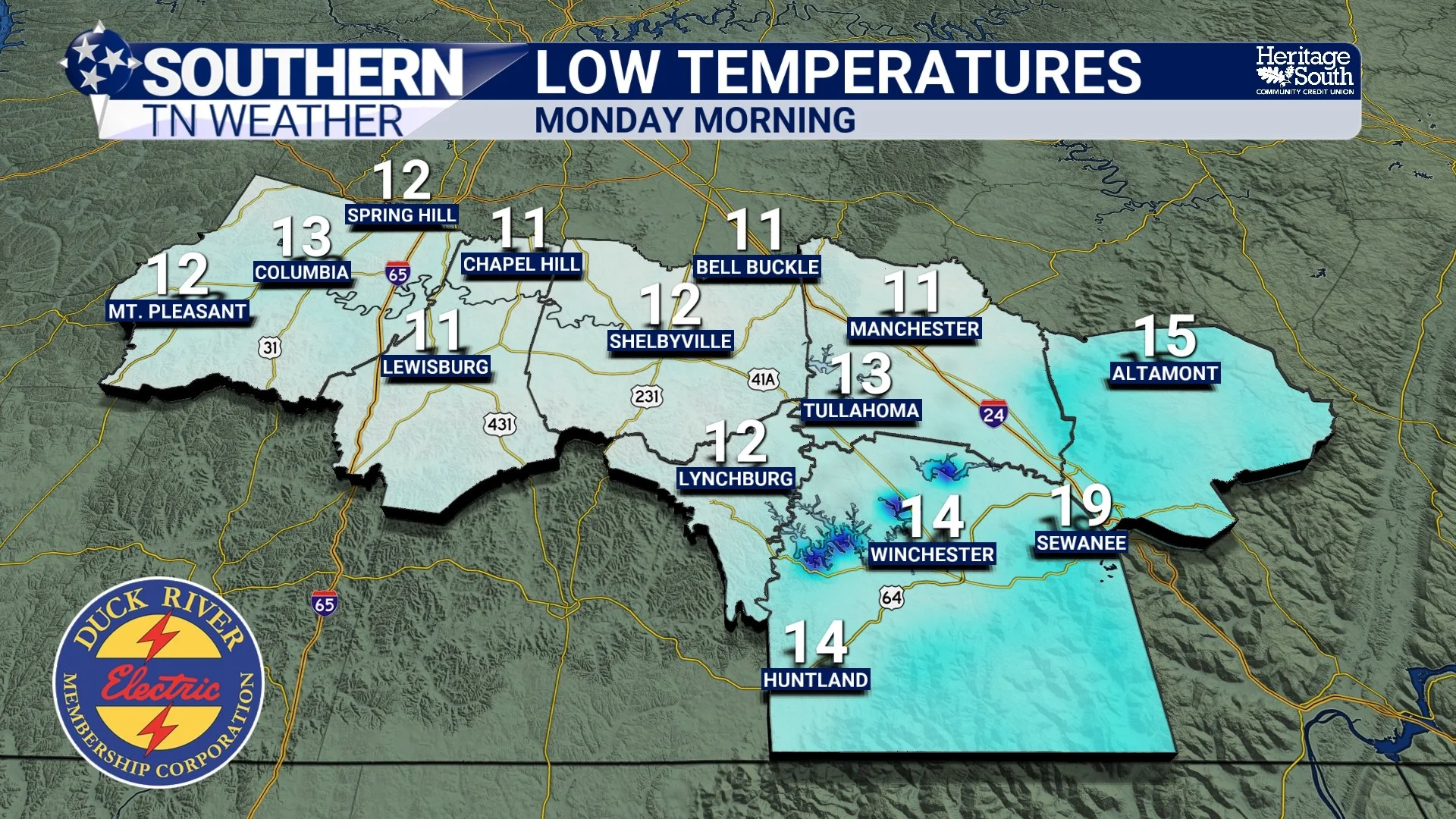
Low Temperatures - Monday Morning
Cold Weather Precautions to Keep in Mind
- Dress in layers if you’ll be outside, especially early Sunday and Monday mornings
- Limit prolonged outdoor exposure when wind chills are at their lowest
- Bring outdoor pets inside and make sure livestock have wind shelter
- Protect exposed pipes and allow faucets to drip if needed
- Check in on elderly neighbors or anyone without reliable heating
The Good News: A Warm-Up Follows
The Arctic blast will be intense, but it won’t stick around for long. Monday morning appears to be the peak of the cold, and temperatures will begin a steady recovery as we move through next week. By midweek, highs should climb back closer to seasonal norms, and possibly a bit above. Rain chances also remain low for now, with the next potential system not showing up until later next week.
The Bottom Line 🧾
• Today is calm and mild — enjoy it
• Saturday turns cooler behind a weak front
• A strong Arctic front arrives Saturday night
• Sunday morning wind chills drop into the single digits
• Monday morning brings teens to single-digit lows
• Cold weather precautions are important this weekend
• Temperatures rebound gradually next week
📰 Reminder: The Southern Tennessee Weather Blog (Presented by Heritage South Community Credit Union) is updated Monday through Friday with fresh, locally tailored forecasts you can trust.