
WEATHER BLOG

Presented By:
A BUSY FEW DAYS ON TAP!
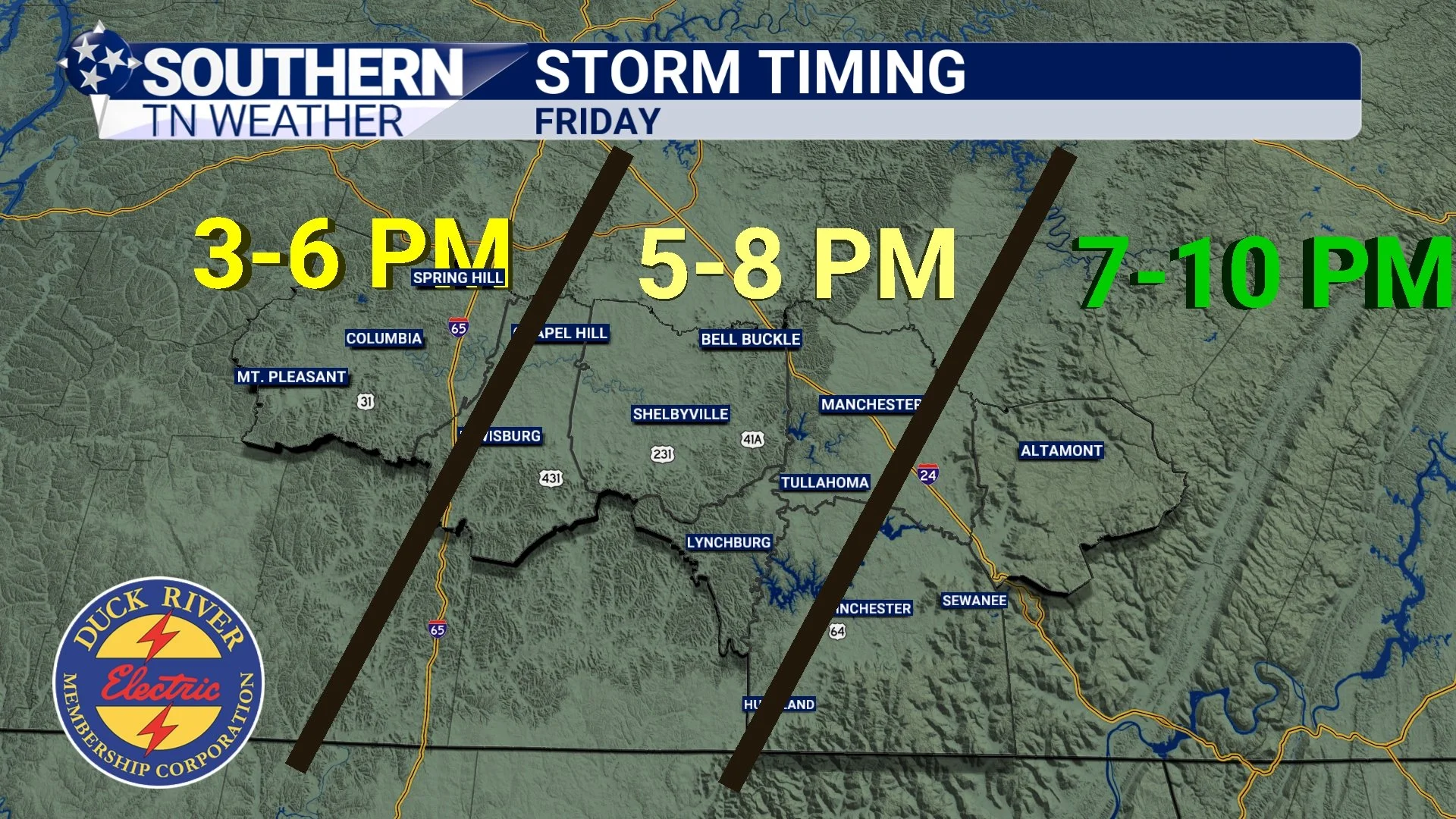
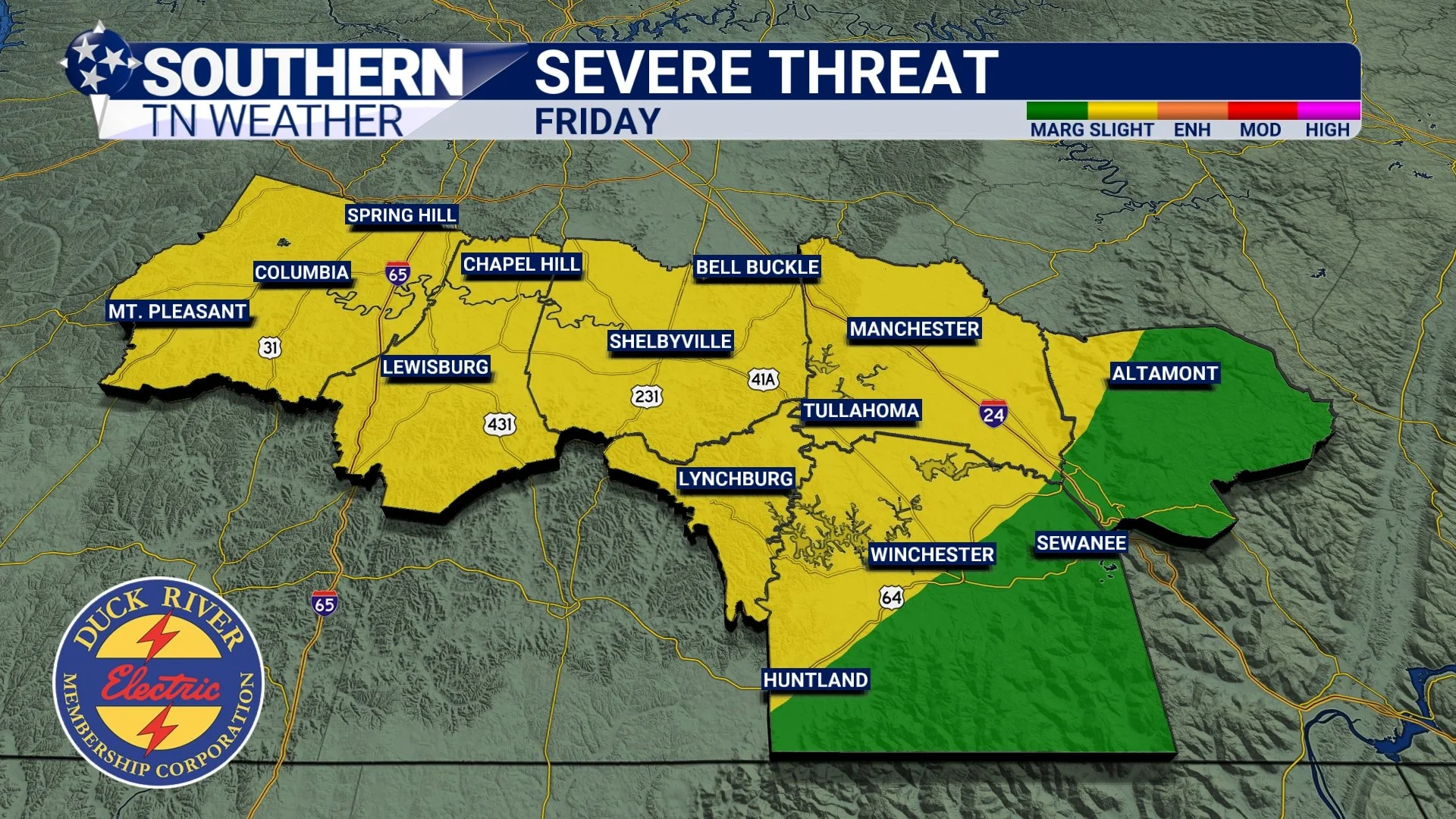
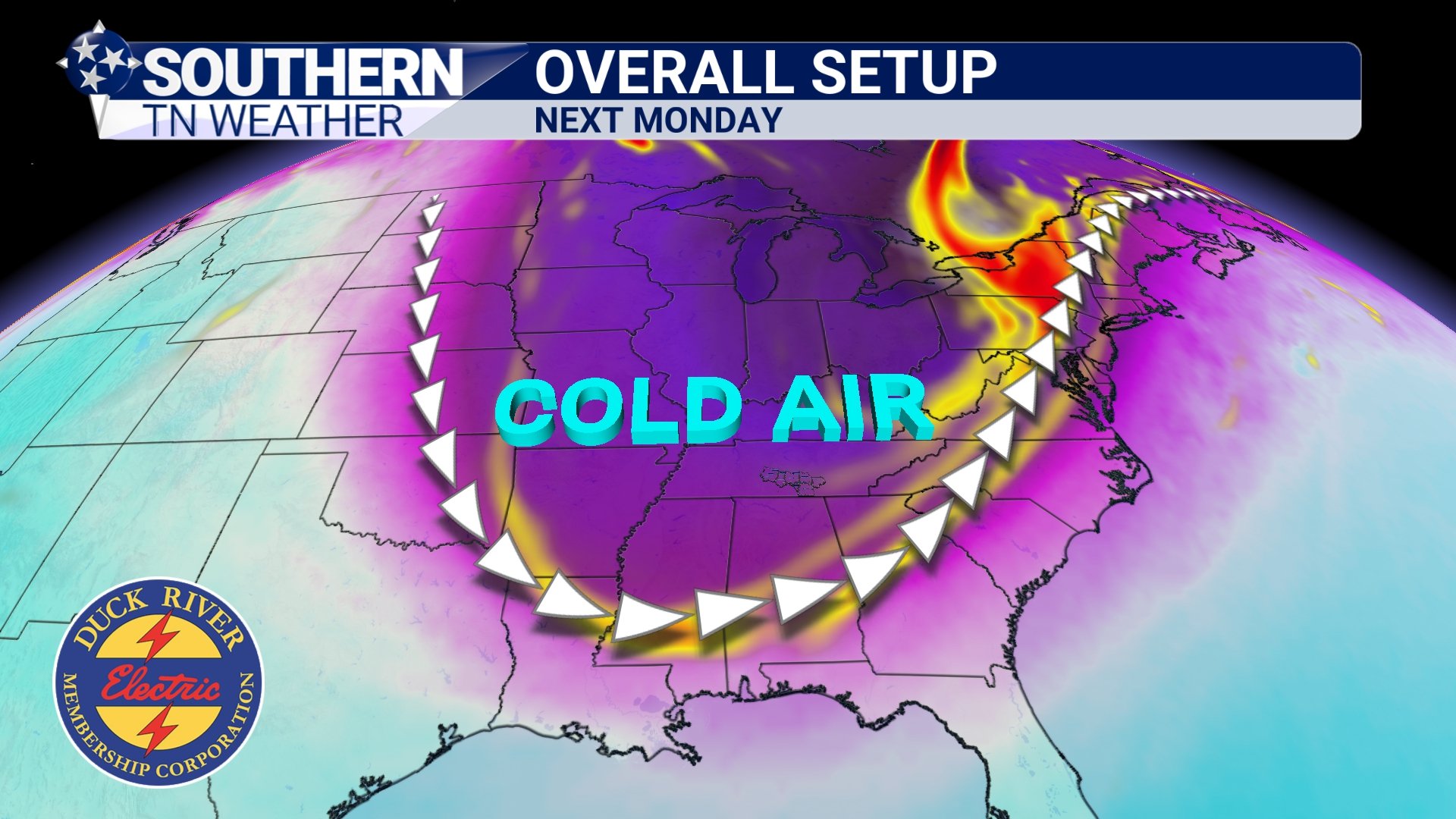
It’s been a downright beautiful Thursday across Southern Middle Tennessee, and this pleasant weather should hold through the rest of the afternoon and evening. But don’t get too comfortable — a BIG flip in our weather pattern is on the way over the next 48 to 72 hours. Two cold fronts are set to move through, dropping us straight into our first deep freeze of the season. But before we talk about that cold air, we need to address the chance for showers and storms on Friday… and maybe even a few lingering into Saturday.
Storm Chances Increasing for Friday
The weather will stay pretty quiet over the next 48 hours, with above-average temperatures and mostly sunny skies continuing across Southern Middle Tennessee. Of course, this quiet stretch has to end eventually — and unfortunately, I’m expecting that change to arrive on Friday as a cold front pushes in from the north and west.
If you’ve been following my blog over the last few days, you know I mentioned that the forecast could shift as we got closer to Friday. And that is exactly what’s happening now.
Above-Average temps for a few days… Cold returns soon!
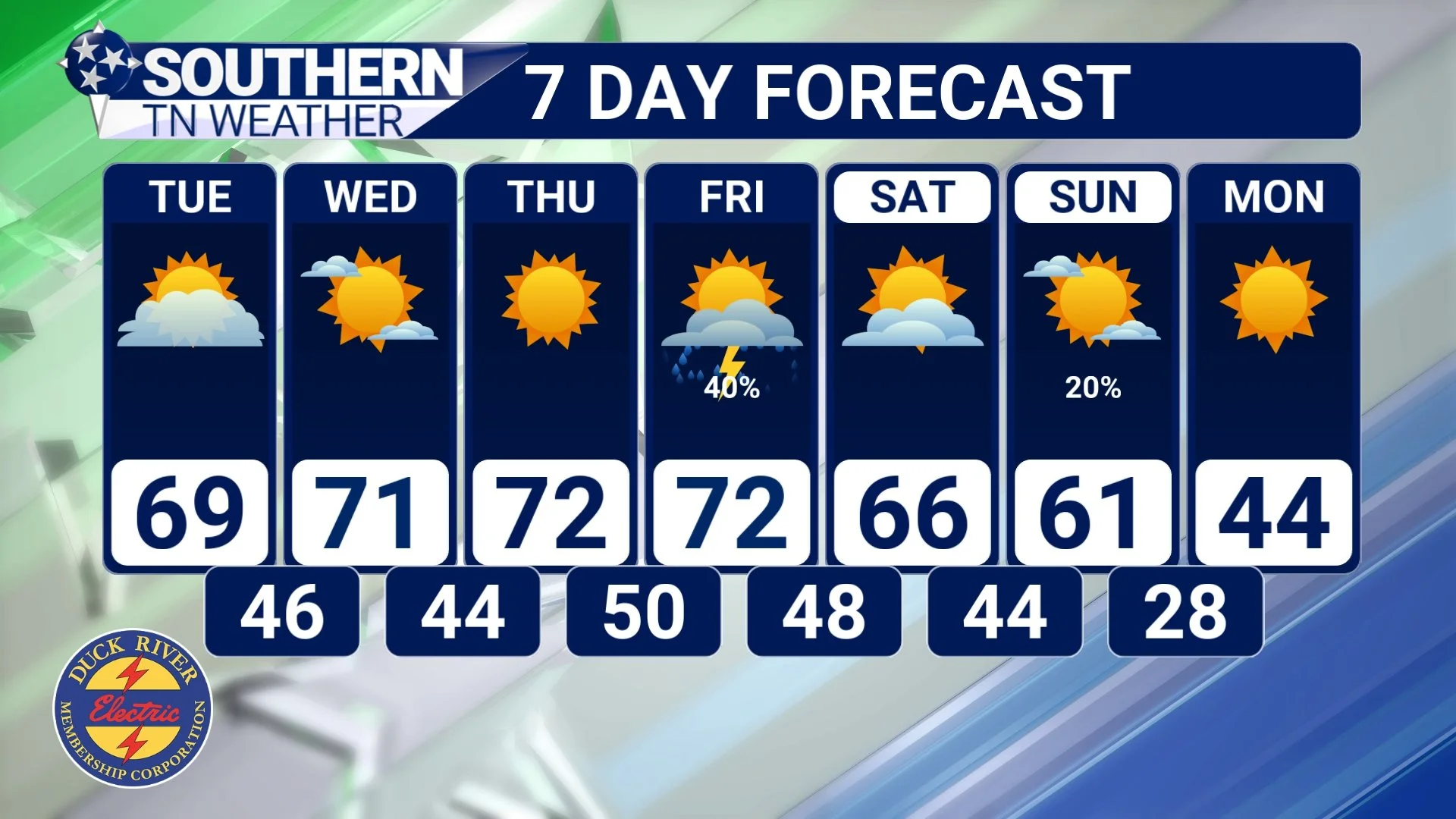
It was a beautiful day yesterday, and that stretch of nice weather is expected to continue! This morning, temperatures dipped into the mid-30s for many spots — but that should be our last morning in the 30s until Sunday night into Monday morning, when our first hard freeze of the season is set to arrive.
Over the next three days, high pressure will remain firmly in control, delivering gorgeous weather with highs in the low 70s and nighttime lows in the upper 40s to near 50 degrees. For reference, this is well above average for early November. Our typical highs this time of year fall between 62 and 64 degrees, with normal lows in the 36 to 40 degree range. It may feel odd since we’ve only had a couple true chilly mornings so far, but yes — we should be seeing lows in the 30s pretty regularly by now.
Quiet start to the week… first freeze on the horizon!
A quiet stretch of weather is on tap for Southern Middle Tennessee through at least Thursday, thanks to a broad area of high pressure overhead. Temperatures will run above average for this time of year, with highs climbing into the low to mid-70s under plenty of sunshine. Tonight, a little light patchy frost or fog is possible once again, but this still doesn’t look like a freezing setup for our area.
Pesky rain chance this weekend
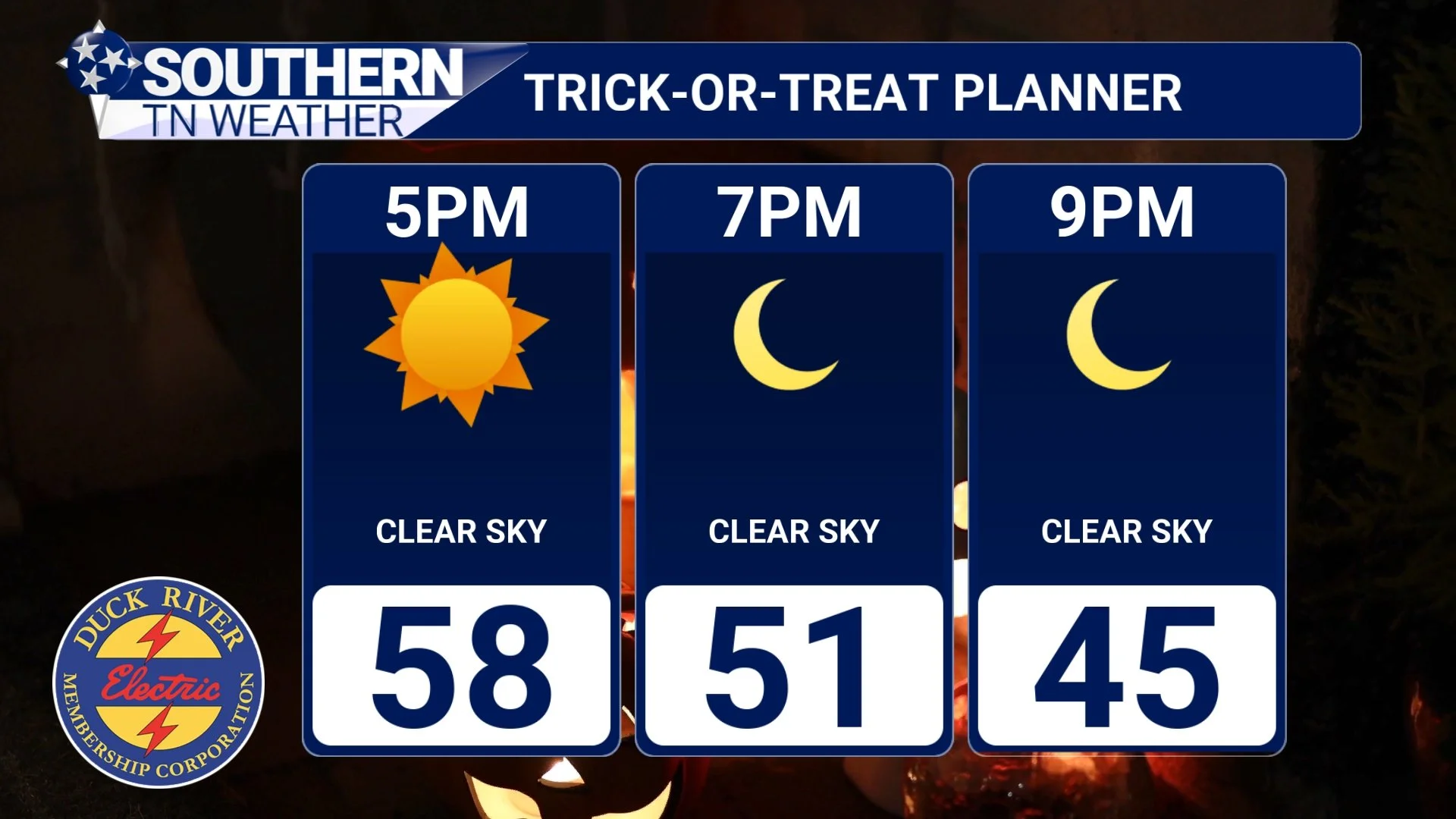
It’s been a pleasant start to Halloween across Southern Middle Tennessee. This morning brought widespread lows in the mid to upper 30s, along with pockets of patchy ground fog and frost. We’re still waiting on our first official freeze of the season, and it looks like we’ll need to head a bit deeper into November before that becomes a real possibility. Regardless, it was a chilly start to the day — and more of that cool weather is expected this evening for trick-or-treaters.

Cool nights ahead!
Our wet pattern that has dominated the week is finally beginning to wind down today. While a few isolated pockets of drizzle lingered early this morning, any remaining precipitation has since tapered off, leaving us under mostly cloudy skies. In total, most of Southern Middle Tennessee picked up between 1 and 2.5 inches of rainfall over the past several days. You can view the observed radar rainfall totals from the last seven days here.

Midweek Rain; DRY Halloween
Our first low-pressure system is slowly working on clearing the area today, but patches of drizzle and stubborn cloud cover continue to hang around. Temperatures are on the struggle bus this afternoon, only managing to reach the upper 50s.
Drier conditions on Tuesday 🌤️
Tomorrow looks a little better! We should see at least a temporary break from the rainfall during the daytime hours as we find ourselves between two low-pressure systems. Some patchy fog can’t be ruled out early in the morning, but it shouldn’t last long. Cloudy skies can be expected, with maybe a few breaks of sunshine here or there.
By late Tuesday night, rain chances will begin to increase again as our second low-pressure system of the week approaches from the west. Highs will be slightly warmer than today, generally in the low to mid-60s.
Widespread rain returns Wednesday 🌧️
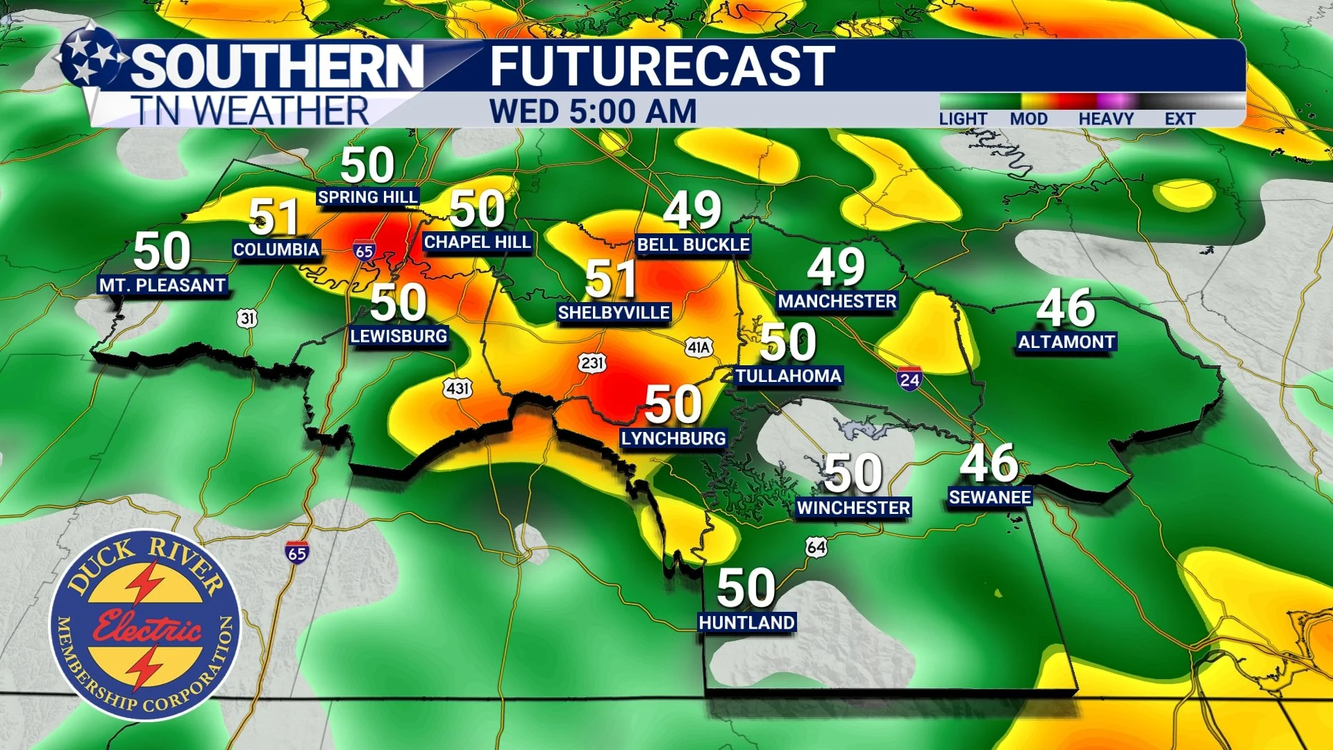
Heading into the overnight hours Tuesday into Wednesday, expect shower coverage to ramp up as the next low-pressure system (and its trailing cold front) move closer. Our in-house weather model shows widespread rainfall developing by 1:00 AM Wednesday, continuing through much of the day. A few rumbles of thunder are possible, but no severe weather is expected. It’ll be too cool, with temperatures in the low to mid 50s.
Rainfall totals of 1 to 2 inches are likely through early Thursday, which will bring another nice soaking for much of the region. Winds may get a bit breezy on Wednesday, with gusts of 10–20 MPH possible… Nothing damaging, but definitely an extra-hold hairspray kind of day.

soggy start to the week ahead!
It’s been a beautiful week so far across southern Middle Tennessee, with mostly sunny skies and even a touch of early-season frost in a few spots. Our “winners” of the lowest-temperature trophy this morning go to Chapel Hill and Lewisburg, both bottoming out around 34°. For many of us, that was the first real taste of winter chill this season and likely the last for at least the next week as temperatures slowly rebound and clouds increase.

WELCOME
Hey everyone — welcome to Southern Tennessee Weather, your new go-to spot for reliable, up-to-date forecasts right here in the heart of Southern Middle-Tennessee. 🌦️
I’m Elijah Kirby, and I’m passionate about keeping our local communities informed and prepared for whatever the skies bring. Whether it’s a calm, sunny weekend or a line of strong storms moving through, my goal is to bring you accurate, timely updates you can trust.
Here, you’ll find daily forecasts, severe weather alerts, radar snapshots, and behind-the-scenes insights into how we track weather across southern Middle Tennessee. I believe that local weather coverage should be local — focused on the people and places that make our region special.
Thank you for following along! Make sure to subscribe, follow on social media, and share the page so your friends and family never miss an update.
Here’s to staying informed, safe, and weather-aware — together.
— Elijah Kirby
Southern Tennessee Weather