
Above-Average temps for a few days… Cold returns soon!
Quiet weather expected through Thursday…
It was a beautiful day yesterday, and that stretch of nice weather is expected to continue! This morning, temperatures dipped into the mid-30s for many spots — but that should be our last morning in the 30s until Sunday night into Monday morning, when our first hard freeze of the season is set to arrive.
Over the next three days, high pressure will remain firmly in control, delivering gorgeous weather with highs in the low 70s and nighttime lows in the upper 40s to near 50 degrees. For reference, this is well above average for early November. Our typical highs this time of year fall between 62 and 64 degrees, with normal lows in the 36 to 40 degree range. It may feel odd since we’ve only had a couple true chilly mornings so far, but yes — we should be seeing lows in the 30s pretty regularly by now.

Observed low temperatures this morning
This weekend / Early next week
I’m still watching this weekend and early next week closely. This is really our “next big thing” happening in the weather department — and with the quiet pattern over the next few days, it’s basically the only active weather we have to talk about. There is a chance for some rain and a few rumbles of thunder, especially Friday night into Saturday morning, but rainfall totals look meager (generally under an inch) and the storm threat looks pretty “bleh.” But honestly… bleh is a good thing.
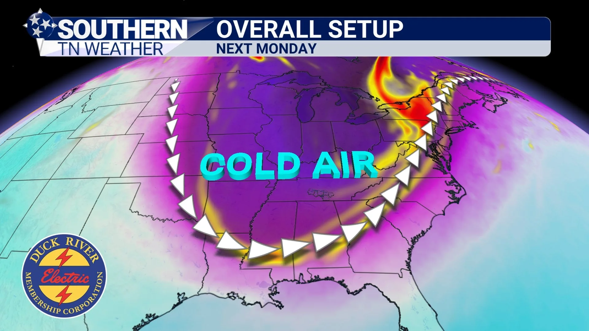
The overall setup coming in features two cold fronts and a dip in the jet stream. Combined, these will help usher in a fresh push of colder Canadian air. Below, you’ll see this laid out in our graphics: the jet stream (white lines) dips straight into our region, dragging down those colder purples behind it. I also highlighted absolute vorticity in red and yellow — a tool meteorologists use to identify areas of atmospheric “spin” often tied to troughs and low-pressure systems. You’ll notice a lot of red up north near New York … that’s tied to a strong low pressure system that will bring widespread snow showers to the Great Lakes and the Upper Midwest. Here at home, though? The low is simply too far away to give us anything meaningful. You may notice some elevated vorticity values down our way (the yellow shades). That’s tied to the general trough swinging through.
Since some folks may not be familiar with absolute vorticity, here’s the quick version: it’s basically a measure of how much spin or rotation the atmosphere has in a certain location. Higher values can sometimes help trigger clouds, showers, or storms — if moisture is available. In our case, we don’t have the moisture or strong lift needed, so the vorticity just signals energy aloft, not precipitation. Think of it as a supporting ingredient helping the cooler air move in, not something producing weather on its own down here.
All of that meteorological jargon basically leads us to this: next Monday will be cold. Cold for early November at least… Low temperatures Monday morning will likely fall into the mid to upper 20s, bringing our first hard freeze of the season. High temperatures Monday afternoon will only reach the low to mid 40s. While some of the details may wiggle a bit as we get closer, this overall setup is robust and gives us a very strong signal of a major cool-down early next week.
Overall setup next Monday
The Bottom Line 🧾
• Beautiful weather through Thursday.
• Rain returns Friday PM.
• Well below-average temperatures to start next week.
📰 Reminder: Our Southern Tennessee Weather Blog is updated Monday through Friday with fresh, locally tailored forecasts you can trust.
Be sure to follow along so you never miss an update!