
Cool nights ahead!
Our wet pattern that has dominated the week is finally beginning to wind down today. While a few isolated pockets of drizzle lingered early this morning, any remaining precipitation has since tapered off, leaving us under mostly cloudy skies. In total, most of Southern Middle Tennessee picked up between 1 and 2.5 inches of rainfall over the past several days. You can view the observed radar rainfall totals from the last seven days here.
As we head into the evening, expect the cloud cover to gradually thin, and we may even catch a few brief peeks of sunshine before sunset. Tonight, skies will continue to clear out, allowing temperatures to drop into the 30s and lower 40s across the region. The latest run of our in-house weather model even suggests that a few communities could dip as low as 33 degrees — and I don’t think that’s out of the question at all. With clearing skies and lighter winds overnight, at least patchy frost is expected to develop. If you have any sensitive outdoor plants, it may be a good idea to protect them… but please don’t cover up the wasps and stink bugs. I’m ready for those guys to disappear for the season! 😄
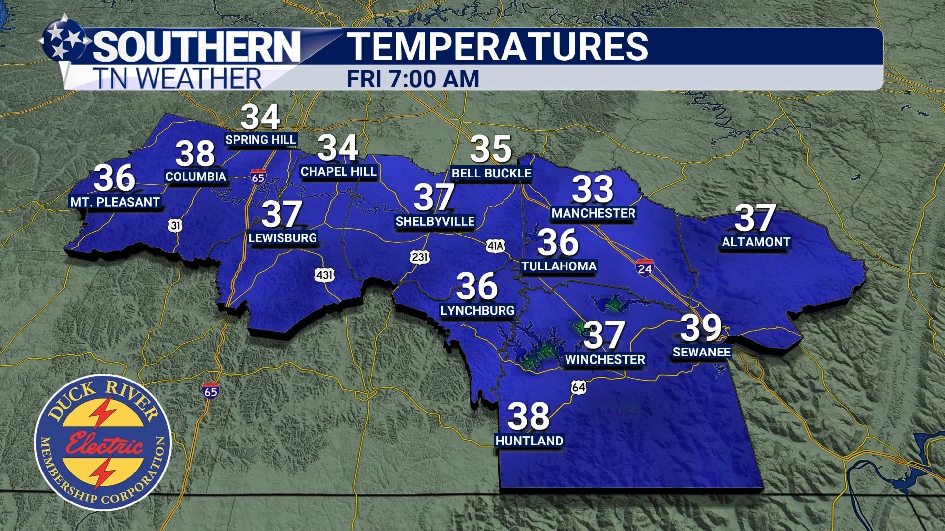
STNWX In-House Computer Model showing widespread temps in the 30s tomorrow morning
Halloween Forecast
Halloween is shaping up to be beautiful in the weather department, just a bit on the cool side. Expect partly cloudy skies with highs in the low 60s tomorrow afternoon. By the time trick-or-treating begins around sunset, temperatures will start to drop quickly. Many of us will already be down into the mid-40s by 9:00 PM, so I definitely recommend bundling up the kiddos before they head out for some candy.
Looking ahead to early Saturday morning, lows will fall into the upper 30s and low 40s across Southern Middle Tennessee. It’ll be just a tad warmer than tonight, but not by much. Patchy frost is once again possible, though it still appears we’ll have to wait a little longer before seeing our first true widespread freeze of the fall and winter season.
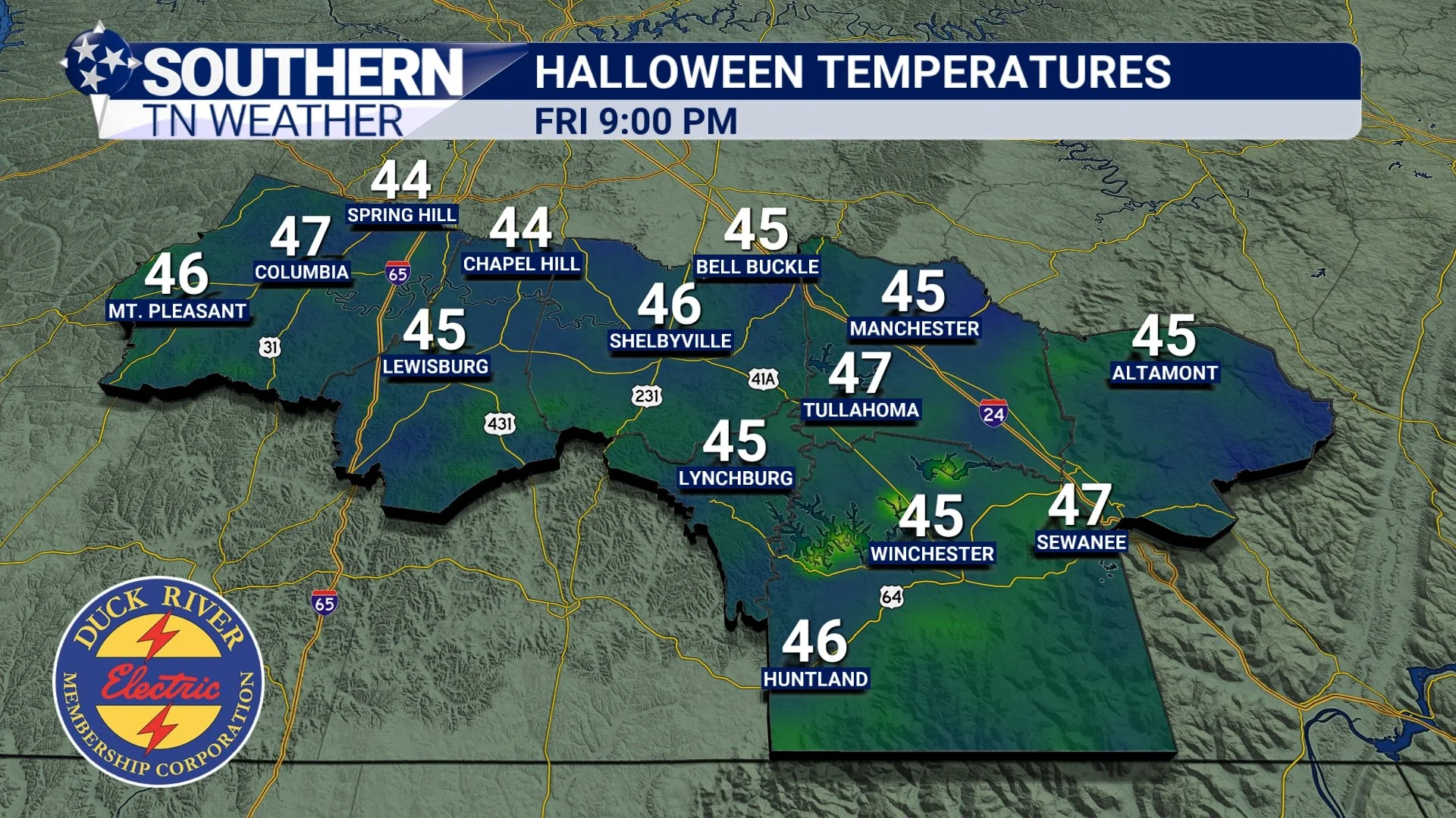
STNWX In-House Computer Model showing cool temperatures around Halloween Trick-or-treat time
Dry most of Saturday… Scattered showers Sunday?
While no rainfall is expected tomorrow or Saturday morning, our latest weather model guidance continues to hint at a weak disturbance sliding through the region late Saturday night into early Sunday. Please take the image below with a grain of salt … I personally don’t think the rain will be quite as widespread as our in-house model is currently showing but it’s still worth keeping in mind that a few showers are possible during that timeframe. If this trend continues in the data, I’ll likely bump rain chances from 20% to around 40%. Should this quick round of rain materialize, totals look light, generally between 0.1" and 0.5" with most locations staying under an inch. I’ll keep everyone updated on this brief rain potential as we get closer to the weekend.
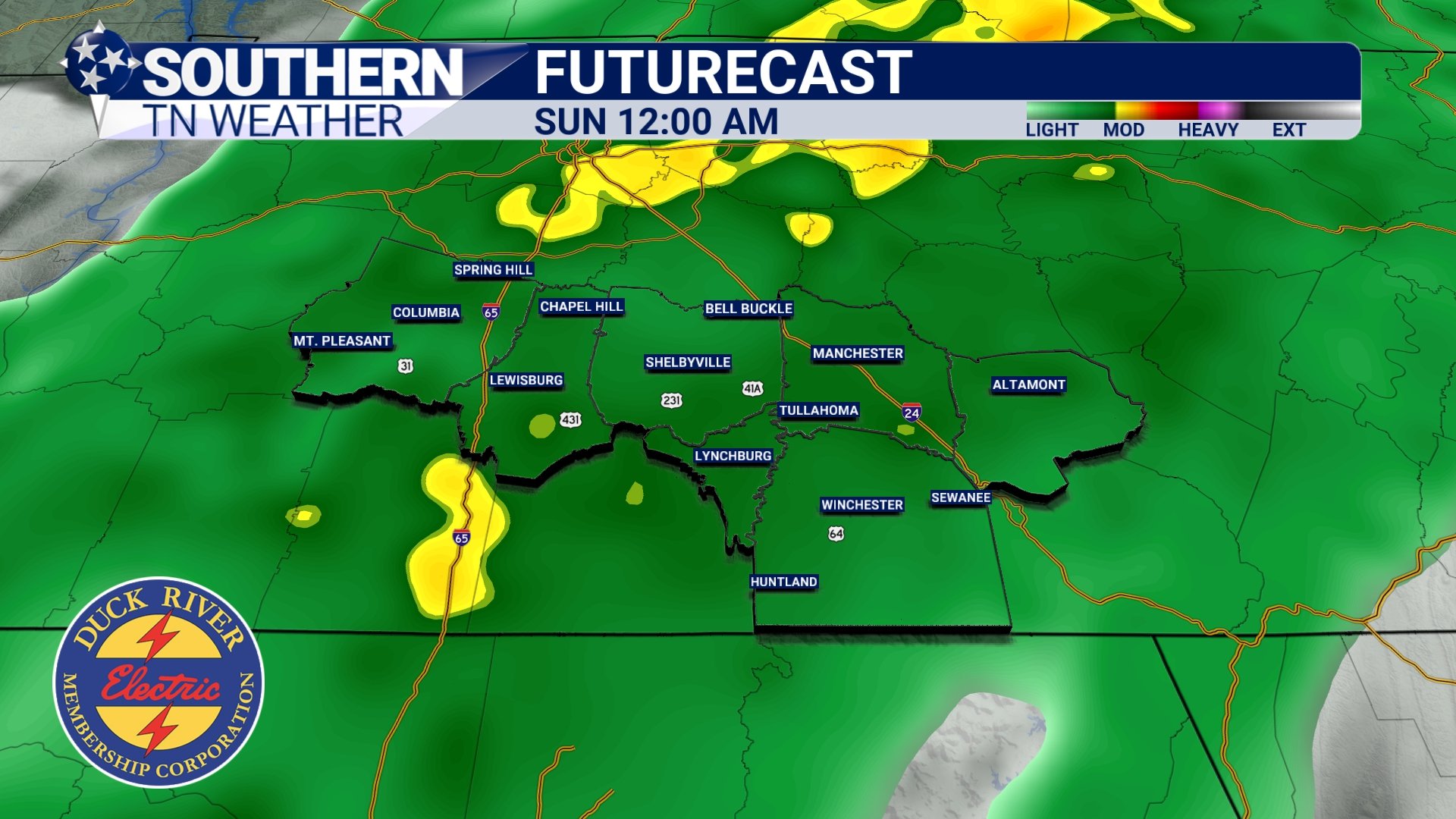
STNWX In-House Computer Model showing showers Sunday Morning
The Bottom Line 🧾
• Cold tonight with patchy frost; lows in the mid to upper 30s.
• Not as cold Friday night, but still pretty chilly for trick-or-treating.
• Partly cloudy most of Saturday, but a small chance for showers returns to the forecast late Saturday into Sunday. Rainfall totals would be between 0.1 and 0.5” (if we get any).
📰 Reminder: Our Southern Tennessee Weather Blog is updated Monday through Friday with fresh, locally tailored forecasts you can trust.
Be sure to follow along so you never miss an update!