
Rain moves in tonight
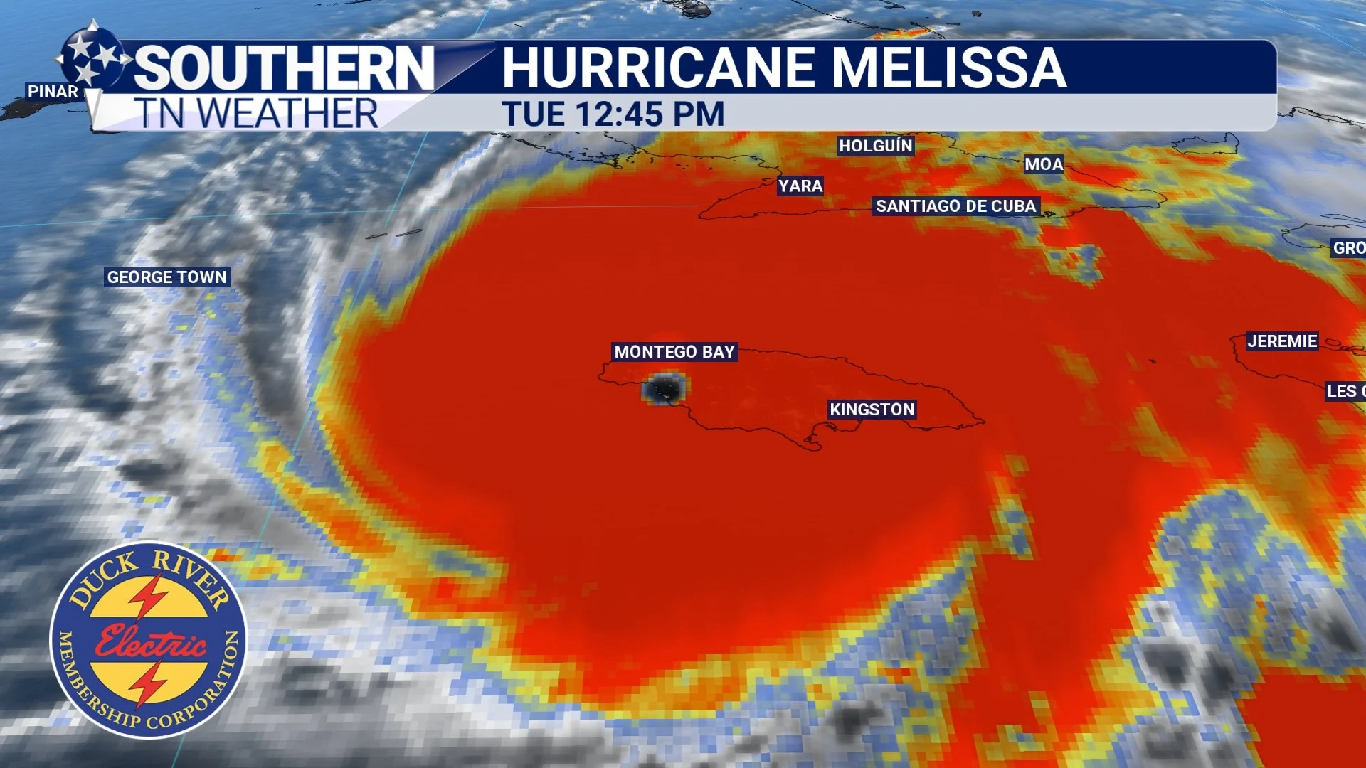
Hurricane Melissa made landfall this morning on the southern coast of Jamaica as a Category 5 hurricane, marking one of the most powerful landfalls ever recorded in the Caribbean. Melissa reached a staggering 892-millibar central pressure with sustained winds of 185 mph. For perspective, our typical low-pressure systems here in Southern Tennessee sit between 1000 and 1010 millibars, making Melissa more than 100 millibars deeper — a clear indicator of just how intense this storm truly is. And while the hurricane is incredibly strong, it remains relatively compact, with hurricane-force winds stretching only 30–50 miles from the center and the most destructive winds packed tightly around the eyewall.
You can follow Melissa’s progress in real time using the live satellite and radar tools inside the STN Weather App, free to download now on both the Apple App Store and Google Play.
Satellite view of Melissa early this afternoon
Now, for the weather here at home…
It’s been a fairly quiet day across Southern Middle Tennessee. We saw a few pockets of drizzle early this morning, but most of that cleared out, leaving us with mostly cloudy skies and even a few occasional peeks of sunshine. This calm stretch won’t last long, though. Widespread showers (and even a few rumbles of thunder) are expected to move in early tomorrow morning, mainly between midnight and 5 AM. Periods of rain will continue through much of the day on Wednesday, with occasional breaks in the activity. Showers should finally taper off by Thursday morning. In total, most areas can expect 1–2 inches of additional rainfall through early Thursday.
I’m also watching the winds closely. Gusts between 30 and 40 MPH are likely on Wednesday, especially across the higher elevations of the Cumberland Plateau (including Grundy County, Sewanee, and the Keith Springs Mountain area). Winds will ease somewhat by tomorrow afternoon, but gusts of 10–20 MPH will still be common. Bottom line: be sure to secure any lightweight outdoor items before heading to bed tonight!

STNWX In-House Computer Model showing widespread rainfall tomorrow morning
Cool, dry end to the week (including Halloween)…
Once this weather system pushes through the area, skies will begin to clear Thursday afternoon and continue into Friday. Both Friday and Saturday mornings will start off cold, with lows dipping into the mid to upper 30s. I can’t rule out the first light freeze of the season for a few locations, but either way most of us can expect our first widespread frost Friday morning.
And if you’re heading out for trick-or-treating on Halloween evening, bundle up! Temperatures will fall into the 50s and upper 40s before midnight. At least the candy won’t melt, right?? 🎃

STNWX In-House Computer Model showing chilly temperatures Halloween Morning
The Bottom Line 🧾
• Widespread rain returns tonight into early Wednesday, with embedded thunder possible.
• 1-2 inches of rainfall through Thursday is still the forecast.
• We’ll dry out and clear up on Thursday, leading into a stretch of calmer weather.
• A beautiful (and chilly) Halloween is on tap, with temperatures hovering in the upper 40s and low 50s Friday evening after dark.
📰 Reminder: Our Southern Tennessee Weather Blog is updated Monday through Friday with fresh, locally tailored forecasts you can trust.
Be sure to follow along so you never miss an update!