
Put Down the Snow Shovel: Why Those Winter Snowfall Forecasts Are Mostly Guesswork Right Now

The Southern Tennessee Weather Blog is proudly presented by Heritage South Community Credit Union.
We Help When Others Won’t!
Visit https://www.heritagesouth.org/ today to see how HSCCU can help YOU!
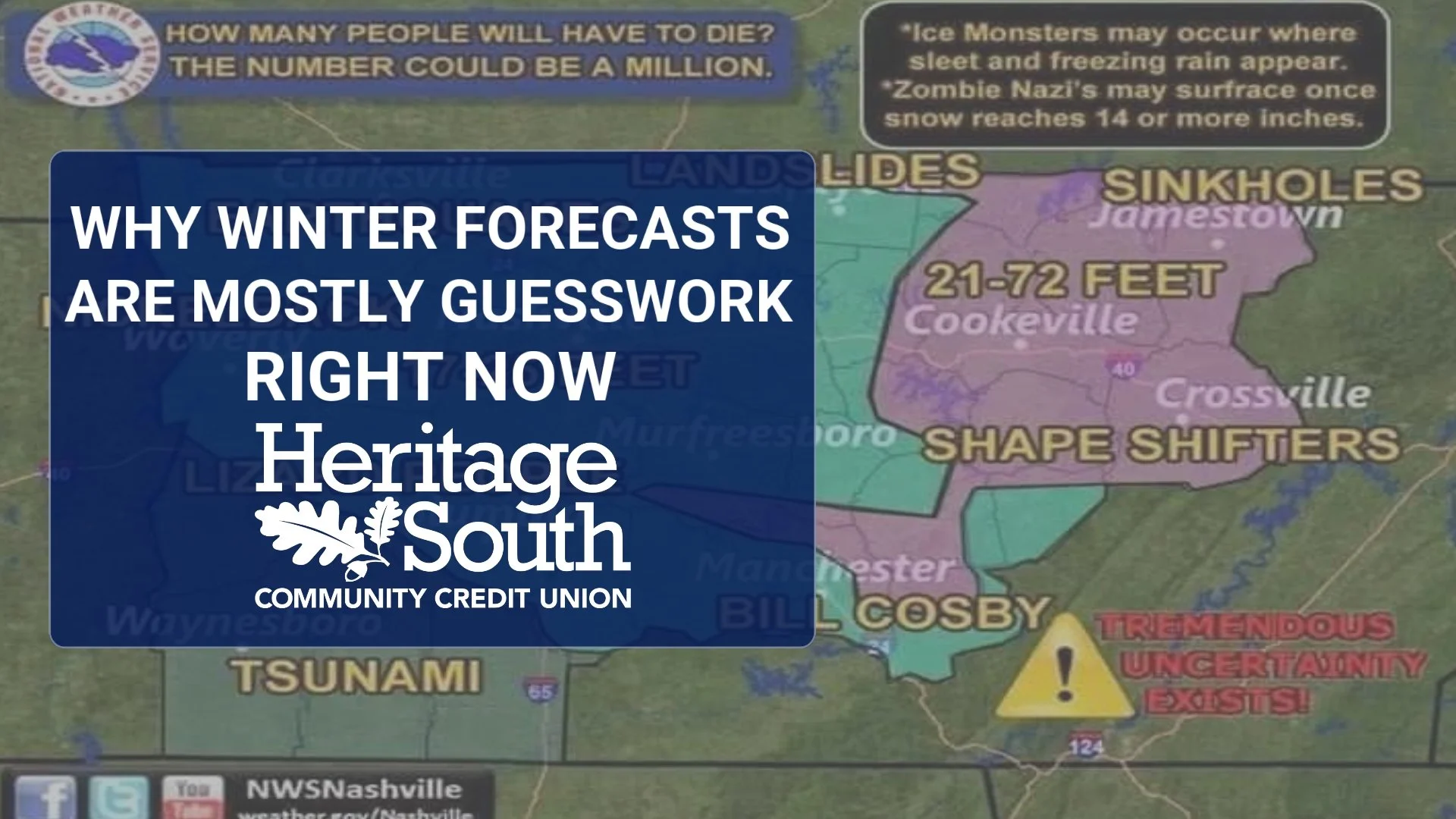
It's officially that time of year. October has arrived, temperatures are finally beginning to feel a little more like fall, and social media is filling up with colorful maps supposedly showing how much snow we're going to receive this winter. Somebody paints Tennessee blue, adds a few snowflakes, mentions El Niño, and suddenly half the South is preparing for a winter apocalypse three months before the first flakes have even had a chance to fall. So, I think we need to have a little chat about winter forecasts.
There are legitimate reasons to be fascinated by the upcoming winter. El Niño is rapidly strengthening, and current projections suggest this could become an exceptionally strong event. There is even a legitimate possibility that its strength reaches territory beyond anything in NOAA's modern record dating back to 1950. That's meteorologically fascinating, and it's something we'll be watching VERY closely over the next several months. What it is NOT, however, is evidence that Southern Middle Tennessee is guaranteed a cold, snowy or historic winter.
That's an important distinction because every fall seems to bring a competition over who can release the most interesting winter forecast. Television stations do it. Private forecasting companies do it. Social media pages do it. Almanacs do it. Before long, everybody has thrown their hat into the ring with predictions about temperatures, precipitation and, everyone's favorite here in the South, SNOW. Southern Tennessee Weather isn't going to join that competition just because everyone else is doing it. Our forecasts are based on what the meteorological evidence can actually support. If the science doesn't allow us to confidently tell you how much snow Southern Middle Tennessee will receive this winter, we're perfectly comfortable saying we don't know yet. That's a lot less exciting than putting a giant snowflake over Tennessee, but it's also a much more accurate representation of where the science stands in early October.
TITLE PAGE
This El Niño Makes an Already Difficult Forecast Even Harder
Meteorologists aren't completely flying blind when looking several months into the future. One technique we can use is examining analog years, which are previous years when oceanic and atmospheric conditions looked somewhat similar to what we're experiencing now. If several previous winters began with similar Pacific Ocean temperatures and large-scale atmospheric patterns, looking at what happened afterward can provide useful clues about what might happen this time. The problem is that an analog is exactly that: similar, not identical. The atmosphere doesn't replay old seasons frame by frame. We can compare the current setup with previous strong El Niño events, but differences elsewhere across the atmosphere and oceans can eventually produce very different weather patterns over North America. Even among historically strong El Niño winters, the resulting temperature, precipitation and snowfall patterns haven't been identical.
That becomes particularly important this year because the El Niño developing in the tropical Pacific could become exceptionally strong. Current projections give this event a very high probability of reaching the "very strong" category, with a legitimate chance that its peak strength exceeds anything in the modern record dating back to 1950. To be clear, we cannot say that has happened yet. We're still talking about a forecast. But if you're potentially dealing with an El Niño stronger than anything contained within the modern observational record, finding a truly comparable historical analog becomes pretty difficult.
Imagine trying to predict how a race will unfold by studying previous races, except this year's horse may be faster than any horse you've ever watched before. You can still learn something from the old races, but you probably shouldn't assume this one will unfold exactly the same way. That's basically where we are. Historical analogs still have value, and seasonal forecasting itself isn't some made-up science. But this is a year when those analogs deserve an especially large grain of salt.
El Niño Is NOT a Southern Tennessee Snowfall Forecast
This is probably the biggest misconception we'll encounter over the next couple of months. You'll see an El Niño graphic, somebody will mention a more active southern storm track, and eventually the conversation turns into, “We're going to get hammered with snow this winter!” That's a pretty enormous leap. El Niño can influence the large-scale atmospheric circulation and shift the probabilities toward certain temperature and precipitation patterns across the United States. In other words, it can load the atmospheric dice in favor of some outcomes over others. What it cannot do is tell us whether Shelbyville gets six inches of snow on January 18.
Snowfall in Southern Middle Tennessee requires a very specific combination of ingredients to come together at almost exactly the right time. We need moisture, a favorable storm track and sufficiently cold air, but even that isn't enough. The cold air also has to be deep enough through the atmosphere to support snow rather than rain, sleet or freezing rain, and all of those ingredients have to overlap while precipitation is actually falling. Small differences can completely change the outcome. Move a winter storm 100 miles north and Southern Middle Tennessee could end up with a cold rain while Kentucky gets buried. Move it farther south and the deepest moisture may miss us altogether. Change the temperature by only a few degrees several thousand feet above the ground and what looked like snow can become sleet or freezing rain.
Those are details meteorologists sometimes struggle to resolve several DAYS before a winter storm, particularly here in the South where temperatures frequently hover near critical thresholds. So imagine trying to resolve those details in October for storms that may or may not occur in January or February. That's the problem with specific seasonal snowfall forecasts. A broad seasonal outlook may provide useful information about which large-scale patterns are favored, but translating that into an exact amount of snow for Southern Middle Tennessee is a completely different proposition.
A wetter-than-normal winter doesn't necessarily mean a snowier-than-normal winter, either. We could have storm after storm move through the region while temperatures remain in the 40s and receive plenty of cold rain. On the other hand, one perfectly timed storm could dump six inches of snow and dramatically increase our seasonal total even if the remainder of winter is relatively uneventful. Here in the South, one or two storms can make or break an entire winter snowfall forecast.
Why Those Snow Maps Get So Much Attention
There's also an unavoidable reality behind some of the increasingly dramatic winter forecasts you see online: snow gets clicks in the South. Tell somebody in Minnesota that it's probably going to snow this winter and they're unlikely to care very much. Tell somebody in Tennessee that a snowy winter is coming and suddenly your Facebook post is being shared across half the state before lunch. We LOVE snow down here. Or, at the very least, we love the idea of snow until the power goes out, the roads turn into skating rinks and somebody realizes they forgot to buy bread.
That excitement creates the perfect environment for bold winter predictions. A colorful map showing Tennessee covered in snow is considerably more exciting than a meteorologist saying, “There are some interesting large-scale signals, but confidence in individual winter storms remains extremely low this far in advance.” Unfortunately, the boring answer is often the scientifically responsible one.
That doesn't mean every seasonal forecast you see is worthless or intentionally misleading. There are very talented meteorologists who specialize in long-range forecasting, and legitimate seasonal outlooks can provide useful information about broad temperature and precipitation tendencies. The problem begins when those broad probabilities are presented with a level of precision the science simply cannot support. There's a huge difference between saying “the pattern may favor a wetter winter across portions of the southern United States” and saying “Southern Middle Tennessee is going to have 18 inches of snow this winter.”
One is a probabilistic assessment of a large-scale pattern. The other sounds much more precise than our actual forecasting ability allows. So when one of those winter maps inevitably appears in your Facebook feed, don't automatically believe it just because Tennessee is colored blue. Ask what the map is actually showing, how far into the future it's attempting to predict, whether uncertainty is being explained, and whether the person publishing it discusses what could cause the forecast to fail. If the entire explanation consists of “Strong El Niño = BIG SNOW for Tennessee!”, you can probably keep scrolling.
So What's Southern Tennessee Weather Predicting for Winter?
Our official October snowfall forecast is incredibly simple: We don't know yet. And there's nothing wrong with saying that. Could this unusually strong El Niño contribute to an interesting winter pattern across the southern United States? Absolutely. Could Southern Middle Tennessee receive above-average snowfall this winter? Sure. Could we finish below average despite having a powerful El Niño? That's also entirely possible.
We're going to watch the large-scale pattern evolve throughout the fall. We'll monitor El Niño, the jet stream, atmospheric blocking, the availability of cold air and the other pieces of the puzzle that eventually determine what kind of winter pattern develops. Then, when individual storm systems actually enter a meaningful forecast window, we'll start looking at the details that matter for Southern Middle Tennessee: storm track, moisture, temperatures throughout the atmosphere, ensemble agreement and precipitation type. When the evidence supports talking about snow, we'll talk about snow.
Until then, we're not going to manufacture certainty that doesn't exist. Southern Tennessee Weather is built around factual weather reporting and telling you what we can actually see in the data. Sometimes that means the correct forecast is detailed and confident. Other times, the correct answer is simply that we don't know yet. I'd much rather tell you that in October than promise Snowmageddon in January because a long-range model painted Tennessee blue.
For Now, We've Got Some BEAUTIFUL October Weather
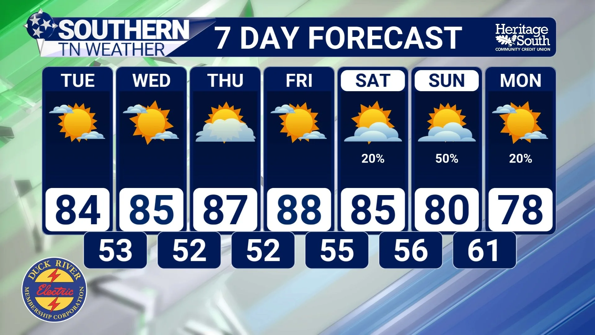
Thankfully, we don't need to predict January to have something worth talking about this week. High pressure has settled into the region behind our weekend rainfall, setting Southern Middle Tennessee up for a beautiful stretch of early October weather. Monday afternoon will feature plenty of sunshine with highs generally ranging from the upper 70s into the lower 80s. Humidity will be considerably lower, and a northerly breeze should make it feel pretty darn nice outside. The combination of lower humidity, breezy conditions and our ongoing drought does create some marginal fire-weather concerns, particularly Monday afternoon. Even after the rain we received over the weekend, vegetation and other fuels remain quite dry, so continue using extra caution with outdoor burning or anything capable of producing sparks.
Clear skies, dry air and lighter winds Monday night will provide an excellent setup for radiational cooling, allowing temperatures to fall into the upper 40s and lower 50s by Tuesday morning. From there, afternoons gradually warm through the remainder of the work week. Highs should reach the lower and middle 80s Tuesday and Wednesday before climbing into the middle and perhaps upper 80s Thursday and Friday. Despite the warmer afternoons, humidity will remain much more comfortable than what we dealt with throughout September. Our next opportunity for rain could arrive this weekend, but confidence in the details is currently LOW. Forecast guidance generally suggests Gulf moisture will begin moving northward again, but there are significant differences regarding exactly how that happens. Some solutions have hinted at a tropical system moving out of the Gulf and toward portions of the Southeast, while others keep the more organized system farther west or south with considerably less moisture reaching us.
In other words, we don't know exactly what will happen yet. And wouldn't you know it? That's kind of the entire point of today's blog. For now, rain chances remain below 50% for the weekend. We'll continue watching the pattern and become more specific when the atmosphere gives us a reason to become more specific. No voodoo required!
STNWX 7-DAY FORECAST
The Bottom Line 🧾
❄️ Be VERY skeptical of specific Southern Middle Tennessee snowfall forecasts being published in early October.
🌊 El Niño is rapidly strengthening and has a very high probability of becoming an exceptionally strong event this fall and winter.
📈 There is even a legitimate possibility this El Niño eventually exceeds the strength of previous events in the modern record, but that has NOT happened yet.
🧩 Historical analogs can provide useful clues, but no previous winter perfectly matches this one. An exceptionally strong El Niño makes finding a truly comparable analog even more difficult.
🎲 El Niño can shift the odds toward certain large-scale weather patterns, but it cannot tell us how many snowstorms Southern Middle Tennessee will receive.
🌧️ A wetter-than-normal winter does NOT automatically mean a snowier-than-normal winter.
❄️ Snowfall here depends heavily on individual storm tracks, moisture, cold-air placement and timing. Those details cannot be reliably determined months ahead.
📱 Snow forecasts generate enormous attention in the South, which makes dramatic long-range snowfall maps especially attractive on social media.
🚫 Southern Tennessee Weather will not publish a snowfall forecast simply because everybody else is doing one. We'll talk about snow when the evidence actually supports it.
☀️ In the meantime, expect a dry and beautiful work week with cool mornings, warm afternoons and relatively low humidity.
🌡️ Morning lows will generally fall into the upper 40s and 50s, while afternoon highs gradually warm from the upper 70s and lower 80s into the middle and upper 80s later this week.
🌧️ Another opportunity for rain may develop this weekend, but confidence remains low regarding exactly how that setup evolves.
📰 Reminder: The Southern Tennessee Weather Blog, presented by Heritage South Community Credit Union, is updated Monday through Friday with fresh, locally tailored forecasts you can trust.
