
Scattered Showers and Storms Tonight
So far today…
Today’s blog is running just a little behind schedule, but for good reason! I wanted to give time for the afternoon suite of short-range weather models to finish running so we could have the freshest possible data. Now that we have it, here’s what you can expect:
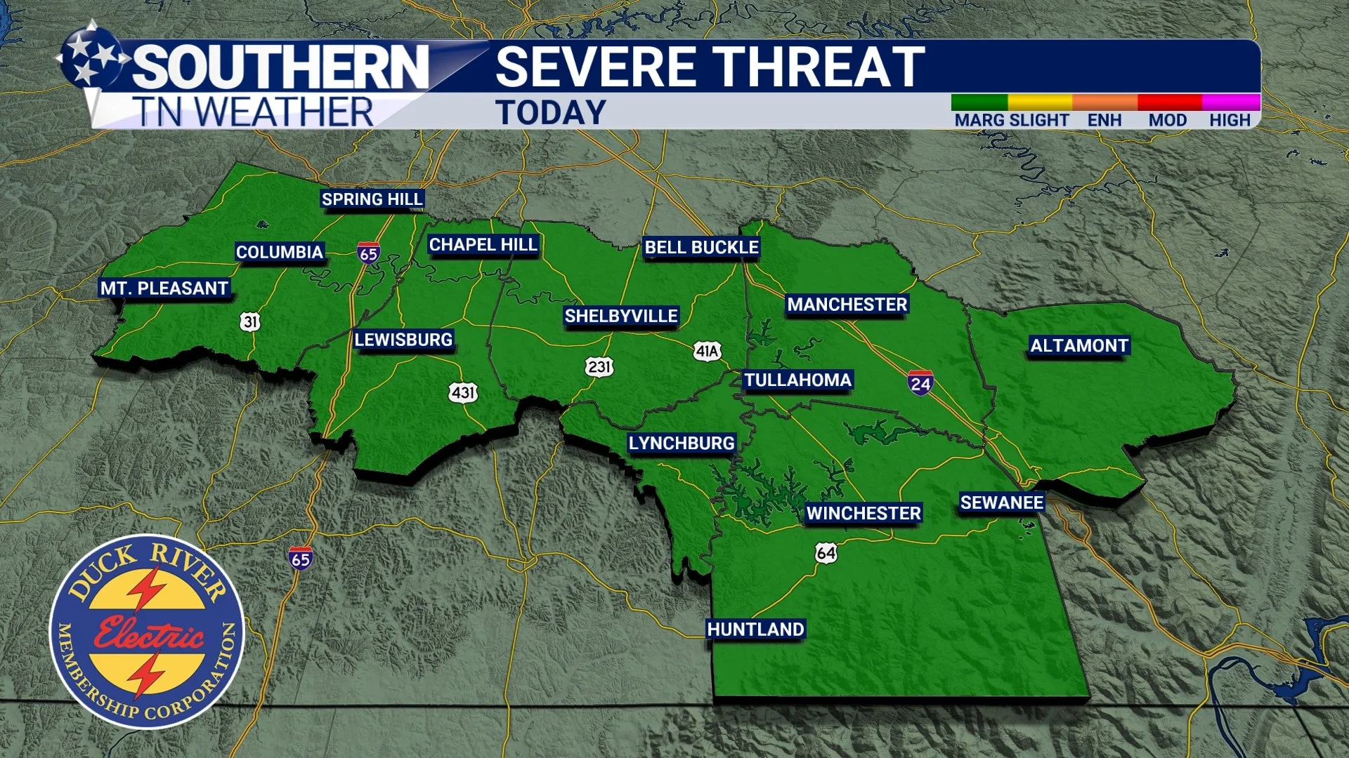
We’re gearing up for scattered showers and a few rumbles of thunder tonight into early Saturday as a cold front pushes in from the northwest. This is ROUND THREE that I mentioned in yesterday’s blog, and it will be the final round before we dry out for the weekend. It’s important to note that there is a good chance a few locations don’t see ANY meaningful rainfall tonight… Storms will be scattered about! This morning, the Storm Prediction Center introduced a very low-end MARGINAL risk (Level 1 of 5) for severe thunderstorms tonight. Let’s break down what that means.
Understanding Tonight’s “Conditional” Risk
The SPC assigns risk probabilities based on the chance that a specific hazard occurs within 25 miles of your location:
Tornado: 2%
Damaging wind (>60 mph): 5%
Large Hail: Not anticipated
A 2% tornado probability and a 5% damaging wind probability is extremely low, but not zero. This is why we call tonight a conditional threat, meaning storms would need to overcome a few atmospheric limitations before anything strong or severe could materialize.
SPC Outlook - Tonight
Why the threat is low
Two key ingredients for severe weather are struggling today:
Instability (storm fuel)
This is basically the atmosphere’s “energy reserve” for thunderstorms. Higher numbers mean stronger, healthier storms. Tonight, the latest short-range models show CAPE values around 300–400 J/kg. That’s very low. For reference, we typically need 800–1,000+ J/kg just to start worrying about organized severe storms. In the cool season sometimes lower CAPE can still do something if everything else lines up — but tonight, it’s hard to say that it will. Notice the blue on the futurecast map below… Those would be storm fuel values BELOW what I would consider “good” for severe weather development…Lapse rates (how quickly temperatures cool with height)
Lapse rates tell us how quickly the temperature cools with height. Steeper cooling = stronger storm updrafts. Tonight’s lapse rates sit around 5–6°C per kilometer, which is pretty weak. Stronger severe weather usually needs something closer to 7–8°C/kg. Weak lapse rates = weak updrafts = weak storms.
So… what do we have?
Wind Energy
This is actually the one ingredient we have plenty of. Winds increase with height, which helps storms rotate or produce damaging winds if the other ingredients are there. But wind alone doesn’t make severe storms. Without instability and steep lapse rates, the atmosphere doesn’t have anything to “work with.”So what does all this mean?
Even with good wind energy above our heads, the lack of storm fuel and weak temperature profiles make it very hard for storms to organize tonight. Could one or two storms briefly pulse stronger? Yes. But the setup overwhelmingly points to a few noisy showers and storms, not a major event.I’ll still be watching trends closely, and if anything starts to shift upward in the data this evening, I’ll put out updates immediately across all platforms.
Timing
The window for showers and storms tonight is between Midnight and 5:00 AM. Not everyone will see rain, but don’t be surprised if you’re awakened by a quick burst of thunder. This will be a fast-moving system. I will post updates on social media if anything unexpected develops, but based on current data, it’s not looking like a “stay up all night” threat.
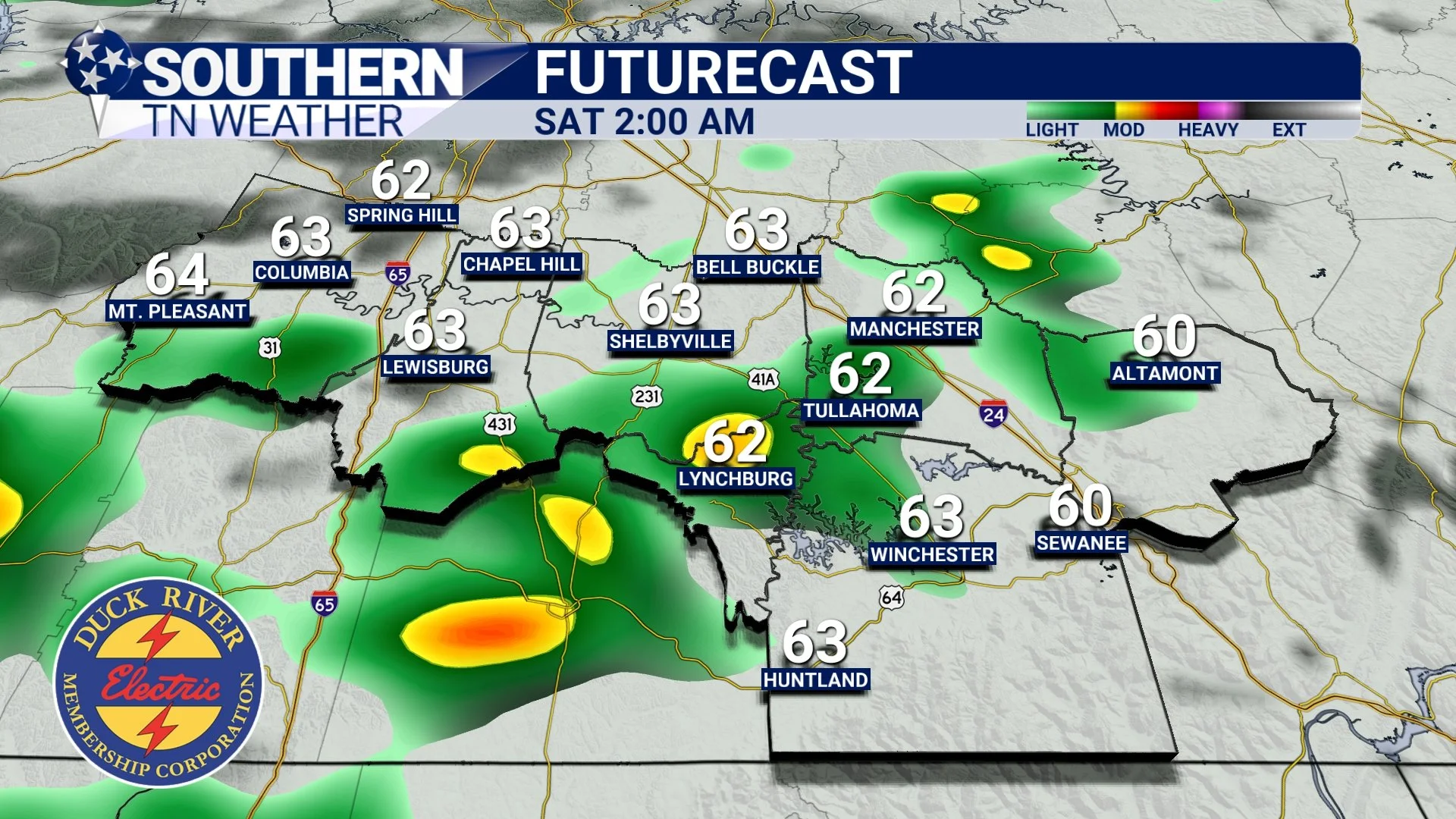
HRRR Futurecast - 2:00 AM Saturday
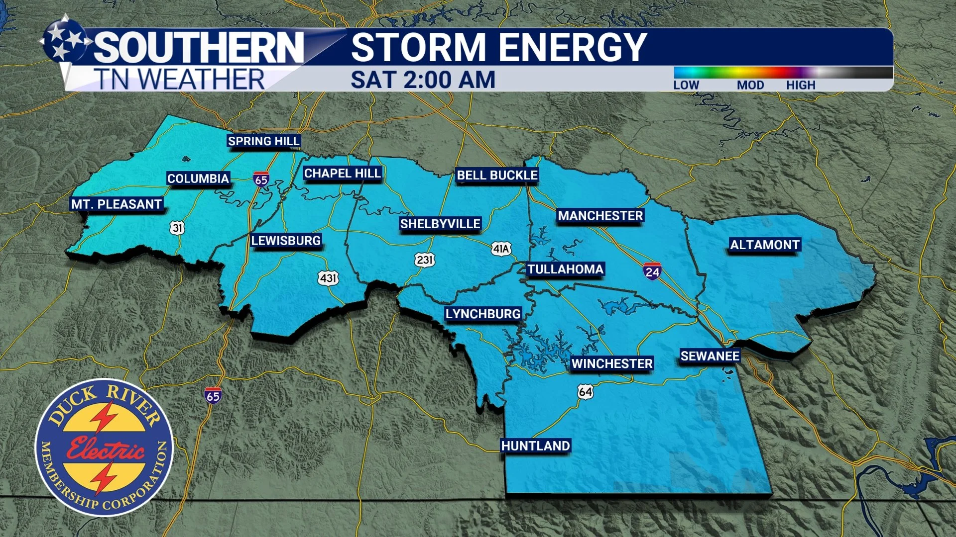
HRRR Futurecast - Storm Fuel - 2:00 AM SAT
Saturday and Sunday
Once the cold front moves through early Saturday morning, we’ll still have a few leftover sprinkles or pockets of drizzle to deal with through the day, though most areas will stay dry. As we move into the late morning and afternoon, skies will gradually brighten. Highs will climb back into the low 70s, which is impressively warm considering a front will have just moved through. Sunday looks even better, though! Sunshine returns in full force, and temperatures will settle into the mid 60s. It’ll be one of those classic late-fall days that feels cool in the morning but absolutely perfect by the afternoon… Great weather for getting outdoors, running errands, or spending some time with the family before our next storm system arrives Monday into Tuesday.
Looking Ahead: Next System Monday Night–Tuesday
Our next widespread rain chance arrives Monday night into Tuesday, bringing another 1–2 inches of rain region-wide. Severe weather risk looks low again, with weak instability and marginal lapse rates (similar to tonight), but plenty of rain and a breezy cold front. I’ll have a blog post out on Monday with the latest on this system.
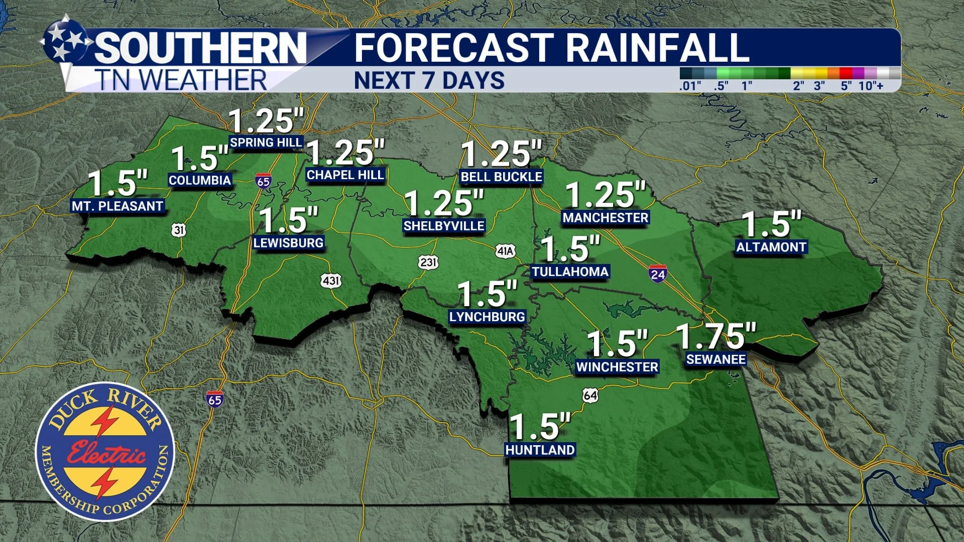
Forecast Rainfall Totals - Next 7 Days
Thanksgiving Preview
Looking ahead to Thanksgiving, things are actually shaping up to be really pleasant and honestly, pretty fitting for the holiday. Behind Tuesday’s cold front, cooler and drier air settles in, giving us that crisp, true “late November” feel we haven't had much of this month. Right now, Thanksgiving Day looks mostly sunny with highs in the low 50s. Cool, comfortable, and seasonably chilly. This is the kind of weather where the house feels extra cozy with the oven going and the scent of holiday food drifting around.
After the back-and-forth pattern we’ve dealt with lately, I think we can all be a little thankful that Thanksgiving is actually going to feel like Thanksgiving this year!
The Bottom Line 🧾
• Scattered showers and storms tonight (midnight–5 AM)
• Severe threat is very low — instability and lapse rates are weak
• Saturday: partly sunny with some patchy drizzle
• Sunday: beautiful, sunny, mid 60s
• Monday night–Tuesday: next round of widespread rain and storms
• Thanksgiving looks sunny and cool with highs in the low 50s
📰 Reminder: Our Southern Tennessee Weather Blog is updated Monday through Friday with fresh, locally tailored forecasts you can trust.
Be sure to follow along so you never miss an update!
Where to get updates tonight
If anything unexpected pops up this evening or overnight, you can get radar (and other updates) on:
STN Weather App
Facebook, X, and Instagram: Southern Tennessee Weather
YouTube: STN Weather Channel (24/7)
stnweather.com