
Rain Today, Cold Returns Briefly, Then a Clear Path to Warmer Weather

The Southern Tennessee Weather Blog is proudly presented by Heritage South Community Credit Union.
We Help When Others Won’t!
Visit https://www.heritagesouth.org/ today to see how HSCCU can help YOU!
Southern Middle Tennessee is transitioning into a much quieter and more favorable weather pattern, but not before one final round of rain moves through the region this afternoon and evening. This system is not particularly strong, nor is it dangerous. Still, it does serve as a clear dividing line between today’s unsettled weather and a stretch of colder, dry conditions midweek, followed by a notable warm-up as we head toward the end of the week and early next week.
The Setup Today: Shortwave Brings Widespread Rain
A compact upper-level shortwave is moving through the Tennessee Valley today, and satellite imagery already shows this disturbance translating eastward across the region. As this feature passes overhead, large-scale ascent will increase, allowing rain coverage to become more widespread through the afternoon. Rain will overspread Southern Middle Tennessee from west to east today, becoming most numerous during the mid-afternoon through early evening hours. Atmospheric profiles show very little instability in place, which means thunderstorms are not expected. Rain rates will generally remain light to moderate, resulting in a steady, soaking rainfall rather than anything stormy or intense.
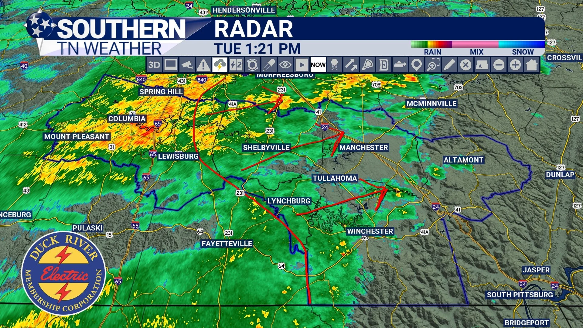
Radar - Tuesday Afternoon
Rainfall totals are expected to average between 0.25 and 0.50 inches across much of the area. Guidance continues to favor slightly higher totals east of Interstate 65, where pockets of 0.50 inches or a bit more are possible. In the higher terrain near the Cumberland Plateau, particularly in Grundy County, there is a low but non-zero chance of localized totals approaching an inch, though this would be the exception rather than the rule. Rain will gradually taper off from west to east this evening, with most locations seeing precipitation end by or shortly after midnight.
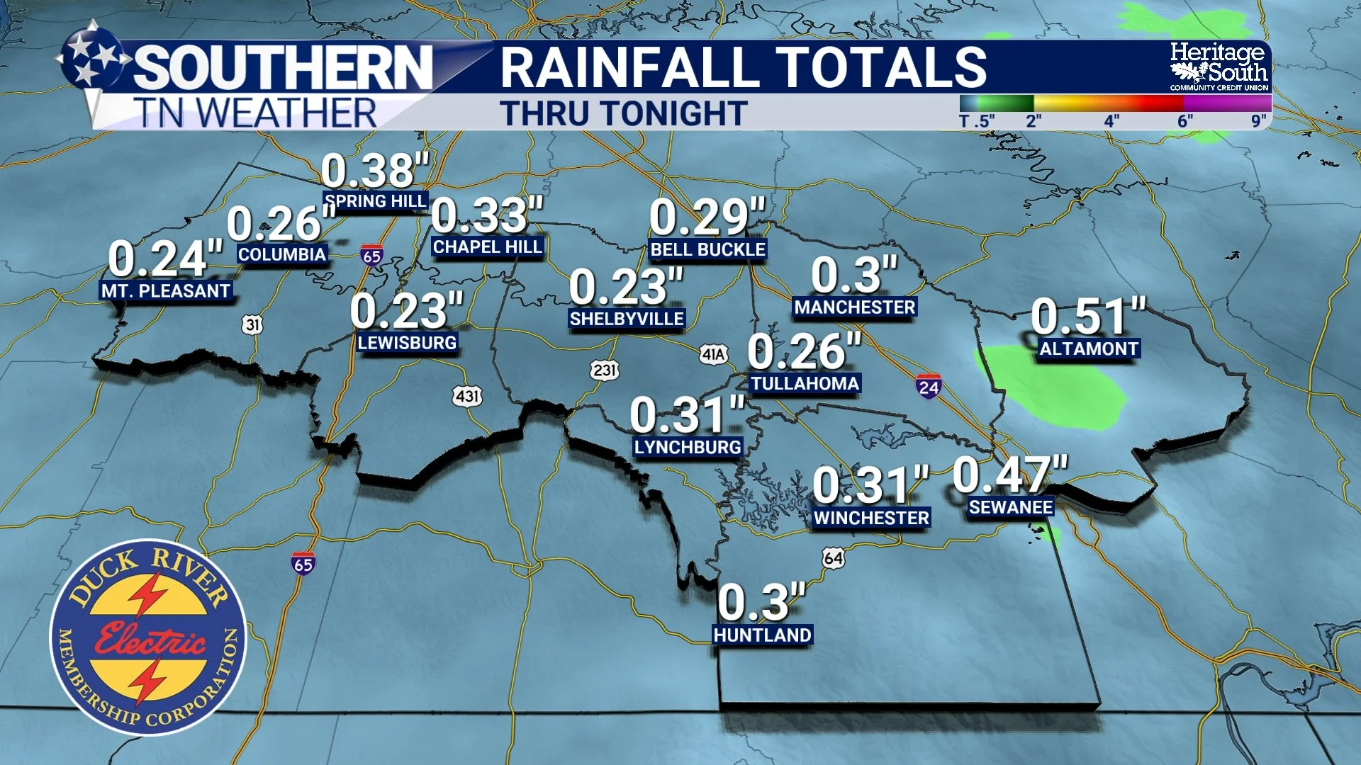
Rainfall Totals - National Blend of Models
Tonight Into Wednesday: Cooler Air Filters In
Behind today’s rain, a cold front will sweep through Southern Middle Tennessee late tonight. Importantly, the colder air lags behind the precipitation, so there are no major winter weather concerns associated with this system. That said, temperatures will take a noticeable step down on Wednesday. Highs will only reach the 30s, and lingering cloud cover may persist through much of the day, reinforcing the cooler feel. By Wednesday night, clearing skies and building surface high pressure will allow temperatures to drop into the teens to low 20s across the region.
There is a very low chance for wrap-around moisture to generate a few flurries late tonight into early Wednesday, mainly across the Cumberland Plateau. Moisture with this feature is shallow and fleeting, and no accumulation or impacts are expected. Precipitation probabilities remain around 10 percent for most of the area, but given the setup, it is worth mentioning the possibility of a few passing flurries as colder air settles in. See the second photo below showing flurries on the HRRR model… Not super impressive, right?
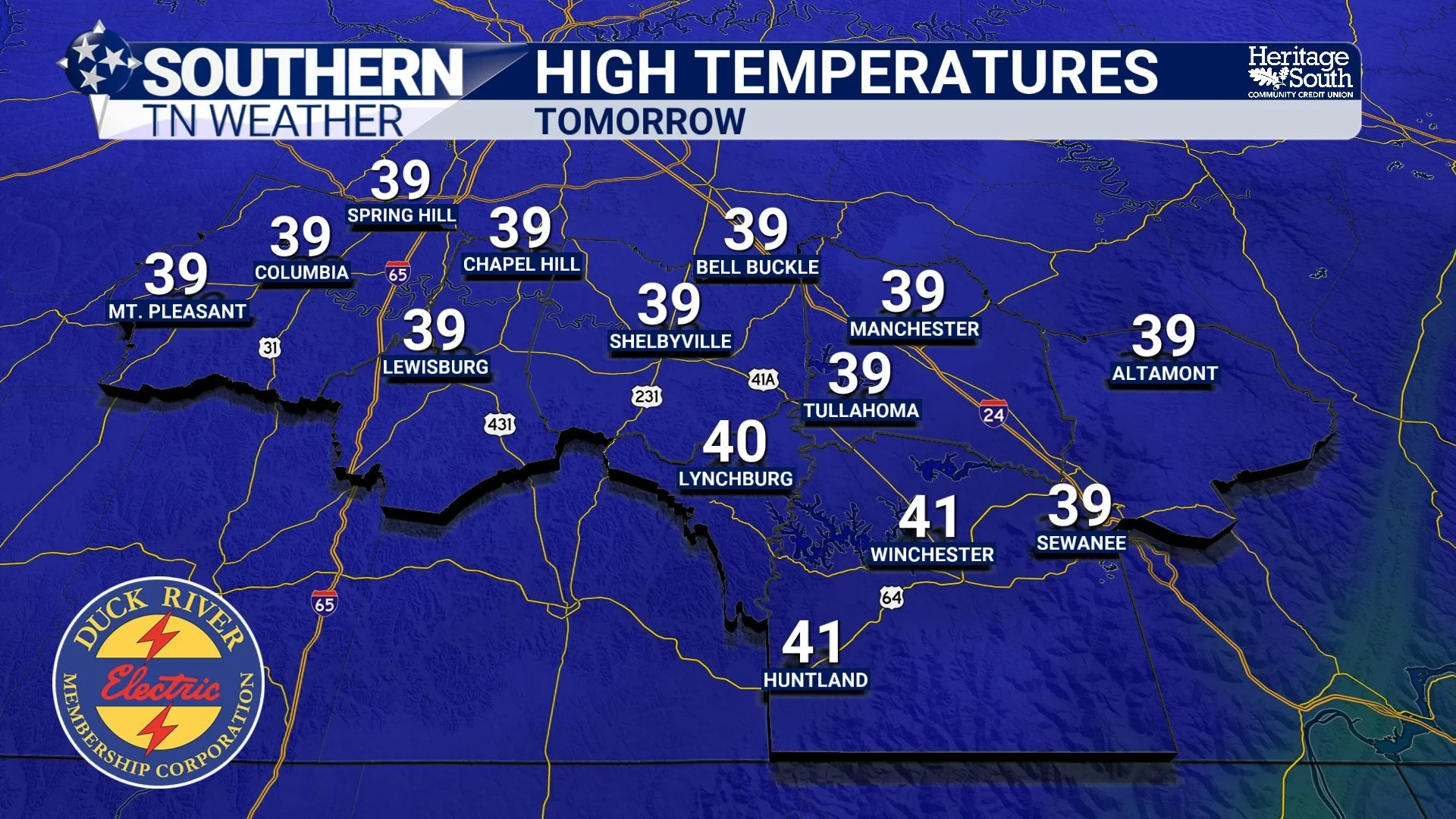
High Temperatures - Wednesday
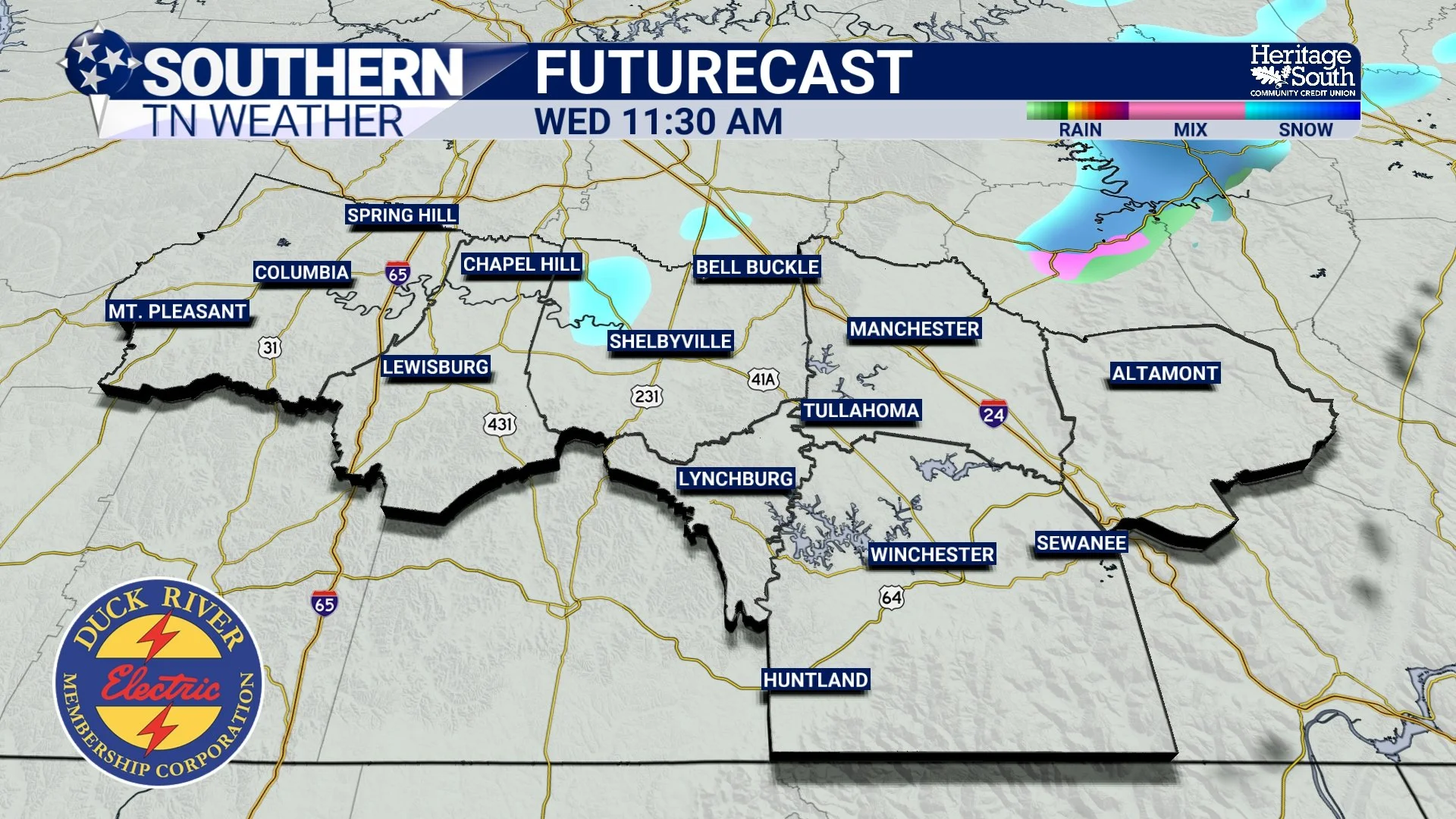
Futurecast - Flurries tomorrow morning?
Thursday Through the Weekend: Dry and Gradually Warmer
After Wednesday’s brief cool-down, the pattern becomes much more cooperative. A large-scale ridge builds over the western United States, placing Southern Middle Tennessee under dry northwest flow aloft. This effectively shuts off precipitation chances for several days. Thursday will remain on the cool side, with highs in the upper 30s to lower 40s, but sunshine will be more prevalent. Cold mornings continue, with overnight lows dipping into the 20s.
From there, temperatures begin a steady climb:
Friday: highs rebound into the lower to mid-50s
Saturday: a weak front may briefly cool temperatures, but conditions remain dry
Sunday into early next week: highs return solidly into the 50s, with some locations flirting with 60
Importantly, no significant storms or Arctic intrusions are showing up in the forecast through at least the next seven days. Winter may not be finished with us, but for now, Southern Middle Tennessee is finally heading into a calmer and more manageable stretch of weather! HALLELUJAH!

The Bottom Line 🧾
• Widespread rain will move through this afternoon and evening
• Rain totals generally range from 0.25–0.50", locally higher east of I-65
• No thunder and no winter weather concerns with today’s system
• Rain ends tonight, followed by cooler air Wednesday
• Highs only in the 30s Wednesday, lows in the teens Wednesday night
• Dry weather dominates Thursday through the weekend
• Temperatures warm back into the 50s by Friday and remain mild into early next week
📰 Reminder: The Southern Tennessee Weather Blog, presented by Heritage South Community Credit Union, is updated Monday through Friday with fresh, locally tailored forecasts you can trust.