
Midweek Chill Lingers Before a Notable Warm-Up Enters the Picture

The Southern Tennessee Weather Blog is proudly presented by Heritage South Community Credit Union.
We Help When Others Won’t!
Visit https://www.heritagesouth.org/ today to see how HSCCU can help YOU!
Southern Middle Tennessee is settling into a brief but stubborn stretch of colder, gray weather today and Thursday as we sit on the backside of yesterday’s cold frontal passage. While this is not an impactful winter weather setup, lingering moisture and cold air aloft will keep conditions feeling raw for another 24 to 36 hours before a meaningful and sustained warm-up arrives heading into the weekend and early next week.
This forecast is less about hazards and more about understanding why the gloomy conditions are hanging on (and why they won’t last much longer).
Today: Cold, Cloudy, and a Few Passing Snow Showers
Behind yesterday’s cold front, colder air has filtered into Southern Middle Tennessee, and temperatures today are struggling to climb much beyond the 30s. Low-level moisture remains trapped beneath a passing upper-level trough, resulting in widespread low clouds, areas of fog, and occasional drizzle earlier today. While visibility has gradually improved since this morning, skies remain largely overcast across the region.
There is still a low chance for light snow showers east of Interstate 65 through tonight, primarily across Bedford, Coffee, Franklin, Grundy, and Moore Counties, including the higher elevations of the Cumberland Plateau. This activity is being driven by shallow lift within the cold air mass combined with lingering low-level moisture beneath the trough. Expectations remain very low with this setup. Most locations will see no accumulation. Areas along the Plateau have about a 50 to 70 percent chance of a dusting, with only around a 10 percent chance of reaching a half inch. Any snow that does fall will be light, brief, and non-impactful. Road temperatures remain marginal, and travel impacts are not expected. As you can see off the latest run of our Futurecast model, it’s not very impressed with the snow chances this evening either.
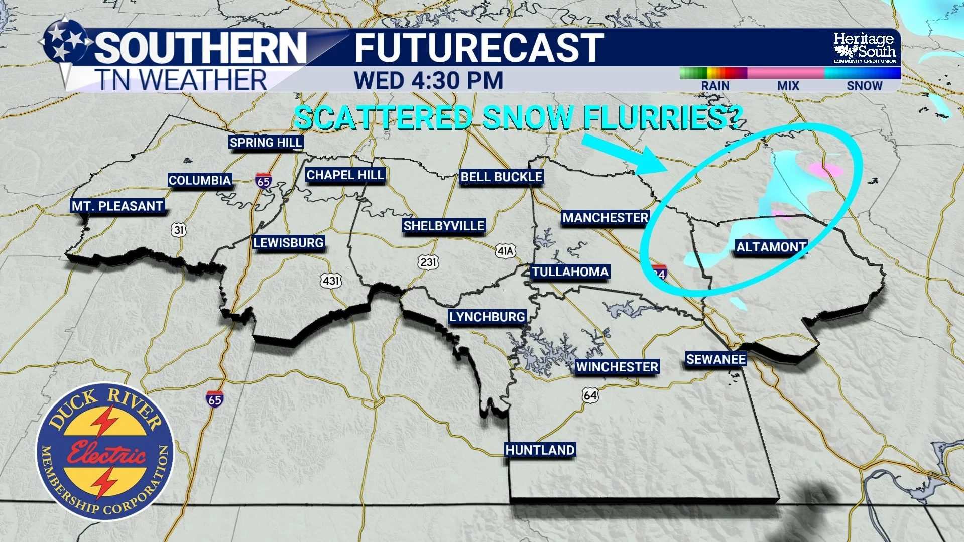
Futurecast - This Evening
Tonight Through Thursday: Cold Air Holds Firm
While a few light flurries or snow showers may linger into tonight, the focus shifts squarely to cold temperatures. Skies remain mostly cloudy overnight, limiting radiational cooling somewhat, but lows will still fall into the teens to lower 20s across Southern Middle Tennessee. Thursday brings little change in the overall feel of the weather. Cold air remains entrenched, and despite some gradual thinning of cloud cover, highs once again stay in the 30s. This is a classic post-frontal cold pool scenario, where shallow cold air near the surface struggles to warm under a weak February sun angle.
The good news: Thursday will be the final day of this (short-lived) colder stretch.
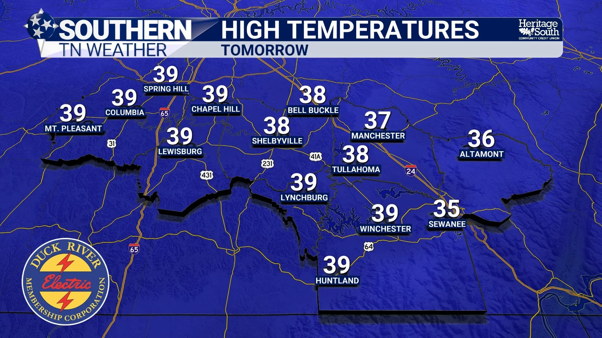
High Temperatures - Thursday
Friday and Beyond: A Much-Needed Pattern Shift
By Friday, the larger-scale pattern finally begins to evolve in our favor. Upper-level ridging develops across the western United States and gradually expands eastward, allowing heights to rise over the Tennessee Valley. This shift initiates a warming trend that carries us through the weekend and into early next week. Highs rebound into the 50s on Friday under increasing sunshine. A weak, dry front passes through on Saturday, briefly knocking temperatures down but keeping conditions dry. From Sunday into early next week, highs climb back into the 50s, with some locations potentially reaching the lower 60s. Below is the latest Climate Prediction Center Outlook for next week. Notice the orange and red colors? Those indicate greater than 50% chances for warmer than average temperatures.
Importantly, no significant precipitation is expected after today for several days. I am watching a system around Valentine’s Day, but we’re still too far out for the specifics. This one looks like a rain maker, though.
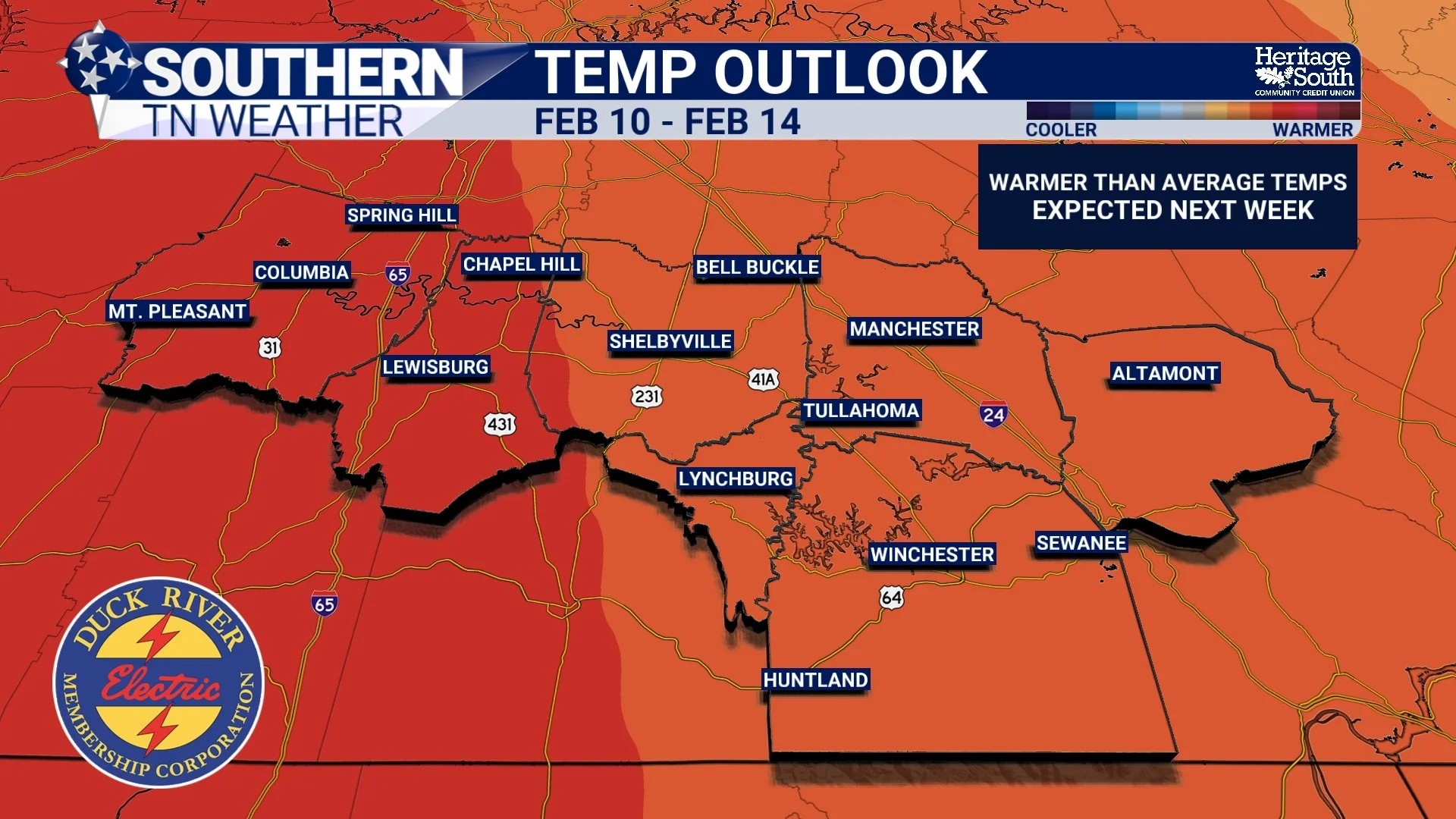
Climate Prediction Center Temperature Outlook - Next Week
The Bottom Line 🧾
• Cold, cloudy conditions persist today and Thursday
• A low chance for light snow showers east of I-65 today into tonight
• Any snow will be minor and non-impactful
• Highs remain in the 30s through Thursday
• A warming trend begins Friday
• Highs return to the 50s this weekend, with some spots nearing 60 next week
• Dry weather dominates for several days
📰 Reminder: The Southern Tennessee Weather Blog, presented by Heritage South Community Credit Union, is updated Monday through Friday with fresh, locally tailored forecasts you can trust.