
A Brief Cooldown Saturday, Then a Springlike Turn Ahead

The Southern Tennessee Weather Blog is proudly presented by Heritage South Community Credit Union.
We Help When Others Won’t!
Visit https://www.heritagesouth.org/ today to see how HSCCU can help YOU!
Southern Middle Tennessee is wrapping up another week of winter variability, but the overall pattern is beginning to turn a corner. While we do have one more weak front sliding through today and a cooler, breezy Saturday ahead, the bigger story is the increasingly confident warm-up that unfolds late this weekend and continues into next week. By early next week, temperatures will feel far more like early spring than early February.
Today: Mild Ahead of a Weak Front
Satellite imagery this morning shows upper-level ridging firmly established across the western United States, while a trough tracks well north of Tennessee. This setup places Southern Middle Tennessee in a relatively quiet weather zone today, at least initially. Ahead of the approaching cold front, temperatures will warm into the 50s across much of the region this afternoon, which is near or slightly above average for early February.
Skies started mostly clear this morning, but cloud cover will gradually increase through the afternoon as the front approaches from the north. There is a very low chance for a few light showers, but moisture is limited and impacts are not expected. Most locations will remain dry. By this evening and overnight, the front pushes through the area. Winds will shift to the north and increase slightly, signaling the arrival of cooler air.
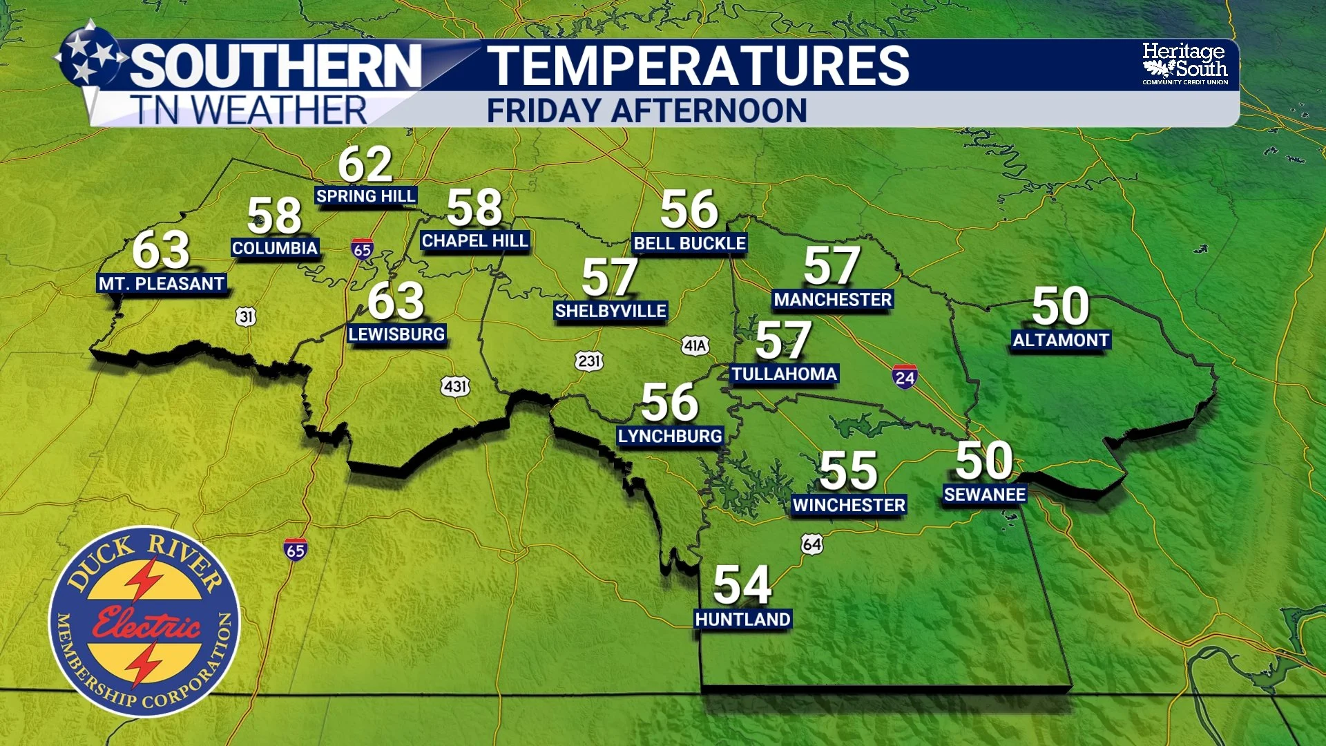
Temperatures - Friday Afternoon
Tonight into Saturday: Cooler and Breezy, but Quiet
Behind the front, temperatures drop noticeably tonight. Lows will fall into the upper teens across the Plateau and into the 20s elsewhere across Southern Middle Tennessee. Saturday will feel colder than today, not because of winter precipitation, but due to cold air advection and persistent northerly winds. Highs will generally top out in the 30s for most locations, with some low 40s possible in our far western counties. Winds will remain breezy through much of the day, adding a chill and keeping it feeling colder than the thermometer suggests.
Importantly, this is a dry cold. No snow or ice is expected, and skies will gradually clear as high pressure builds in. Saturday night remains cold, but this marks the end of the colder stretch.
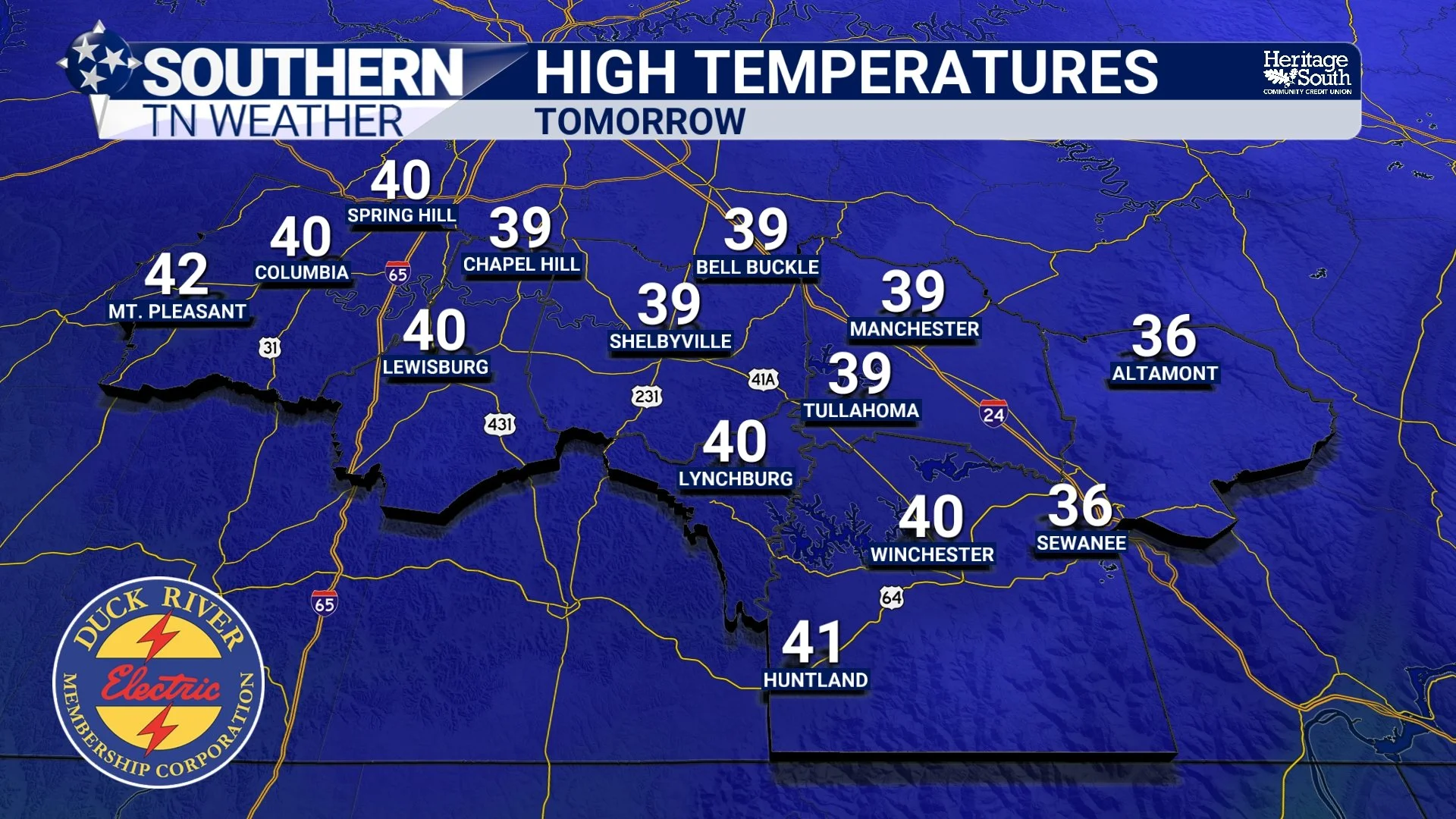
High Temperatures - Tomorrow
Sunday Through Early Next Week: A Strong Warm-Up
Beginning Sunday, the pattern shifts in a meaningful way. Upper-level ridging over the western United States slides eastward, allowing heights to rise across the Tennessee Valley. This promotes southerly flow, warmer air advection, and a steady temperature climb. Sunday highs rebound into the 50s, and the warming accelerates from there. By Monday and Tuesday, much of Southern Middle Tennessee will see highs in the mid to upper 60s, with some locations approaching 70 degrees. Overnight lows also moderate, climbing into the 40s by early next week.
This warm-up does not appear fleeting. Ensemble guidance supports several consecutive days of above-normal temperatures, signaling a more sustained shift rather than a brief spike. Average highs this time of year are in the upper 40s.
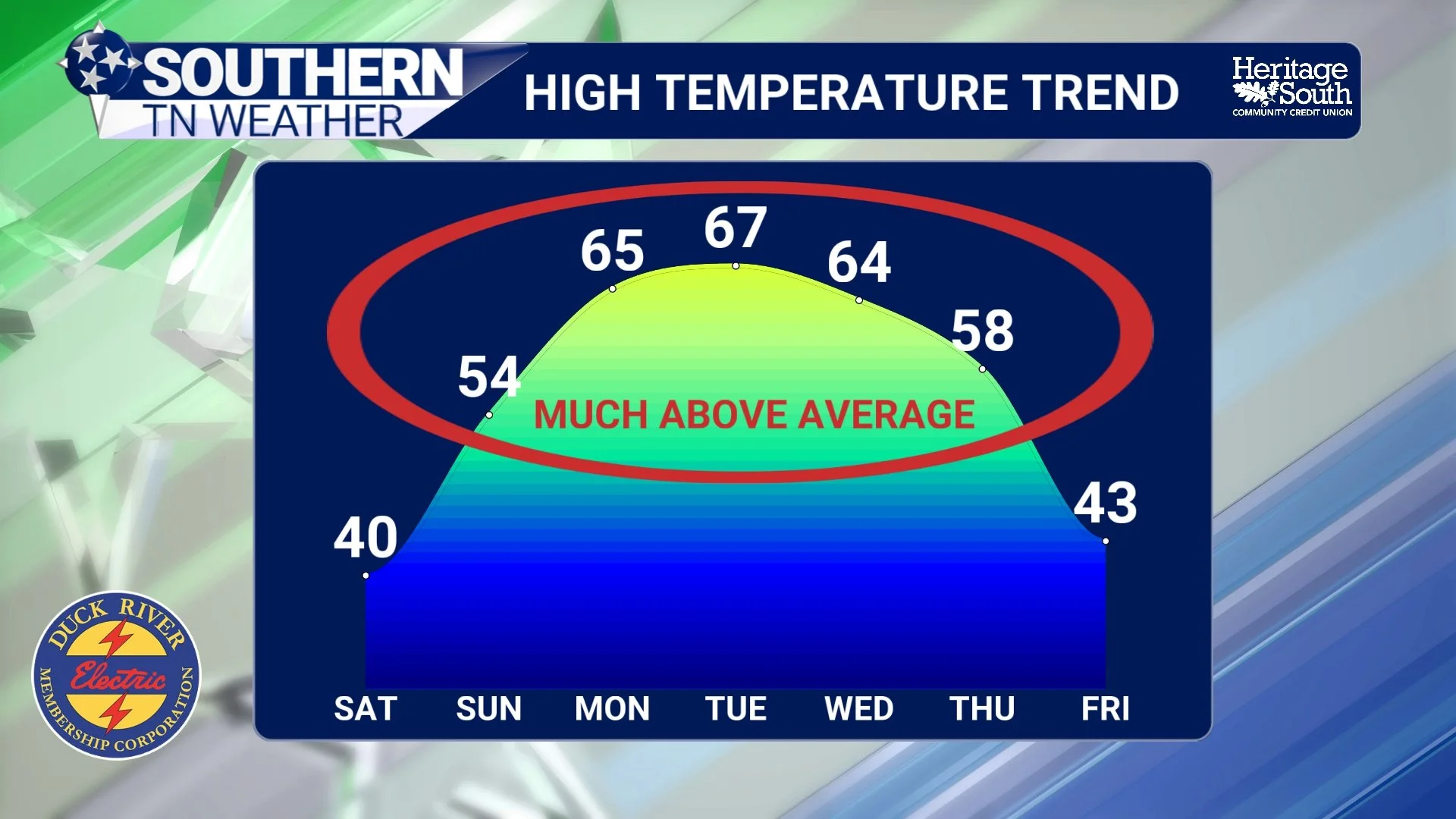
High Temperature Trend - Next 7 Days
Rain Returns Midweek
As the ridge weakens slightly next week, a shortwave and surface low are expected to move through the region Tuesday into Wednesday. This brings the next chance for rain. Rain chances currently sit in the 30 to 60 percent range, with forecast totals generally between 0.10 and 0.25 inches. Instability remains limited, and no severe weather concerns are showing up at this time.
I know this may come as a surprise, especially since earlier forecasts leaned drier for early next week. However, the latest global guidance has trended slightly wetter. This does not look like a washout, but it does suggest a more active midweek period than previously advertised. Behind that system, another weak front nudges temperatures back slightly, but nothing resembling Arctic air is on the table.
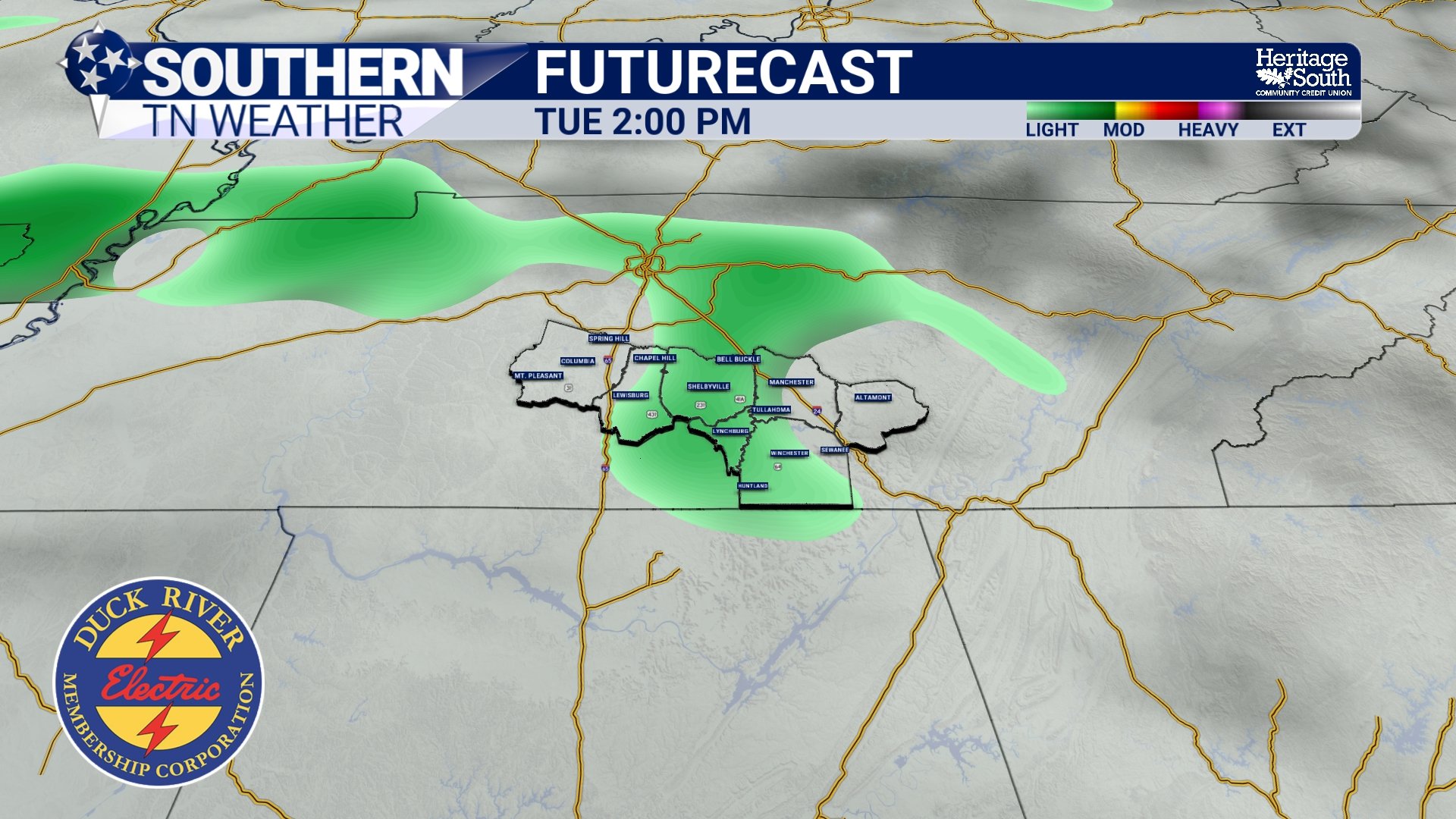
Futurecast - Tuesday Light Rain
The Bottom Line 🧾
• Mild today ahead of a weak front
• Cooler and breezy Saturday with highs mainly in the 30s
• No winter weather concerns this weekend
• Strong warm-up begins Sunday
• Highs in the 60s Monday and Tuesday
• Rain chances return Tuesday into Wednesday
• Pattern remains active but far less wintry
📰 Reminder: The Southern Tennessee Weather Blog, presented by Heritage South Community Credit Union, is updated Monday through Friday with fresh, locally tailored forecasts you can trust.