
Are Weather Events Really Getting More Intense?

The Southern Tennessee Weather Blog is proudly presented by Heritage South Community Credit Union.
We Help When Others Won’t!
Visit https://www.heritagesouth.org/ today to see how HSCCU can help YOU!
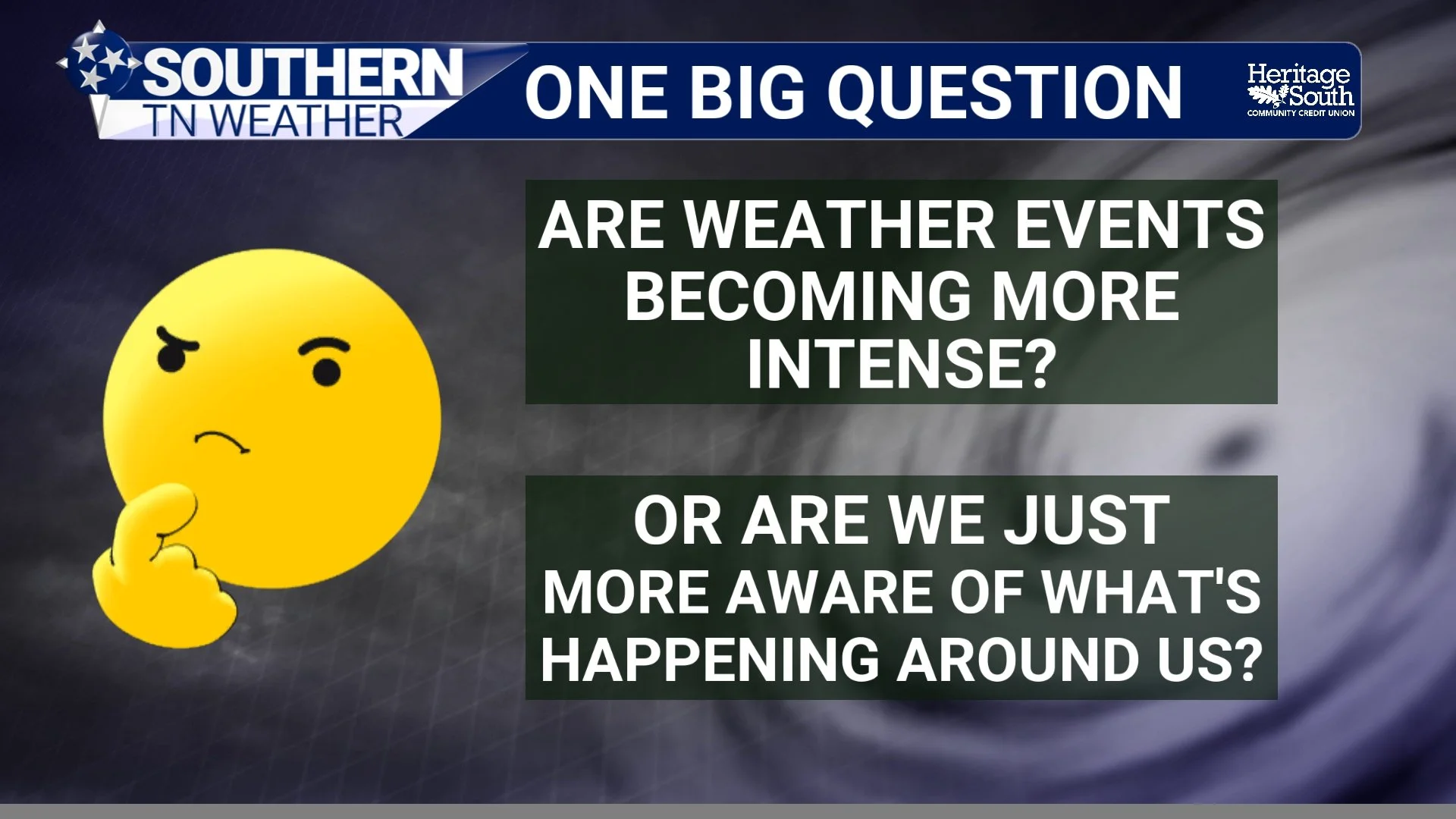
We're taking a one-day break from our Weather Folklore series because there's another weather question I get asked ALL THE TIME: “Elijah, does it seem like weather is getting more intense?” Usually it comes after a major tornado, a flash flood, a hurricane, a ridiculous heat wave, or one of those videos on Facebook where somebody's trampoline is achieving low-Earth orbit. Even after the lightning storms on Tuesday night, I had many people reach out and say this is the “worst” lightning storm they’ve ever seen.
I understand why people ask. It really can feel like we're seeing extreme weather more often than we used to, but for this blog I don't want to get into a debate about whether the atmosphere itself has changed. I want to approach the question strictly from a communications standpoint, because the way we receive weather information has changed tremendously over the past few decades.
We see more weather, hear about more weather, get alerted to more weather and watch more weather videos than any generation before us. We can follow a thunderstorm hundreds of miles away in real time even if the sun is shining at our own house. That constant stream of information can make it feel like severe or extreme weather is happening everywhere, all the time.
Think About How We Experienced Weather 30 Years Ago
This is where things get interesting. Let's say a powerful thunderstorm hits a small town in rural Tennessee in 1985. It knocks down several trees, damages a barn and maybe produces a measured 70 MPH wind gust. The people who lived there certainly knew about it, the local newspaper might write about it the next day, and perhaps a television station would mention it if the damage was significant enough. Outside of that immediate area, though, a huge number of people would probably never know the storm happened.
Now imagine that EXACT SAME storm happening in 2026. Within minutes, we've got:
📱 Cell phone videos
📸 Doorbell cameras
🎥 Security cameras
🌩️ Live Doppler radar
🛰️ High-resolution satellite imagery
📡 Personal weather stations
💬 Facebook posts
📍 Storm reports
🚗 Dash cameras
🎬 TikTok videos
...and about 47 people standing on their porch filming it when they probably ought to be inside.
Suddenly, one localized thunderstorm becomes something thousands (or potentially millions) of people can experience from wherever they happen to be. The storm didn't necessarily become more intense. Our ability to SEE it and communicate what happened became dramatically better.
Social Media Completely Changed Weather Awareness
Social media is probably the biggest change during our lifetimes. Before Facebook, X, TikTok and YouTube, most people primarily experienced the weather that happened where they lived. You'd certainly hear about a major tornado outbreak, hurricane or flood on television, but you weren't routinely seeing every hailstorm in Oklahoma, flash flood in Kentucky, tornado in Kansas and dust storm in Arizona.
Now I can open Facebook or X and watch video of a tornado in Nebraska practically while it's happening. Ten minutes later I'm watching baseball-sized hail in Texas, followed by flooding in Missouri, a shelf cloud in Alabama and somebody in Florida with a trampoline stuck 40 feet up a palm tree. After consuming all of that within 20 minutes, it's incredibly easy for your brain to conclude, “Weather has gone CRAZY lately.”
The important thing to remember is that those events may be separated by hundreds or thousands of miles. You just experienced weather from half the country while sitting on your couch in Tennessee. For most of human history, that simply wasn't possible.
Weather Information Is Everywhere Now
Social media isn't the only change. Weather information itself reaches us faster and through more channels than ever before. Your phone can buzz with a warning, your weather app can send a push notification, a local weather page can post radar updates every few minutes, television stations can stream coverage online and radio stations can interrupt programming. At the same time, you can pull up live radar yourself while your friend sends you a storm video and a nearby security camera or skycam shows exactly what conditions look like on the ground.
Thirty or forty years ago, most people had nowhere near that amount of weather information coming at them during the course of an ordinary day. Today, even a relatively routine summer thunderstorm might generate radar screenshots, lightning maps, warning graphics, videos, photos, push notifications and several social media posts before it finally fizzles out around sunset. That's a LOT of communication surrounding one storm.
And that's really the heart of what I'm getting at: more information about weather doesn't necessarily mean more weather is happening. It means we're communicating much more of what IS happening.
Then There's the Way Weather Is Presented
I work in weather media, so I'll happily call us out on this one: weather gets attention. A headline saying “Scattered thunderstorms possible Saturday” probably isn't going viral. Something along the lines of “MILLIONS AT RISK AS POWERFUL STORMS TARGET THE SOUTH!” has a much better chance of grabbing somebody's attention as they scroll through their feed.
The internet rewards attention, and dramatic weather content generates clicks, shares and engagement. That certainly doesn't mean every meteorologist or media outlet is intentionally misleading people—there are plenty of excellent sources doing responsible work—but there is absolutely more weather content being produced and distributed today than ever before.
Every model run can become a post. Every hurricane model can become a screenshot. Every long-range snow map can get shared thousands of times. A single thunderstorm may have multiple people livestreaming it while weather pages across the region post radar updates. We aren't just seeing more weather; we're talking about it more, and we're talking about it almost constantly.
The Difference Between Experiencing Weather and Experiencing Weather CONTENT
This is probably the biggest point I want people to take away from this blog. We used to experience weather primarily based on what happened around us. Now we experience what happens around us plus everything our phones show us from everywhere else.
You can have a perfectly sunny afternoon in Shelbyville while watching tornado footage from Nebraska, giant hail from Texas, flooding from Kentucky and a hurricane spinning somewhere in the Atlantic. Meteorologically, absolutely nothing happened at your house, but you may have consumed an hour's worth of extreme-weather content that day.
Repeat that day after day and week after week, and it's pretty easy to understand why someone eventually asks me, “Why does it seem like the weather is so much worse now?” We're exposed to an amount of weather information that would've been unimaginable not that long ago, and I think that plays a major role in how we perceive the weather around us.
So... Are Weather Events Getting More Intense?
From a communications standpoint, I think a huge part of the answer is pretty simple: we're exposed to WAY more weather than previous generations were. That doesn't tell us whether a particular storm was stronger, weaker, unusual or completely ordinary—that's a separate meteorological question. What it does help explain is why weather can feel so relentless today.
Weather information follows us everywhere. It's on our phones, televisions and radios, and throughout our Facebook feeds, X timelines, TikTok feeds and YouTube channels. We receive warnings automatically, watch storms live and see damage videos sometimes only minutes after the damage occurred. We are no longer limited to knowing what happened in our own community, county or even state.
That's an incredible advancement for weather safety. Getting warnings and useful information to people faster can save lives, and I certainly wouldn't want to go back to a time when we had fewer ways of reaching people. But all of this information creates an interesting side effect: we're more aware of the weather happening around the country than we've ever been before.
So the next time it feels like there's some sort of crazy weather happening every single day, keep that in mind. You may not necessarily be personally experiencing more weather—you may simply be hearing about a whole lot more of it.
A Quick Look at the Forecast
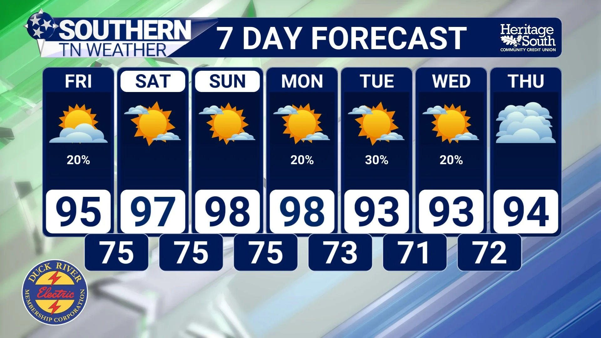
Speaking of intense weather, unfortunately there's nothing imaginary about the HEAT we're dealing with right now. 🥵 A strong ridge of high pressure remains parked across the Southeast, and temperatures will continue climbing through the weekend.
Highs this afternoon will reach the middle 90s across much of Southern Middle Tennessee, with heat index values generally reaching 105–110°. Rain chances are fairly low (generally around 20–30%) but an isolated thunderstorm remains possible, especially along and east of Interstate 65. If a storm does manage to develop, gusty to potentially damaging winds and very heavy rainfall will be possible. Most communities, however, will stay dry.
Friday gets even hotter as highs climb into the middle and upper 90s with another afternoon of 105–110° heat indices, while rain chances drop below 20% for most of the area. Saturday and Sunday currently look like the peak of this heat wave, with many communities reaching the upper 90s and some locations potentially hitting or exceeding 100° actual air temperature. Heat index values of 105–110°+ will remain possible, and warm overnight lows in the middle and upper 70s won't provide much relief after sunset.
Some minor relief remains possible early next week as the ridge begins shifting west and a weak front approaches the region. Rain chances may also begin creeping upward Monday night into Tuesday, with highs potentially falling back into the lower 90s Tuesday. Of course, this is August, so don't get too excited about that “relief.” 😂
The Bottom Line 🧾
📱 We're exposed to more weather: Smartphones and social media put weather from across the country in our hands instantly.
📺 There's more weather coverage: Local pages, television, radio, apps and online streams can provide updates around the clock.
🎥 We see events we never would've seen before: Doorbell cameras, security cameras, dashcams and cell phones document storms almost everywhere.
🔔 Weather finds us now: Push notifications and Wireless Emergency Alerts can deliver information without us even looking for it.
🧠 The takeaway: More weather information can make it FEEL like more extreme weather is happening, even when what has really changed is how much of it we're able to see and hear about.
🥵 Forecast: Dangerous heat continues through the weekend, with highs near 100° possible and heat indices reaching 105–110° or higher.
📰 Reminder: The Southern Tennessee Weather Blog, presented by Heritage South Community Credit Union, is updated Monday through Friday with fresh, locally tailored forecasts you can trust.
