
Summer Preview Weekend… Then Storm Chances Return Next Week

The Southern Tennessee Weather Blog is proudly presented by Heritage South Community Credit Union.
We Help When Others Won’t!
Visit https://www.heritagesouth.org/ today to see how HSCCU can help YOU!
We’re running a little late on today’s blog, but honestly… the weather pattern hasn’t changed much since this morning. Southern Middle Tennessee is heading into a full-blown summer preview weekend with temperatures climbing well above normal, very little rainfall, and drought concerns continuing to worsen across the region. The good news? It finally looks like the atmosphere may at least attempt to bring better rain chances back into the picture by the middle portion of next week.
The Weekend Forecast: Hotter, But Still Comfortable
A major warm-up is now underway across the Tennessee Valley as winds turn more southerly and a broad ridge of high pressure strengthens across the Southeast. Today’s temperatures already climbed into the upper 70s and lower 80s across much of the area, but this is only the beginning. Highs Saturday will surge well into the 80s, and many communities west of the Plateau will likely approach or exceed 90° by Sunday and early next week.
The key driver behind this pattern is strengthening upper-level ridging. When meteorologists refer to a “ridge,” we’re talking about an area of higher atmospheric pressure aloft associated with warmer, sinking air. That sinking air suppresses widespread cloud development and rainfall while allowing temperatures to heat up efficiently during the afternoon hours.
This is one of the more classic “early summer” setups we see across the Southeast. The good news is that humidity levels still look relatively manageable for mid May. Dewpoints will gradually creep upward through the weekend, but this should not feel oppressively humid just yet. In other words, this is more “Memorial Day cookout weather” than “July swamp misery.”
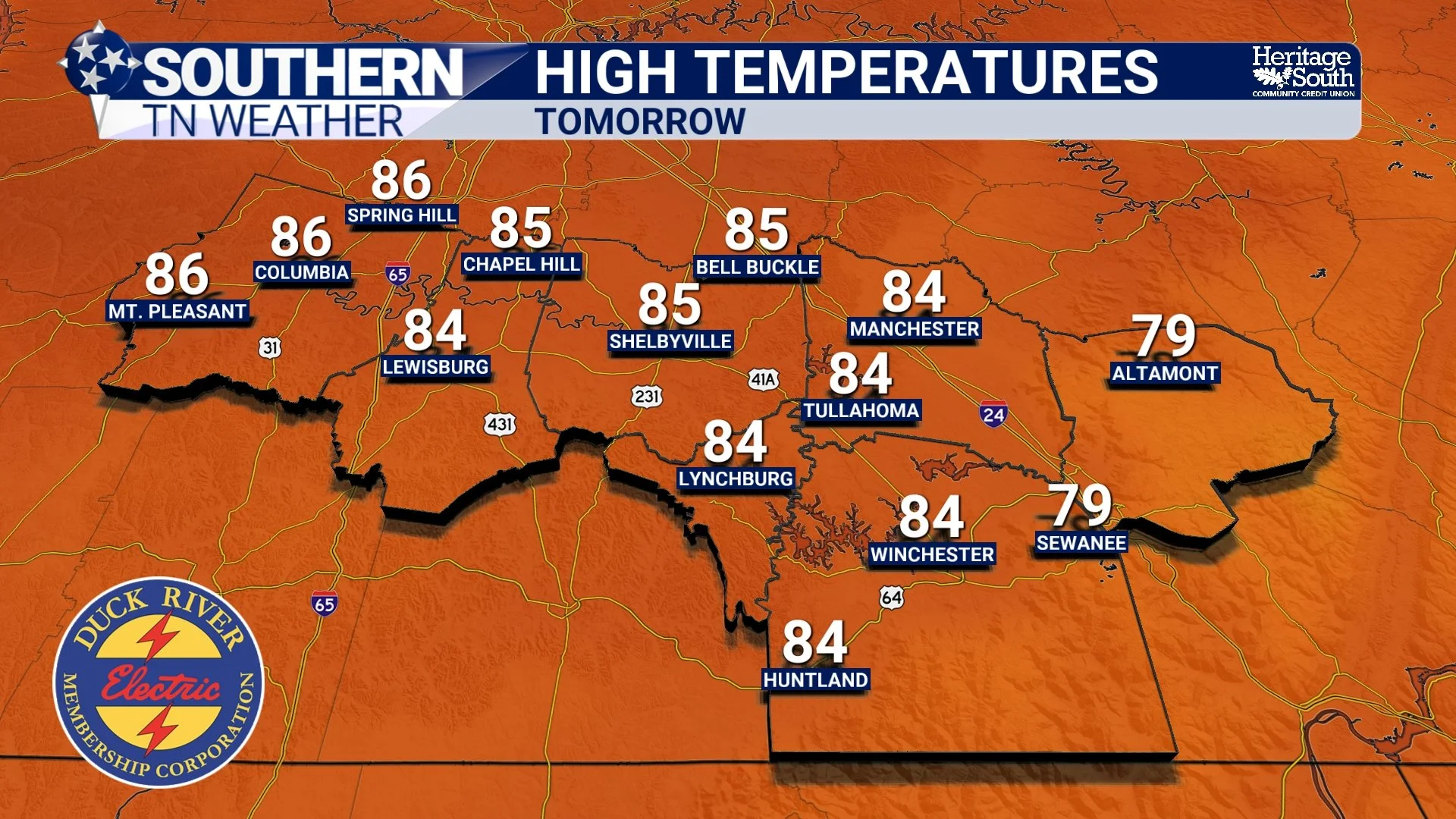
HIGH TEMPERATURES - TOMORROW
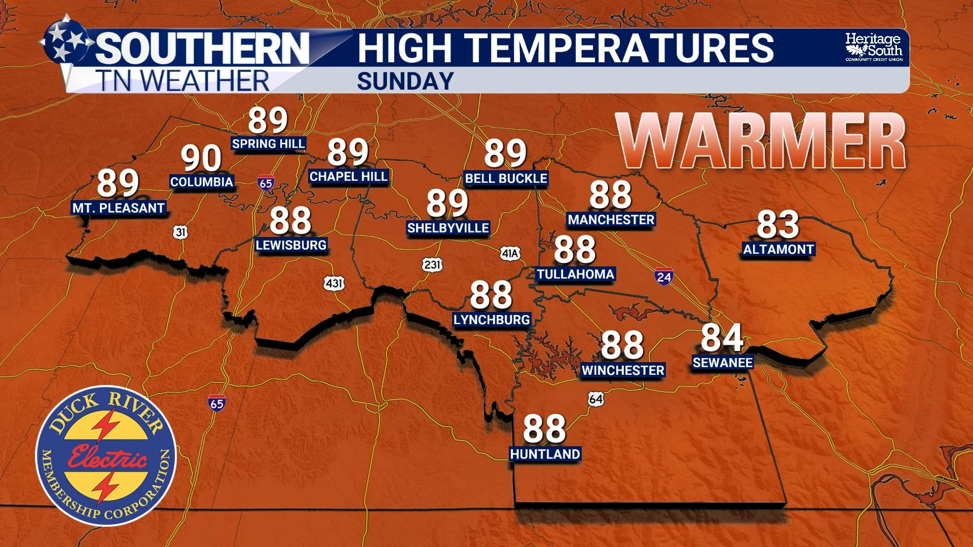
HIGH TEMPERATURES - SUNDAY
A Tiny Storm Chance Saturday
Most of Southern Middle Tennessee will stay dry through the weekend, but there is a very small caveat to Saturday’s forecast. A weak disturbance moving through the Ohio Valley could push an outflow boundary toward northern Middle Tennessee Saturday afternoon or evening. An outflow boundary is essentially leftover cooler air produced by thunderstorms farther upstream. Sometimes these boundaries can help trigger isolated showers or thunderstorms when they move into unstable air.
Right now, the better chances for any activity remain north of Interstate 40 and closer to Kentucky. Even there, coverage looks extremely limited. Most communities across our coverage area likely never see a drop of rain.
The Drought Problem Continues
Unfortunately, the lack of rainfall remains the biggest long-term concern. With temperatures heating up into the upper 80s and lower 90s, evaporation rates are going to increase significantly. That means soil moisture will continue drying out even faster across Southern Middle Tennessee.
We’ve now entered the time of year where strong ridging patterns can become self-reinforcing. Once the atmosphere establishes persistent sinking air and dry conditions, storm systems often get pushed northward around the ridge instead of moving directly through Tennessee. This is why summer droughts can become stubborn in the Southeast. Lawns, gardens, ponds, and creeks across the area will continue feeling the effects of this prolonged dry stretch unless we can get more organized rainfall soon, and we’re still in a big-time rainfall deficit over the past year.
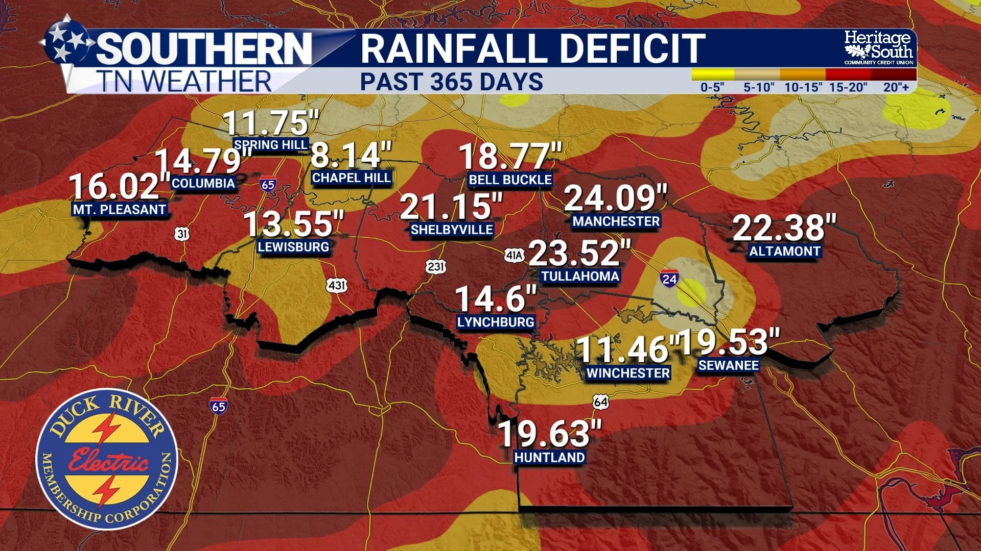
RAINFALL DEFICIT - PAST YEAR
Finally Some Better Rain Chances Next Week
There is at least some encouraging news in the longer-range forecast. Forecast models continue showing an upper-level trough slowly moving eastward from the Rockies into the Plains and eventually toward the Tennessee Valley by the middle of next week. As that happens, the strong ridge currently overhead should begin weakening enough to allow higher moisture levels and better storm chances to return to the region. Right now, Tuesday night through Wednesday appears to hold the best opportunity for scattered showers and thunderstorms across Southern Middle Tennessee.
This does NOT currently look like a major severe weather setup. Instead, this appears more like a typical late spring / early summer pattern with scattered afternoon and evening storms developing along a front and higher moisture axis.
There are still plenty of timing and coverage questions to work through, but at least the atmosphere finally appears willing to try producing meaningful rainfall again.
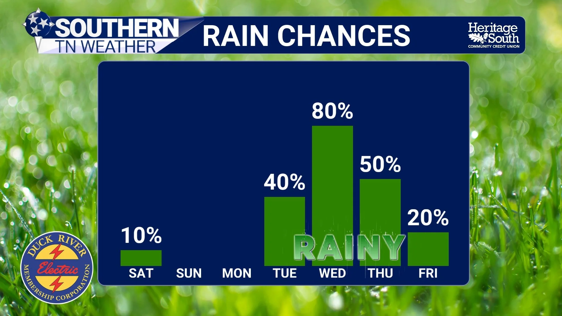
RAIN CHANCES - NEXT 7 DAYS
The Bottom Line 🧾
Summer-like temperatures are arriving this weekend with highs climbing into the upper 80s and lower 90s.
Humidity levels will remain relatively tolerable despite the heat.
Most of Southern Middle Tennessee stays dry through the weekend.
A very isolated shower or storm is possible north of I-40 Saturday.
Drought conditions will likely continue worsening through early next week.
Better shower and thunderstorm chances finally return by the middle portion of next week.
No organized hazardous weather is expected through the next 7 days right now.
📰 Reminder: The Southern Tennessee Weather Blog, presented by Heritage South Community Credit Union, is updated Monday through Friday with fresh, locally tailored forecasts you can trust.